Like this? Follow me:
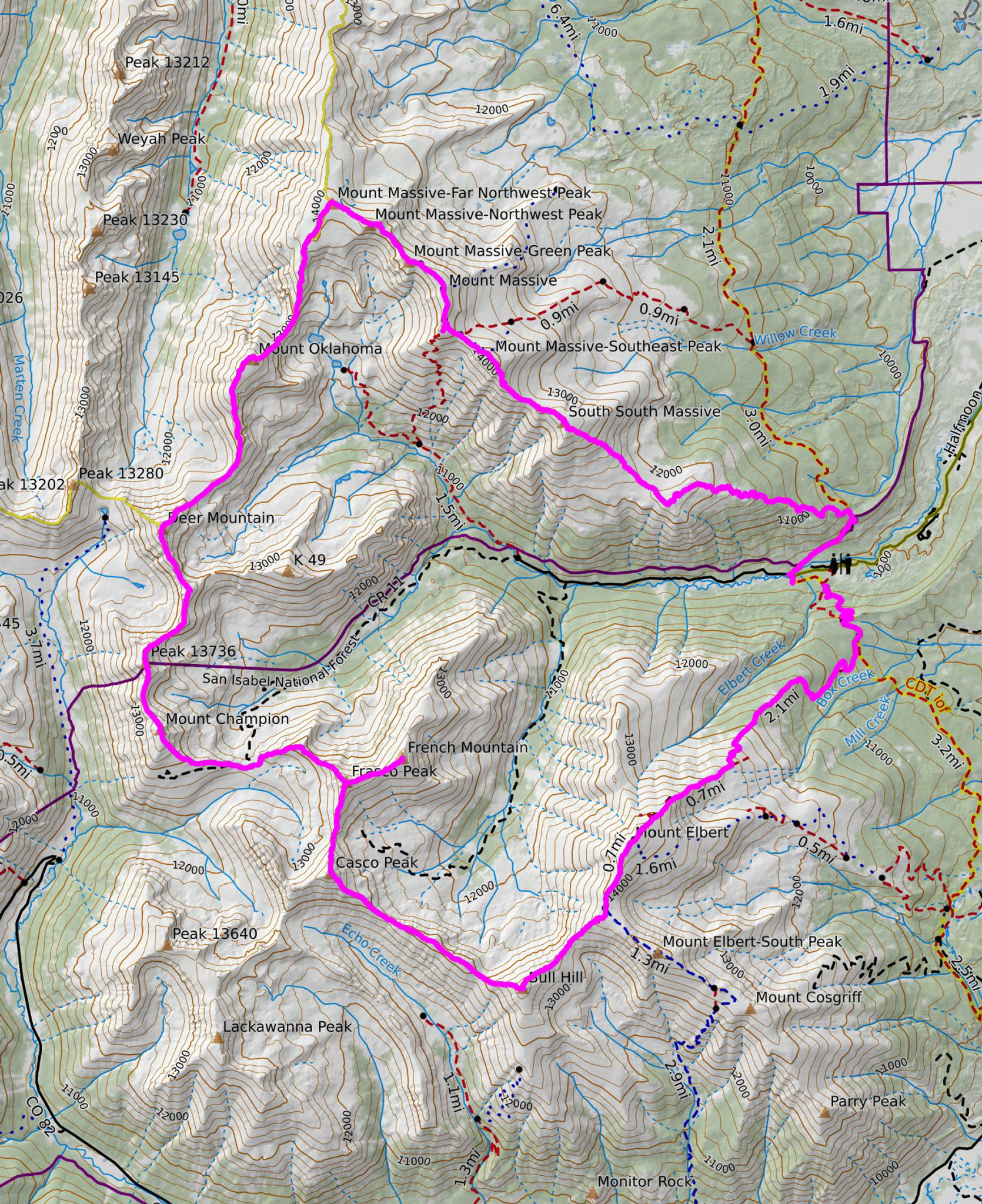
Elbert/Bull Hill/Casco/Frasco/French/Champion/13736/Deer/Oklahoma/Massive Mania
Summiting both Mt. Elbert and Mount Massive – the highest and second highest peak in Colorado – in the same day is usually a big but doable day out. Trailheads for the easiest routes up are practically across the road; the trails are both rated as an easy Class 1.
I’ve done it a few times myself by making it a loop by taking the SE Slopes up Massive, down the SW Sloops down and link Elbert’s steep West Ridge route up to finally descend it’s standard NE ridge. A righteous day out. This is mostly on smooth Class 1 trail – the only time off trail is the mile you’ll be on the west ridge of Elbert.
I’ve even gone up the route to Massive from the Fish Hatchery, down SW slopes, up the West Ridge, then kept going south to Indy Pass Road and taken the Colorado Trail back to the Fish Hatchery from Twin Lakes! This adds a ton of trail miles on the Colorado trail, but just a little bit more off-trail time getting from Elbert to Bull Hill and down the road at the Golden Fleece mine.
Since I’m wild for ridgelines these days, I’m always looking to see if I can’t link disparate peaks via one – and wouldn’t you know, you can with Elbert and Massive. This route would have the majority of travel be off-trail with a ton of loose, Class 3 traverses to cross. Lots of unknowns, including a bunch of new peaks for me. It would come to around 27 miles of terrain to cross – perfect! As I’ve got a 50km race coming up, and I haven’t done one of those in about five years, so I need some long days on my feet!
I don’t own a car, so my trip started at 2:00pm the day before, running down the bus in Boulder to take me to Denver, where I transferred to the Bustang West Line to Frisco, and took a third bus to Leadville. A project of mine is creating a guide for people to get to the Colorado mountains without a car. It usually means a bus ride, a bike ride, and a bivy. Four hours later, I was in downtown Leadville, riding 12 miles to the Half Moon Trailhead. The road to the trailhead itself was closed to cars, and I bivied at the Colorado Trail, so I had the entire area to myself: a rarity.
My alarm was set for ~2:15am and I was up and hiking at 3:00am. I brought a fairly minimal kit with me all things considered, but several things were conspiring for me to bring some extra gear – and that slows you down when the elevation gain/loss gets to these stratospheric levels:
There’s no water located on this route at all, so I had to pack all I needed from the beginning. For me, that was 5 liters of water – weighing over 11 pounds. I’ve been adding weighted carries to my workouts since the Spring, so even though this weight isn’t exactly something I prefer, I’m used to it. Dreaming this loop up, my initial plan was to bivy on top of Elbert, do my intended route, then bivy on top of Massive, but adding 5 or 6 extra pounds to my kit just wasn’t attractive just to brag about bivying on a 14er or two. So, let’s do this as a day-trip.
Even as sub 24, I was planning to spend most all day on the route – my hope was to summit Mount Massive and near the easy-to-follow trail to descend by nightfall, so I brought around 3,200 calories. It’s Fall in the mountains, so I brought enough clothes to not freeze at the highest, and second highest point in Colorado in the middle of the night. I brought a high-powered head torch w/extra battery, and a few small battery packs so that my phone would not die, as it was my navigator (via Caltopo), my music player, and my track recorder. Some sunscreen rounded out my kit – everything fit in a 18L UD FKT Vest – a perfect piece of kit for this trip.

Although there are bailout points on the route, there’s still the problem that if I’m overdue and get benighted while up high, I’ll have to continue to hike miles out to get back to my bike and my camping gear no matter if I stayed on route, or dropped off. As is usually the case on the types of risks I take, I was leaning on my fitness and mental fortitude (ergo: just stubbornness) to get myself out of a sticky situation.
The trail up Mt. Elbert via the NE ridge is an easy one – perfect for someone like me just waking up. I haven’t been on it since perhaps 2014 during my first Tour 14er, so it was nice to revisit the trail. This was actually the first 14er route I’ve ever done on foot after I took two days to ride to it way back in 2009, during a seminal self-powered trip of mine.
In 3 hours of easy night-time hiking, I was at the summit – no one else, except two people bivying just off the summit proper, still snug in their 0 degree bags on top of space blankets. Well, glad I didn’t try the same thing, or I’d be skunked out of a campsite!

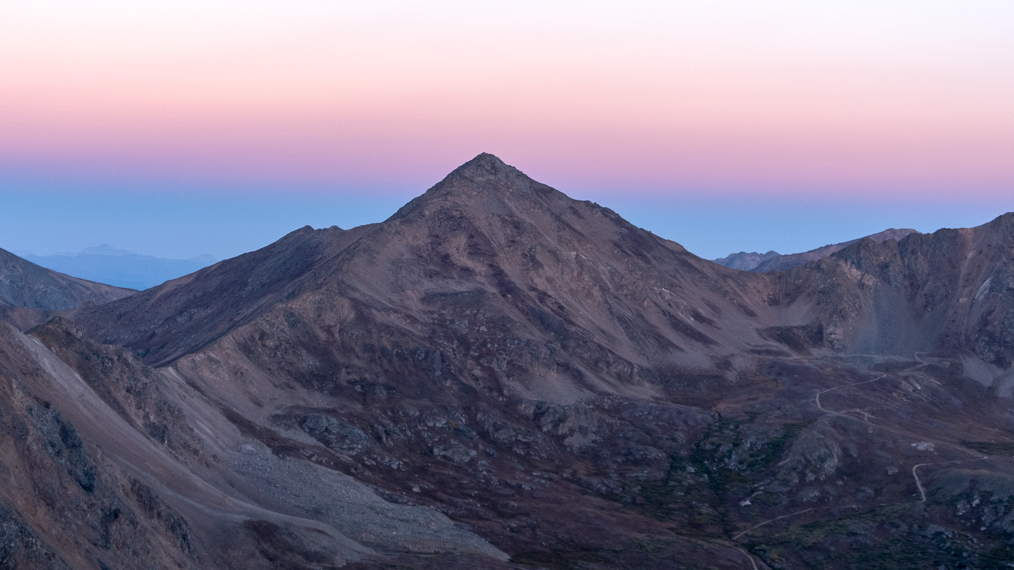
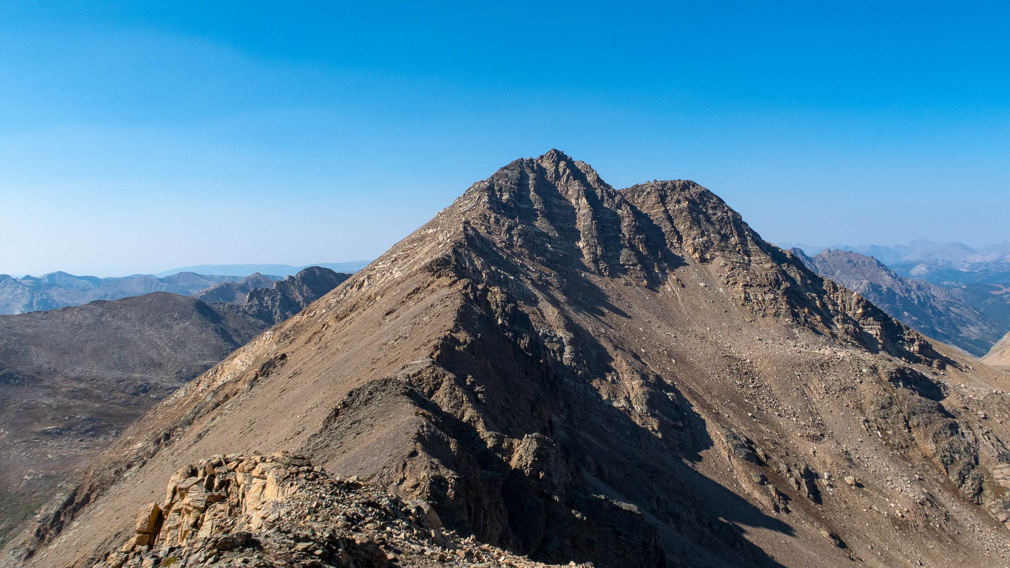
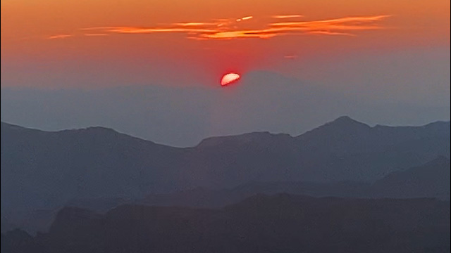
As I was taking the easy ridge to Bull Hill, the next peak on my list, the sun started to rise, so I took the opportunity to shoot the Centennials in the area: Casco, Frasco, French and Oklahoma. Not coincidental, these peaks were also on the route. Another project of mine is a guidebook of the Centennials! I have a habit of combing disparate projects together – hey: time is limited for me like everyone; projects that can be combined are prioritized. Knowing I was somewhat previewing a tiny slice of the Nolans line was also on my mind. Due to the smoke still lingering in the area, and the fact the Mt. Elbert is blocking much of the sunlight coming into the basin, the Golden Hour was a bit weak, but I enjoyed at least trying to stretch the light to paint some photos.
With Bull Hill summited, I moved towards Casco. I’ve looked at this ridgeline before and although long, it seemed entirely doable. With an enjoyable walk, a discovery of a trail coming from Echo Canyon to research later, and some brief scrambling near the top, Casco was summited at 9:15 am. The ridgeline to the Casco/Frasco col is similar to Casco’s east ridge: some scrambling to start, then an easy off-trail route down.
Frasco was next, and its ridgeline is pretty similar, although a bit more difficult to start, with a few towers to negotiate. I’ve done this traverse on my Tour of the Highest Hundred, so nothing too surprising. After Frasco, I dropped my pack and summited French Mountain as an out and back – about a mile. The rest of the route of more distant peaks would be all new terrain to me, until I get to Oklahoma.
“Well, that looks like total shit.”, I noted to myself while looking down the west ridgeline down Frasco to what would eventually connect to Champion Peak. This isn’t a popular route to try – Champion is much easier accessed from either the North Fork trailhead off of Independent Pass, or by following the 4WD track that goes to the col of Champion and Frasco. But at the beginning of the second third of my route, I couldn’t be in a more inconvenient spot for either of those two points. Just where I wanted to be, of course.
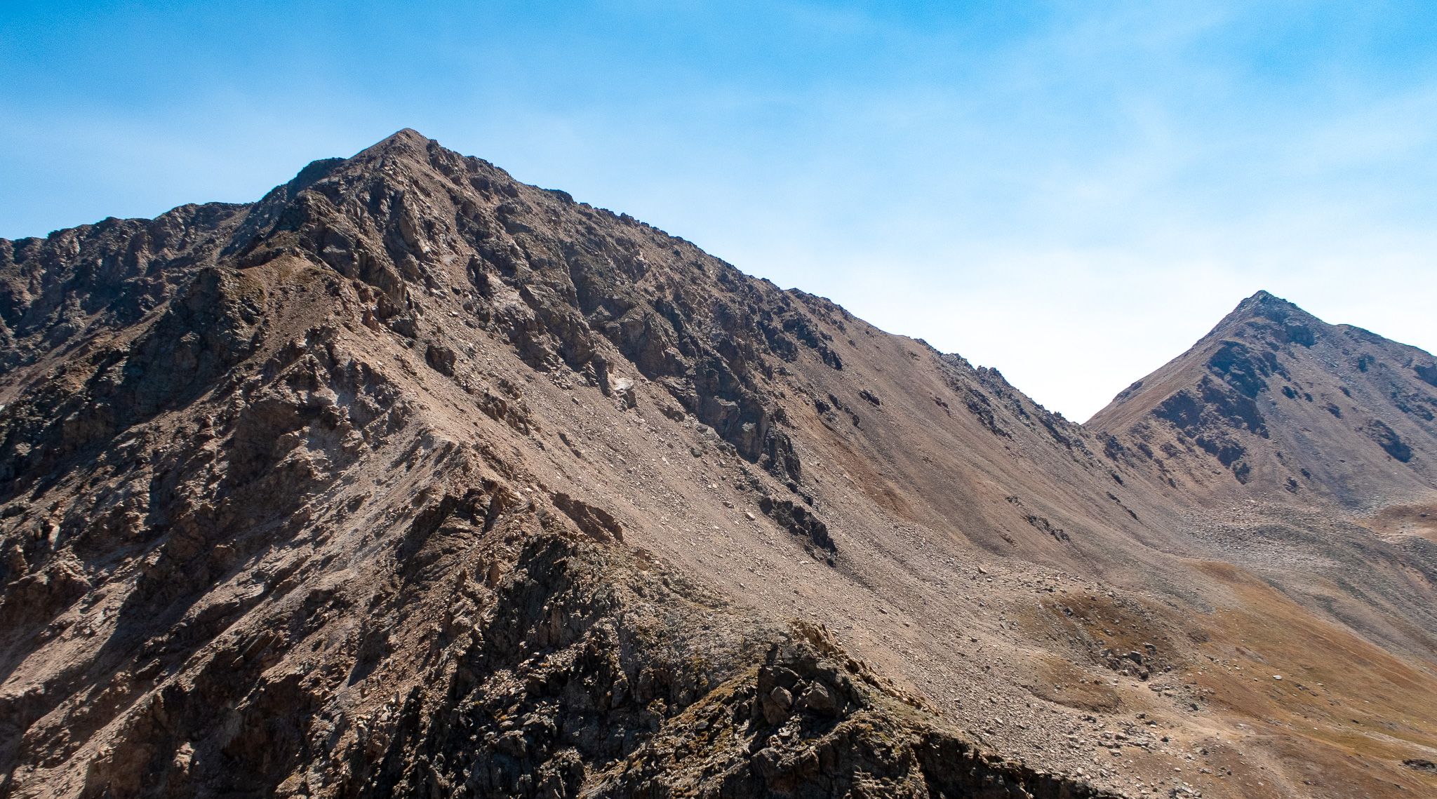
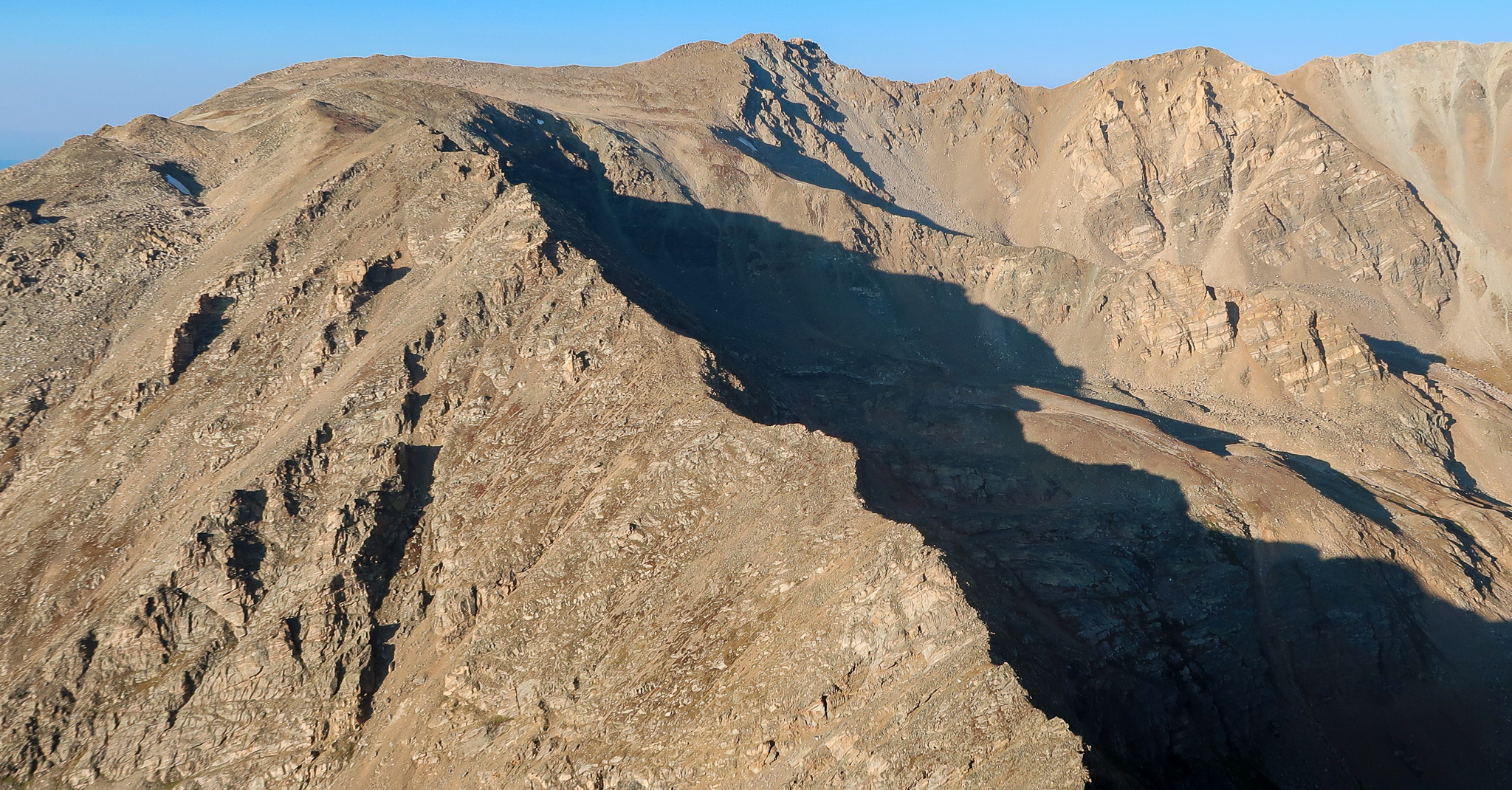
Sometimes looks are deceiving and a ridge that appears steep, chossy, and dangerous turns out to be a total banger. Well, not so here. The ridgeline seemed to skip any intermediate parts and devolve from “rock” to, “powder” in places it was decomposing – which was also: everywhere. It’s late in the summer, and I’m now very acclimated to the Sawatch geology from all the trips I’ve made into the region. So although slow, negotiating the ridgeline was also fun enough.
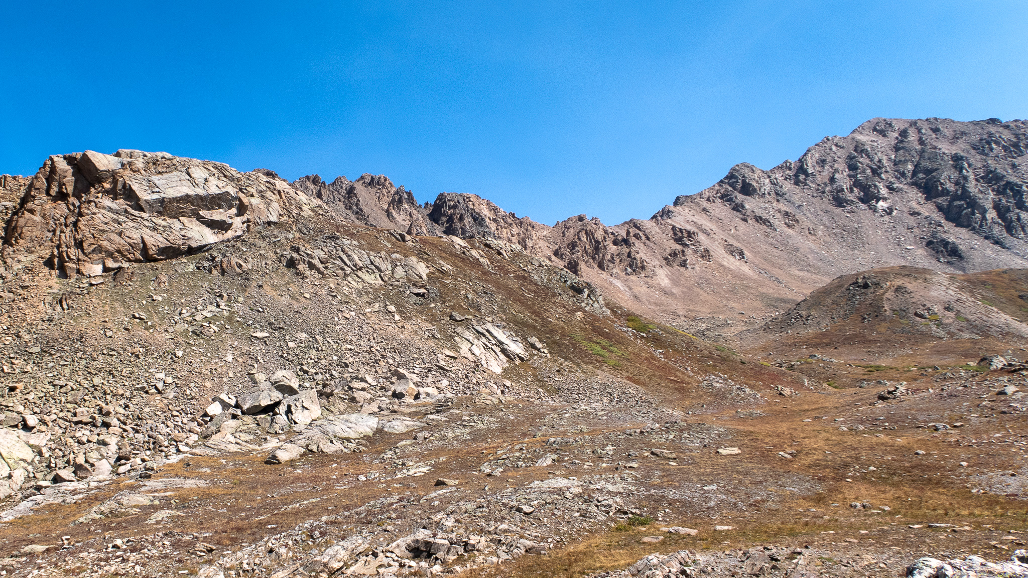
The west ridgeline of Frasco abruptly ends its edginess with a large rock buttress. After a small talus field, you reach the mining road that crosses it. Here it feels like the ridge line all but disappears – except you’re still 2,100′ higher than where you started at the trailhead! 100 meters later – the longest stretch of relatively flat ground you’ll reach on the route, and the terrain ramps up again up towards Champion.
Reaching the Frasco/Champion col at around 1:00pm and with the mining road back to the trailhead making the best bailout point for a long while, it was time to double-check how realistic it was to continue my trip’s itinerary. Seeing it took 7 1/2 hours to get to this point, mile #12.2, making it to Massive at mile #22.3 in 7 more seemed a tight timeline. Ridgewalking chossy ridges is slow.
But I had confidence in myself, my bright light, and the fact that I at was least under the impression that I knew Mount Massive well-enough – it’s just a big talus heap, right? Just as long as I could do the traverse between Mt. Oklahoma and Mount Massive before nightfall, I should be fine. With foreshadowing out of the way, I continued.
Loose and middling is a fine way to describe the ridge up Champion, and I didn’t appreciate much of it. On the summit, I met my first and only (awake) hiker of the trip – a six shooter-laden man coming from the Aspen side of the pass. They had started from the North Fork trailhead and must have been just a little confused on where I had come from – or they will be when they don’t see a second car at the start. They asked if I was going to summit the two peaks ahead of me, two unnamed peaks. I said, oh yes: of course, plenty of daylight and the weather was holding well. I did not tell them my start point, or destination.
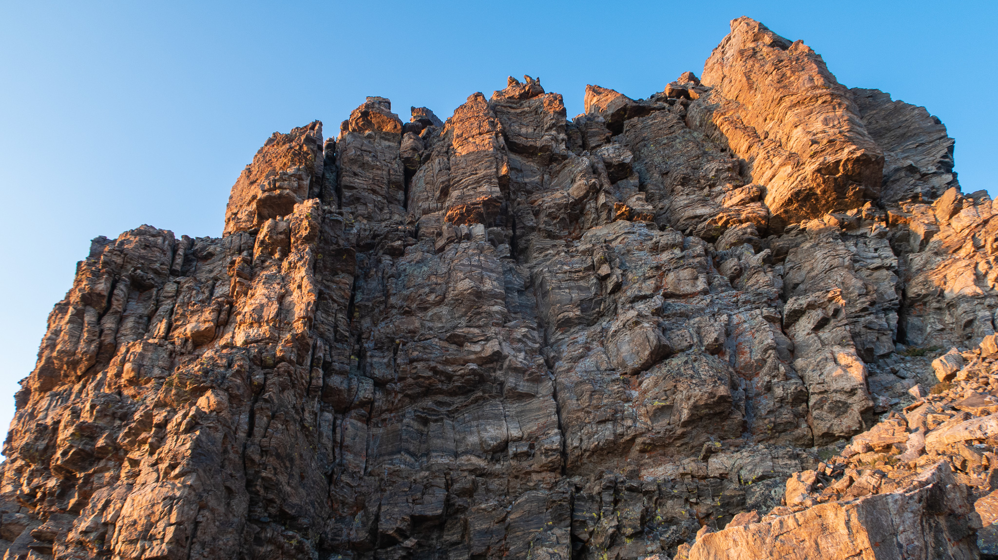
The ridgeline towards Deer Mountain was more variations on the day’s theme: loose and choosy, with a few towers to negotiate. Deer is a handsome mountain from afar, with a black and white strata prevalent. I hope that meant some good rock to scramble. I wasn’t disappointed. From the south, nice easy slabs await you, and getting to the summit was delightful.
Descending towards Oklahoma took a minute or three, as terrain was looser and steeper on the north side. Nothing too crazy, but a time suck in places. It’s humbling to take three minutes to travel just a few feet in some parts of a route, where the same time frame can find you a quarter of a mile farther in a route.
The rock quality again became better ascending Oklahoma and I gave myself space to sigh, as it seemed like I’d have enough time to get out of most of the difficulties before I lost daylight. Summiting Oklahoma was a breeze, and I looked forward to the traverse from Oklahoma to Massive which I’ve done twice before.
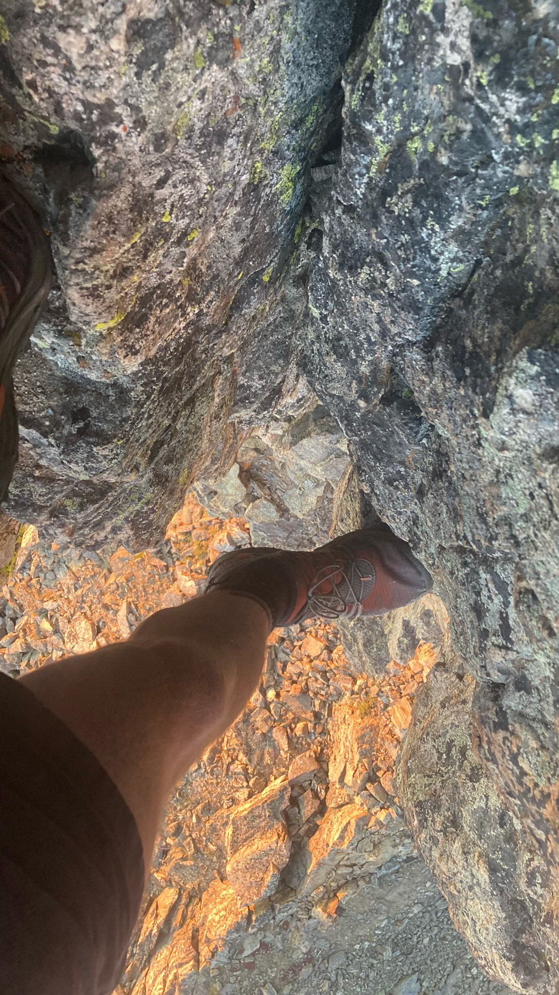
The scrambling is engaging, the rock solid and the views are surprising. The daylight though, was becoming a rarity and I was happy I knew what and where the cruxes were and could motor through everything, while still enjoying myself and the movement. The ridge traverse has one notable crux chimney you’ll have to negotiate. There may be a sneak-around, but I would suggest if you do the traverse yourself, you take the chimney, as it’s a good thrill.
I spend a good few minutes just a little short of the Mount Massive main massif watching the sun set behind a distant mountain.
It was 7:00pm, which meant there was still an hour of strange twilight left in the day to work with. I noted my water supply (20 ounces left), changed into warmer clothes and made a rash decision to not take the SE Slopes trail down to the trailhead, but instead: summit all the subpeaks of Mount Massive down its ridge, crashing through the trees after the last little bump that makes up Massive, and meet up back at the trail near the trailhead – Massive Mania!
Mount Massive Far Northwest Peak (who comes up with these names?) is an easy high point, but Northwest Peak is slightly trickier. Thankfully, I’ve been here before, and knew a few of its little beta secrets, so that in the darkness that I was now enveloped in, this didn’t turn into an epic. Summit the point, turn east, jog down a bit, reverse course, traverse an exposed ledge, climb down a chimney. Crushed it! The next point isn’t named, but seemed prudent to do for completeness sake – up another chimney, and a few delicate face moves to reach a pinnacle of a high point. Delightful to revisit a little cruxy part of the ridge I haven’t been to in years.
Massive Green is an easy hike up, but this is when I started to really feel the day’s effort. The legs weren’t having it, and my resting heart rate was elevated a dozen or so beats/minute higher than when I started. But the technical portions of the route were absolutely over and little elevation gain was left, so after a bit of parlay, the legs were committed in continuing – I’m not sure what the alternative was!
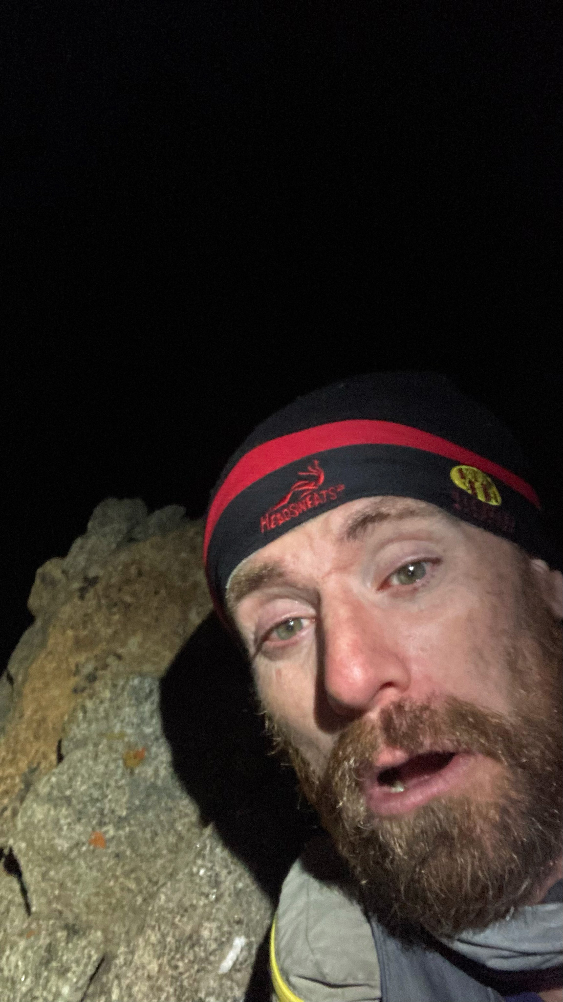
The summit of Mount Massive itself is a little nondescript. Enough so that I didn’t take the tiny cairn I passed as being very authoritative, but after a minute of wondering (and descending!), I double checked Caltopo – whoops! Yup: passed right by. I double backed and sat on the summit for a spell, ate the last of my food, drank the last of my water and took some goofy photos for later posterity. It was around 9:30pm, pitch black with the crescent moon and smoke-filled air, and I still had over 7 miles to go.
I hadn’t actually done the rest of the descent down Massive Mania, but I wagered that it couldn’t be too hard, or challenging, or confusing – right? It’s a big wide talus ridge! I certainly was mistaken. Thankfully, I had a track of the route, and with eyes completely pinned to my phone’s screen, I made it back to the trail. Without that track, I wouldn’t have had a chance. Massive sports a collection of subsidiary ridges that my instincts really wanted to take in lieu of the main ridge and I had to course correct often.
Entering into the trees felt completely counter-intuitive, as my brain got soft and dumb from the day’s mileage. I was getting close to my breakdown point (or a breakdown point) while on the trail. I couldn’t tell for sure if I was hiking towards the trailhead, or away. I checked a few times, things seemed to take such a long time to get to the road and I was started to get very, very thirsty.
At ~1:40 am I was back at the starting point, with my bike and camping gear. Terribly thirsty, I grabbed some water straight from the creek. I made my bivy as quickly as possible and without eating anything, tried to pass out. My wakeup call was at 4:30am to be able ride to Leadville and take the next bus outta town!
The Half Moon Complete Revolution was swished!