Like this? Follow me:
Monday
Spin Bike, 1hr
Tuesday
Bouldering @ Movement, 1 hr
Worked on a V7, but only mild progression. Later did a set of 12 pullups, which probably matches my all-time best. Happy with that, strangely.
Spin Bike, 1hr
Wednesday
Backpack into Boreas Pass
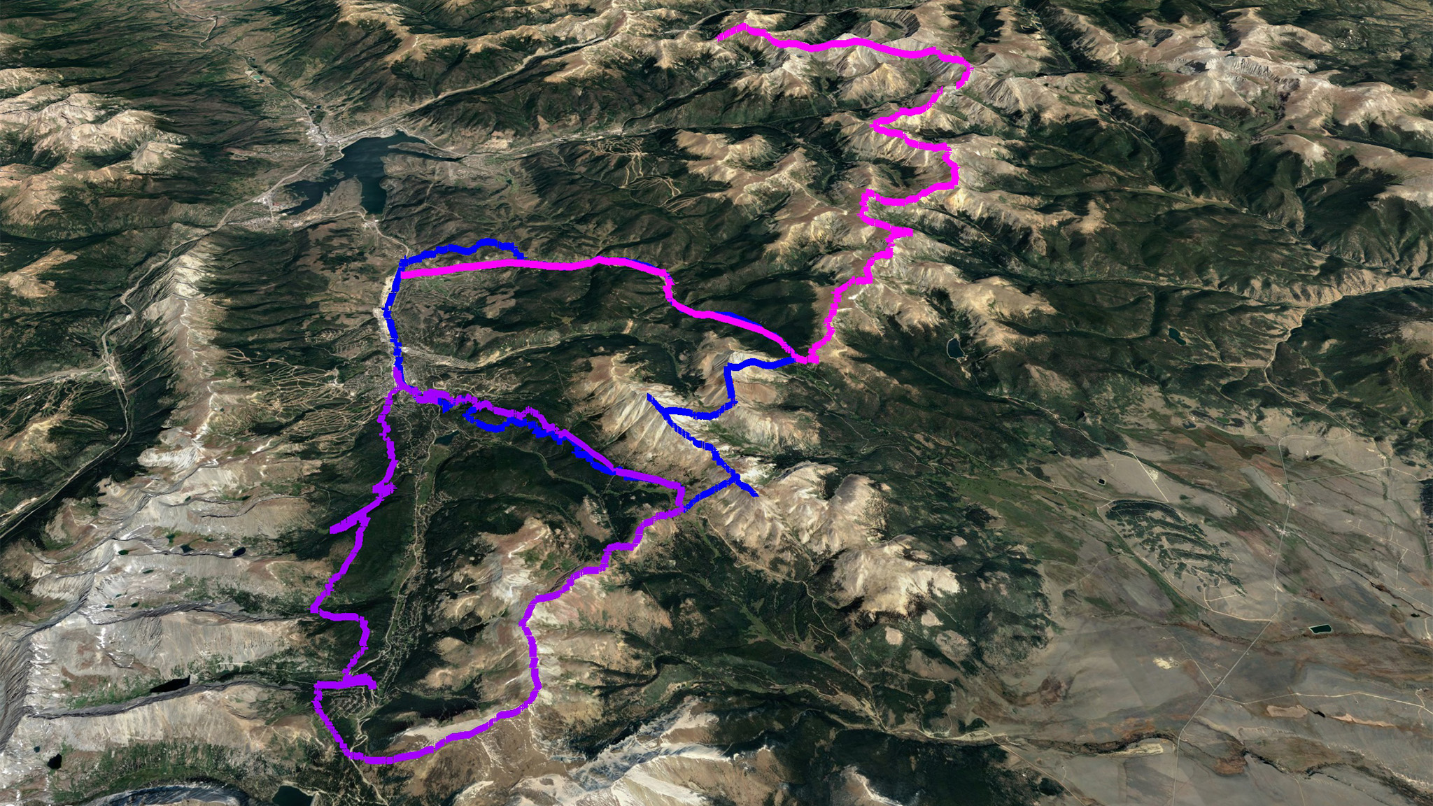
Time to tie up loose ends! The Loveland to Hoosier Pass Traverse project has been on the back of my mind all summer, but since it was supposed to be a quick, four-day trip in the late Winter, other adventures had precedence for the Summer. Now that I’ve exhausted (most of) those, I decided to return.
On my first trip out in April I made it to Georgia Pass; then from Georgia to Boreas Pass on my second. I only had to get to Hooiser Pass to finish my original vision – just nine miles more.
I had hoped to get out last weekend, but a snow storm thwarted my plans, dumping two feet in the high country and effectively closed Summer in the high country for good.
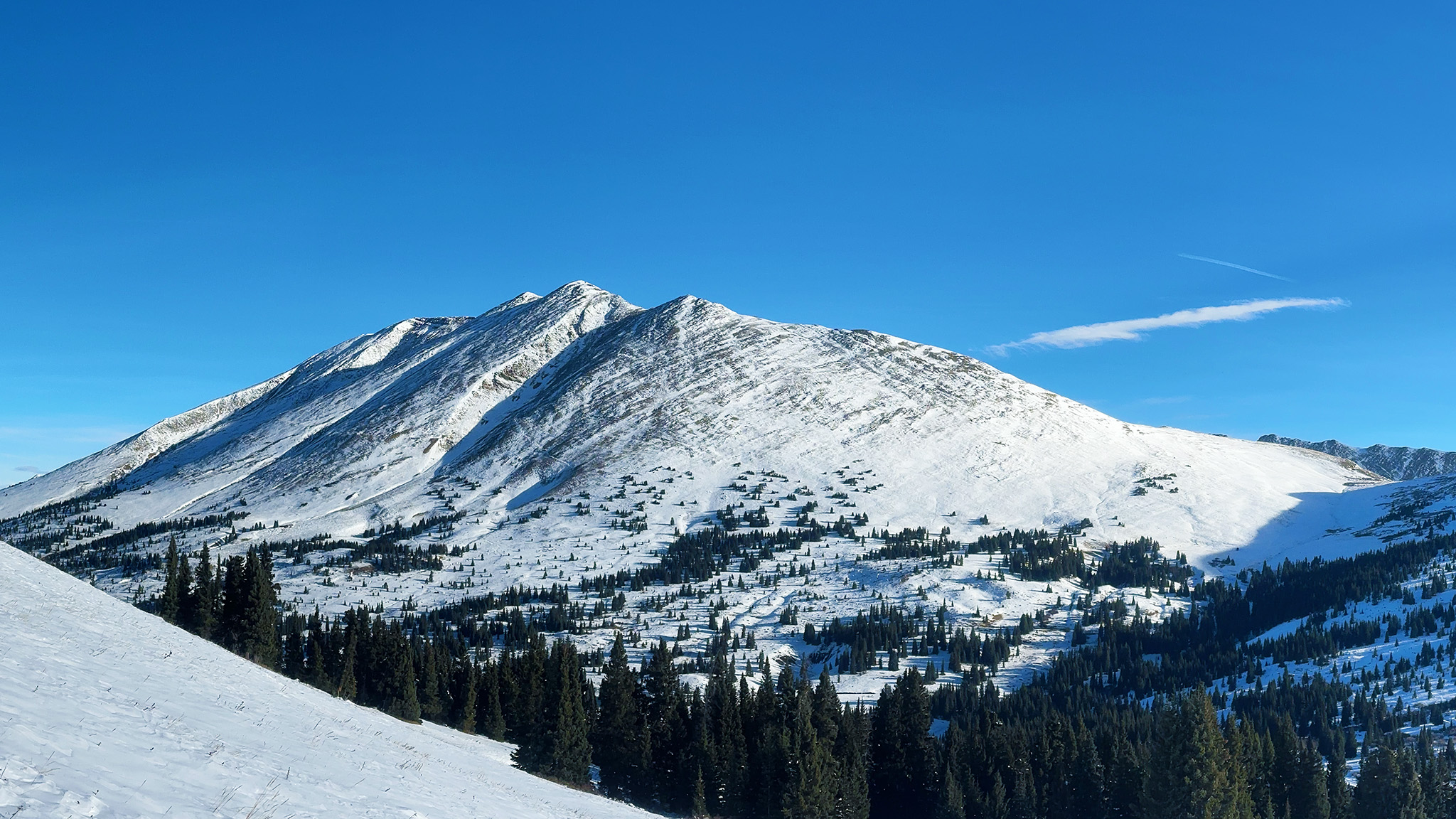
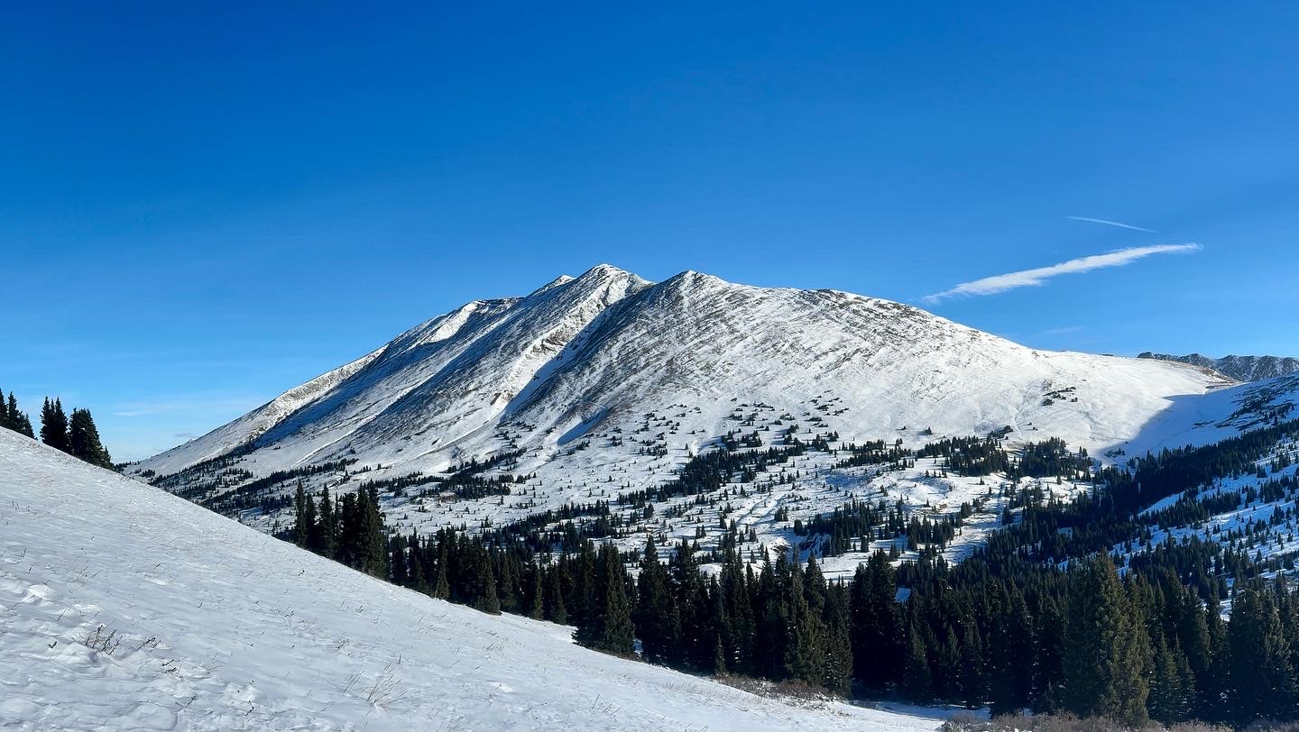
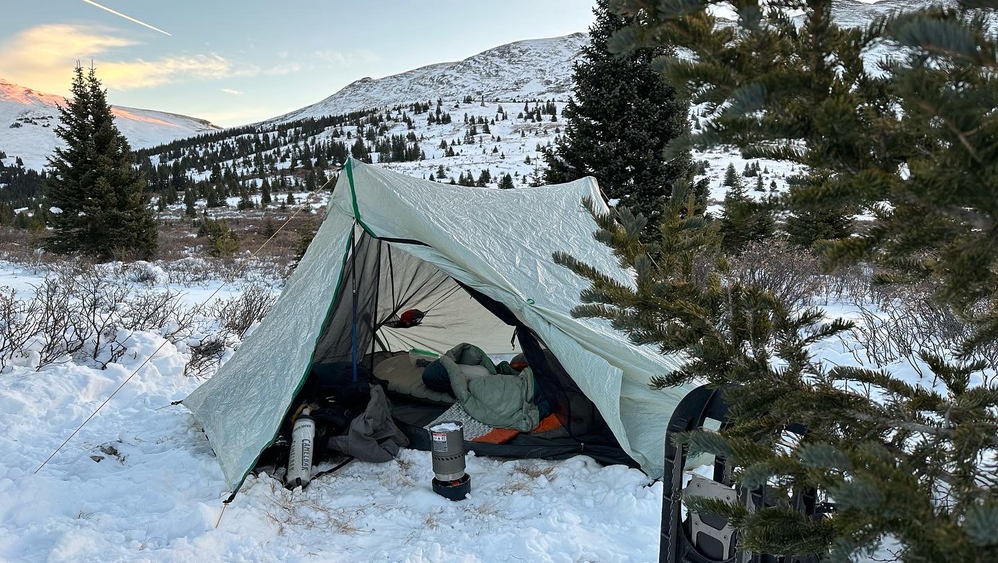
So with the new reality in front of me, I left the Breckenridge bus stop and trudged through town up towards and onto the Baker’s Tank trail. The main objective was just to get up to Boreas Pass and camp, but I had my eyes on also getting on top of Bald Mountain, but I only got up Boreas Pass Road proper at 7:00pm. A midnight summit wasn’t out of scope, but the wind sounded pretty fierce, so I nixed the idea. Finishing Baker’s Tank, I rejoined the road itself to the pass and made camp a little ways east at a nice flat spot.
Thursday
Boreas Pass to Hoosier Pass to McCullough Gulch
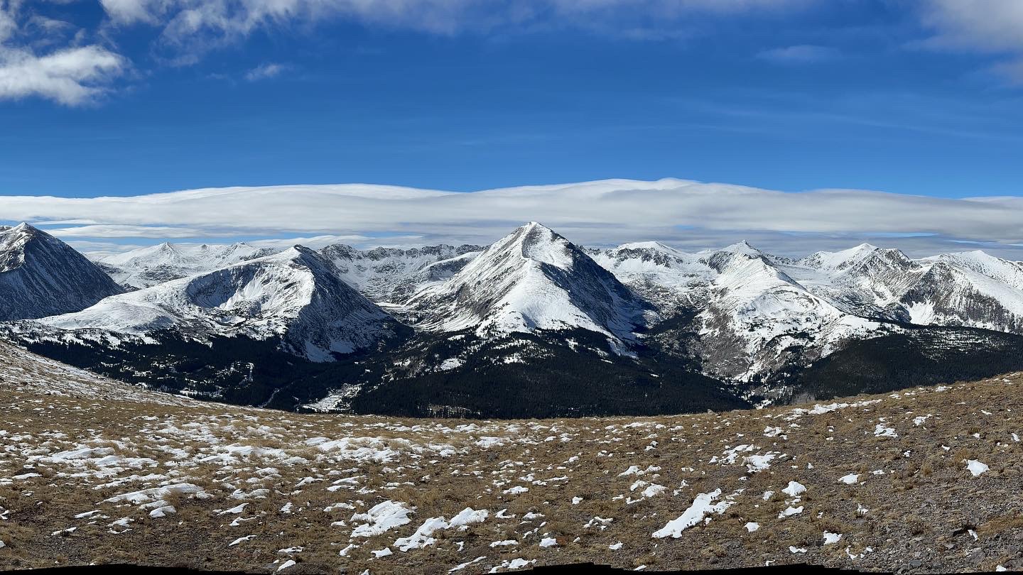
The big day! After a slow morning taking some photos, I started up the ridgeline. I wasn’t expecting a terribly difficult day – this whole trip was to be more Chill than Epic – and it was nice to start up into the trees via a old mining road. Once above treeline, conditions changed for the worst, and the wind was at least as strong as I feared. The first bump, “Madonna Dome“ was easy enough – albeit very windy. But getting to Hoosier Ridge proper was a test of my meddle. The wind was strong enough that forward travel was desperate to say the least.
Once summited, I was second-guessing if going forward was the best course of action, as I had many miles to go to get to the pass. It seemed far more realistic to backtrack or even head north down into Horseshoe Basin and then just figure it out from there. Since I had a full backpacking setup, I had a ton of options and flexibility.
After hemming and hawing a little off the ridgeline in a deafening gale, I thought best to at least try to keep going, even though I’d be above treeline until the last half mile. The wind got progressively worst the higher I got and thankfully the ridgeline was going progressively down. As it did, my chances of finishing the ridgeline segment went up and up.
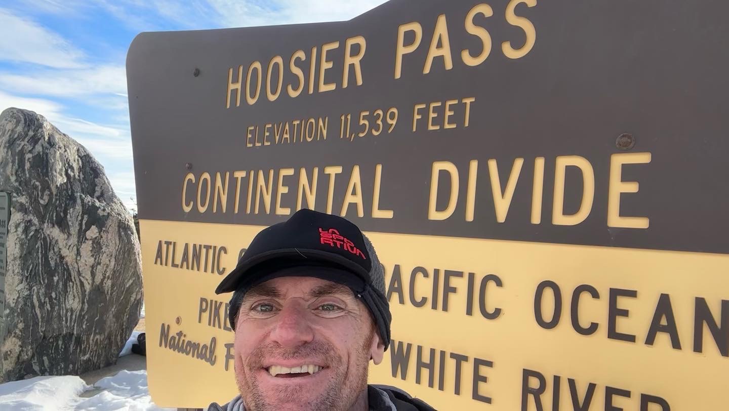
This turned out to be one of the more milder sections of an already easy going section of the CD, so no big surprises to Hoosier, where I reminisced about the time I had last been in this area to bag Silver Heels very early in the morning, then tagging Quandary, Fletcher, Pacific, Atlantic, and Crystal Peak on an absolutely massive day on my 2017 Tour of the Highest Hundred.
Once on Hoosier, my day wasn’t done, as I still had to get down off the Continental Divide, and towards my planned campsite on McCullough Gulch. I planned to camp here, as I wanted to participate in the 14ers.com Winter Welcomer (which also got reschedule – for the next week).
Getting off Hoosier by foot is not easy. The highway really gets in the way of that mode of transportation, but I thought that my map showed a route west off of the pass, then straight down towards the road to Blue Lakes. Worth a shot, right?
I sniffed the terrain looking for a trail, and found a ditch with old, large pipes and one stale ski track. Seemed good enough! As the night settled in, I found the trail that went inexplicably “straight down” didn’t exist, and I had misread the map. There was no trail, the map was showing an old aqueduct! Failure of my own map-reading part. The bushwhack through the several feet of snow was less than ideal, but it went well-enough, less that I kept hitting private properly boundary lines. D’oh!
But as the sun went down for good, I hit the road and it seemed I could smell McCullough. How wrong I was. I wasn’t on the main road to Blue Lakes, but on a subsidiary road. Tired of taking chances after my aqueduct debacle, I walked east down the road with my tail between my legs towards the very highway I was trying to avoid, rather than checking if taking the road west would get me where I wanted to go.
Thankfully, the highway wasn’t sensationally dangerous – a good shoulder and the locals are pretty used to idiots in outdoor gear walking the highway while they’re side country skiing – and I finally made it to McCullough and to an actual signed dispersed campsite to lay down for the day.
Friday
McCullough Gulch to Breckenridge
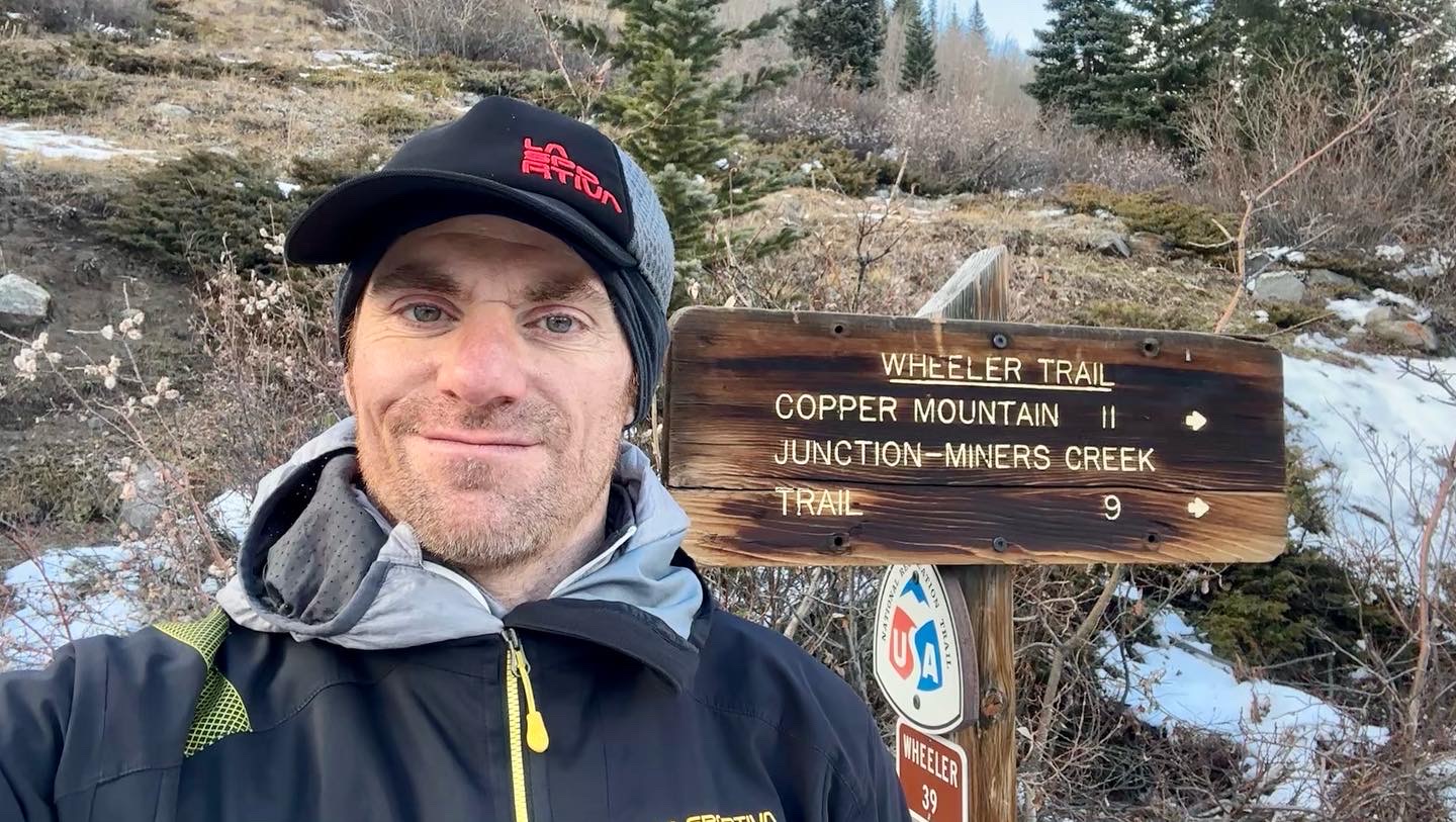
Lucky for me, the night wasn’t too frigid, and the bear that visited my campsite to paw at my tent was really just falling dollops of snow from the surrounding trees. I had a good idea on what to expect today hiking Wheeler Trail to Spruce Creek to Burro: deep snow that would progressively thin out as I lost altitude. The real question was, how tracked out everything was going to be?
I found Wheeler to be devoid of activity, and I made fresh tracks until Spruce Creek, where traffic from a nearby trailhead/parking lot attracted visitors even late in the season. I stripped off most of my clothes in the parking lot and took on Burro wearing shorts. The rest of the hike was uneventful and soon I was back in Breckenridge by around 1:00pm. Trip, completed! After a series of three bus rides and many hours, I was back in Boulder.
Saturday
Rest.
Sunday
Bouldering @ Movement, 1hr
New set from Thursday. Worked on a few V6s and got up one on slab. Got a set of 13 pullups, so that’s a PR for me. Onwards to 15!
Spin Bike, 1hr
Gear of the Week
La Sportiva Trango Tech GTX
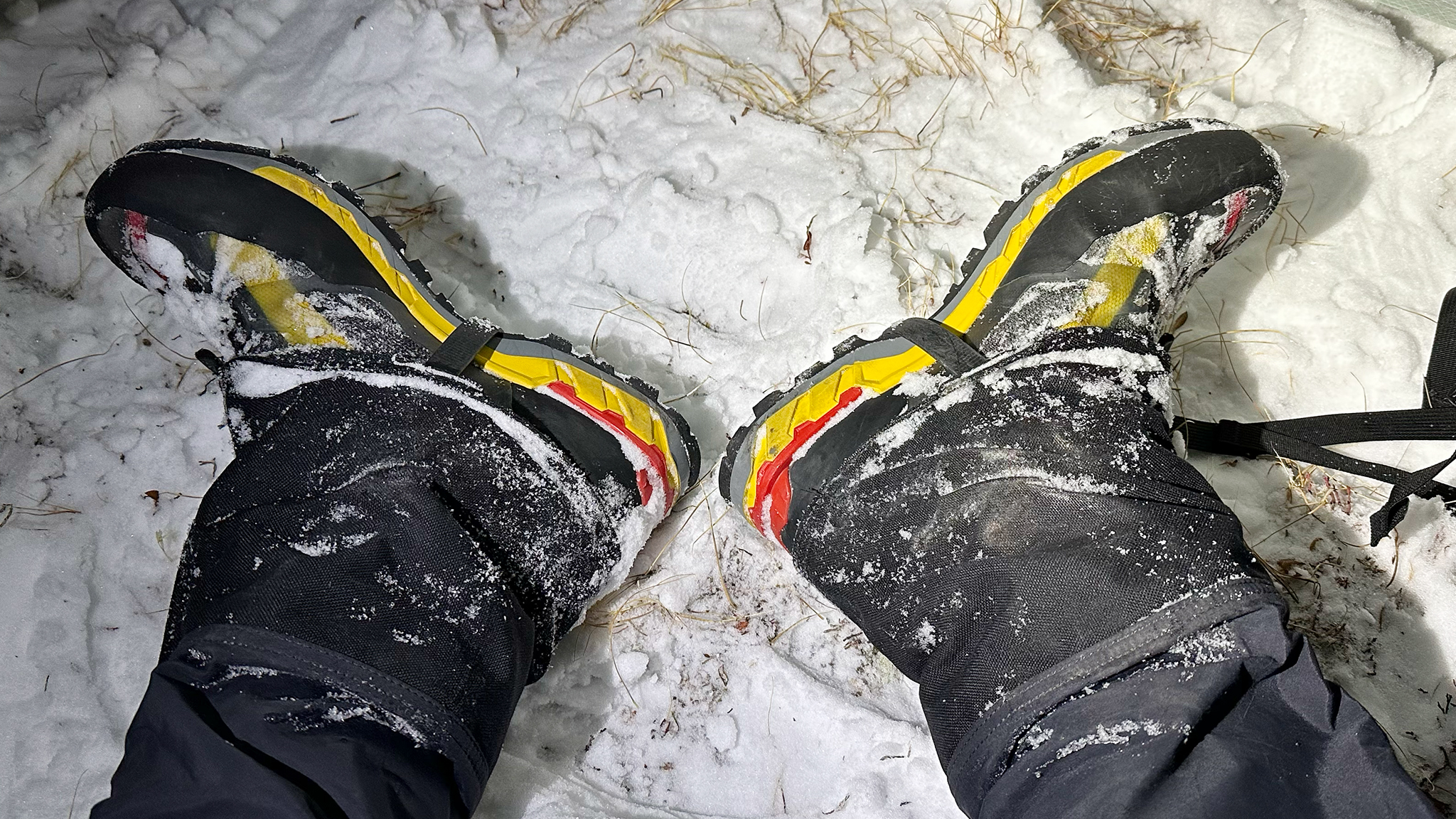
The Trango Tech GTX are the boots I wore on my three-day backpack this week, as well as my first leg of this project from Loveland to Georgia Pass. They’re more of a dolled-up hiker than a true mountaineering boot – the sole is slightly flexible, which facilitates with walking, although it’ll hurt when trying to use these with crampons and not wanting a crampon to pop off. What I found them to be was both warm and water resistant – both characteristics I wanted when trudging through snows multiple days in a row. Wet feet are cold feet and cold feet lead to a lot of very dangerous situations, which I was happy to completely avoid.
For day trips, even all-day trips, I’ve been getting away with just using winter-specific GTX trail runners in Sportiva’s line, like the Blizzard and Cyklon Cross, as I can always switch out a new pair of socks, do my best to keep my feet relatively dry, and just be a bit miserable until I get home to warm back up.
For multiday, this boot made far more sense, as I just could carry so many socks (I used the same pair all three days), and getting wet wasn’t a good option. Overnight, the boot laces did freeze, but quickly warmed up after a few minutes of wearing them, so no: I didn’t store these in my sleeping bag.
