July 2019 + July 2023, +120 miles, ~6 days+, Class 1-5.easy, Solo + Unsupported
Below are additional pages of information, besides this one:
[su_menu name=”Sangre de Cristo Range Traverse” class=””]
Guidebook
Looking for a guide to the route? Here’s mine:
Route Description
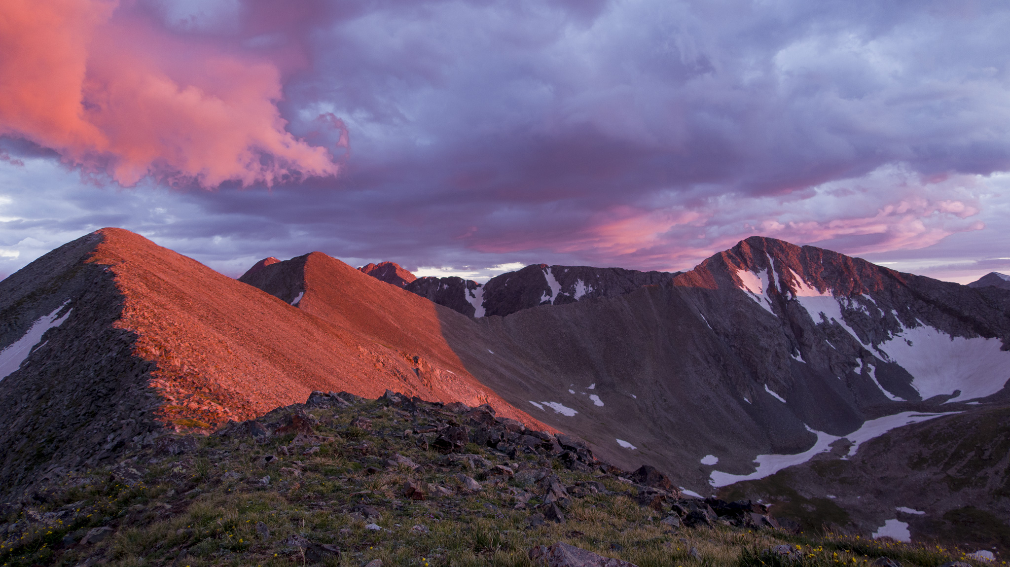
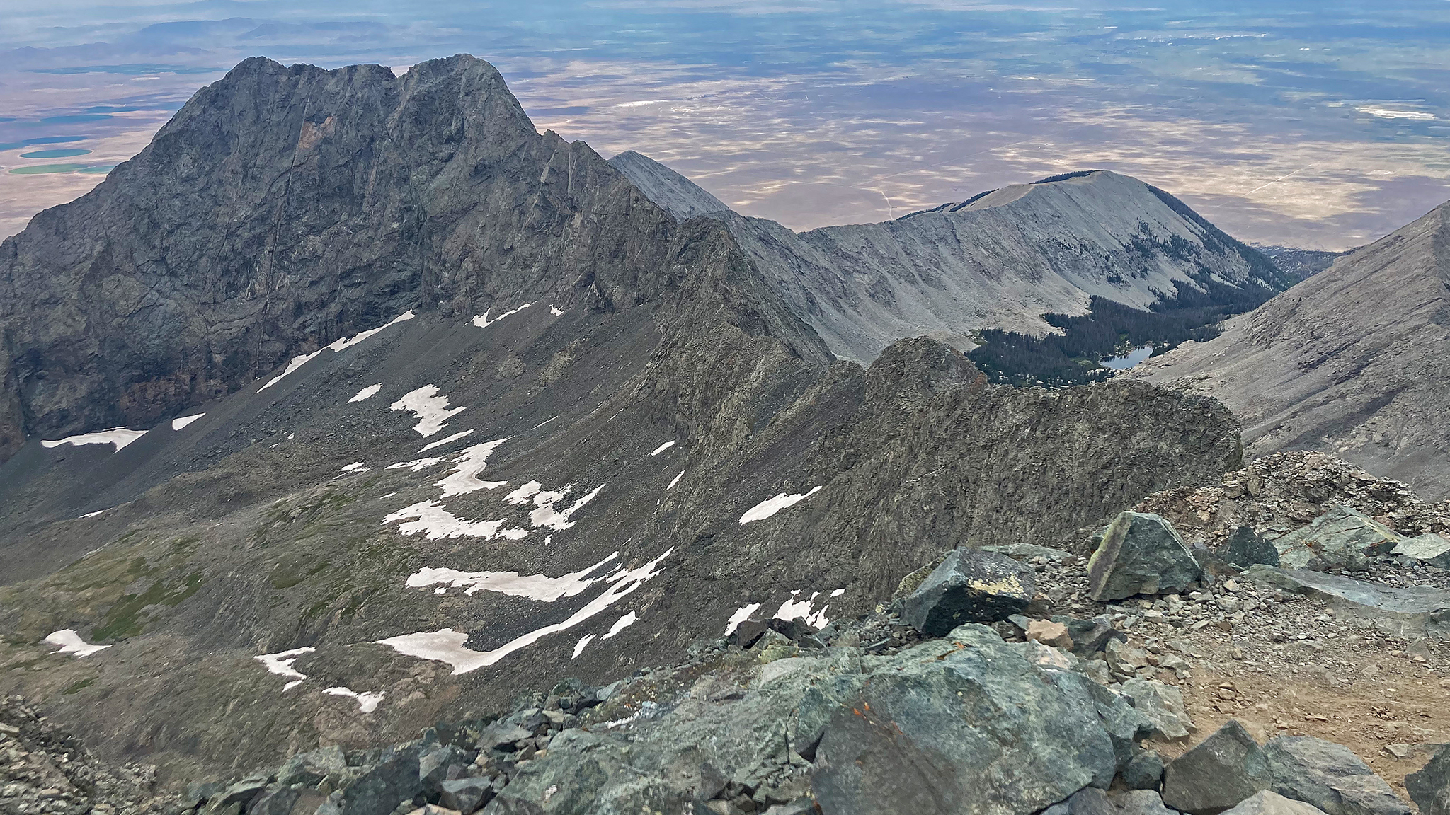
The Sangre de Cristo Range is a long chain of mountains starting (going South to North) between La Veta Pass near Fort Garland, CO to Poncha Pass, near Salida, CO. Around 75 miles long as the crow flies. The range rises straight from the valleys that flank it without any foothills, making a very dramatic spine of mountains.
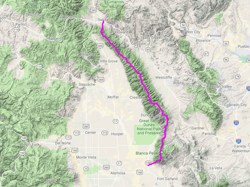
Variations of the route exist, especially where one may start/finish the route, but generally one follows the very crest of this range. I started from Highway 150/Lake Como Road and ascended the Southwest Ridge route to Little Bear Peak, then to Blanca, then traversed the ridge crest, finally descending off of Methodist Mountain towards Salida, CO. I finished at the intersection of E. Rainbow Blvd/HW50 and CR 107.
Dozens of peaks comprise the very spine of the range (70 – 80 peaks, depending how you count), including five fourteeners, and two Colorado centennial peaks. This spine also includes two of the Four Great Fourteener Traverses: Little Bear/Blanca, and Crestone Needle/Crestone Peak (both rated easy 5th Class). The route will thus link these two traverses together.
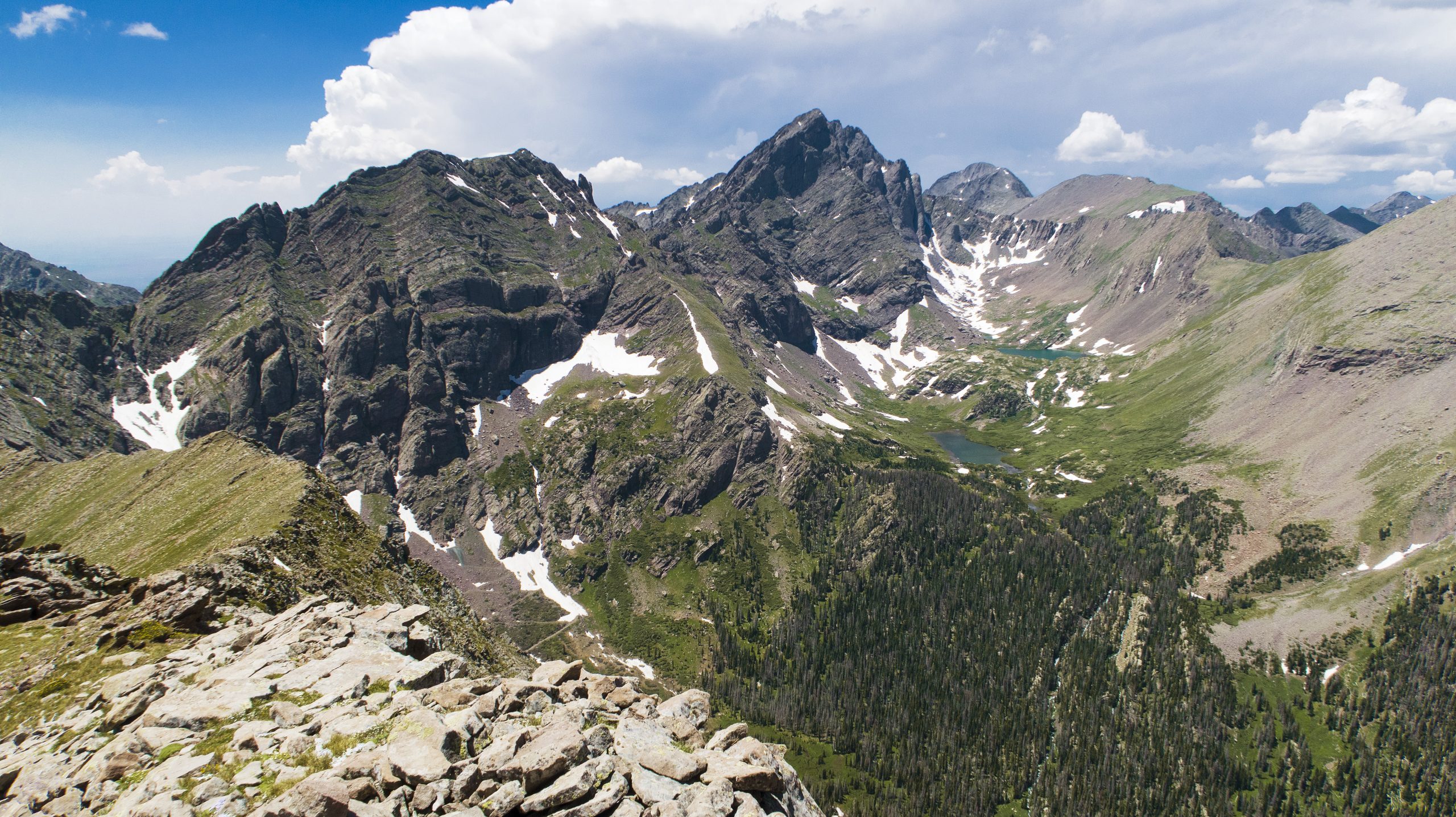
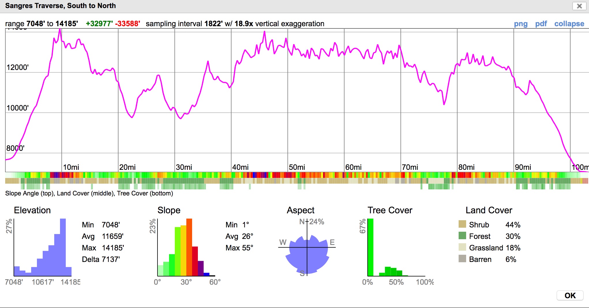
Many other semi-technical traverses can be found on this ridge of similar quality. Most of the route is off-trail – perhaps a few miles of trail in the total line. Talus, tundra, and forested areas will all be passed through.

The total elevation gain/loss of the route is between 50,000′ to 60,000′; the equivalent elevation gain/loss of two summits of Mt. Everest from sea level, back to back.
Explore the Route in More Detail:
My Style: Solo, Unsupported
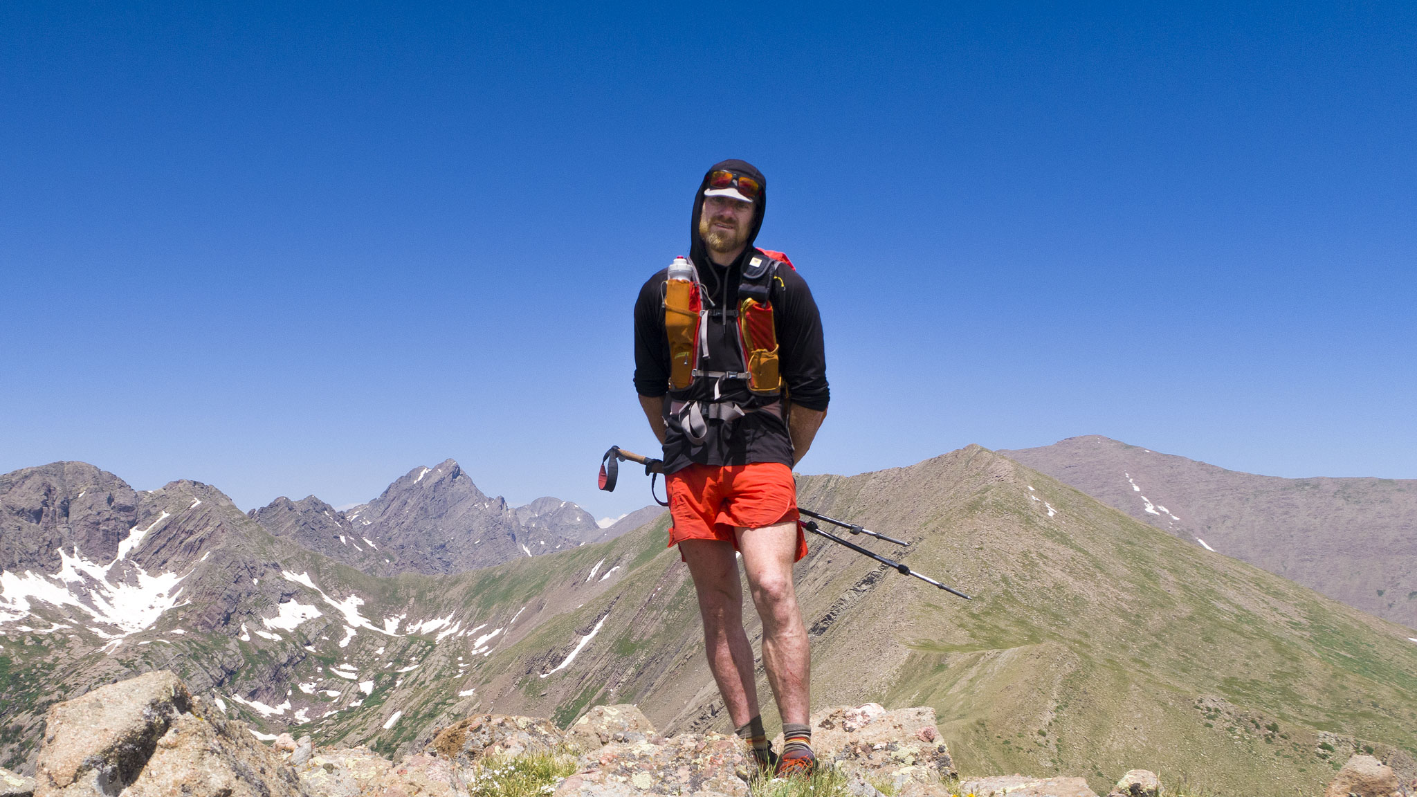
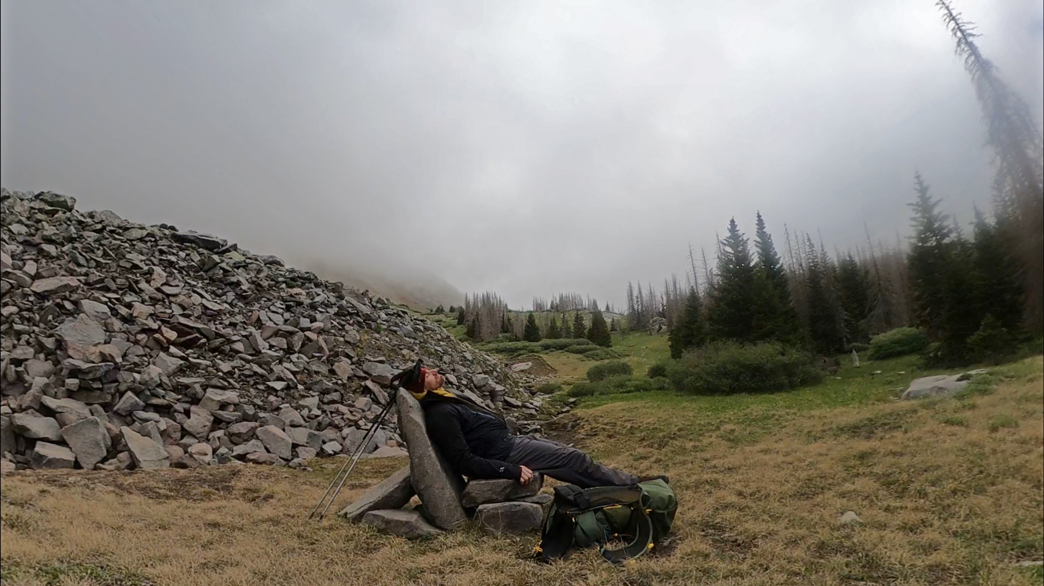
I went solo and unsupported, packing all the food I needed for the entire trip with me from the start and only sourcing water either from lingering snowfields I found along the way, or from creeks/lakes if I needed to drop off the ridgeline itself. The north side of the range is more difficult to source water from then the (higher elevation on average) south side.
I brought enough food for about five days – about 4750 calories/day, although I was out for over six. I did not use any food caches. Total weight of just my food was weighed 13.3lbs. My pace suffered greatly from this added weight – especially at the start.
I am attracted to the purity of going unsupported, as well as its simplicity. I also am enamored by how committed you are required to be, knowing that there is no relief to be had in the form of an awaiting bag of food/supplies, as well as the planning that needs to be done to put together a kit that will get you through this type of route.
Route Comparisons
The Mosquito/Tenmile Range Traverse that I did in 2018 would be the most similar trip in Colorado to the Sangres Range Traverse, although the former was shorter at 81 miles, had less elevation gain at 29,000’+ and took me less time: 3 days, 19 hours. Mosquito/Tenmile though, stays at a higher average elevation (maybe 1,000 feet higher on-average, roughly).
The Sangre de Cristo Range Traverse differs greatly in the Nolans 14 linkup, as dropping down into the valley with its relative safety and copious water sources just won’t happen in any part of the line.
2022 North to South Attempt
See my story, Ceiling Zero on Thirsty Peak about my 2022 attempt to do the traverse north to south.
2023 North to South Success
In 2023, I tried again to go North to South, this time, successfully in around the same amount of time I went South to North. I have much to write about this incredible trip, and will when I have enough time to dedicate in doing so. For now, see the FKT page and my own small summary.
[su_menu name=”Sangre de Cristo Range Traverse” class=””]