Like this? Follow me:
Adventure Cycling‘s Great Divide Mountain Bike Route (GDMBR for short) is one of my favorite off-pavement bike routes in the country. I’ve done two tours of it myself while racing it, and have used segments the route itself quite a bit while doing shorter bikepacking tours. It’s well-designed, lots of beta about accommodations exist, and you’re bound to find like-minded people traveling on the route to bump into.
When I designed my Tour 14er, and later Highest Hundred tour, knowledge of the Great Divide Mountain Bike Route was key in piecing together my own custom route. It’s actually pretty surprising how many 14ers can be accessed without getting too far from the main GDMBR.
Here’s some of the more convenient detours off of the GDMBR to Colorado’s 14ers. Names of mountains will be linked with the appropriate route to the summit from the trailhead my directions give access to.
Frisco, detour to Leadville and the Sawatch giants beyond
Your first opportunity for a huge detour off the GDMBR comes in Frisco, CO. From here, you’ll want to take a paved route to Leadville, CO and into the Sawatch (Google’s directions). Be warned though: this is a very committing detour, and you won’t get back onto the GDMBR until Salida (with one very caveat-ed exception).
This detour starts as a bike path to Copper Mountain, then you’ll jump onto Highway 91, then to State Highway 24, which is also the main drag through the town of Leadville.
To keep with the theme of the GDMBR, you’ll cross over the Continental Divide at Freemont Pass. Once in Leadville, plentiful camping options exist, as well as hostels, motels, and hotels.
Think of Leadville as a hub town for hiking 14ers, as most all directions out of town land will get you towards a proper mountain.
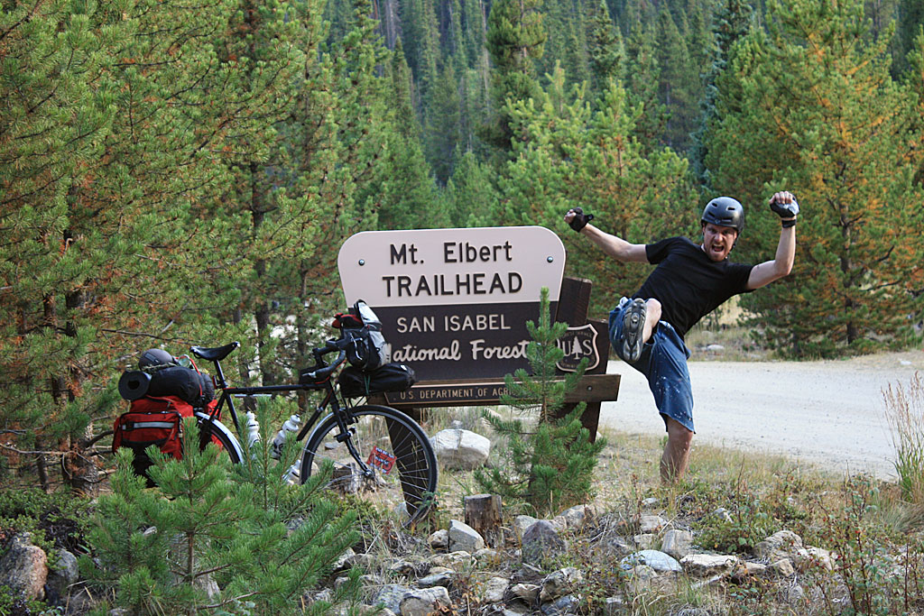
West of Leadville is the Sawatch Range, and ~9 miles from town, are the trailheads for both Mt. Elbert and Mt. Massive: the highest and second highest mountains in Colorado (Google’s directions – Mt. Massive’s trailhead is just a few hundred feet west of Mt. Elbert’s).
North of Leadville via US 24 is access to Mount of the Holy Cross (Google directions from Leadville) via the Half Moon Trailhead.
East of town is access to Mt. Sherman in the Tenmile/Mosquito range (directions from Leadville) via the Iowa Gulch Trailhead.
One of my favorite access points to some of the Sawatch 14ers is Chaffee County 390 to Winfield (an old mining site).
This road itself will give you access to La Plata Peak from the south, Mr. Huron, Missouri Mountain, Mt. Belford, and Mt. Oxford. You can spend a few days just on this one road! (Google directions)
Continuing down US 24 south will give you access to all other Sawatch 14ers Once at Buena Vista/Johnston Village, just continue South on US 285/24 all the way to Salida, where you can rejoin the GDMBR.
Although the easiest way to rejoin the GDMBR is to continue south down US 24/285… there is one other way to rejoin the GDMBR, straight from Leadville: Mosquito Pass!
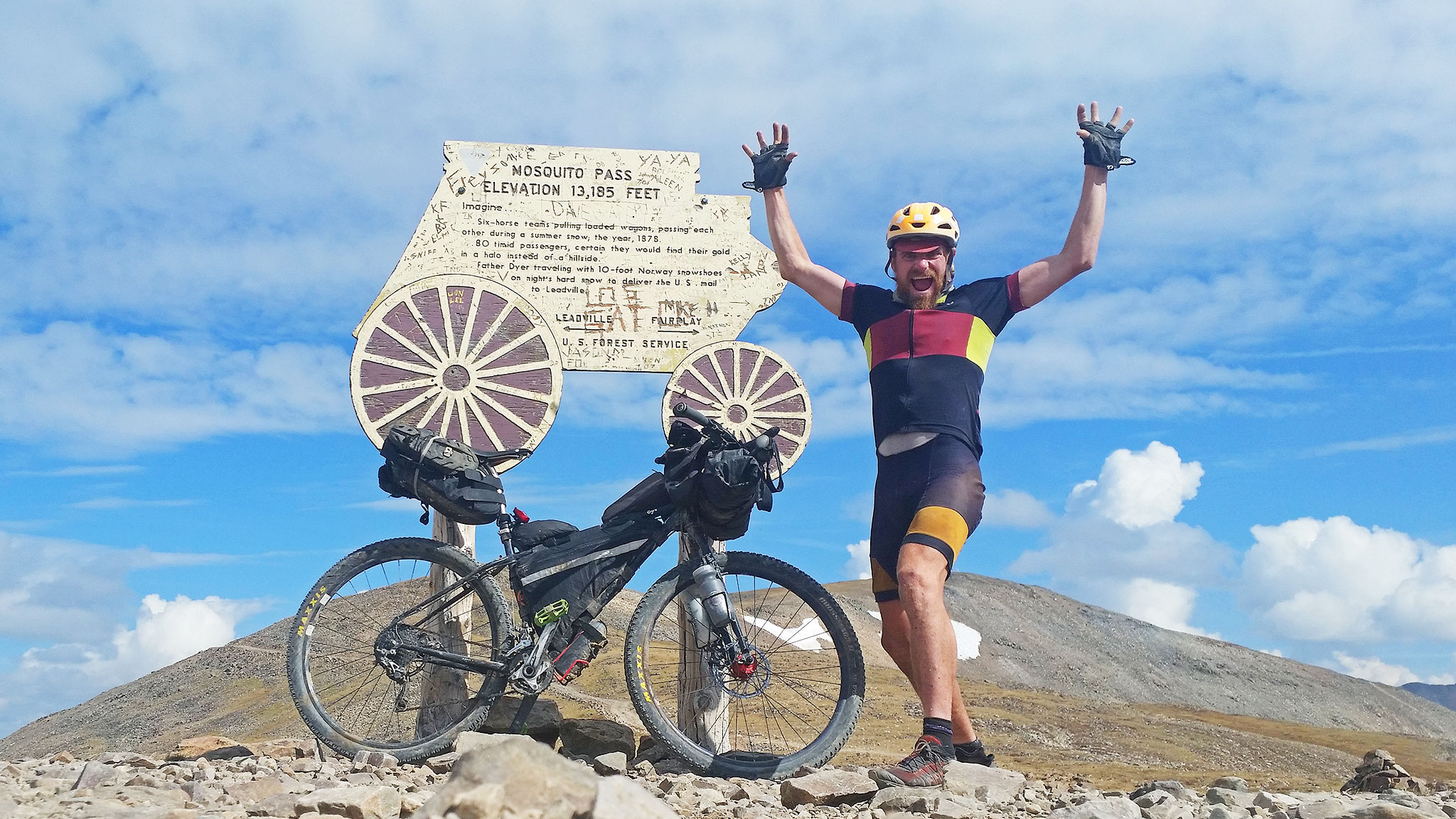
Be warned though: Mosquito Pass is one of the highest mountain passes in Colorado at over 13,000′! It’s not so much a shortcut back east, as it is an adventure in of itself. From Leadville, you’ll head east over Mosquito Pass, then outside of the town of Alma, and rejoin the GDMBR in Como (Google directions)
Breckenridge, Quandary, Alma, and DECALBRION!
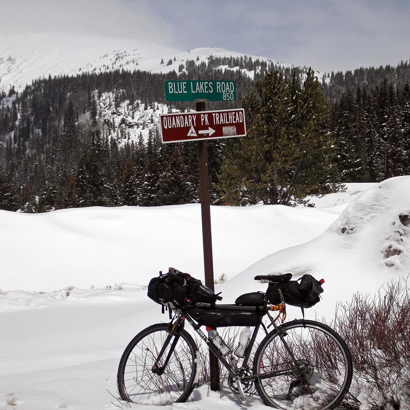
Speaking of Alma, the town of Alma lies just a few miles from the Kite Lake Trailhead. This trailhead gives you access to four 14ers you can do in a day. From the GDMBR, the easiest detour is from Breckenridge, just a few miles south of Frisco. Instead of turning onto Boreas Pass Road, you’ll continue straight up and over Hoosier Pass on Highway 9.
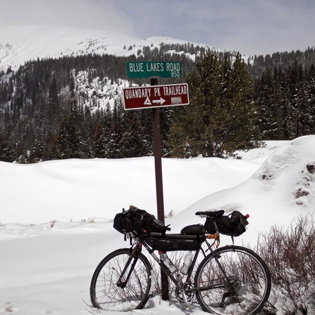
Nine miles out of town, and before you summit Hoosier Pass, you’ll come right to the trailhead for Quandary Peak, another 14er.
Continuing over Hoosier Pass, you’ll enter the town of the Alma. Just west of town, the Kite Lake Trailhead and access to Democrat, Cameron, Lincoln, and Bross. Continuing south on Highway 9, you’ll get to the town of Fairplay. Mt. Sherman can also be accessed from Fairplay via the Four Mile Creek Trailhead.
As before, you can then rejoin the GDMBR at Como, east via US 285. (Google directions). Try one, some or all of these options on your way back to the main route!
Salida, access to Shavano and Tabeguache
The last detour I’ll describe off the GDMBR is in Salida. Salida is a wonderful town on the route, and one I’d suggest staying more than a day, if you have the time. Conveniently, there are two 14ers just west outside of town: Shavano and Tabeguache (Google directions)
I’ve actually skipped a few other access points (for Mt. Harvard/Columbia, Mt. Yale, Mt. Princeton, and Mt. Antero), but the driving directions you can find on 14ers.com will work well for you, as all these peaks are accessed from US 24.
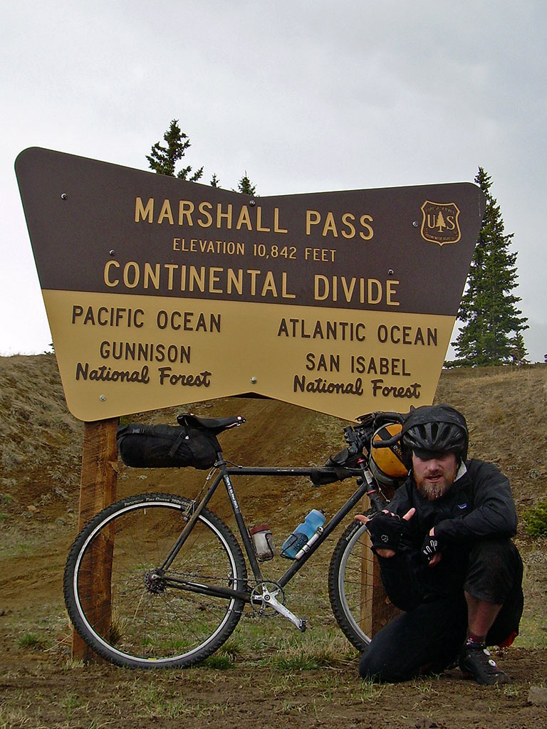
Sadly, that’s about it when it comes to easy access to Colorado 14ers off of the Great Divide Mountain Bike Route). One extra notable Centennial Peak you can grab right off the route is Mt. Ouray – it’s trailhead is right on the summit of Marshall Pass.
If your appetite has been whetted for detours off the GDMBR for hiking 14ers, and you don’t mind going even further off (that) route, see my post: GDMBR Detours: Lake City Linkup, which will take you far off the GDMBR and into the heart of the San Juans.
In a future post, I’ll describe the 14ers that can be accessed right off the Colorado Trail.
