Like this? Follow me:
![]() If you’re enjoying this content, considering joining my Patreon to support future work.
If you’re enjoying this content, considering joining my Patreon to support future work.
- This trip was also documented in the video, Invite the Chaos.
As soon as the bus pulls into Salida, I’m out the front door, heading down to the old school motel – the one at the outskirts of town with the larger than life flamingo statues, classic cars decorating the front, and rock-bottom room prices. I check in, throw my pack on the bed, then I’m out the door for dinner and to find a few forgotten necessities I’ll need for the next week. Lights out after finishing up my French fries; a 1:30 am alarm set.
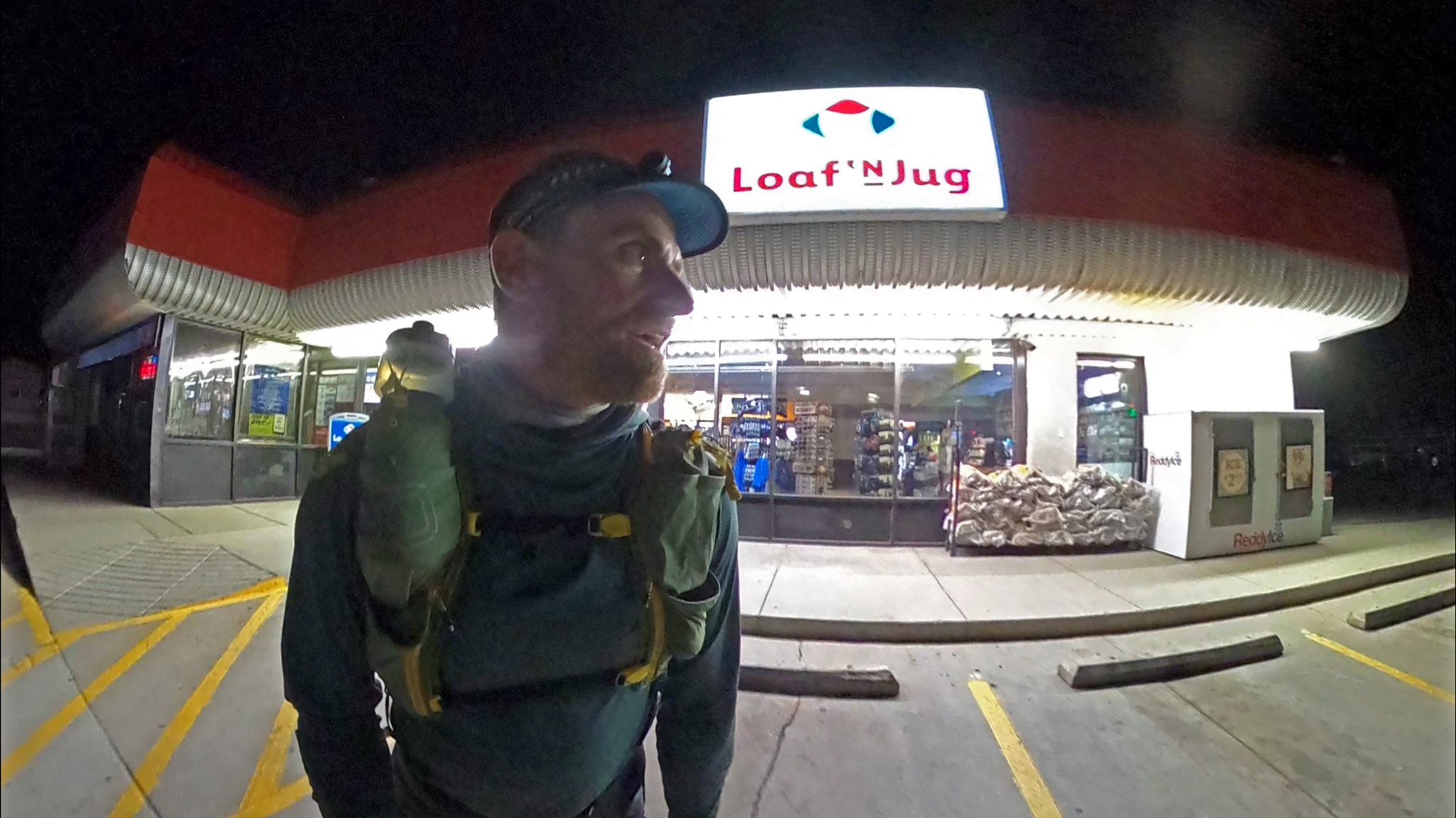
By 2:30am, I’m starting out from the Loaf ‘n Jug at the end of the corner, briskly walking up CR 107 towards the summit of Methodist Mountain, the first of a few dozen peaks that I’ll be topping out while traversing the entire Sangre de Cristo range, until the end of my traverse on Little Bear Peak, 120 miles away.
I would think a massive linkup like this to be impossible if I hadn’t done it myself before from the opposite direction a few years ago. Granted, it took almost 7 days, but I’ve now optimized, including slashing six pounds of total weight out of my already spartan kit.
To cut this much out, I had to ask myself some pretty serious questions. Like: did I really need a stove to melt snow for water? An ice axe for the snow climb up the Northwest Couloir of Crestone Needle (one of the route’s high points)? All those pesky warm and comfortable clothes? I’m betting big for the sake of weight savings that I did not.
My new sleeping bag fits as tight as a body bag to my large frame, but packs down to the size of a half a loaf of bread. It’s warm and comfortable, so long as I don’t move around too much. After a 20 hour day with upwards of 12,000’ of climbing, one does sleeps like the dead. The full traverse clocks in at around 60,000’ of elevation gain – two Everests climbed from sea-level worth – every ounce count I leave home helps.
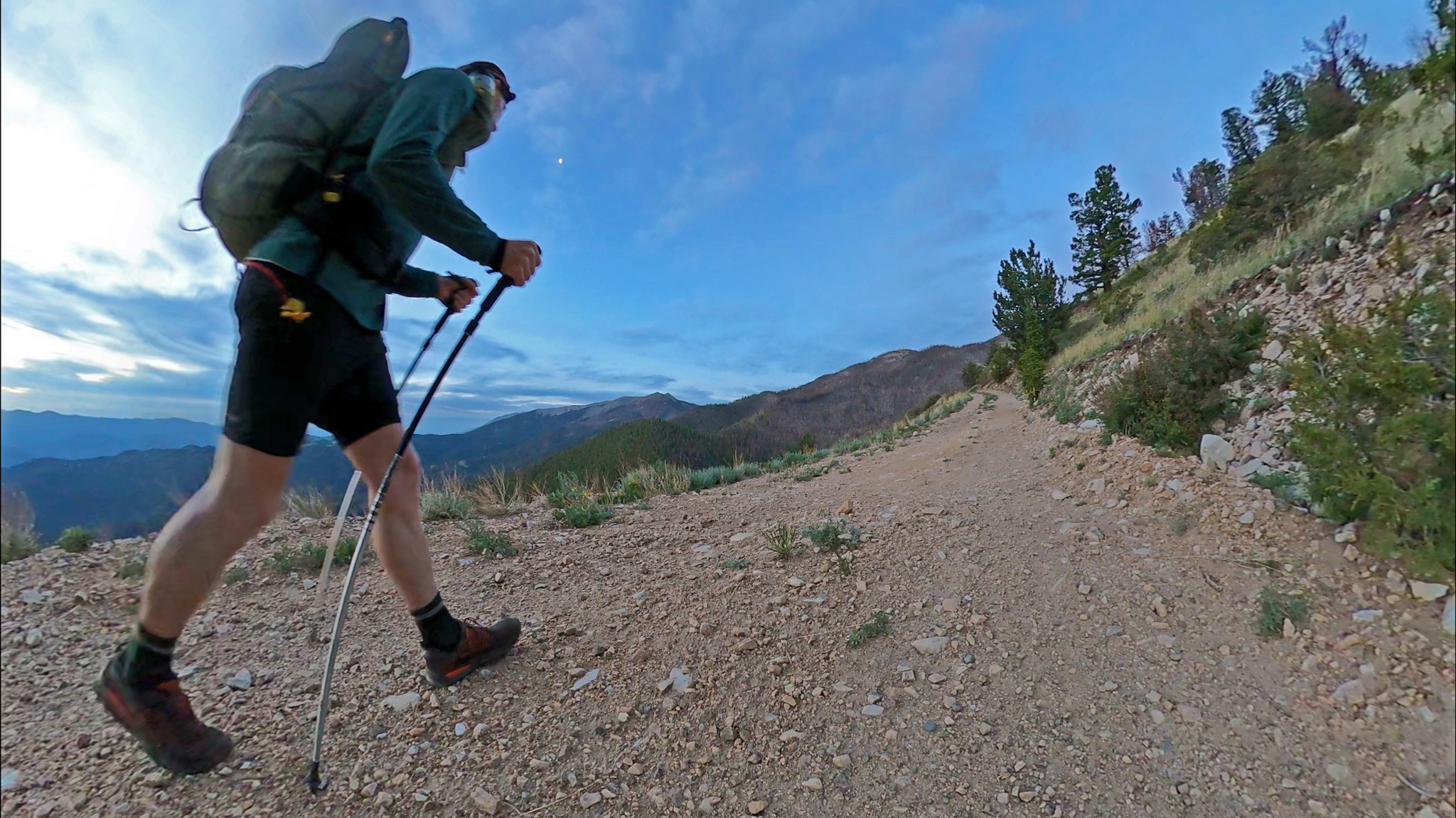
I also wagered that this direction was naturally faster, even though it doesn’t seem anyone has yet gone north to south yet. The first 10 miles are a nonchalant road walk up to Methodist, then easy Class 2 talus hopping for another 20 miles to Hayden Pass – one of the route’s low points, and if I could get to it: a comfortable place to bivy far below treeline.
Things on the line don’t get too serious until a few miles later, where the range rises to over 12,000 feet and stays there for forty straight miles. But before then and with fresh legs, you could really make some headway, starting to work on making that 13 pounds of food brought disappear through mastication.
To compare going South to North, your first day forces you to encounter three 14ers, a technical traverse across two of them, and summiting a Centennial, before anything approaching level ground is found for you to pass out upon.
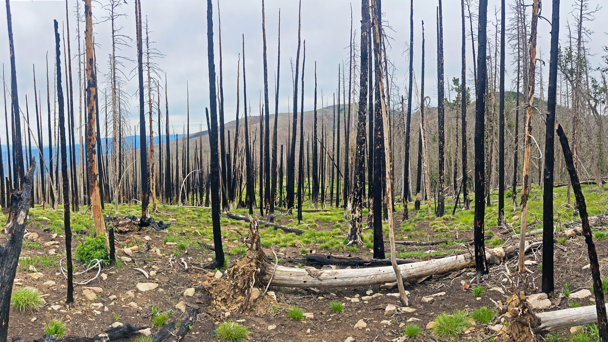
I greet the summit of Methodist mountain along with the sun rising from the east. A little breezy, but the weather was mostly fair. I was hearing rumors from locals that the blow down just ahead which swamped me in a self-pity quagmire on my first trip was miraculously absent, being one of the victims of the 9,000 acre Decker Fire:
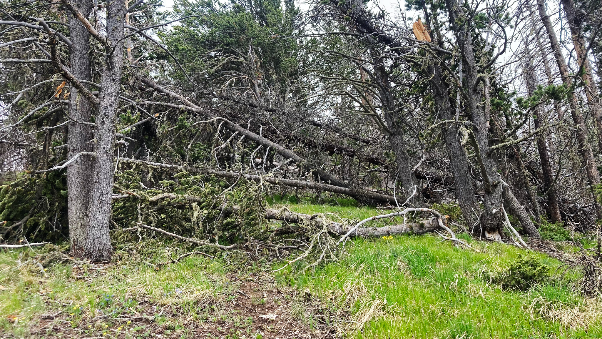
In 2019, between me and guaranteed cold drinks and all the salty potato chips I could snack on back down at the Jug, was an obstacle course of massive downed tree trunks with dagger-like snapped-off branches, with no way to shortcut around. It had taken hours to weave a wandering path up, down, and around this cataract of timber. Clothes were torn up and I was left with scratches all over my body. Amazed I didn’t lose an eye. I’ll take high exposure and crumbling cliffs any day, but stuck in an overgrown underbrush for too long brings me to my knees.
Upon reaching this area, I was left gobsmacked, finding all that talk to be true! I giggled to myself, as I merely sauntered through a landscape of scorched earth and bare, but still standing tree trunks. With light feet, I continued.
The rest of the peaks for that day felt a good warm up: Simmons, Hunts, Red, Twin Sisters, Bushnell, Otto – all Class 2 talus hops. With the goal of beating my former mileage for this section, I keep pushing it through the night as far as I feel capable of doing: almost 26 miles towards Hayden Pass. 12,000’ of elevation gain. Day #1 in 2019 was less than 15 miles, with 9700’ of gain. A cracking start and confirmation of my speed theory.
If I could keep this pace up (a big “if”), I could wrap up this Mother in five days! I bedded down on an admittedly crap location of sloping tundra. The location offered a menial shelf to escape a little bit of the rising breeze, but I thought, “Good enough.” This isn’t unusual for ridge traverses. Any relatively flat, relatively soft plot of land that’s about the shape of a coffin works, when all the other alternatives are piles of rocks at various angles of repose.
Brr!
I woke up in the early morning colder than I wanted to be. And parched. I made a note to try to drink more, and to put on my bottom woolies at the next bivy – maybe even my rain pants to act as a vapor barrier. Seemed alarmingly late before I started moving again – 6:30am. I may have overcooked it the day before. But I wasn’t interested in a party pace on this trip, I was out for blood. Every morning is going to be rough.
I noticed a lack of sloshing from within my pack: about done with the 4 liters of water I managed to haul up from town. I find the entire range unseasonally dry this year. In 2019 I had to delay my trip by a month to allow for a late dumping of snow in May to melt off enough. An hour into this day from a high summit, I spy a lone patch of snow below: perfect. But as if from a Saturday morning cartoon, I go down looking for my oasis of moisture, only to have it disappear right in front of my eyes. Dejected, I trudge back up to the ridge and oafishly keep going. Was the snow there and I just couldn’t find it, or…?
From experience, I knew that this severe dip in mental acuity often happens when one mixes a cocktail of all-day traveling, outdoor exposure of the elements, and little if any sleep. You’re sort of losing your mind – but you’re doing it for fun! At the extreme, it becomes an almost religious experience. No wonder many of the most remarkable coming to God moments happen to prophets alone, tired, in the desert.
Another peak summited, and I spot another patch of snow down below. This time, it seems quite real – down a loose scree slope, near the start of treeline. I memorize the area, dump most of my gear on top of the ridge, and scree surf down. Again, I’m at a loss: it’s nowhere to be seen – supposedly hiding out deep in some rock crevasse, away from the sun that eagerly wants to wipe it away for good, as well as my eyes. This is getting serious: if I can’t find snow soon, I’m looking at more than 10 miles until the next opportunity.
Back on the ridge, I backtrack north up to a high point – if I’m hallucinating, I bet to myself I wouldn’t see the same patch of snow twice. One part of me – perhaps the majority, wants to lose this bet, prove that I am seeing things, and laugh in triumph. The rest of me is just thirsty.
I turn around after climbing up a bit, and see that same snow patch again. Down the scree slope I go with my flask, I identify the correct area the snow is hiding out in this time, greedily grab as much as I can to passively melt. My flask is 4 liters in capacity, but the snow takes up more space than melted water, so I’ll probably have two liters of water to drink while looking for me. I descend towards Hayden Pass to lunch and a nap. Feels like I need it – my brain is already fried from all this sunny weather.
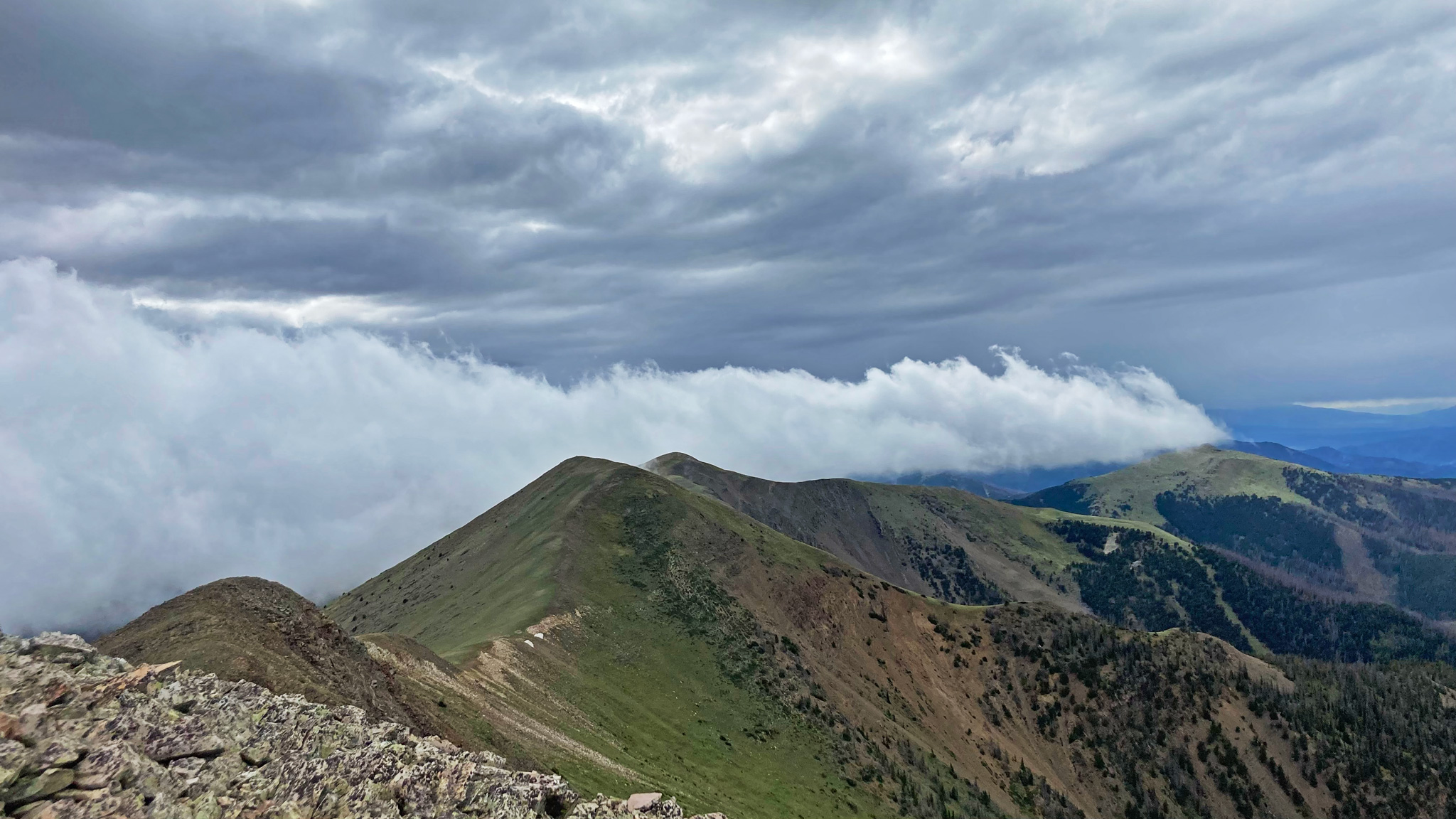
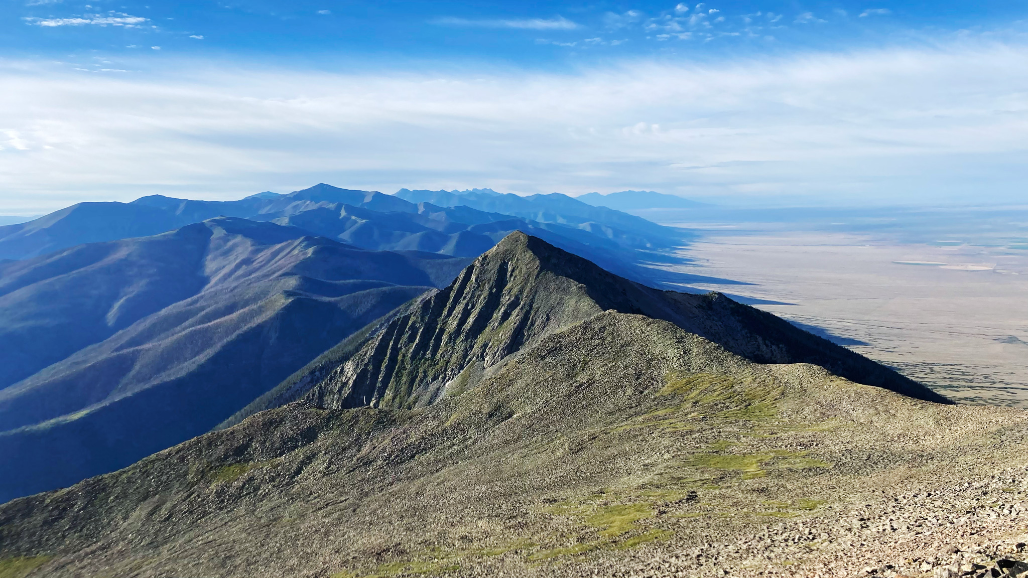
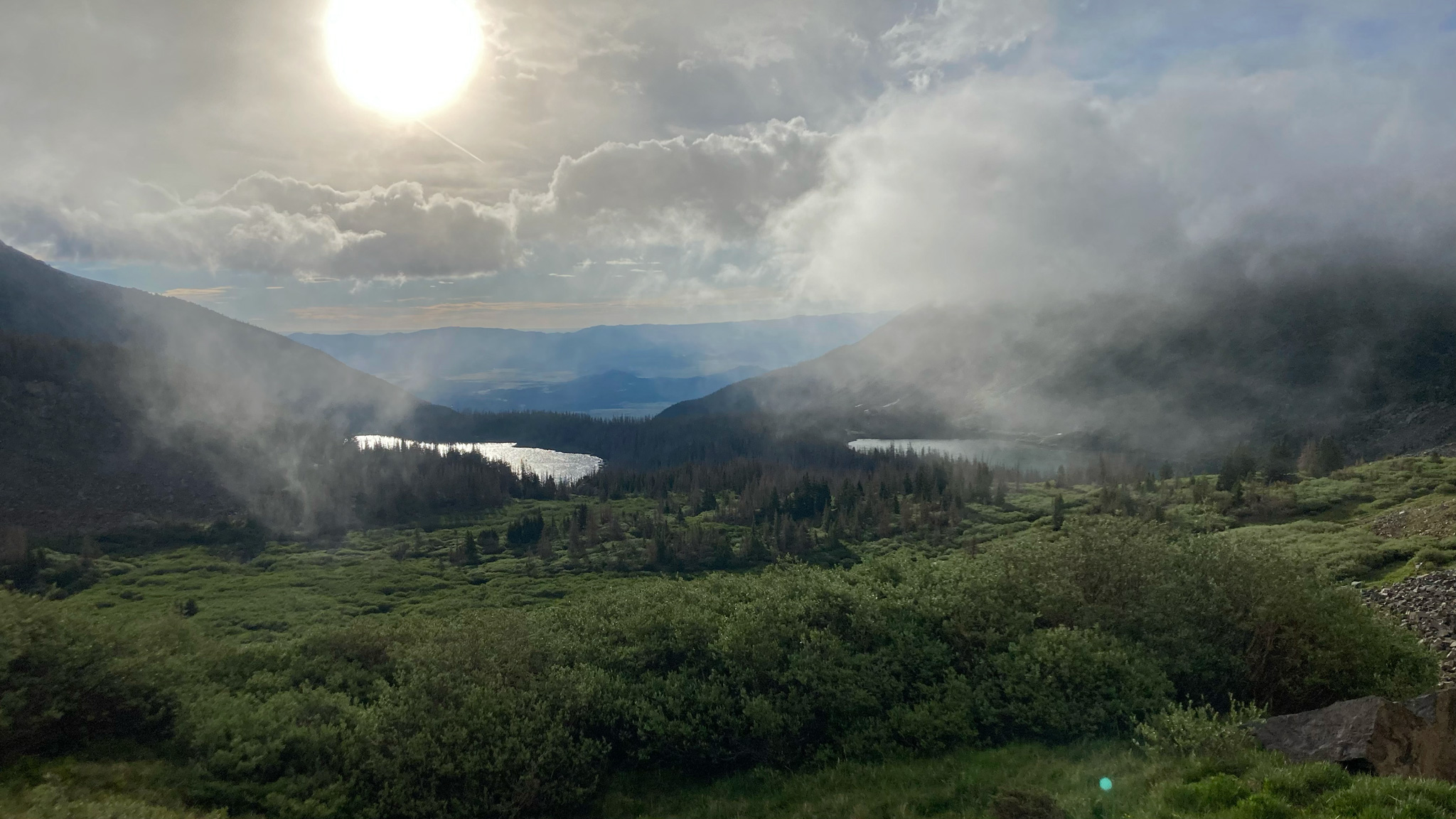
The traverse south of Hayden Pass starts in the trees again, until hitting that money portion of the route that never goes under 12,000’ for over 40 miles, finally dipping below at Music Pass. It’s an unrelenting sea of peaks: 1000’ foot climb in a half mile, a summit, then descending 1,000’ to the saddle shared with the next peak. Extremely excited to get into this terrain again – there’s literally nothing else like it in the State if not in the lower 48.
The trail up from Hayden Pass starts with blowdown right behind the trailhead sign, and intermittent trees haphazardly blocking the trail would be the norm. But it’s all manageable, especially from what I’ve experienced in the past – almost fun!
I had actually forgotten – or more specifically never formed memories of this section in 2019 due to exhaustion – it was day 6 of 7, which made things interesting to revisit it all for the first time. The reprieve from high alpine wandering was a welcome one, and I found my rhythm again, despite the lack of Z’s
Passing another new to me burn area, I saw its first hand revitalization: many hungry aspen groves flourishing, and wild strawberry shoots running anywhere the wildflowers weren’t choking out already. Small herds of elk frolicked around me, just out of reach, not used to human travelers outside the hunting seasons.
Clouds began to gather. I could feel the wind revolt around me as I summited Nipple Mountain, moving in from the west, tracing pinwheels in the sky. The sheer heft of the rising ridgeline seemed to be blocking the system from going further east, and to my naive eyes, not enough energy was in the system itself to cause too much bother to me in terms of thunder and lightning – at least immediately.
I kept an eye out to the west and continued south. Still ample opportunity to rush down quickly into the trees and out of danger of lightning if I needed to, without losing too much ground. It started spitting, but not enough for me to want to put on my rain gear. Just usual mountain weather. Quite refreshing to be out of direct sunlight.
Onwards and the ridgeline finally cast off its velvet of trees, leaving only talus and cliffs as far as I could see. A wry smile started to envelop my face as I felt the excitement of starting to be above treeline for the next few days. The next high point, Cottonwood Peak greets me with a snow squall that accumulated enough on the wrinkles of my midlayer for me to take notice. But as soon as it blew in, it blew out.
“A shelter tonight might not be a bad idea,” I think to myself.
Who knew if another expedient system would run its course through my path? Sure would hate to be interrupted from my sleep at night.
It’s 8pm, and I start to tire again. Two options are open to me:
Caffeinate myself up and keep going; sleep at an unknown spot. Or, pack it in for the night and sleep at a place I knew would be at the very least: tenable. The southern saddle of Thirsty Peak right up ahead features an out of character flat area right on the ridgeline that can hold an entire boy scout troop if pressed into service.
It is at 13,000’, but beyond that, a sharp buttress marks the steep start up towards Lakes Peak. I’ve only felt my way down Lakes in the middle of the night, but I remember it being semi-technical, with the memory of crab crawling down towards the saddle not something I could have forgotten.
I choose the conservative choice to bivy below Thirsty. This wasn’t as far as I had wanted to go on this day, but I consoled myself that a good sleep is worth twice as much time-wise than lumbering up and down ridgelines half asleep on only the second day. Maybe I’ll wake up extra early tomorrow. Even though I wanted to travel fast, I still had to play the long game and keep my mental acuity somewhat reasonable.
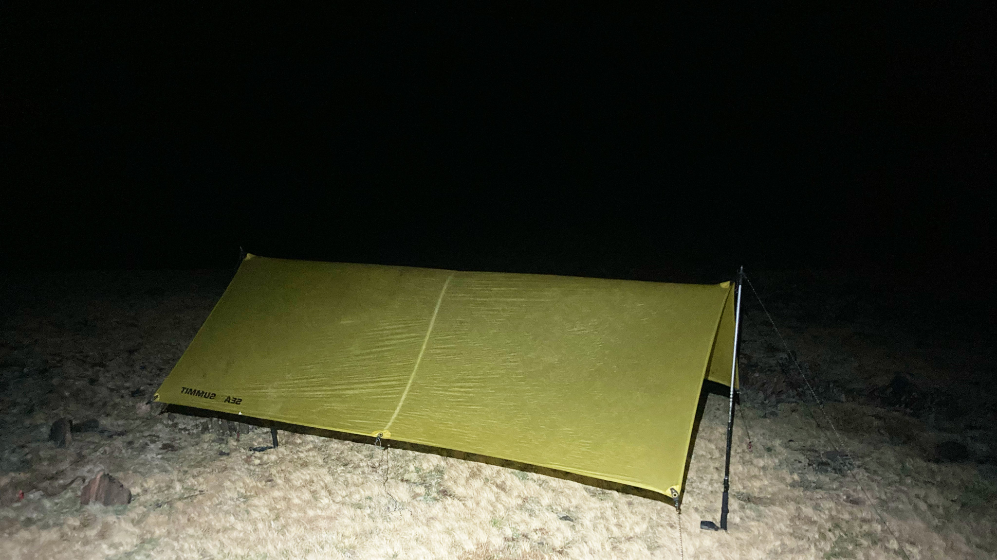
I took time to pick out a perfect spot to bivy. The soil and tundra here is deep enough to put in a few good stakes – quite the luxury. The tarp I brought is simply a rectangular piece of silnylon, with grommets to plug my trekking poles into. A rudimentary A-Frame is probably my best choice for a configuration.
Embarrassingly, even though I’ve taught whole groups how to put these fucking things up, I’m still particularly crap at doing so myself. One side manages to get barely tacked up with a pole for support, then I wander over to the other side to repeat the steps, only for the far side to flop over. Repeat this until somehow, the tarp stands up by itself and only then do I tighten things down. If filmed on a hand-cranked film camera, you would have a scene out of a Little Tramp short. This is all exacerbated by my trekking poles, which aren’t height-adjustable: the tarp stands higher than I’d like. But, it’ll keep an itinerant squall at bay.
Finishing, I stand back to marvel at my work as a first grader looks proud in front of a finger painting. I snake into my sleeping bag, set the alarm for an early time, then pass out.
THWACK! THWACK! THWACK!
I open a crust-covered eye.
“Gotten a little breezy,” I surmise.
A loose guyline is hitting the tarp at an annoyingly quick tempo. I’m wrestled awake and decide to flip on my head torch just to check on things – maybe a stake came out? Greeting my beam is half of the tarp pushed taut, straight into my face like an overzealous dog impatiently waiting for her morning walk; the other side of the tarp seemingly already running out the door.
I erected the tarp to be perpendicular with the direction of the wind. Great to try to shield oneself from both wind and weather; bad if one doesn’t want to haphazardly launch off from the ridge itself.
If the wind doesn’t let up, this tarp is not long for its earthly home. I remember being in a similar predicament with an actual three season tent: after a few hours, with many of the tent poles having snapped in half, I simply awaited liftoff to land at a point halfway to Kansas.
But today I told myself this was merely another passing squall – like the brief snow storm a few hours before. It blew in, it’ll blow out. I’ll get back to sleep in just a few, and get on with my day in the early predawn. Maybe the rock on the initial ridge would be a little wet, but that’s not the end of the world. Now just to wait this out…
The hours slowly evaporated away. The now-gale has strengthened, and everything around me has become drenched with the moisture of existing in a weeping cloud. I fear the jetstream has heavily settled down onto my lap. The power of the moon lights up the entire landscape with a ghoulish glow. I’ve been holding the guyline taught by wrapping it around my finger, it’s now turning white and clammy from lack of circulation. I keep waiting for either a climactic event to occur or be surprisingly relieved when this all astonishingly ceases.
TEEEEEEAR!
The tarp’s fabric finally surrenders to the elements in heightened dramatics, now I find it flapping around like a raggedy flag. I’m greeted to the surprise lack of shelter with a shocking wave of mist in my face. Instinctively, I wrap what is left of the tarp around myself and burrow deep into my bivy sack. A few hours before, I had put on my raincoat to sleep in, now the hood was working well as a top cap to the opening of the sack. Although fairly miserable in my ship-wretchedness, I’m still relatively dry and… still sort of warm.
Despite all the histrionics around me, there is nothing more to do but hold fast until morning. Can’t move anywhere – where was I to go? How was I going to pack things up in this wind storm – and in the dark?! Dangerous situations are oftentimes also exceptionally boring. The threshing of the loose pieces of tarp are deafening, making sleep all but impossible. I only had two questions I needed to ponder: if and when to call Search and Rescue; and where to go if I could self-extract?
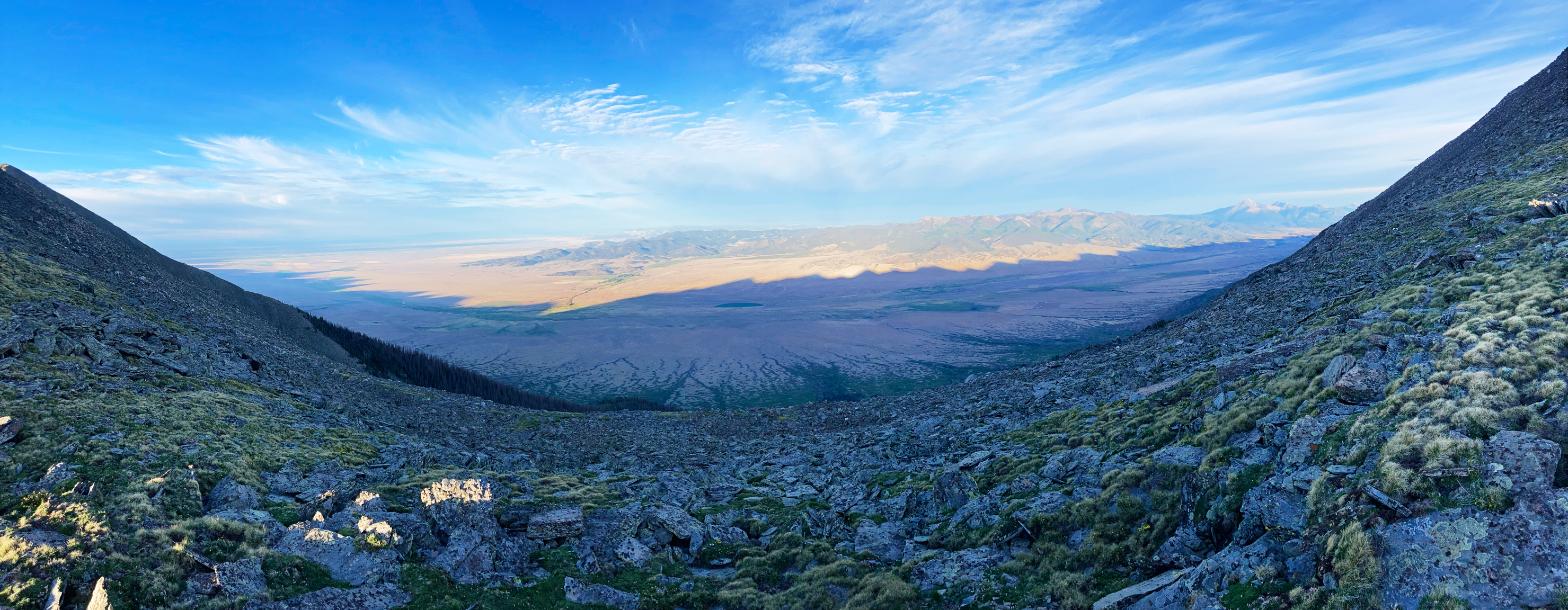
Rescue via SAR seemed a laughable idea. I was at ceiling zero – within a cloud, and out of reach from anyone from above. Glancing at my map for a possible exit in the morning, I estimated that it’s about 9 miles to the nearest trailhead east. Not close. I had no idea what would be in store for me dropping in the basin. The map did show a trail halfway down the basin, but maps often lie.
I made notes about this basin beforehand, how the lakes shown would be a great water source if one couldn’t find snow on the ridge, but I had no first hand experience in getting down to them. The topo lines made it look straightforward enough, but the devil is in the details. I keep patiently waiting.
I knew I was getting wetter and wetter, the loft of my ultralight sleeping bag’s goose fill seemingly melting around me. The less I moved around it seemed, the better. The hours ticked on…
Finally around 6:00am, it was time to rise up with the sun, the only goal being to pack everything up, without losing any of my gear, and leave. Hard to do, as the gear I needed to stuff into their respective sacks is what I was presently wrapped around – the gear keeping me alive. There was still an absolute gale around me, and nothing to break the relentless wind battering my menial camp. I sit up, turn my back to the wind and in discrete steps I slowly get to work, ignoring much of the weather’s impacts to my environment.
First, my old-man pillow deflated and stowed away. The ripped tarp, complete with stakes knotted all up in the guy lines, is mashed into a soggy ball. Sleeping pad deflated and wadded tightly up. Finally, my sleeping bag is rung out carefully and stuffed into its own bag.
Although out of its usually meticulous order, all my gear is back in my minuscule pack: good enough. I can finally venture off the ridge and into the unknown – helped incidentally by the wind that has been trying to blow me off this ridge for the last few hours.
I wasn’t happy to bail from a project I’ve spent countless hours daydreaming about, but it was impossible to ignore that the weather just wasn’t going to cooperate even if I somehow made it through the night relatively dry. I didn’t know how long the jet stream was planning to be parked in the area. An hour, a week?
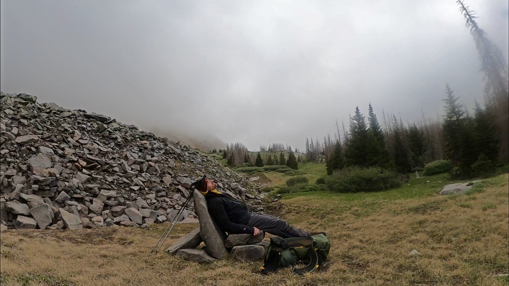
Only one garbage chute gully of rocks separated me from the pristine looking alpine lakes and forest found below, the rest was easy talus hopping at a reasonable angle until I met up with talus, bushes, trees!
I couldn’t have been more fortuitous, as no other option like this presents itself for dozens of miles. Finding a makeshift chair made out of flat rocks, I drop my pack, and indulge in a 20 minute nap to recover from the past 7 hour ordeal. Once awake, I repack more carefully, and look for this so-called trail to hike down.
It seems not to exist.
I knew that people had been up here – and recently. Bootprints, a forgotten trowel, as well as a large cookpot were littering a lakeside campsite. That should mean there’s an easy way up, right? The farther down I venture past the lakes, the worst the terrain became. Any trace of a main trail disappeared, leaving me to chase social trails that just led to dispersed campsites and dead ends. I easily lose my patience at the best of times and right now, I’d rather just gamble it all and take the directissima line down.
Days before, I was relieved to have dodged the bullet of blown-down trees choking off my way; now I was in some of the worst blow down I’ve ever encountered – and added to this melee, a full-on creek is snaking around the path of least resistance. At least becoming dehydrated is now a past problem. I just couldn’t surmise how long it was going to take to get out of here. What irony to escape the ridge storm only to succumb to a broken leg down in the trees.
In a small clearing, surrounded by great tree trunks fallen from a past microburst, I gorge on about a thousand calories, take another small nap, and come to terms with my situation: I am exhausted, and the terrain was an almost impenetrable sea of cataract tree trunks and branchs. I would just have to take my time, try not to slip and impale myself on a sharpened branch and laugh at all this. Make it… a game! A puzzle if you will, and gosh Justin: you love puzzles! With a renewed vigor, I set off, weaving my way around the downed and confused forest.
Five minutes later, I happen right upon the trail.
Having little idea where it had materialized up the hill, I am relieved that it exists at all and greedily make my way down on any actual path. The plan now was to take it all the way to the Rainbow Trail, then take Rainbow north back to Salida, where I had actually crossed it on the first morning. I had some extra time now, as I surprisingly seem to not have died from exposure and hubris a few hours ago.
Rainbow Trail is a funky system: since it’s made more for motos than hikers. I wasn’t really expecting a wilderness experience. Chuckling to myself that I was soon to become a, “Rainbow Trail Segment Hiker”, I would wear this dubious title with honor for absolutely no one.
Once down – and I really mean down: the Rainbow Trail is almost out of the subalpine zone and into some fairly hot terrain, I hung up all my sopping gear on the branches of a pair of pine trees to dry out and make snore for two hours underneath. No reason to start my alt. in the middle of the day! What’s the rush now?
Once awake, the weather had turned much cloudier, that same system still swirling around in the high country, and threatening to even bring the rain all the way down here. Perfect for some low elevation hiking. The Rainbow Trail didn’t really offer too many surprises to begin with – being two-track in width and fairly exposed with little tree cover. But the more north I traveled on the trail, the weirder things became.
In many places, the trail all but disappears, having been a victim of the same fire I had seen up high. In the trail’s place is an often chaotic array of choices forced through by motor’d enthusiasts. It’s not that the trail has been abandoned or forgotten, but things are certainly in flux. Reroutes were of varying quality – some put in by excavator machines; others are just the repeated tread of dirt bike tires. My map of the trail was worthless: the new alignment being all over the place. I took all this in stride, as there was nothing to do but continue on.
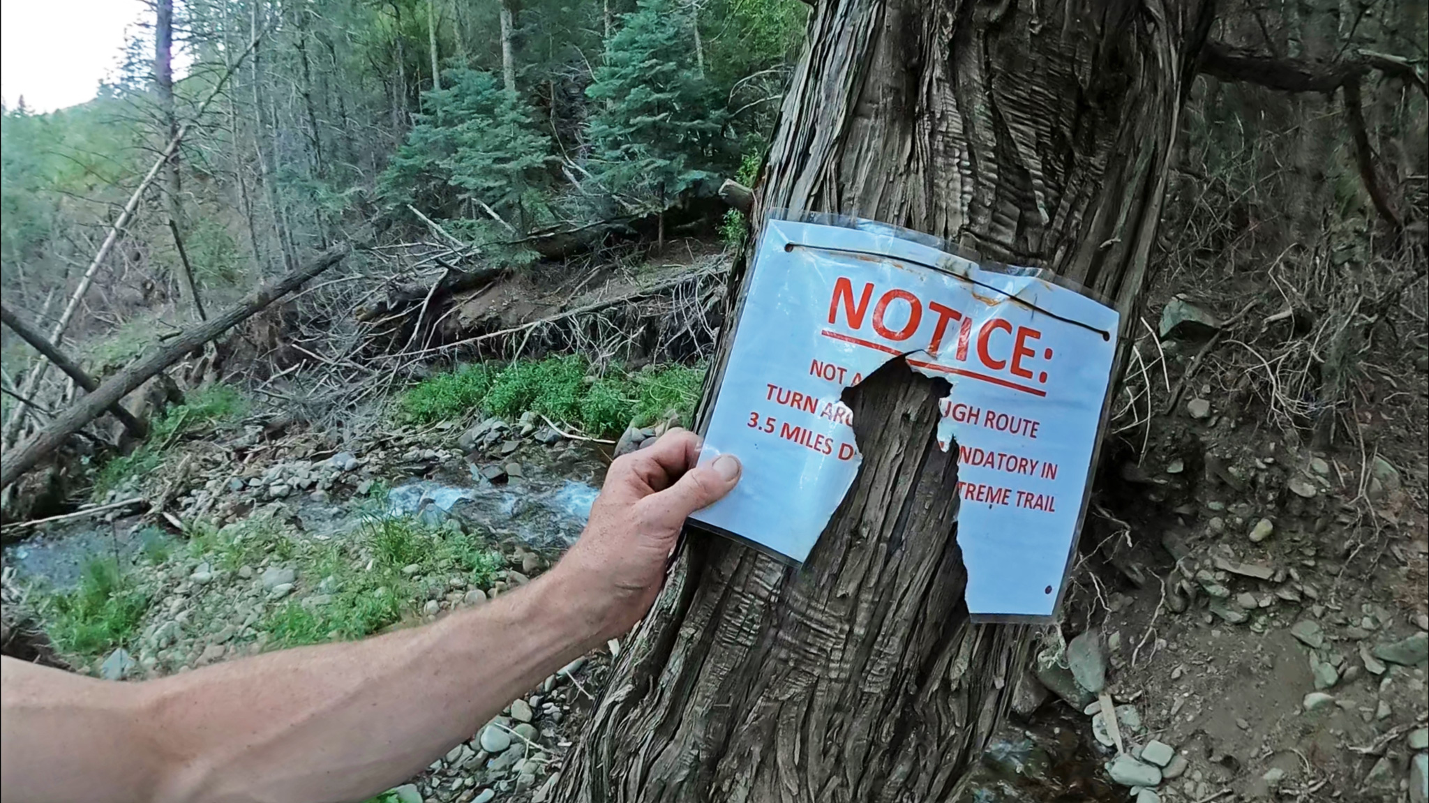
By 8:00pm, I made it to Big Cottonwood Creek Trailhead. The creek was quite lively with fresh meltwater, and I cleaned up a bit and refilled my flask. I knew I’d be hiking up towards Hayden Pass Road, with some substantial elevation gain. No real water would be available until I dipped down again – and really: I had no idea where that would be, as I was onsighting all this, having not planned to be in this part of the area at all. I needed to stop somewhere a bit before – I doubt I could make the 6.5 miles without sleeping.
Making it only about 100 meters, I encounter a foreboding sign: “MANDATORY TURN AROUND 3.5 MILES” – the sign itself looking as if it’s seen a regional military skirmish or two. Past the sign, the entire slope had given way, into yet another cataract of blowdown. I had to guffaw. Usually going off-trail is very much part of my repertoire, but this sign: I believe.
If I couldn’t hike the Rainbow Trail, I guess I could simply hitch back to Salida from the highway. Spying my map, the forest service route dumps you on the highway in a canyon, so no great shoulder to stick a thumb out. What to do what to do… I’ve just about reached my limit for critical thinking for the last 24 hours, deciding to leave that as a bridge I’ll cross when I get there.
Dejected, I make it down the forest service road until I hit what looks like a bunch of summer houses, then I backtrack it back to National Forest to camp. But on my about face, I notice a well-maintained yet unmarked ATV trail going up. Not on any of my maps, either.
Thinking there’s no harm in seeing where this went – perhaps it would link me up to Hayden Pass, and allowing me to cancel the hitchhiking plan? Could it really be used as a detour to points on the Rainbow Trail north? It was now 10:30pm, but what else do I have on my plate, except sleeping in the dirt? Might as well sleep in what seems like more attractive dirt up there.
With renewed vigor, I set forth into the unknown, making good progress both to the north and towards the mountains. That was, until I heard the mooing of cows and set off the flash of a trailside camera.
“I’m on a private ranch, aren’t I? Those were ranch houses. I’m about to get a search party after me for trespassing…”
My ATV trail started to turn more west, then south – a bit more wandering than I would have liked and I wasn’t sure it was going to right itself. It’s fun to do dumb things exhausted, and this was no exception, but I had to admit defeat on this track, and wander back down at double speed. A few hundred meters before the start, I stumble a bit off trail to a nice, flat piece of dirt to bed down for the night: alarm set for 3:00am.
Up and about at this evilly early time, I make haste to get out of the ranch property, and down to the highway. The houses I passed earlier were merely the start of a huge complex – if anyone wanted to catch me, they would have copious opportunities, but I doubt anyone really cared. Once on the highway, it was as I expected: a crap location to hitch a ride.
My best chance, I wagered, was to walk a mile further north to the intersection with the Hayden Pass Road. May give me a small stream of outdoor enthusiasts coming from Hayden Pass sympathetic to my cause.
Arriving at the intersection, I find a hippie campsite, an arts and collectables gallery, a post office and a massive shoulder to use to turn off into this mini complex. Couldn’t have planned this better. I make a naked bed in the tall grass at the roadside campsite – it was still a half hour before daylight! Then awake with the sun for what I expected to be a long morning putting my thumb out for a ride. As a grizzled looking dude who had just logged a death defying night, I didn’t expect to attract an easy to come by ride.
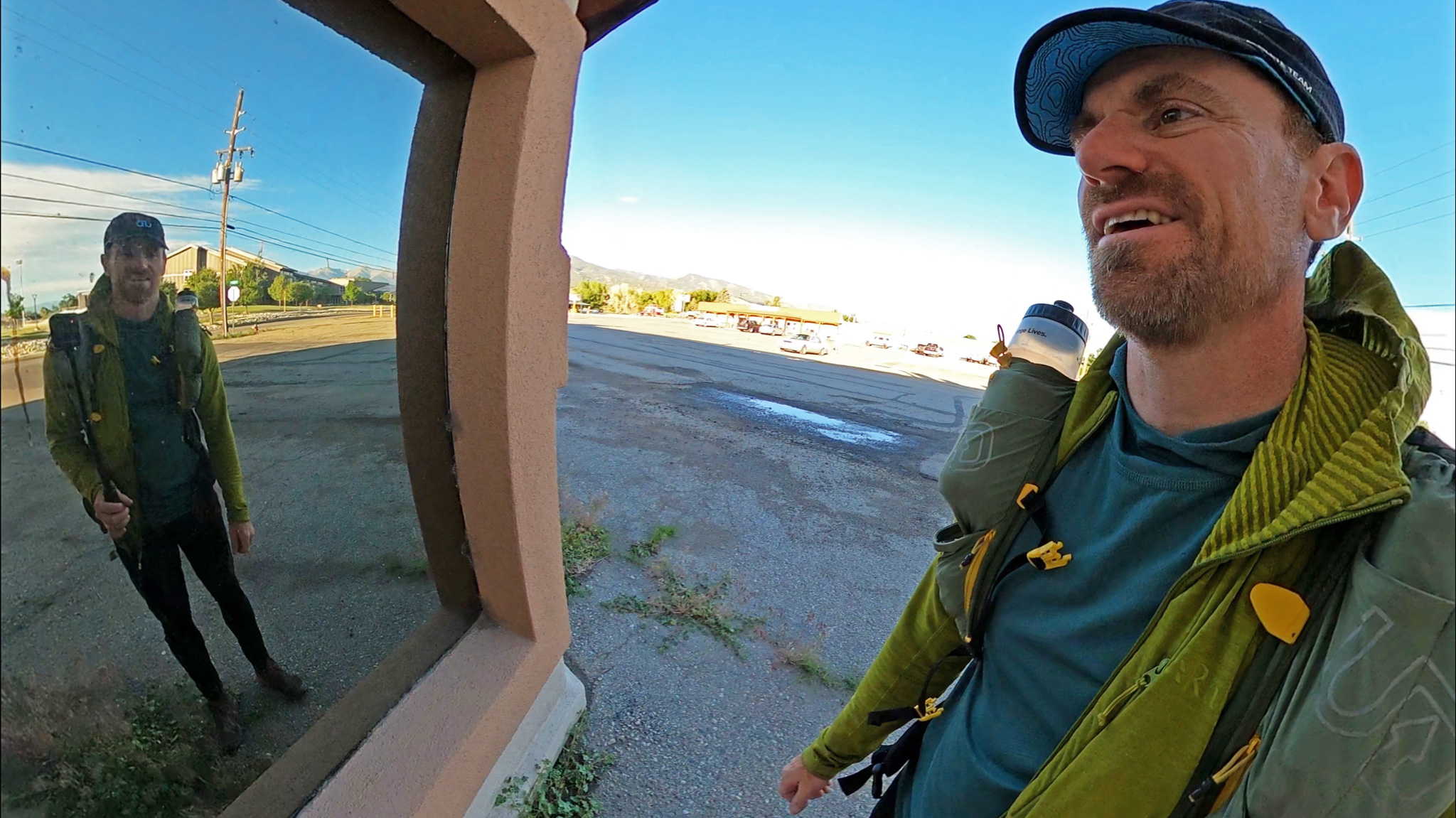
5 passing cars later, a 65 year old woman traveling alone except for 3 dogs stops to offer me a seat, all the way to Salida. We hit it off immediately and have a grand ol’ time yammering away, the stink of my misadventure slowly enveloping their car, as I receive puppy kisses from a precocious pint-sized golden retriever.
I make it back to Salida in time to not only catch the bus home, but to have a pancake breakfast beforehand. Hot coffee! Whisked away from the ridgeline, I was back home in Boulder, CO before 2:00pm, finally able to indulge in 12 hours of uninterrupted sleep, before starting to really process all that had happened to me in the stretch of just a few days.
Mulling away at my ridge weather misfortunes, it’s not surprising to me how almost blasé I was in a situation that may have led others to panic and perhaps perish. Although not entirely routine in my life, I have been in worse situations. I knew what to expect: the long bouts of feeling relatively useless in effecting my situation in any constructive way being paramount. Sometimes, you just have to ride the shit situation out.
But there were still some good decisions I had made that might have made all the difference. I brought a water-resistant bivy sack (or any bivy sack, at all!), rather than the feathelight bivy I had brought the last time. The latter whose job is more to keep dirt off the sleeping bag and bugs out of my face, rather than give any protection to the environment. I took along six tent stakes instead of the four my notes from my last trip said I had used. Who knew how many extra hours those two stakes gave me that night.
I had also decided on a fairly stout raincoat in lieu of the wispy trail running jacket I stretch the performance out of – even though it’s really just designed to get you back to your car when a downpour is imminent. I had days of food and battery power. I made a fortuitous decision on where to stop on the ridge for the night, even if a ridgeline itself is a fairly precipitous place to bivy at all.
And because of all that, in around a day, I had escaped in good spirits, munching on bacon back in town, almost all on my own power. Thankfully my experience, wrought on by some questionable past decisions I survived before, doesn’t weigh all that much, and wasn’t something I mistakenly left at home.
![]() If you’re enjoying this content, considering joining my Patreon to support future work.
If you’re enjoying this content, considering joining my Patreon to support future work.

Nice write up. Too bad about the weather. Awesome you found the rainbow trail after all. Funny about the “finding god” while thirsty, sleep deprived, and in the desert. Happy trails!
Great read (and walk!). I for one enjoyed this.
Congratulations on a safe return to the lowlands. I’ve been pondering the Sangre Traverse for decades, but I might be over the hill for such a strong project, nonetheless, I’d love to know what your (en)lightened kit was composed of. Stay safe!
[…] Ceiling Zero on Thirsty Peak […]