Like this? Follow me:
I HAD SO MUCH FUN on my “failed” Nolans run. “Failed” in quotes, as I believe I set my intention on trying to do the best I could do to get through summiting 14 14ers in a row in less than 60 hours. But I came up short – only summiting 7. Cutting it short felt the best thing to do at the time.
Here’s how my 33 hours on the Nolans Line went down:
My Nolans 14 trip started in earnest with catching the bus from Boulder to Denver, then another bus to Salida. Another related project of mine that I’ve been working on is documenting how to access the mountains of Colorado using things like public transportation and of course: human power (bicycles!).
My thesis is that one does not necessarily need a car – and certainly not an expensive and fuel-inefficient SUV/4WD vehicle to enjoy the type of activities that I’m passionate about. If I hadn’t already proven that with my Tour 14er, and again with my Tour of the Highest Hundred, I could describe people other alternatives that may not require such elite fitness.
This is the fifth trip I’ve done by taking the bus to the mountains this year – the first was for my Sangres Traverse trip, which was bookended by bus rides – just like I was hoping this Sawatch/Nolans 14 trip would be.
Taking the bus to the mountains feels almost futuristic– as if we finally have caught up to how things are done in Europe. I remember living in Paris a decade ago, and wanting to visit a friend in Switzerland. But how? It just meant going to the closest train station, buying a ticket, and getting on the right train. Why isn’t it not like that here? Well in some cases, it is!
Once in Salida, I grabbed a quick bite to eat, and called on a local taxi service to get to the trailhead proper. Once at the trailhead, I nestled into my emergency bivy – the only thing I brought with me that bore any resemblance to a proper sleep system.
I forgo’d even my most minimal sleeping bag/pad/tarp setup for just a mylar bag I would stick myself in once I put on most of my clothes on – and then, only if needed: I wasn’t intending to sleep all that much in the next three days. This saved me a lot of weight, and allowed me to wear a running vest, rather than a pack. I intended to run part of the Line, and that meant going light.
My running vest was filled with 2 1/2 days of food, enough clothes to survive most anything out there, my GPS, my Inreach Mini for tracking purposes, sun screen, and a few batteries to keep things charged up.
That’s it.
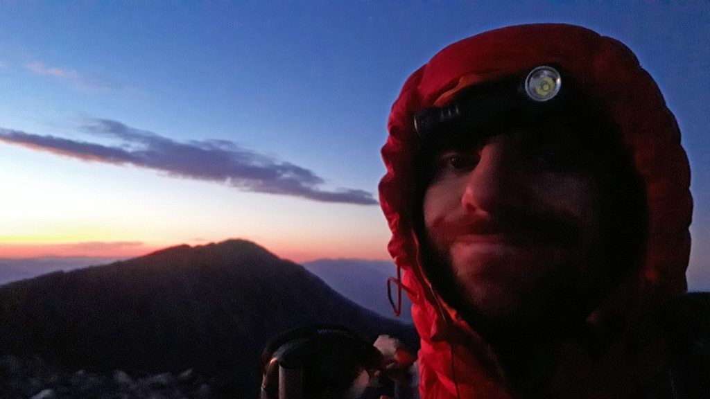
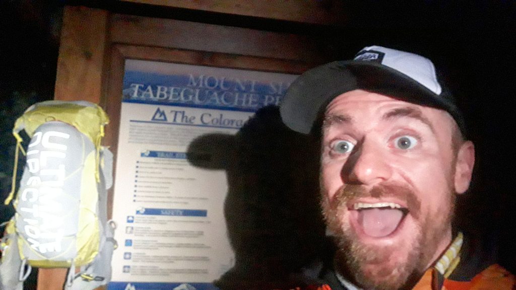
I slept well, as the night was cool, but not cold. I snapped a silly photo or two at the info sign, and started on my way up Shavano at around 2:30 am. I love early alpine starts to be honest, and although a little nervous, I was also really excited on the prospect of spending the next three days covering so much terrain.
I had intensely recon’d the first two thirds of the Line, and had meticulously weighed the pluses/minuses of different route choices between the peaks. I felt confident on my final choices, and also of alternatives if conditions required me to make an on-the-spot course change.
The route up to Shavano is one of the easiest on the Line – just take the standard route up the trail to the summit! I topped out in 2hr 44min – not bad, considering the weight of all the food on my back! Tabeguache was summited in 3hr 29min in – about 45 minutes later. The two peaks are only separated by a little rock-hopping action.
By Tabeguache, the sun was just starting to come up – right on time, as my first test was to descend of Tabeguache towards Antero – a little light would be helpful. I had chosen a blunt ridge almost directly off the summit of Tabeguache as my route of choice, after trying three other options through my years of reconnoitering routes.
This one proved to be my favorite, and one I’d do again as well as suggest to others. The bottom of the ridge ends in a lovely tundra-covered incline which directs you down through an old avalanche path towards Browns Creek.
I knew the perfect place to cross the creek with minimal bushwhacking to the 4WD track, then up the gully that’ll take you to the Jeep trail up Antero. Antero was very quiet in the early morning, and I enjoyed the crisp, cool air as I made haste slowly to the summit itself. Summit at 9:05 am; 6hr 33min into my run.
My descent path had me backtrack down the “wrong” way south on the social trail to the final Jeep parking lot of Antero @ 13,660′, then took a newly cut mining “road” west until I hit a ridge that would take me straight down to the Jeep road that would be traveling north. I’d miss each and every switchback of that same road that can be found above treeline, saving what seemed miles. My shortcut was steep, but mostly on easy to handle tundra, and I made good time down.
Once on the road, I ran as fast as I dared to, not wanting to bob too much, what with the weight of my pack. My form looked more like a stride than a run, which I thought prudent, as I wanted to save my legs from too much pounding.
Off the Jeep road, and onto Chalk Creek Road for a hot second to the hamlet of Alpine. I made a critical route finding error on the two roads that make up, “town”, and had to backtrack a bit to get onto the correct road, costing me a few minutes. Soon though I was at the terminus of a dead end street, passing through a creepy cemetery, and onto an old trail that eventually leads to an abandoned mine site, and farther: the Baldwin Creek Basin. This trail through Alpine is far and away more desirable than the usual approach from Baldwin Gulch. There’s no public parking really in Alpine, but that wasn’t a problem for me on foot.
For the first time in my run, I got a little thirsty, and it was a relief to finally get to Baldwin Creek and take a little break to top off water bottles and horse down some food. The sky at this point was absolutely perfectly clear, but that was changing fast.
I didn’t know exactly how I was going to approach attaining Mt. Princeton’s south ridge, but decided on a western subsidiary ridge that had a good crop of thick trees growing on it up high, which then led to a carpet of tundra for most of the way up to the south ridge proper. It turned out to be a good call, as storm clouds moved in, and I took shelter underneath one of the last trees of the area. So well protected was I, that I took a 20 minute snooze to let the weather do it’s thing around me: rain, then hail fell around me as I stayed perfectly dry.
But 20 minutes was all I had to give for the weather, and I decided to dash up for my summit bid. The worst of the weather stayed away, and I topped the summit in approximately 3:12 pm, 12hr 38min from when I started. I was now four peaks down and 20 miles into the Line! My pace was at the right speed, and I felt very confident moving forward.
I was greatly anticipating the descent off Princeton and onto the Colorado Trail. I had recon’d the route many times, and had it pretty much wired, but still felt the need to improvise, as I was just sure there was an even better way that I had found before.
From the summit of Princeton, I made my way down the southeast ridge, but soon took a turn northwards to a steeper subsidary ridge that looks as if it’ll cliff out sooner rather than much later. It didn’t (yet), but gets narrower and even more steeper. On my previous recon. mission, I exited to the left of the ridge before it does simply cliff out, finding a band of loose, choosy talus. Rocks did roll, but I simply chalked this 200 feet of crap as part of the game of getting off Princeton.
But this time, at the very last moment – at the very last tiny brush growing on top of the ridge, I turned right, and made my way carefully down a steep blocky face of green-stained rocks, which ended at the beginning of the old mining track one can take all the way to the Colorado Trail. This track isn’t found on any map – historical or contemporary. I myself didn’t believe it existed at all, until I stumbled upon it looking to escape a particularly nasty overgrowth of weeds and thickets I simply did not want to bushwhack through, a few weeks prior.
Once on this track, I found myself yet again running down precipitously to the Colorado Trail, and once on the CT – and once letting out a Yawp! of absolute delight in picking the most perfect line, kept on running to the South Cottonwood Creek trailhead. I detoured to the paved road of CR 306 to shave a few minutes, and soon was at the Avalanche Trailhead and back on the CT with Mt. Yale as my next objective.
I took another solid break – even letting my eyes close for a few minutes after I smashed food in my mouth, and drank a copious amount of water. The sun was setting, and my ascent up, then down Yale would be completely in the dark.
My preferred route after much recon’ing was to start up on trail, detour off west, then take a steep subsidiary ridge to the main east ridge of Mt. Yale, which would lead me to the summit. This pattern was becoming the norm of the routes I preferred and the basis of my preferred Nolan lines: after treeline, get up as fast and as steep as you can and be above treeline for as little as possible, then get down as quickly as you went up.
Marching up the trail towards Yale, I was starting to feel the effort of the day. I was now 32 miles into my run, with 12,700′ feet of climbing. But I was also feeling something I was dreading more than massive amounts of vert: asthma. Soon I was above treeline, but I was also in the throes of simply fighting to breath correctly, and my pace suffered mightily. Each step became its own battle, and I had to stop often – usually only after a few steps.
Devastating.
Only one thing to do: keep going. I knew that if I could make the summit, it was thousands of feet of downhill I could enjoy, and hopefully get my legs – and lungs, back underneath me. I made a goal of getting to the summit by midnight – a little more than 4 hours after I had left the trailhead after my break. Four hours is a good chunk of time to cover a little less than 4.5 miles, even if its with 4,600′ of elevation to gain.
Once on the ridge, I knew I didn’t take the best route possible – the start of exhaustion, my asthma, and the darkness around me made sure of that, but I did make the summit 10 minutes after midnight, which was close enough for me. Next goal was to get to the bottom of the basin below Yale, and in between Yale and Columbia by 2:30am.
The descent down Yale starts easy enough: descend west via the standard route, then break down a north ridge that curves easterly to a low point. From this low point, descend a steep slope south. All Hell breaks loose right at treeline, where that steep slope turns into an even steeper avalanche chute, filled with downed trees, overgrowth, cliffs, a waterfall of a creek, and deadfall. To say this is not where I’d like to be in the middle of the night would be an understatement.
But, here we go: I picked the western-side of the avalanche chute, and found a reasonably clear passage down, until I hit a patch of tall overgrowth next to a gurgling creek. I immediately slipped on all the wet plants. I realized that this direct line wasn’t going to work anymore: the plants were too slick to walk on, and well: the creek was even wetter. Thrashing commenced.
I made my way to the eastern side of the chute – one I was more familiar with, but things weren’t all that better. It’s just the nature of this particular line that it was a simply a Patch of Suck – so suck it up! I knew also of the field of down trees that was just beyond the chute itself. Thankfully no Rodents of Unusual Size, Flame Spurts, or Lightning Sand.
At 2:42am, I finally reached the Horn Fork Basin Trail – only 12 minutes past my goal. I needed a solid break, so found a quiet place off the trail to take a luxurious hour nap. I still felt solid, despite the asthmatic lungs. There was a chance I could bounce back after a good rest, and felt positive that that’s what would happen.
After a rest and faffing about eating, drinking, and organizing, I was off again up the south slope of Columbia at 4:35 am. Feeling a little less than fresh, but that seemed pretty normal given I was 40 miles, 17,400′ climbed gain and 5 14ers in. My total time was still on target to finish in less than 60 hours.
My pace climbing was a little slower than I would have liked, but I still wanted to solider on. The route up the south slope of Columbia is fairly straightforward and shares none the nightmare of descending Yale. A little loose patches here and there, but certainly manageable.
Unfortunately for me, as I hit treeline, so did the effects of asthma hit me again, and I started to crawl. There’s not much I could do, but to will myself to the summit at a glacial pace. Columbia was not so much of a triumph, but a momentary pause, as Harvard isn’t all that far away. For the first time in the run, I was questioning going forward, but thought best to try for one more peak.
Even though I recon’d doing the connecting ridgeline between Columbia and Harvard, and enjoyed it’s technical 5.7 crux, I felt no interest in attempting it on this day. One hour of sleep in more than 24 hours seemed like a foolish way to prepare for such serious climbing. Regrettably, I linked up Columbia and Harvard the conventional way, far below the rabbit-ear’d ridge, hopping boulders and following cairns.
I’ve done this version of the traverse at least twice before and hated it now as I hated it then. You lose sight of Harvard’s summit, which leads you believe you’re very much off route. This standard way is not so much farther in distance or elevation gain/loss, but it feels entirely off-route – as if you’ve exited the Line completely. I felt the weight of previous Nolan 14 runner’s pity parties, and had a little one of my own.
Again, as the Line ascended, so did my descent into an asthmatic hell accelerate. But my climbing legs were also not really turning over all that well either. The organism was breaking down. I was approaching 20,000′ of hill climbed in total, and that amount was certainly starting to take its toll.
I found myself metaphorically, then literally crawling to the summit of Harvard. Until, I just had to stop fully. A hundred feet from the summit, it seemed prudent to roll up into a tiny ball and take another ten minute nap. When I awoke, I was slightly confused on just how to even summit the peak, even though I was at this very same spot only a week ago. I eventually figured out that I had to primarily go upwards and follow something called, “a trail” to the top of the summit and soon enough I was there. It took about an hour to go that last hundred feet up.
This was discouraging.
My plan was to take a good 45 minute nap at the summit and then make The Call. My instincts said that my < 60 hour Nolans completion was out the window, but maybe I could tag a few more peaks before I toss in the towel. Oxford/Belford/Missouri should fall in quick succession, if I could just cross over and up from Pine Creek. Abstractly, that sounded easy, but up on Harvard, looking across the way to Oxford, it seemed particularly impossible in my current sleep-addled state.
I shared the summit of Harvard with two other people who were already enjoying the late morning. One asked where I had started.
“That’s a loaded question.”, I replied. I didn’t really wanted to say, “Yesterday morning! Mt. Shavano!”, or anything like that, so I wheezed asthmatically something like,
“Early. Today. Mt. Columbia. Just did the traverse.”
It was probably easy to see that I was very depleted. 7 peaks, 46 miles, 22,700′ of elevation gain – essentially the mid-point of the route, will do that. At 11:00 am, it was also very evident that bad weather was moving in. A big factor to consider. With no shelter with me, getting stuck out in the shit was a dangerous proposition, especially when coupled with a 12 hour asthma attack, scant sleep and much enervation.
I folded.
Surprisingly, both people on the summit offered me rides to town, which made my decision a lot easier to deal with, as it meant that afterwards I still didn’t need to extract myself back into civilization.
Although the legs to go up where blown, the legs to go down – and only down, were still hanging tough, and I made quick-enough work getting to the trailhead, beating my two new summit buddies by a few hours. I took this time to nap under a tree, as the sky began to release it’s pent-up moisture. By the time we hit the road to Buena Vista, it was a full-on thunderstorm with thick rain drops tumbling down. Good call to call ‘er quits, was all I could think.
I was left on Main Street BV – many thanks to my driver, and left with the problem of, well: what the hell to do now? There’s no real cheap lodging in BV, and the prospect of cowboy camping out for the night to grab the bus in the morning was a bit of a dicey one, if this weather system persisted, which it really seemed like it would love to do.
I wandered to the coffee shop to see if some caffeine could help the thought process, when I heard someone say my name,
“Justin?”
I turned around.
Someone familiar with my outdoor misadventures recognized me, and wondered what I was up to. I gave them the short version of the story: started Nolans yesterday morning, just bailed – wondering myself what’s next?
They offered me a ride back to Denver, which I most graciously accepted. In a few hours, we were on the road, spinning yarns of both our mountain trips we had gone on this year. A wonderful turn of luck for me, and maybe a way for the Universe to confirm to me that I made the right call to get off the mountains.
A light rail trip, then a bus ride (or well: two, actually), and I was back at home, a few days early, but feeling quite a bit better than just 12 hours previously, way back on the top of Mt. Harvard. Although cliché, it really all seemed so far away and so long ago. I was happy to find a bed, and soon: quality sleep.
Despite having to deal with asthmatic lungs – something I’m sadly: all too familiar with needing to manage, I had a hoot of a time out there. It’s something very special to move over so much ground in such mountainous terrain, linking up sections I had so carefully studied over the years.
The last time I tried Nolans, I failed as well – only after three peaks. Afterwards, I felt embarrassed and depressed – really beat myself up about it. This run was different. I enjoyed ever second of it (even when things were painful or uncomfortable) and knew how privileged it was to even give it a try. I tried the Line on my own terms (alone, unsupported), and for that I’m grateful I have that opportunity to do so – and come out the other side safely. I came out of the Line without destroying my body, and feel as if I’m going to bounce back quickly, recover, and be stronger than I was before, rather than being massively depleted and having that be the end of my summer.
Here’s looking forward to future adventures!
Gear
Here’s some clutch gear that I utilized that I found to be particularly useful for the trip:
Ultimate Direction FKT Vest

The first UD running vest I ever bought was the Peter Bakwin Adventure Vest 2.0. This vest seems like it’s spiritual successor. It’s definitely a running vest, it has far more capacity than what you’d expect from the category. I brought only food, clothes, an emergency bivy, a few personal items, water filter, and batteries on my trip, and I stuffed almost everything into this pack.
The pack can be compressed via its roll top. I greatly anticipated slowly eating away at my food supplies, and being able to compress the pack smaller, and smaller.
I would keep batteries in the small, outside zipper’d pocket so they’d be out of the way, as well as secured – being without a working headlamp would have been disastrous. I kept my water filter, some food, and a layer in the outside mesh pocket.
On the pockets of the straps, I kept my inReach Mini/head torch in one of the top pockets, and my asthma inhaler in the other top pocket. Water bottle in the water bottle pocket, and eTrex 35t GPS in the cellphone/burrito pocket.
Ultimate Direction Utility Belt
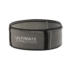
Still a favorite of mine, I use the UD Utility belt to stuff in major calories, as well as my cellphone, as well as anything else that would help me limit how much I would need to take off/then on my FKT Vest. Simple things like keeping my wired earbuds on as I took off my vest saved me time and limited frustration. Knowing I always had a 1,000 calories on me, at the ready, whenever I wanted is required on a run like this. When I need to eat, I need to eat.
La Sportiva Ultra Raptor
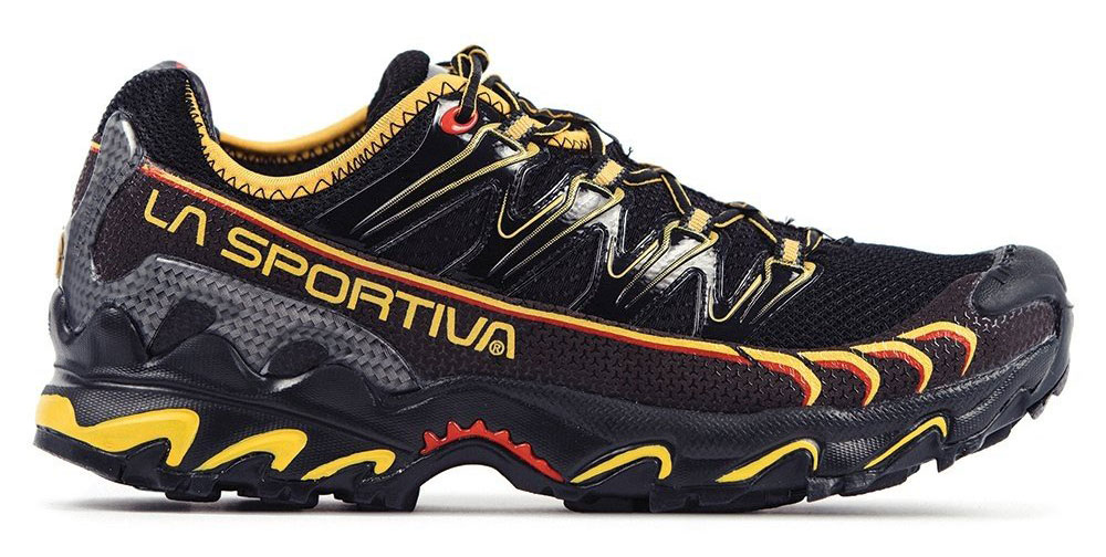
I’m a big fan of Sportiva running shoes and climbing boots (no secret). If your foot fits their shoes, they rule.
I usually pick the Mutant for such mountainous adventures, but decided to go with the Ultra Raptor for Nolans: The midsole has a little more cush, the shoe has an honest-to-God rockplate, the toe box is protected by a beefy toe cap, and the rest of the upper has quite a bit more structure to it. You lose a little bit of upper ventilation (a plus for the Mutant), but the mesh upper of the Mutant is far too fragile for so much off-trail talus hopping. The outsole is far less aggressive, but seemingly grippier than the Mutant.
One of those shoes that feels good just to put on.
Garmin inReach Mini
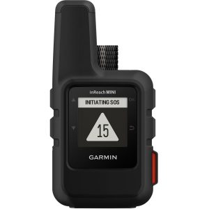
Coming from a SPOT II Tracker and its somespot spotty network, the inReach Mini in comparison is an absolute dream. From my experience, it’s exceptionally reliable and accurate. I had set the tracking to only send a point out every 30 minutes, and at that rate, it seems that the inReach’s battery would make it to the end of the 60 hours, easily. If I needed to recharge, I had brought a USB cable, but that just didn’t seem like it would be necessary.
Here’s the live tracking map it produced:
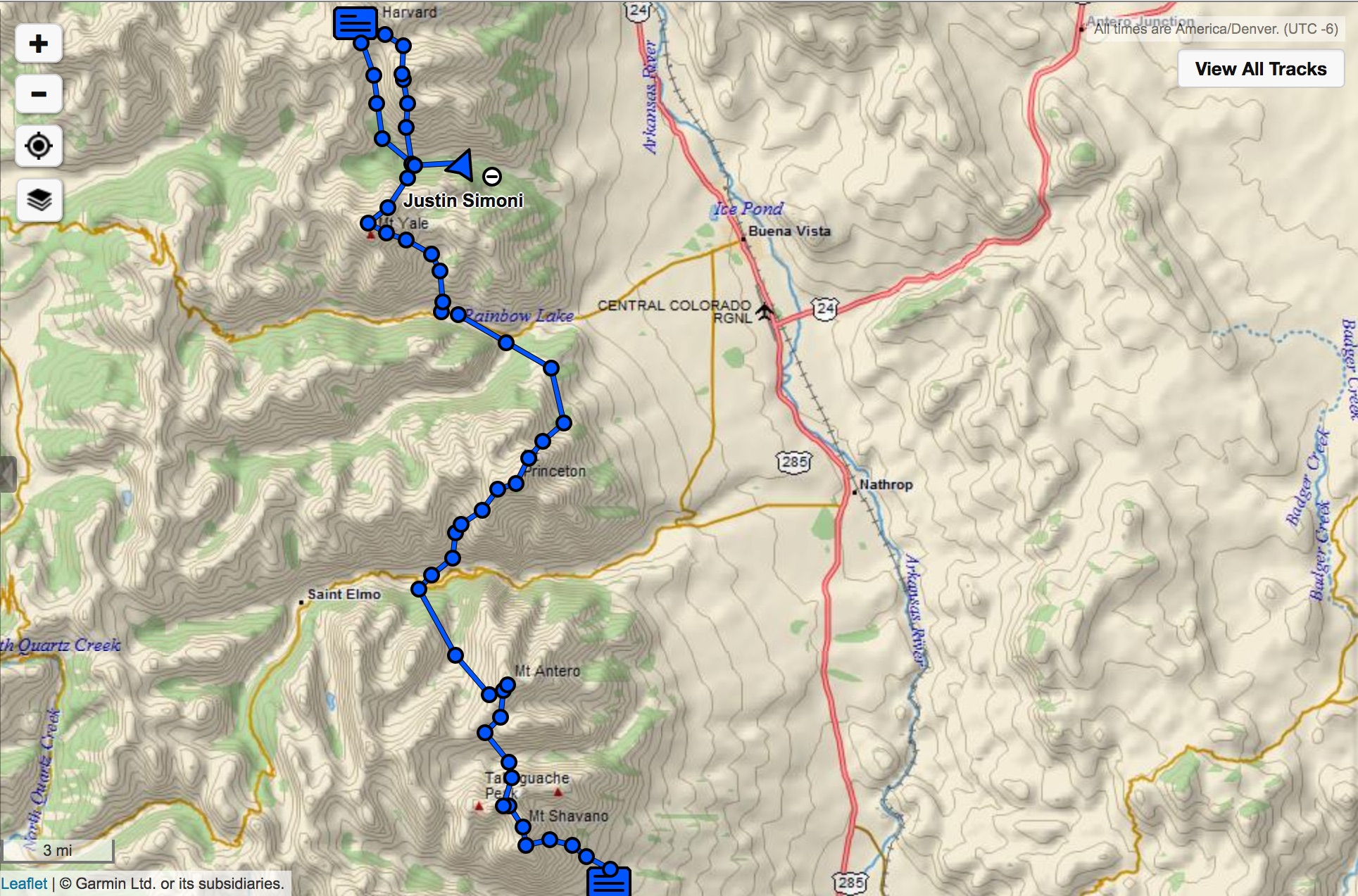
Pretty good! That’s where I think I was. How does it compare to the GPX track made by my Garmin eTrex 35t that I was also carrying?
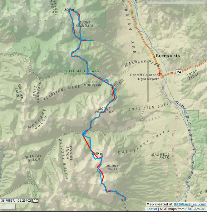
Seems to agree with the eTrex 35t (line in blue – inReach is in red), which was saving a point every second, rather than every 30 minutes. The seemingly lack of accuracy of the red line east of, “Mount Momma” (I’ll have to visit that mountain, one of these days…) is actually caused by how fast I was going at that point – fast enough where 30 minutes per point really shows the distance I covered in that half hour.
Black Diamond Distance Z-Poles
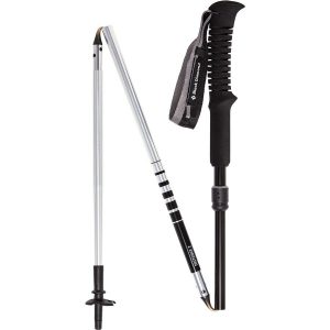
(These are the aluminum versions). I had tried the REI-brand carbon version, and they last all but 6 hours before exploding on me, so I don’t suggest those.
These poles made it through my run, and seem to have a lot of life left in them, so I can suggest them to you. This breakdown design works well with the Ultimate Direction FKT Vest, as there’s places to store the poles up front and out of the way, so if you don’t want to carry them, you don’t have to – and you don’t have to take off your pack to stow them away. That’s a nice integration.
SOL Escape Lite Bivy
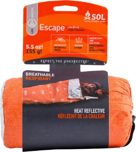
To go fast, you must go light. I decided to forgo my entire sleep system, even though I’ve whittled the weight down to only a few pounds total. Still, nothing is lighter than, nothing! As a compromise, I packed this, just in case things went south, temperature-wise. I wasn’t planning to sleep much on the Line, anyways.
Before my run, I used this to sleep a good 6 hours at the trailhead, while wearing most of the clothes I had also packed, including my OR down jacket and my Patagonia Nano Puff pants – the latter of which are such a luxury, I don’t know if I’ll ever not pack them for an overnight again!
In total, I used this for about an our off the North Cottonwood Creek Trail, and it did it’s job. What helped to get some quality sleep was choosing a good place to bed down, and for me, that meant a soft bedding of pine needles and not a rocky slope of talus. The latter I could do with my real sleep system – with this emergency bivy, you are limited.
I would be concerned with long-term durability with this bivy – I managed to destroy the stuff sack the bivvy comes in attempting to stuff the bivy back into the sack itself – the bivvy and it’s stuff sack are made of the same materials. I ended up using a silnylon bag, which worked just fine.
I initially was going to just use a 2-person emergency blanket and call the job done, but I found that a lot of heat was escaping when I burrito’d myself within the blanket. The solution was to just – you know: be in a bag, rather than a roll. Unfortunately, this bivy is quite a bit more expensive than a simply mylar emergency blanket.
As far as weight goes, at 5.5 ounces, it seems pretty light, but my usual bivy, The UD FK Bivy, is just a little heavier at 6.6 ounces. Different tools for different jobs though. The FK Bivy is more of a breathable outer liner for a sleeping bag, helping to keep the bag itself clean, and act as a waterproof ground sheet for the bag itself. It has no real heat retention properties.
The bivy, after its brief Nolans duty, is in fine shape, and I would consider packing it with me for things like solo Winter missions. The weight is low enough and it packs down to almost nothing, that I would bring it along, in lieu of nothing.

Hey Justin, thanks for writing this, man. It’s cool being able to hear about what’s going on mentally with big stuff like this and hearing it coming from someone as big as you is encouraging. Nolan’s is just such a beautiful line, it’s definitely on my to-do list as well! I got to scout most of it this past summer, and I just have a few questions:
For the descent off Tab, it seems you take the steep ridge with some tundra on the left side of the old avalanche chute, right? Is it loose at all? It’s steep, and I’ve descended the ridge on the other side of the chute a few times because it seemed more stable/less slidy-talus-like, but I never gave the descent you did a try. Hopefully this summer. I also haven’t found a way up the first bit of Antero from Brown’s Creek Valley up to the plateau around 12,800 that isn’t super lose and slidy. How did you like the way you did that bit?
And yea! descending Yale, especially in the dark, ain’t easy. I’m not a fan of the avy chute either, and I really enjoyed descending the broad grassy slope leading down from the NW ridge, but it takes a while to run back along the trail to start the ascent of Columbia. Think I might try descending that steep talusy bit at coming down from that saddle of Yale’s N ridge around 13,000 next time I get the chance.
This all to say reading your stuff is encouraging and its rad to see someone prioritizing the experience that the mountains give them over time limits. Some days it just doesn’t go your way, but it can still be worthwhile.
No problem, It’s always fun to put thoughts into words (for me, at least!).
I’ve done three different lines off of Tab now, and the way I did it this time is now my favorite. A little loose up top, but also a lot of tundra. Marginally better than on the east side of the deep gully.
My line up to Antero is, I think: my favorite; would change a thing. I think the way I descended Antero was pretty spot-on too. For Yale, I should have reconned a good line going down – I’ve done it many times before, but the last time was over 2 years ago, and it just was a bad time to not have it down perfectly on my descent.
See some of my recon notes, though – I go into more detail of the lines I picked, and why: https://justinsimoni.com/2019/08/14/nolans-14-scouting-shavano-tabeguache-antero-princeton-yale/