
Like this? Follow me:
With the early season snow coming to Colorado, some of my bikepacking plans have had to be delayed for a few weeks. Even though I’m ready and my bike’s ready, I’ll have to wait for the weather and roads to clear up.
Riding in the mountains outside of the summer season can be a little touch-n-go, so this wait-and-see time isn’t really out of the ordinary. And it does give me the space to try to describe some of my thought process and tools I use when planning out a trip.
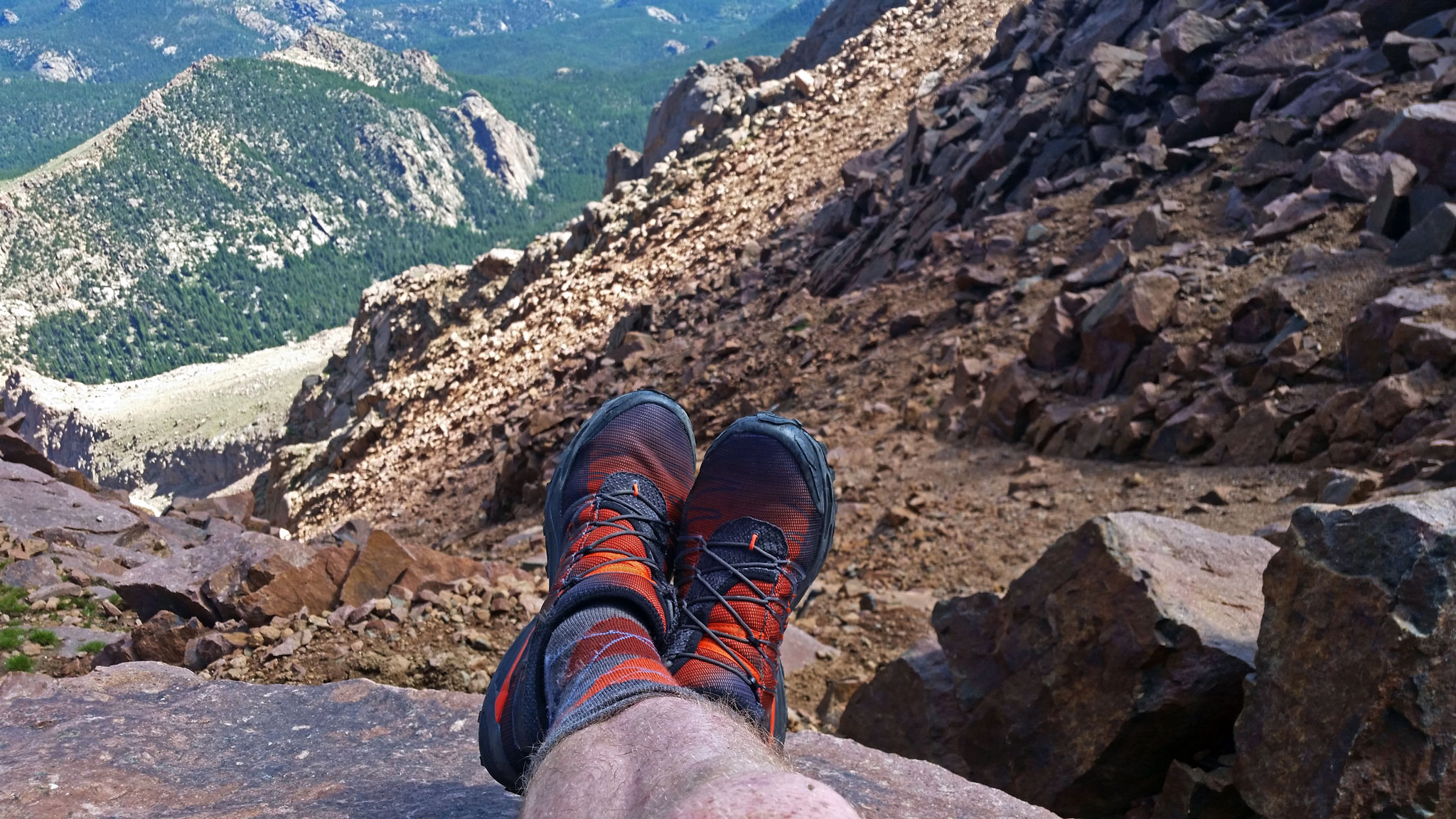
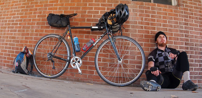
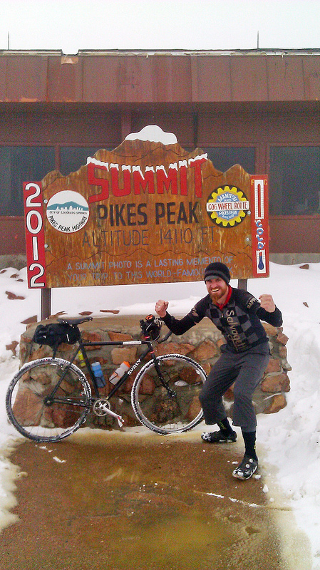
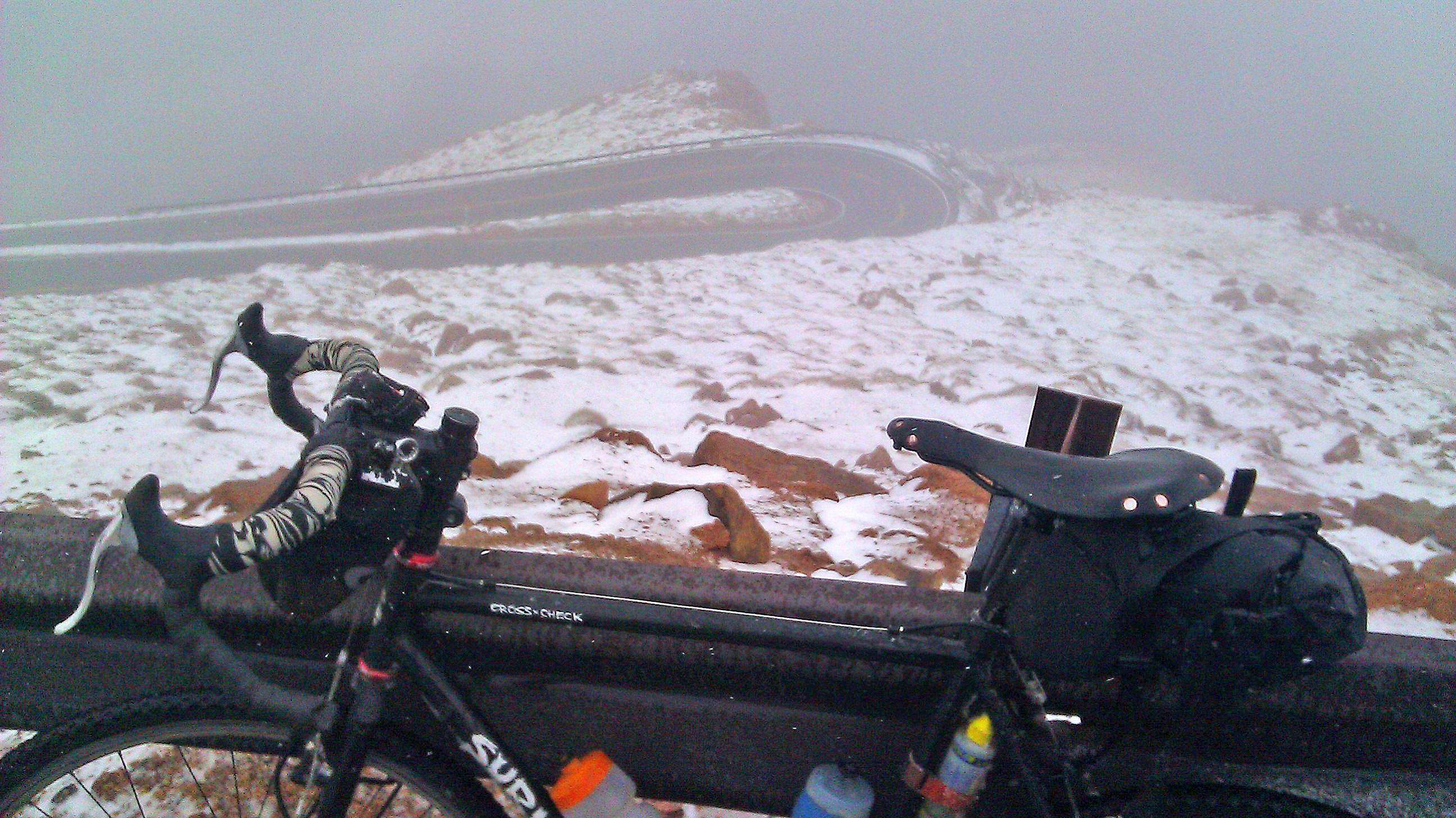
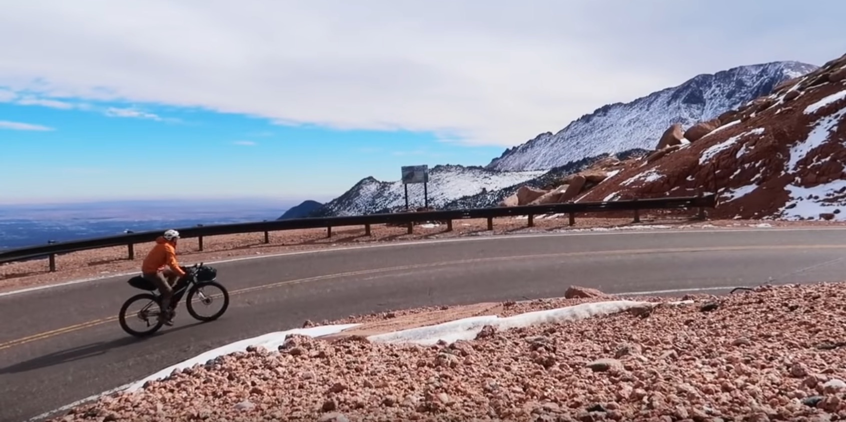
I’m planning to visit Pikes Peak, riding to the trailhead, hiking the mountain, then riding back by bike. I’m going to start somewhere near my house in Boulder, Colorado. Riding to mountains to then summit on foot is one of my favorite things to do, and you can view some long tours I’ve done on my Tour 14er, Tour of the Highest Hundred pages, as well as some of my shorter trips to the local big hill: Longs Peak.
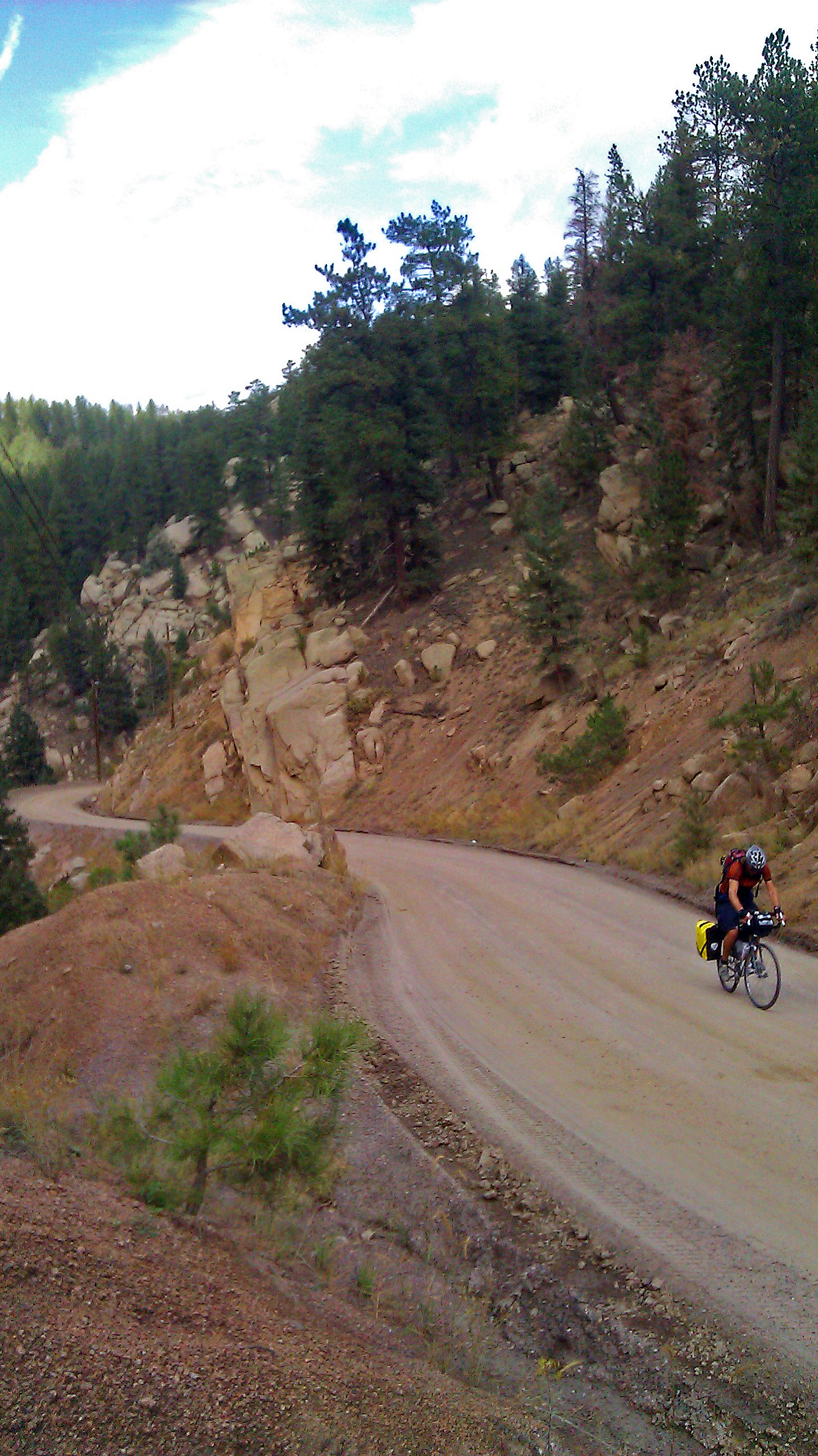
I’ve done a variation of this trip to Pikes Peak a few times (enjoy the photos culled from those past trips) in a lot of different styles, but this trip coming up is going to be a little different: I plan to document my trip in a form that I wouldn’t mind sharing with others as a viable route.
In fact, I’d like to release an entire guidebook of bikepacking to the high mountains of Colorado. If that’s interesting to you, please follow me through the usual social media channels, as well as joining the Bikepacking the Colorado 14ers Facebook group.
So, if I’m going to document the route, I might as well document how I design a section of the route as well (how, meta), and some of the things that I take into consideration when it comes to a fantastic long-distance bike route. The entire route I plan to make a guidebook out of will be around 1500 to 2000 miles in entirety! This segment will be 100 miles – something much more manageable.
What makes a good route narrative?
A good route narrative should be simple enough to follow, have enough information so someone doesn’t get lost, but not so much that it takes away the sense of discovery and exporation out someone’s own trip.
Since we’re talking about a bicycle route, we’ll need to describe the types of surfaces we’re riding, so someone can make a good choice on the type of bike to use.
We should include what sort of traffic one should expect on any roads used – am I directing you onto a sleepy gravel road, or an interstate highway?
We’ll need to include where to resupply food, any bike shops along the way, any public transportation options available if we need to cut the trip short, and camping/lodging options. Although I may want to do a 100+ miles in one day, someone else may find that excessive, and wouldn’t mind cutting the same route in two or three more manageable days.
The hardest part may really be to finalize on a main route, as there’s usually many good options available, and as an enthusiastic bike rider, I want everyone to experience everything – but that’s simply impossible. I can hint at interesting options and try to weigh the pros/cons for those who may want a little more or a little less. These alternatives don’t necessarily have to be as well documented, since someone who may have more experience may already feel comfortable going off less information, having more of an adventure.
Where do I want to go
There’s three basic types of routes:
- Point to Point
- Loop
- Out and Back
– the last which is just a point to point you repeat in both directions. For my trip to Pikes, I have a solid destination: I have to get to that trailhead! So in spirit, I’ve got a point to point route – but if I don’t wimp out and take a bus back home, I’ll be doing it as basically an out and back. My route narrative is only going to describe the ride in one direction, as that’s what’s going to be the most useful to whoever picks up they guidebook.
What type of bike I want to ride
The type of bike you ride really changes the type of route you will want to take. If I wanted to bring my 3″ wide tire’d Surly ECR up Pikes Peak, I most likely would want to stay off pavement as much as possible and see how many singletrack trails I can link together, because that’s how to have the most fun with this bike.
Since a lot of the trails available to me during this time of the season are muddy or under snow, I’m going to be taking my Salsa Journeyman, and paved + gravel roads are its sweet spot. Lucky for me, that still leaves a lot of options still available, since Colorado is basically the best place in the country to ride bikes (personal opinion, of course), so long as you don’t mind heaps of elevation gain.
Starting point
I could start my route narrative from the town I live in, Boulder, CO, but there’s one city between me and the trailhead that you are most likely going through anyways en route: Golden, CO. The most direct route from Boulder to Golden, Highway 72, isn’t all that inspiring, as well as being so straightforward to not really need a route narrative.
Plus, there’s a bus I can take between Boulder and Golden (And bus/lightrail options for those in Denver/starting at the airport, further east) that can help me skip this uninspiring stretch of highway, and cut the mileage I have to ride down to make the trip a little more realistic for the amount of time I have available to me.
Thinking a little more in the future, I can then consider using Golden, CO as a hub city for multiple routes to start/terminate at. Golden, from its inception as a mining supply point, has functioned as this type of hub city.
Finishing Point
Where I end my narrative is another hard choice, as there’s just so many places to finish at, and they’re all great ideas. To keep things simple, for this route narrative, I’m only going to end at one trailhead for the time being: Horsethief Park Trail, on the west side of Pikes Peak.
Lots of great things about Horsethief: It’s a less popular trailhead to the nearby Crags Trailhead, so things will feel a little more adventurous; it’s right off the main road, so it’s accessible year round; it starts on BLM land, so camping is available, plentiful, and free. There is a NF campsite at the start of Crags, but it’s a fee area, and can fill up on a busy summer day. The trail on Horsetheif is also open to bikes, so if one really wanted to, you could ride a ways before setting up camp.
Road and Trail Networks
Now that I know where I’m starting and finishing, the type of bike I want to ride and the type of surface I want to ride on, I can start breaking out a map, and drawing my route.
I have a pretty good idea on the design of my route – and I think that’s maybe the most important thing to have when building a narrative for others to follow: actual experience on the route!, but sometimes it’s fun to look and see what other opinions are. Sometimes they’re fantastic, and sometimes they’re terribly, terribly misguided.
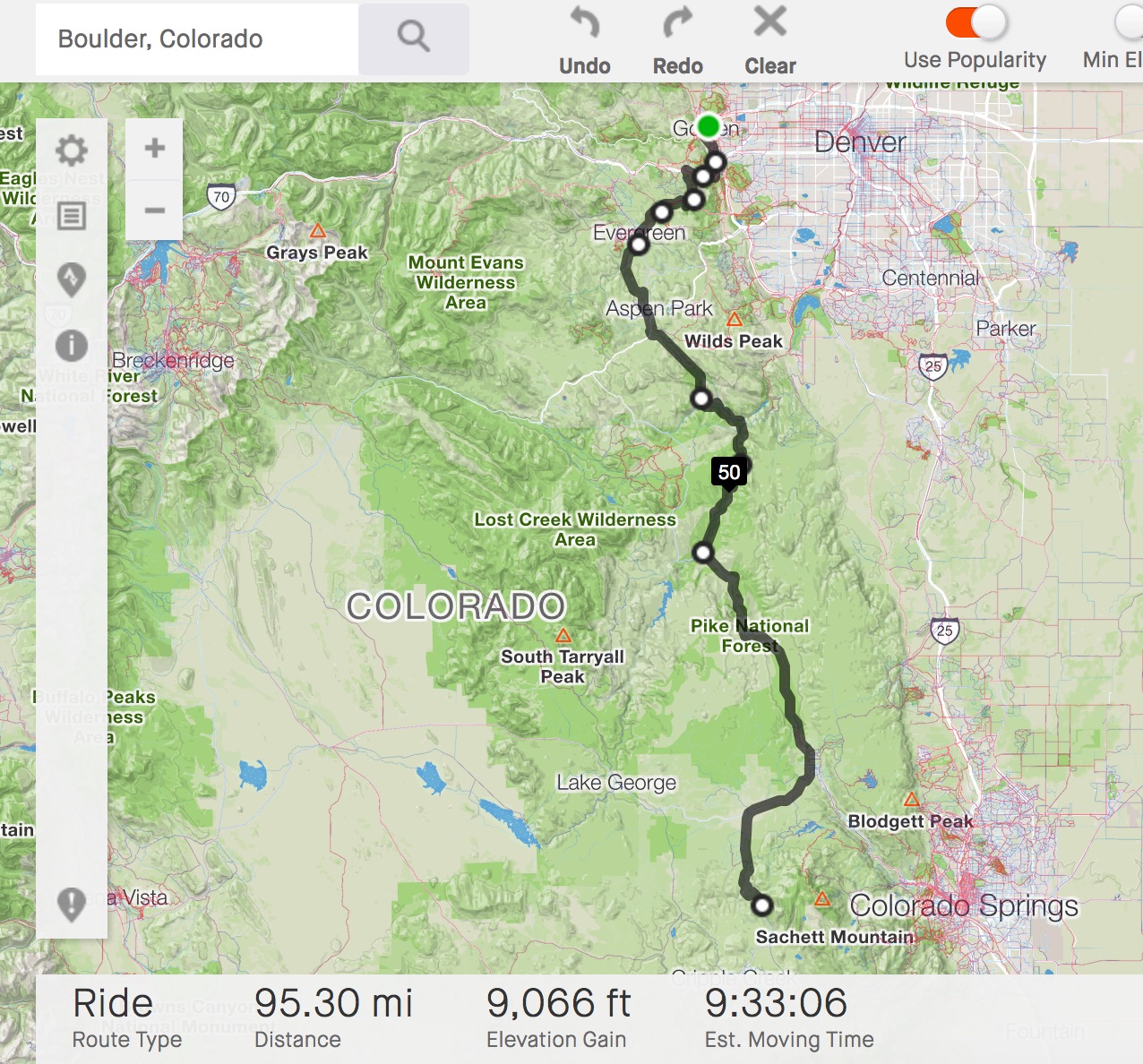
I’ve used quite a variety of online route mapping systems, but I found that Strava’s is probably one of the best. So let’s look at our options. As an experiment, let’s have Strava design the entire route by putting the starting point at the bus stop in Golden where I want to start and the ending point at the Horsethief, near Pikes Peak.
Strava’s route engine attempts to create a route based on all routes that are available, and its algorithm should select weighted on how popular the route options are.
As should be no surprise, it does a great job in some ways, and a terrible job in others. Here’s a big problem, and highlights some of the shortcomings of the route builder:
Getting from Golden to Pikes Peak is generally a north/south route, and the route builder got that part right. But the devil is in the details. From Golden, the route builder directs us to using the bike path that parallels a busy highway: E-470, then to Chatfield State Park, a popular riding destination. That’s all well and good, albeit a little boring, but OK. For my route design, I’m going to take people away from the busyness of the Front Range Urban Corridor, and try to keep them into the mountains.
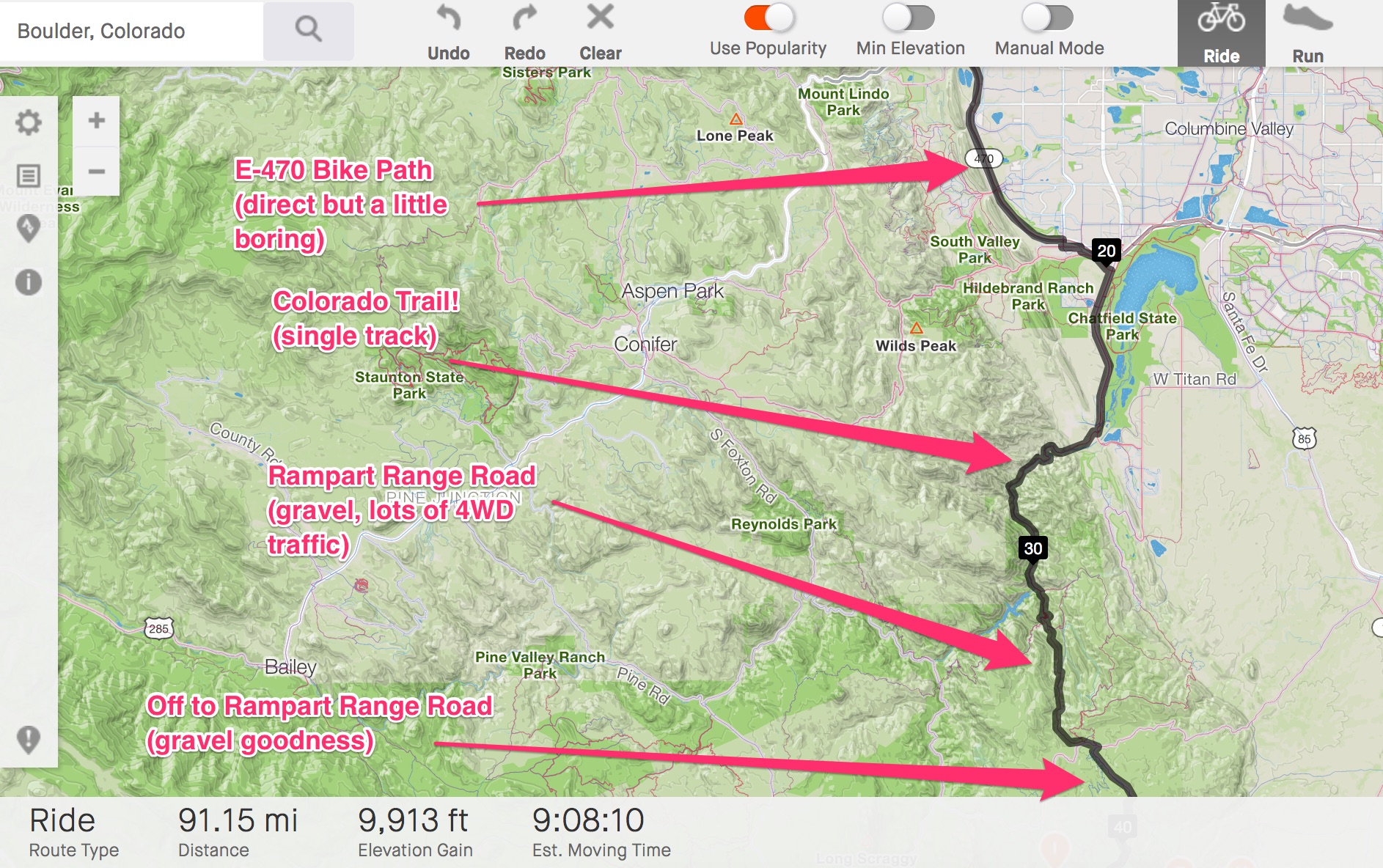
Then, it directs us up Waterton Canyon to Segment One of the Colorado Trail! The Colorado Trail is a singletrack trail system that terminates in Durango, CO, and just isn’t going to be a great option for a ride on a gravel bike in November, as it’ll be under snow and maybe a little too rough for the 40mm wide wheels I’m riding.
There’s no way in Strava’s route builder currently to say, “hey, route me based on these types of road surfaces”, which is unfortunate for us and is a problem that certainly will pop up, since: surprise!, people love riding their mountain bikes on mountain bike trails. This makes such trails popular on Strava’s system, and that makes their route builder greedy in utilizing them.
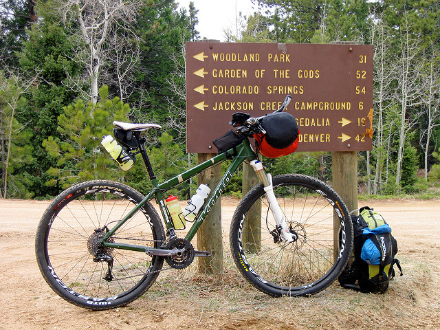
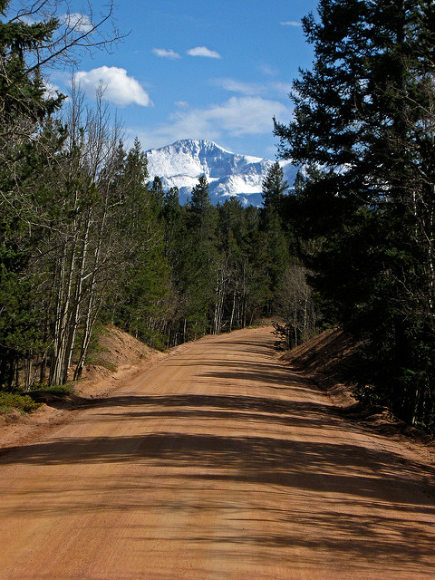
After taking a side trail from the Colorado Trail, the route builder directs us to Rampart Range Road, a 60 mile long gravel road that goes right to Woodland Park. Now we’re talking. Woodland Park itself makes a great resupply point and there’s National Forest campsites just outside of town.
Rampart Range Road is all gravel. It can be a little dusty/busy, as it’s mostly known as a 4WD enthusiasts destination, but as a bikepacking route, it works out pretty well. Camping is available on nearly the entire road (40+ miles). There’s not many bailout points, and not all that much water, so if you take it all the way to Woodland Park, camel up and get ready for the long haul.

Some things to consider if I want to add Rampart Range Road into my route and my trip:
Road Closure
One thing I may have to double-check before I go is if the road is even open, and if it is, if it’s in good condition. Riding on a closed-to-cars road would be fine (even preferred), but it may also not be plowed. The NFS has a page on Rampart Range Road that states it’s operational until December, which is good news for us. Rampart Range Road also has a public Facebook Group for its trail maintenance group we can check in on and see if anyone has posted any condition reports. And since I’m not the only one that likes to ride bikes on Rampart Range Road, I can ask the local MTB trail conditions Facebook Group what they think. Finally, I can see if anyone has geo-tagged photos on Facebook/Instagram to suss out current conditions.
If Rampart Range Road is good to go, all hope is not lost in utilizing it. I know the area between the northern terminus of Rampart Range Road and the roads south and west of Golden with enough confidence to massage the route to avoid the Colorado Trail.
In Strava’s Route Builder, the easiest way to accomplish this is to click on the route you created which creates a new point, then drag that newly made point to a new location. The map should rejigger your route to fit this new point. It’s takes a tiny bit of patience to get things right, but always remember that any points you make, you can also remove.
When you work with a route like this, pay some mind to both the mileage AND elevation. Sometimes elevation explodes, even if the route seems like it’s getting trimmed of mileage (and vice-versa).

So here’s some problems we’re making for ourselves: not only did we add 18.74 miles to our route by avoiding using the Colorado Trail, we added almost 1,618 feet of climbing. At this point, we might as well walk the Colorado Trail, it may actually be faster. Knowing what I know about other alternatives in the area, I’m wondering if there may be quicker way to go.
The back roads I take to avoid the Colorado Trail leads one to the South Platte River Road, up the very steep West Pine Creek Road, and then onto Highway 67. It creates a bit of an oxbow as well, which adds some mileage.
Another option would be to just stay on South Platte River Road to Deckers, then take Highway 67 south all the way to Woodland Park. South Platte is a bit variable in its road surface: sometimes gravel, sometimes broken up pavement, sometimes it’s just smooth tarmac. Highway 67 is all paved, but it’s quiet enough with a good-enough shoulder and even an intermittent bike path that I can suggest it for bicycle travel. There’s camping opportunities along the way, both NFS campsites, as well as dispersed camping options.
Mapping that out, and doing a bit of massaging at the beginning of the route itself, the route builder tells me it’s 97.1 miles, with 9,512 feet of elevation gain. Not a bad option!
Plus my buddy who lives near Rampart Range Road got back to me with some beta,
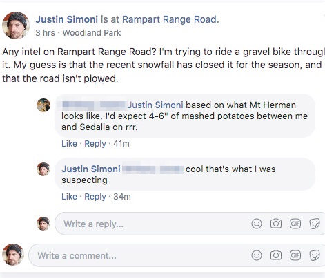
So looks like Rampart Range Road is out, and Highway 67 is in. This will be a great route to suss out for those who want a pavement/gravel option. The Colorado Trail/Rampart Range route is a five star route for those who want to do the trip via MTB.
There will also be some great opportunities to add to the narrative on how to mix these two routes together, as well as link these routes to other farther off places in Colorado.
I’ll to save my route, then export the GPX for later.
Camping
Colorado has a ton of public land, be it BLM, National Forest, Wilderness, or National Park. If land is one of the first two, and there’s no signage saying otherwise, it’s usually OK to disperse camp on the land. Traveling by bike makes this even easier, since you don’t need to find a pullout to park a car – just push your bike to your campsite.
One tool to utilize to try and figure out public land management is Caltopo. I can look around the area I intend to ride through, and see what sort of public land is nearby. I can also import the track I made in Strava’s map builder, and view my route in Caltopo:
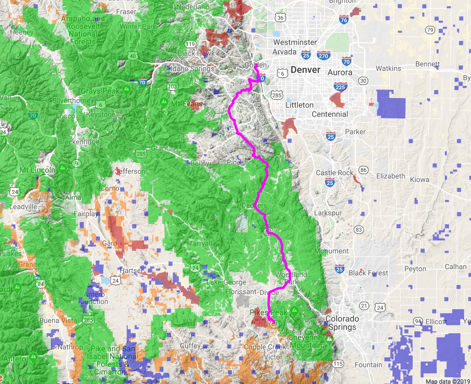
In the above map from Caltopo, the route we created using Strava is colored Magenta, and the land management layer has been turned on. Of interest to us is the green shading over the base map: this corresponds to National Forest.
From our map in this zoomed-out-to-space level, you can see there’s not a whole lot of National Forest in the first quarter of our route, outside of the periphery of Denver. Afterwards, a lot of options open up until we get close to Woodland Park. Things get a little thin until south of the town of Divide, and then there’s National Forest on the east side of the highway – and if we zoom in:
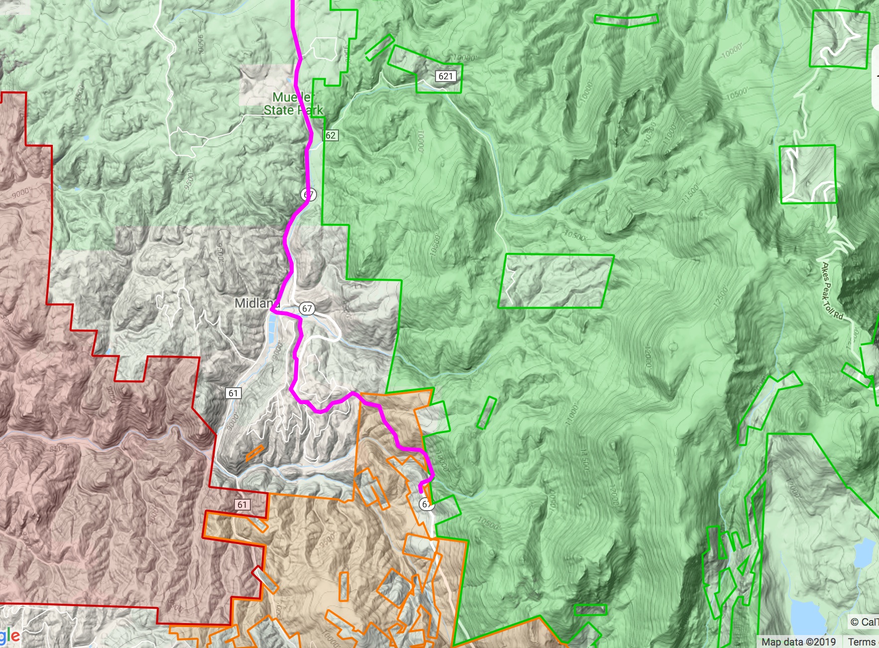
At the end of our route is the Horsethief trailhead. It’s bordered by BLM land (in the orange shading), then National Forest again in Green. Looks good.
For completion, note that the National Forest Land to the north of the trailhead doesn’t come right to the highway, so even though National Forest is there and tantalizingly close, access to it is NOT. Don’t cross private property to access National Forest – you’ll have to find a public road.
Access to National Forest
How to do that? Sometimes it’s hard to distinguish a public road from a private road that goes into National Forest or other public lands just by using an online map. Caltopo again comes in handy, as it has yet another layer called the MVUM (Motor Vehicle Use Map). This will give us an idea on public roads, and the type of road surfaces to expect.
Here’s a screenshot showing an area on our route just north of Woodland Park:
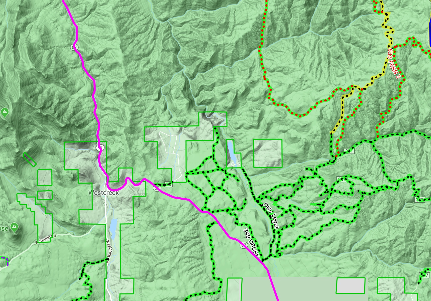
Those green, dotted lines are public roads that are legal for OHV’s (off-highway vehicle) to drive on. They’d also make great roads to access the public land off the highway, and I bet there’s somewhere along one of those roads that would make a good bivy for the night.
As a route developer, I can save some of these locations in my own GPS unit, and check them out while on my actual ride. If you’re developing a route on your own, and you’ve never been to the area, you may have to take a few good guesses on what may be the best place to bed down for the night, and hope you won’t get skunked.
If you want to dig even deeper, consider looking up trails on MTBProject/Hiking Project for additional parking areas and trailheads. The roads that lead to these trails may also be in National Forests, and could be a good place to spirit away for the night. Many times, you’ll discover an actual (paid) campsite this way!
Resupply
A cyclist rides on her stomach, no food: no can go. Finding grocery stores along the way beforehand shouldn’t be too much of a problem: look up grocery stores using Google Maps beforehand, and note where they are, and what their hours are. When I do my recon, I’ll also be thinking of interesting and unique places to check out, to try to add some points of interest. Who doesn’t like checking out a cool bakery, farmer’s market, or coffee shop?
I may add some camping/resupply markers to my Caltopo map, save the map, then export out the map again. With the actual GPX track of the route, my markers will also be exported as waypoints and will show up on my GPS. I can then check things out, and attach some notes to each waypoint as I get to them, fleshing out the beta I have on the route, adding more goodness to my route narrative.
With all this preparation, there’s nothing left to do, but try out the route!
