Like this? Follow me:
I sit here, late at night, with sore knees, having hoped to do this little write up a lot earlier, but so it goes.
This small trip I’m about to describe, I estimated hazily as, “around, uh, 2 days”, with only mentally plodding out the mileage hastily in my head. The idea though, was to cross the Continental Divide somewhere other than Loveland Pass, so as to avoid having to yet again ride through the I-70 corridor. Just for the sheer joy of doing something different.
This doesn’t leaves too many choices, unless I wanted to ride all the way down to Colorado Springs and take 24 to Buena Vista. Which, I didn’t. Another option would be to take the I-70 corridor for most of the way, take the Guanella Pass to a hard-to-spot FSR and traverse Argentine Pass. At 13,205 feet, it’s a somewhat of a lofty option and getting back home would either mean backtracking or, yet again, taking Loveland Pass – it’s nearest Continental Divide neighbor. It’s also going to be filled with snow and trolloping down a scree field @13,000 feet, with a marginal trail dug out over a hundred years ago isn’t even on my TODO list. Maybe in the summer.
Finally, a good-fit option presented itself: Rollins Pass. Reaching almost 12,000 feet, it makes its way through the James Peak Wilderness and out to the Winter Park ski resort/Fraser Colorado, also known as Not Really Close to Anything Else – especially outside of the winter season, where the bustling tourist town turns just about ghost-like in its scene. Which was sort of perfect. From there, it’s a quick jaunt North up HW40 to Rocky Mountain National Park, and another Continental Divide Crossing through the actual park itself. Beautiful vistas of jagged peaks of the Continental Divide in my view for hours and hours on end.
But, that wasn’t enough – a little dirty and then, back on monotonous paved roads? No thanks.
The Adventure Cycling Great Divide Mountain Bike Route maps and book (which I have both) tell of a connecting dirt track, linking the GDMBR with Winterpark: FS 139. After taking FS 139, my plan was to follow the GDMBR backwards, North past Kremmling, and to Radium. The maps and book describes this as one of the most dramatic loss of elevations of the entire route. Going North to South. I was going to take it on South to North, which would make it one of the most grueling uphills of the whole route. Which, whatever – I’m sure I’d be fine.
From Radium, I could loop back to Kremmling, resupply, go East to Granby and then – then! make it to Rocky Mountain National Park and victoriously get back to the Front Range in style. The estimate of it taking, “around, uh, 2 days”, made even myself skeptical, but bailout options were everywhere. As long as Trail Ridge Road – the road that goes through Rocky Mountain National Park was open.
And as the time to leave fell closer, it sort of… wasn’t. Backtracking from the W tollbooth of RMNP would be a slog on an uneventful road, all the way back to the I-70 corridor. 60 miles. Not interested.
Further complexities revealed themselves, as I got ready to go. Namely, my bike broke. Or rather the freewheel seemed a little wonky. So, instead of leaving mid-afternoon, to camp near the start of Rollins Pass, I wheel’d the bike to Salvagetti, to see if it was fixable. Phillip came back and, with a wry smile, told it to me this way:
“You… should take a look at this”, which is never good.
He revealed a nice hairline crack in the frame itself, on the right dropout. Dammit.
“Dammit, Phillip! This bike’s been EVERYWHERE.”
And it had – 9 countries, 3 continents. 7 years and somewhere during like a ride to a coffee shop I’m sure, I probably went off a curb a little too briskly.
Trip on hold.
Before I could even figure out my next step, Phillip was on the phone with the manufacturer, ironing out some details for a replacement frame and wheeling out his own bike for me to use until the time came that my own bike was ready.
‘Wait, you’re going to let me use your bike? Don’t mind if I get a little… rough and tumble with it?”
I say this, right next to the bike frame I just destroyed. The kind of evidence was not on my side.
Another wry smile from P: He didn’t mind. “But, uh, this is the bike I was hit by a car on, so there’s probably something wrong with the frame – probably out of alignment or… something – good luck!”
And that’s how I found myself with a Salsa Casserole touring bike to play with – probably a size too large, decked out with 32mm commuter tires, a Campy groupo, geared for road riding, and a generator hub. I wondered if it would be really all that wise to take this on the, “as much dirt I can find” route I had sketched out.
Well, no it wasn’t, but I wasn’t not going to do it. The bike that was now out of commission was at least a cross bike, with the beefiest tires that could fit in the frame. This frame looked like a randonneur’s Christmas Morning’s sugar plume dream come true. “A generator hub?!”, I thought, “Well, that’s going to get destroyed”. But then again, if this young lady of the 70’s, found in the internet archives could make it up Rollins Pass,

OG Badass.
Well, so could I.
But at 8:00am the next day, I made my way up Coal Creek Canyon at a nice clip towards Rollinsville, to turn West towards the Rollins Pass Road. Rollins Pass has a colorful, albeit sordid history. Conceived as a get-er-done temporary railway project until the Moffat tunnel could be properly built, it never seemed to… quite work, as the harsh weather paid its toll: snow would simply mount up on the track, train’s brakes would freeze and the train itself would derail right off the track.
Some juicy bits from this informative page:
Once the line was completed it became an operational nightmare. 41% of the entire operational income of the Moffat Road went into keeping the pass open. Trains were stuck regularly in snow drifts and avalanches. At first no steam rotary was available, so equipment had to be rented from other railroads.
During the winter months (September – May) nearly every train had to be preceded by a rotary snow plow and due to lack of adhesion and icy tracks, up to five large Mallets where used to pull a train. Other dangers included: Trains that had to stop would suddenly freeze to the rails, brake failures and resulting runaways. The task of the conductor included having to walk back through a snow shed to protect his train from a following train which might be equipped with a view obstructing steam rotary. Let’s not spend to much time thinking about the consequences of that.
Guess it’s the railway’s loss. Let’s ride bikes!
Had a quick bite to eat at the Rollinsville market/liquor store. Proprietor’s talking amongst themselves about a local’s sen
sational booze tab. The road W towards Rollins Pass Road proper is well maintained – you could get a road bike onto it, like… well, sort of like the one I had with me.
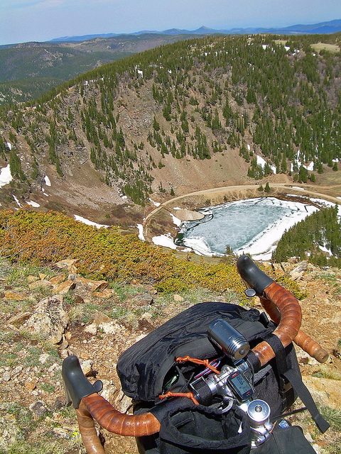
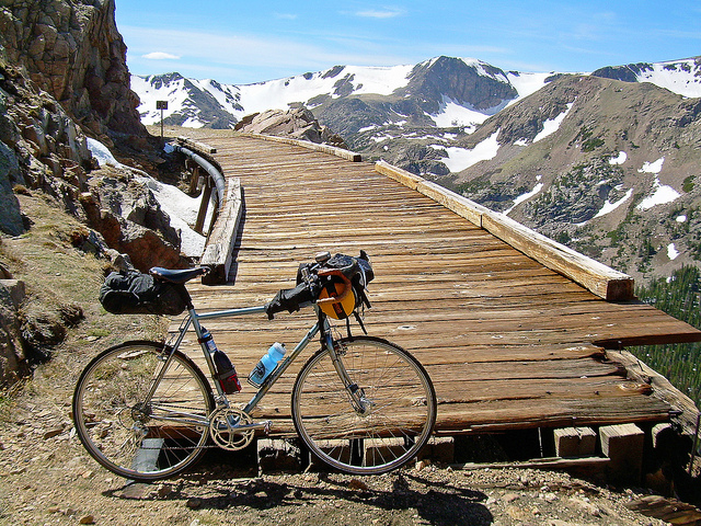
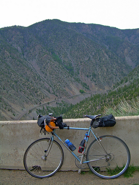
Once on the turnoff, the road turns a bit wild and my job was to simply pick a path through the rocks in the road. Beautiful views were all around me, as the former rail bed makes its way like a past-aldente piece of spaghetti over the terrain.
From whence I came,
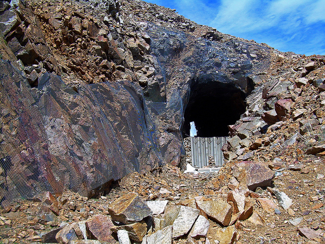
Once the road winds it’s way around, seemingly forever, the last switchback in sight straightens for a few miles N and you get a good view of the Needles Eye Tunnel, which you’ve been anxiously riding in the proximity of, like a shy kid next to his crush. The tunnel itself is fraught with rock fall and officially closed off. I peeped in, but stopped myself from traversing through it, only if because the other side had snow drifts showing up to the barriers – a good 8 feet or so. Could be an interesting time on the N. aspect, I thought.
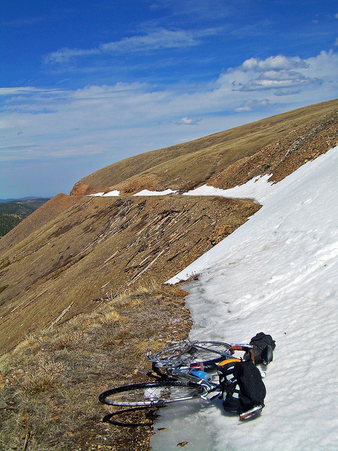
Up and over and from there, the fun really started. The N and then W aspects were more snowy, and I feared – which came true, that my afternoon was going to be filled with a slog of miles in the snow. But maybe a good time to slow down and take everything in – the sky showed no signs of turning into a wretched wench of any kind – a rarity for the Continental Divide, so my worries of getting stuck in a mid-afternoon thunderstorm were put to rest.
The route at this point, until the pass itself was covered in snow, which suited my mountaineering prowess just fine. A few interesting slide points to navigate,
and onto the pass itself!
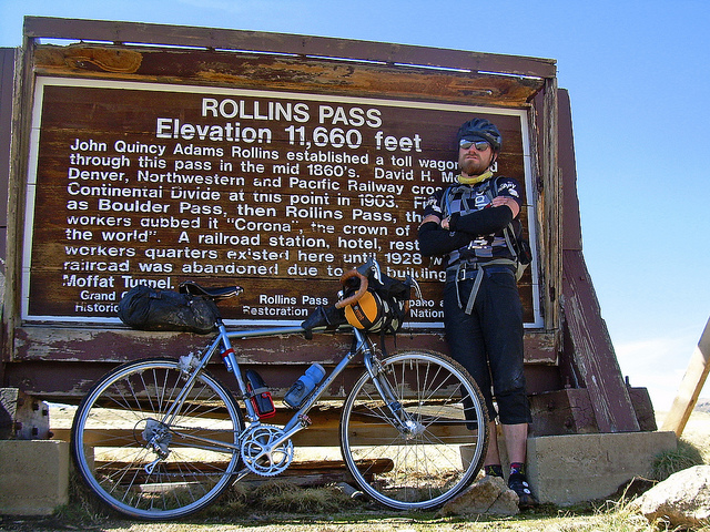
Although I attempted my best, “Bad Ass” face, I neglected to take out the, “What Would Henry Rollins Do?!” print out to finish it all off. Always forget something.
A few more miles of slogging in very much melting snow was in front of me, so I just hunker’d down and got-er done. The next bit of wreckage was a nice reprieve,
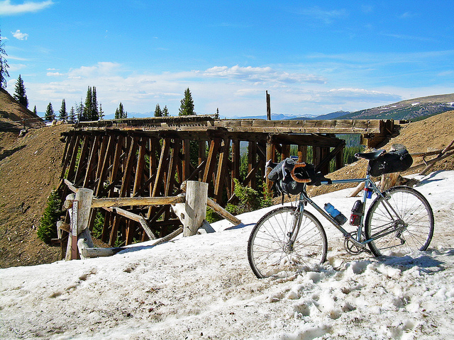
And then, the road opened up, and I was again allowed to wheel down something. And again, the lack of bulbous tires, or suspension, or really anything at all to differentiate this bike from someone’s cared-for commuter made the plain dirt road somewhat interesting. Keep my wits in fine tuning. The road did reveal a gift from the Trail Gods in the form of,
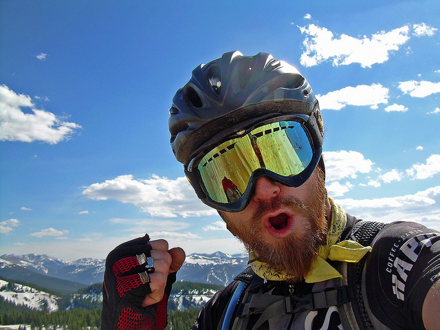
a pair of goggles! I wearily picked them up, knowing that usually such gifts come at a hefty price of needing to be utilized farther into the trip. Like those old-school Nintendo RPG video games where certain items are needed at coincidental points. I imagined I no longer was on a commuter bike, but rather a squishy full suspension free ride bike, pummeling effortlessly down the thousands of feet of elevation loss, with nary a thought in my head, and some sort of loud, energetic soundtrack emanating from speakers placed around the course.
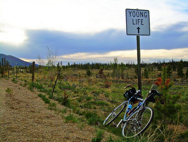
Winter Park. Ate a few Subway sandwiches and garnered some advice on how to find the road I needed and I was on FSR #139 before the sun started to set completely. The road’s top notch and worked as described in the guidebook – a great connector to Winter Park, from the GDMBR. Good job ladies and gentlemen of the ACA.
Once on route of the GDMBR, it was time to turn on the lights and follow the wide dusty road N to Kremmling. And cripes that generator light is out of control amazing. Ended the night a few strides just S of HWY9 in a bivvy on the banks of the lazily-flowing Colorado River. Woke up, fixed the inevitable flat, got some wake-up juice at the gas station, fixed the flat again – this time correctly, and rode back on route towards Inspiration Point, Radium and back onto the highway to loop back to Kremmling.
A nice flight down to the township of Radium and then the inevitable slog up. My gearing failed me and I found myself walking up near the false summit, after I grew tired of paper-boying up the almost-two track. My rig for the trip had certainly met its match for the conditions at hand – not much else to do.
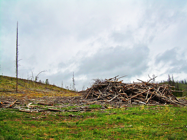
As are many, many places in Colorado and elsewhere in the Rockies, the terrain is being transformed with the loss of so much lodgepole from beetle kill, which leads the landscape in a strange, ominous void,
I reached the turnoff onto the highway and thus, said goodbye to the little part of the GDMBR I had just revisited. Back to Kremmling, via a mostly downhill highway route. All pavement from this point on. Which is nice, as the body was starting to feel the effects and I had much more riding to do, today.
Milkshake at Kremmling, Burritos in Grandby, more coffee in Grand Lake and onto the entrance to Rocky Mountain National Park. With my “borrowed” RMNP entrance card, getting in was, delightfully, on the house! My discussion with the forest ranger was filled with guffawing as they came quickly to the conclusion that I, myself am a delightful trickster –
“So you know, the road’s closed at Milner Pass – so, whatever you do – don’t go past that! Storm’s coming…”
“Oh, oh yeah” (wink, wink), “I’ll see you back here in a couple of hours, most likely” (wink, wink), “No way to get past a storm that high! Coolest heads to prevail!”
But of course, I was playing a game with myself. The forest rangers were serious, if not relaxed about it all; I actually thought I could beat a storm on the Continental Divide, in Rocky Mountain National Park of all places and push on through to the other side. I was in complete and utter denial. But I also really, really didn’t want to back track.
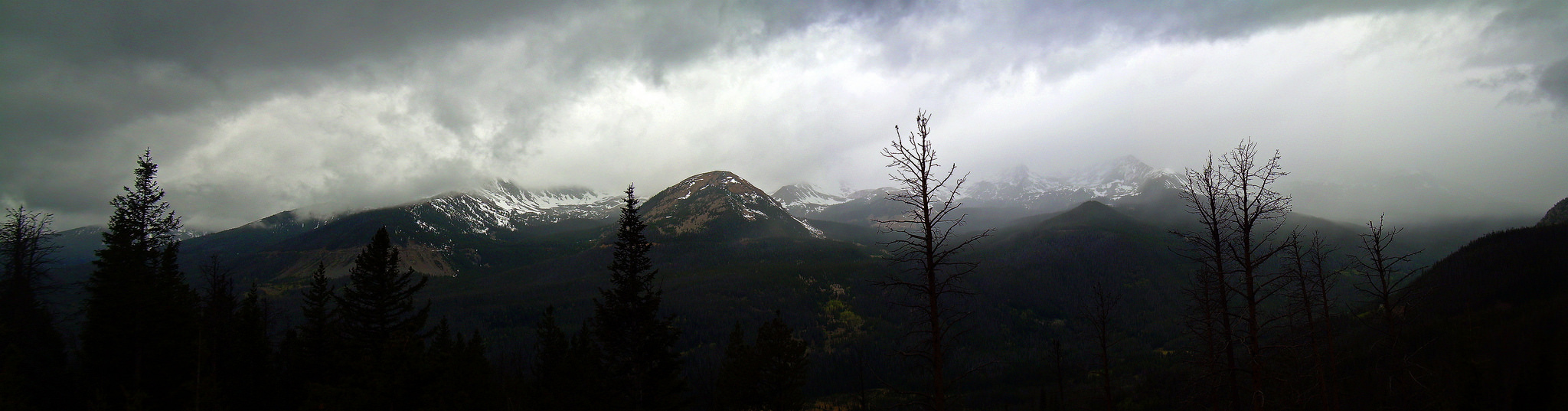
The ride into RMNP park is and will hopefully always be, completely beautiful. The road closure up the track 18 miles worked in my favor as the park was especially empty, so early in the season, and during a weekday. The weather though, was turning a gorgeous hue of ugly,
I decided to press on, at least to Milner Pass and make the Go, No-Go decision but I knew my stubborn mind was already made up.
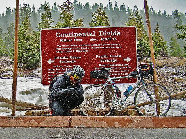
It didn’t take long for precipitation to start falling, and for that precipitation to start being the frozen type. Milner Pass:

Although snowing, the snow wasn’t accumulating and being on the top of the pass, it made sense that the road should go down, giving me relief from such exposure and perhaps a good place to sleep for the night.
Well, that didn’t turn out to be the case. Instead of barreling down, the road just kept going up and up. And up. The more elevation gained, the worse the weather, until what was falling was, without a doubt, snow and was, in fact, accumulating on the road itself. The road made a tight switchback straight into the wind, a few miles after hitting Milner Pass and it seemed that my current setup was coming very close to the extreme end of its usefulness. I mean, I didn’t bring a winter coat – or even a shell. I just had a rain coat.
To my, well, lucky stars, a few steps farther up the track was the Alpine Visitor’s Center, and even though the center itself was closed, the bathrooms weren’t. And thus, I took refuge in the middle bathroom at around 8:00pm, with a good 130 miles for the day, under my belt. I had hoped to ride a few more hours today, but I was socked in at the apex of the road, no one around for miles, as the road was closed to anyone with sense, impassable to anyone else, on account of the tempest that was whirling around me.
I set up the sleep kit, did my best to strip off wet clothes and into some dry, warm clothes and popped the Personal Music Device to Jon Krakauer’s Into Thin Air. Unpacked the burrito I had been riding with since Grandby and mulled over how it must have been like, stuck in a mere 4 season tent about 16,000 feet higher than where I was, on Everest, as people were literally being blown off the mountain all around you. Good company while being cold, tired, cramped and smelling of 2nd-rate mexican food and gravel road. In a pit bathroom. I had decided to not take my incredible, 20 degree rated 850 down waterproof bag on this trip, but instead take my 50 degree rated 750 gram bag, which wasn’t behooving of this exact scenario, but I’m writing this all out, so it worked well enough.
I checked outside every hour, starting at 6:00am, and by 8:00am, I decided it was time to make my break for it. It was still windy, still snowing and still a white out, out there, but I had those magical goggles that I found on Rollins Pass. Without them, I’d still be stuck up there, I suppose. I covered my feet and hands with whatever stuff sacks I had in tow – looking more vagrant than heroic, and started walking up. As long as I kept walking, my body produced enough heat to be comfortable.
Drifts were approaching a few feet on the road, which makes forward movement comical, but most of the time, I could find some of the road only under a mere few inches to walk the bike over. Mostly by feeling, as conditions were that I couldn’t see much in front of me, and what I did see had the same color all to it: white.
Right after the Alpine Visitor’s Center, a sign foretold of another pass, 4.1 miles away. I guessed that, since the road is still going up, it would for about 2 miles, and then go 2 miles down to this sacrilege, “pass” of theirs. From there, hopefully, the road would let up enough to ride the bike again. Roughly two hours of walking blind in store for me, if I’m going at my cruising speed of 1mph – typical for bike-slogging, of which I am the undisputed king at. The worse that could happen is that I would have to backtrack a very uncomfortable few miles back to the visitor’s center and be holed up there, now very wet and very tired, for another day. But hey, it’d be a cold-weather slog in a downhill direction!
To my luck, at the apex of the road at 12,000-some-odd feet, the weather finally broke and with glee, tracks of a recent snowplow showed on the road. I mounted the bike and, without any usable brakes, on account of the ice/snow/wetness on my rims, rocketed down the other side of Trail Ridge Road, stopping periodically for a passing snowplow that I waved on, and got a hearty wave back. Guess it’s not out of the ordinary to find one crazy up here doing silly-stupid things with his life. I kind of wanted them to know I was up here and maybe radio down, in case the rangers on the W side wondered what happened to me and to call the police on the E side to hand me my ticket of failing to follow official commands of a road closure in a National Park, camping without a permit, etc, etc, etc.
But, none of that. The ride down was nothing if not delightfully cold, everything below my knees – bike included, quickly inheriting a fine sheet of verglas, rendering the drivetrain as useless as my brakes. A nice, out of control, skinny-tired rocket. Glad the road was closed to cars, or I’d be… well.
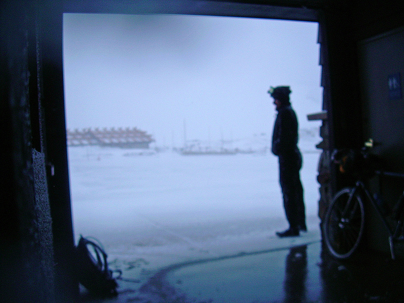
Far down the track, the road finally opened up again for general traffic, and I turned into yet another visual spectacle of the park for the tourists in the area to view. Their collective telephoto lenses whirled away from views of Longs Peak poking out of the haze and onto this strange creature blasting down the road, covered in stuff sacks on all four appendages, teeth audibly chattering.
I flew out of the entrance of RMNP, no one wanting me to stop and, “answer a few questions”. Another half-baked idea perpetrated! I beat the opening time of Ed’s Cantina, a required stop in Estes Park, by a few, so I headed on over to Kind Coffee and stripped off everything wet and laid it down for the sun – or something to hit it, as whisks of snow were starting to fall, even at the base of the park. A curious onlooker asked me some questions on what exactly I just did.
“I shouldn’t tell you this”, I started out, and then gave a quick rundown of the last few days. He seemed impressed. I told him he shouldn’t be.
Ed’s didn’t let down – I had what must have been the best burrito of my life and I headed out, leaving their beautiful wait staff behind towards Boulder. The wind hadn’t relented – getting if anything: stronger, as the day wore on. Once in Boulder, I decided to pack it in and bus it home. My, “two days”, were now in the middle of its third and I couldn’t play hooky forever. Well, not forever, yet. My left knee was also almost verbally protesting and it seemed prudent – what a word to use in this writeup – to finally give it a break and not face 3 more hours of headwinds.
I’m not quite sure what to call this type of riding – it’s almost as if it’s disaster-style touring: I always feel I come home looking like a half-drowned rat, with my gear in disorder and something fairly wrong with my body. Leaving the house with such a ultra light setup, it’s easy to get above and beyond what the gear is made to endure. It could also just be called Spring in Colorado, as the conditions inherent in this season can be a bit drastic. It’s also a hoot of a good time, if you can mentally keep together the more difficult sections. Or thank your lucky stars there’s an open bathroom to hole up into, at 12,000 feet, during a snowstorm on the Continental Divide.
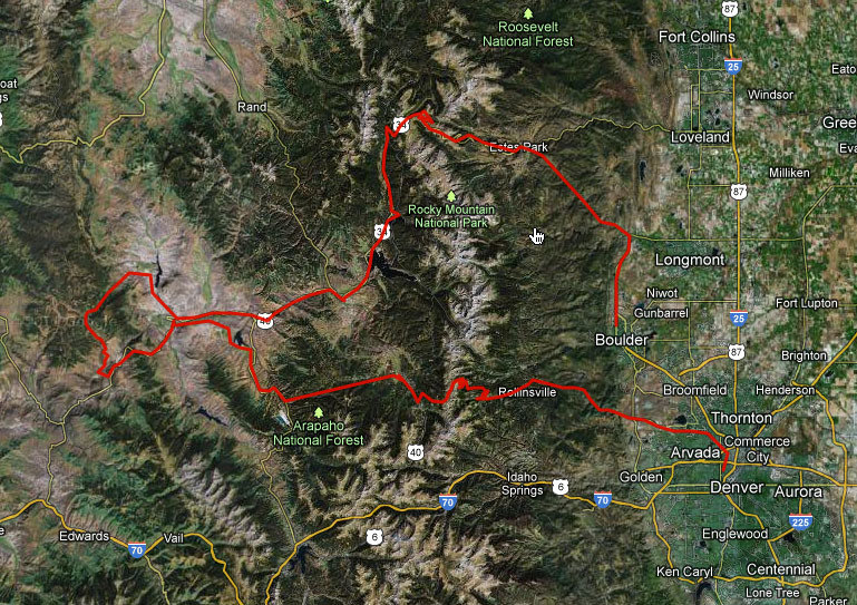
Route map,

Just found this, awesome (going to poke around some more), but especially liked this:
“I wearily picked them up, knowing that usually such gifts come at a hefty price of needing to be utilized farther into the trip. Like those old-school Nintendo RPG video games where certain items are needed at coincidental points.”
I’ve most definitely thought this on occasion when rambling around…sometimes I think I purposely go out of my way to seek out a mini ‘quest’ that requires usage of found object.
Cheers!