The State of Colorado features a land mass that’s one third Public Land! This makes access to this land for hiking, camping, and riding extremely plentiful.
There are some finer points to consider when designing your own trip:
National Forest/BLM Land
Unless otherwise posted, access for dispersed camping is available on most National Forest and BLM land. The great majority of campsites that will be highlighted in this guide will be free, dispersed campsites in National Forest. In a few instances, camping will not be available. These areas include right at trailheads/parking lots or within public watershed areas. These areas are usually posted as being off limits.
Trails that go through National Forest/BLM land aren’t always opened to cycling and each trail is managed independently. You’ll have to double-check on bicycle access on trails you would like to ride. Many, many 14ers are located within National Forest/BLM land. All trails covered in this guide will be clearly marked on the type of access that is allowed.
State/City Public Land
There are no 14ers in any Colorado State Park land. Colorado State Parks all have their own land management systems, so check with each specific state park if you want to ride through, or camp in state parks. Free dispersed camping will most likely not be available in State Parks.
National Parks
Rocky Mountain National Park is the only National Park in Colorado that has a 14er within its borders. In RMNP, the only access cyclists have is the same access granted to cars: paved roads, as well as Old Fall River Road – a well-maintained gravel road. There are no Park trails that you may ride a bike on.
Longs Peak
Longs Peak is one of the more difficult peaks to plan a bikepacking trip too, as camping within the Park requires a permit, and much of the land around the Park is either Designated Wilderness or private property. Careful campsite selection on the scant National Forest land available, planning ahead to reserve a campsite, or making reservations for private lodging will need to be done. We’ve highlighted some choice dispersed campsite selections in the Segment 4 of the Front Range Tour 14ers guide.
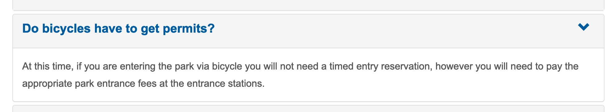
Timed Entry Permit Reservation System
For 2021, Rocky Mountain National Park will have a timed entry permit reservation system you will need to make a reservation for if you enter the Park by automobile. As of 5/5/21, cycling into the Park does not require this timed entry reservation. You will still need a Park Pass/pay the entry fee for entering the Park via bicycle, as before.
More Information:
- https://www.recreation.gov/timed-entry/10086910
- https://www.nps.gov/romo/planyourvisit/timed-entry-permit-system.htm
Private Property
Avoid ever crossing onto private property to access public land, unless you have explicit permission to do so.
There are a few 14ers that are on private property, or can be more easily access by accessing them through private property. The 14ers that you should be most concerned about are:
Mt Bross
Officially, public access to Mt. Bross is closed.
More Information
Culebra Peak
Culebra is entirely on private land. Public access to Culebra Peak is managed by Cielo Vista Ranch. You will need to pay and reserve a date for your hike ahead of time, which you may do at:
Although ranch hands may be a little conservative on allowing you to do so, you may ride all the way to the Four Way junction.
Ranch hands are mostly concerned with your safety in getting down the mountain before the afternoon thunderstorms. The road up to Four Way is a very steep dirt road. Riding down is quite thrilling.
Camping is available to those who hold reservations and is located right outside of the ranch gate. You will be provided with instructions after you gain a spot.
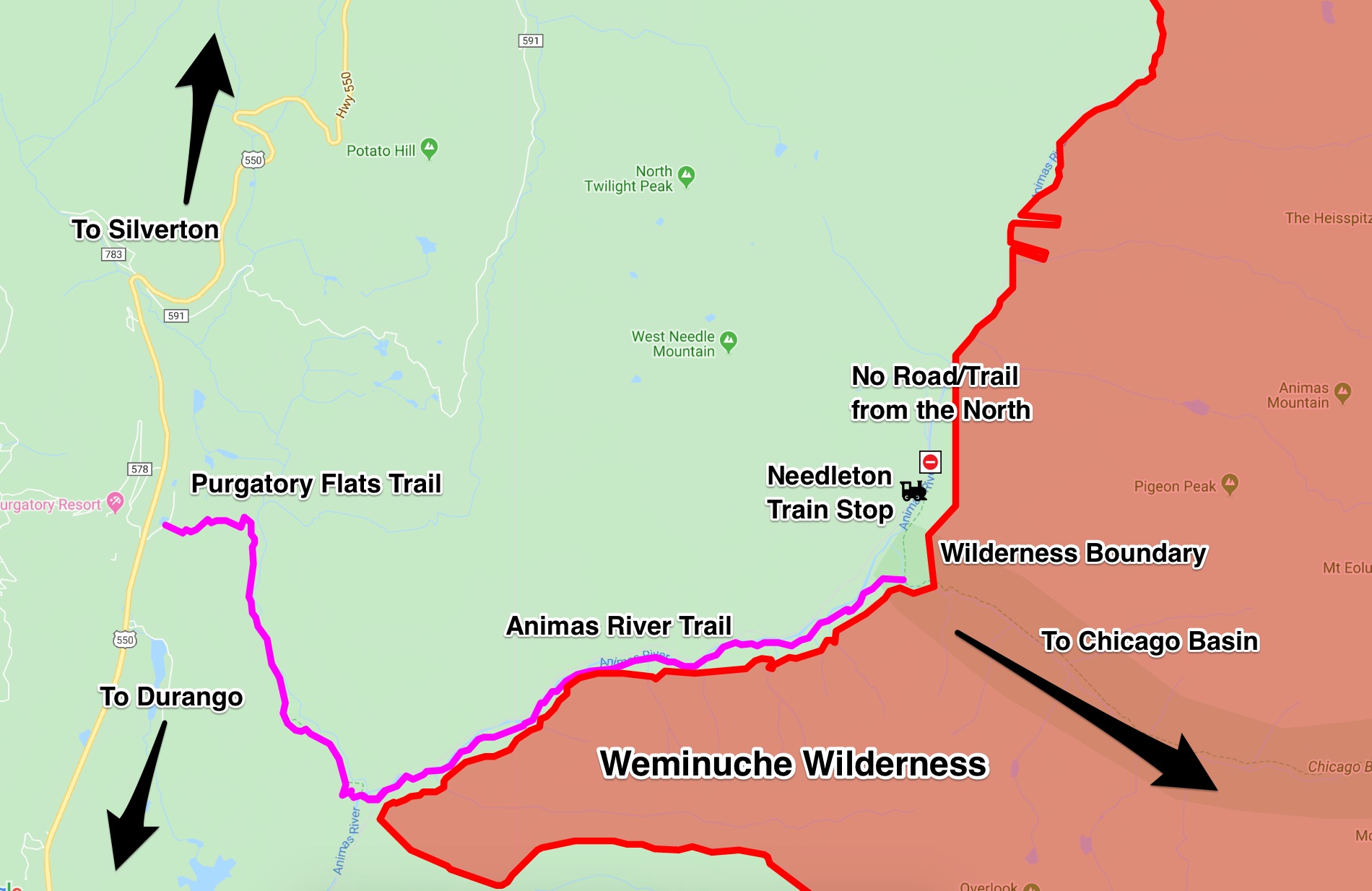
Access to Chicago Basin 14ers
Chicago Basin 14ers are in Designated Wilderness, so access by bike is not allowed.
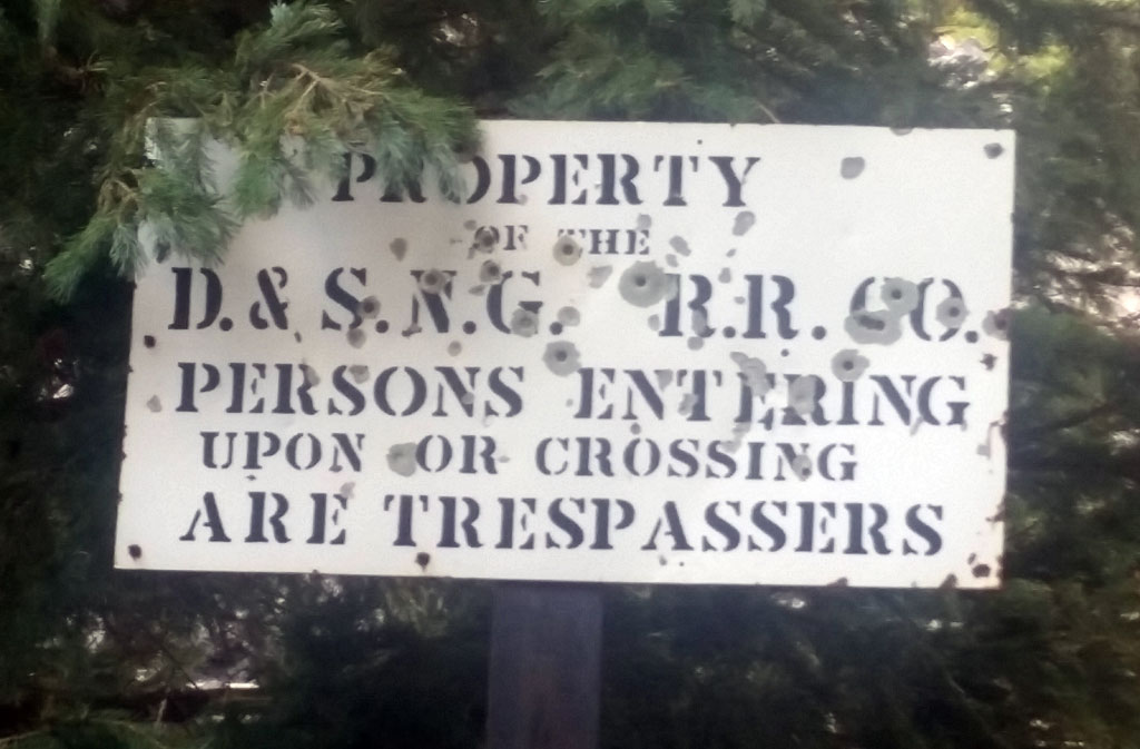
You may not access the Weminuche Wilderness Boundary via the corridor used by the Durango & Silverton Narrow Gauge Railroad. The tracks are private property through public land and thus, utilizing them would be trespassing.
There is no trail besides the tracks and one would also be forced to ride the tracks, sometimes on dangerous sections: not only a danger to you, but for the train passengers. Think of the train tracks similar to how you would a private road.
Leaving your bike in Silverton or Durango, and taking the train to the Needleton station is an option you may consider.
More Information
The closest you may ride a bike to the Wilderness Boundary is via the Purgatory Flats Trail, off of Highway 550 and is specifically marked as being legal to ride bikes on. Expect lots of hike-a-biking, foot and horse traffic, and at the right time of year: enormous groves of raspberries.
More Information
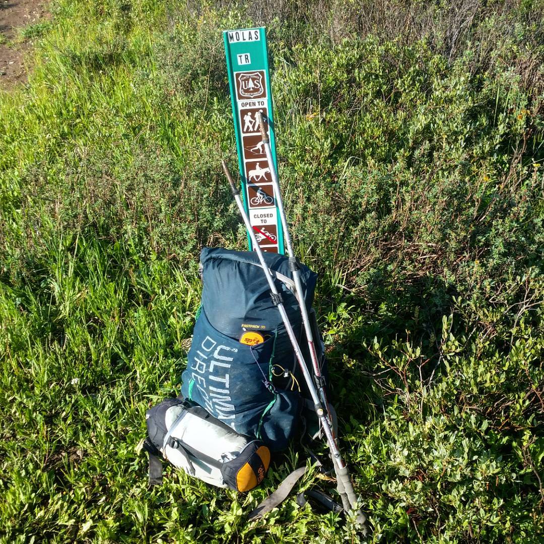
The Colorado Trail, near Molas Lake starts on National Forest and is legal to cycle on starting at Highway 550, but you would soon run into a Wilderness Boundary, well before the bridge over the Animas River, making it a not very useful or convenient way to access it by bike.
Access to Pine Creek Drainage
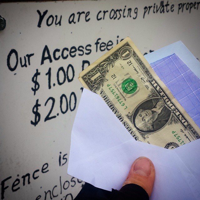
The Pine Creek Drainage allows access to less traveled and more remote routes on Oxford, Belford, Harvard, and points beyond. To gain access, you will have to cross over private property.
The property owners grant this access to visitors and charge one whole dollar to do so. The trail through the private property is rideable, and enjoyable, and National Forest can be found after the private property is traversed. Good camping can be found on the north side. Leave the bike here, as a Designated Wilderness boundary will soon be reached farther west, where bikes are not allowed.
Designated Wilderness Areas/Wilderness Study Areas
Cycling, or even possessing a bicycle in Designated Wilderness areas is not allowed. Portaging a bike through designated Wilderness Areas sounds like a great idea for an adventure, but this is not legal.
The majority of 14ers found in Colorado are in Designated Wilderness.
Wilderness Study Areas have the same “no bikes” rules as Designated Wilderness Areas.
Access and Camping in the Maroon Bells Wilderness
The following 14ers are found in the Maroon Bells/Snowmass Wilderness:
- Maroon Peak
- North Maroon
- Pyramid Peak
- Capitol Peak
- Snowmass Mountain
Climbs up Capitol and Snowmass are usually done as a multi-day backpack. Maroon, North Maroon, and Pyramid are in close proximity to each other, but doing them all in a day is a very long itinerary indeed. You most likely will be doing them all from a base camp.
The paved road up to the Maroon Lake trailhead from Aspen is open to non-motorized forms of transportation (including bikes) 24/7, which makes this road climb quite a treat as this road is also closed to personal cars during the day. The trailhead even has a bike lockup area. Overnight visitors will need to self-register at the trailhead (free).
Dispersed camping within the Wilderness is allowed and does not require an additional permit, except for within the Conundrum Hot Springs Zone, which this guide will not be covering.
A bear canister is also required for overnight camping in the Maroon Bells/Snowmass Wilderness.
More Information
14er Summits Accessible by Bike
The following 14ers can be “ridden” to the summit:
Pikes Peak
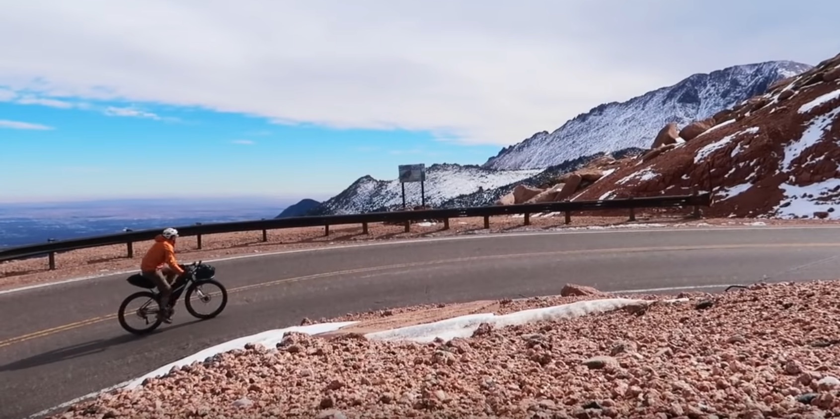
Pikes Peak has a paved road to the top that you may ride to the very summit of the mountain (toll road).
More information
Pikes Peak also has the Barr Trail, perhaps the only singletrack trail up a 14er where it’s reasonable to ride the majority of the trail both up and down for the very fit. The last switchbacks would be an incredible challenge to ride up, but most likely has been cleared cleanly riding down.
Mt. Evans
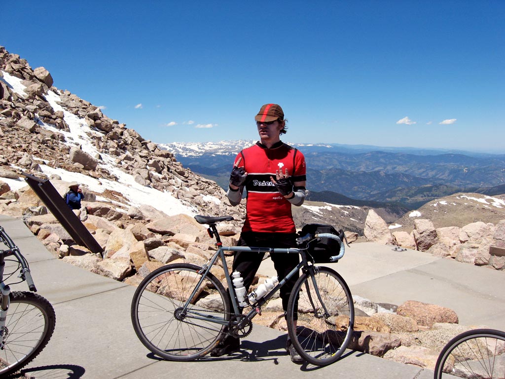
Mt. Evans also has a paved road that you may ride, which ends only a few hundred feet from the summit. The road is found in a corridor through the Mt. Evans Wilderness, making this quite a unique experience. This road is also the highest paved road in North America.
You do not need to pay to ride the Mt. Evans highway, unless you decide to use any of the facilities along the way or at the summit, including stopping at the parking lot and walking around.
The summit itself is right at the Designated Wilderness Boundary, so use your best judgement if you do decide to hump a bike up to the summit block.
More Information
Mt. Antero
Mt. Antero also has a rough, 4WD road you may attempt to ride to the final pullout, and hike the last few hundred feet. Expect a lot of Jeep traffic on this track. The final social trail to the summit is not remotely rideable.
Legal Bicycle 14er Summit Access
The following 14ers have access to possess a bicycle on the summit, in the legal sense:
- Evans
- Pikes
- Antero
- Grays/Torreys
- Elbert
- Princeton
- Shavano/Tabeguache
- Democrat/Lincoln/Cameron
- Antero
- Sherman
- Quandary
- Huron Peak
Other than Pikes Peak, you most likely will not be able literally ride your bicycle to the summit, as the trail will be too rough and/or steep. But legally, it’s OK to have a bike with you on the summit, if you would like to portage up and over the summit itself in whatever style you find realistic, or summit in an attempt to turn around, and then ride the trail down.
Both ideas are rarely done, and are more of Type III activity. Remember that 14er trails are wildly popular. Be a good trail steward and only attempt such an endeavor on low-use times. This guide will not be centered around the idea of hike-a-biking a bike up to the summit to attempt to ride down, but we’ll highlight some rides that are best worth your time.
Riding Ethics
Riding a 14er summit trail isn’t without it’s ethical issues. For the most part, these trails are designed purely for hiking in mind, and are laborious and expensive to build. Those who build them tend to be protective over them. These trails can also cross delicate alpine environments that are easily damaged from abuse. When tundra is heavily disturbed, it can take a lifetime to grow back.
For riders, this generally means being in complete control on both the ascent/descent through these delicate areas. Riding off-trail won’t be tolerated by other trail users.
Verifying Trail Access
One tool at your disposal to verify bicycle trail access is the National Forest Interactive Visitor Map, which ties the NF trail database with a map you may navigate to where you’d like to ride:
(also available as an for Android and iPhone). Using the website, first click on the “Biking” icon:
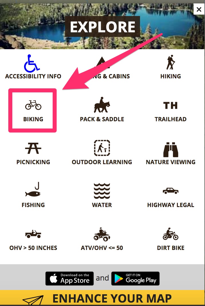
This will highlight trails that are bicycle-accessible. Drill down to the area you’d like to browse, and click on the trail you’d like to get more information about.
As an example, we’ll use the Purgatory Flats Trail, which is located in southwest Colorado, in the San Juan National Forest between Silverton to the north and Durango to the south.

Clicking on the trail marker will bring up a window giving us more information, including riding access:
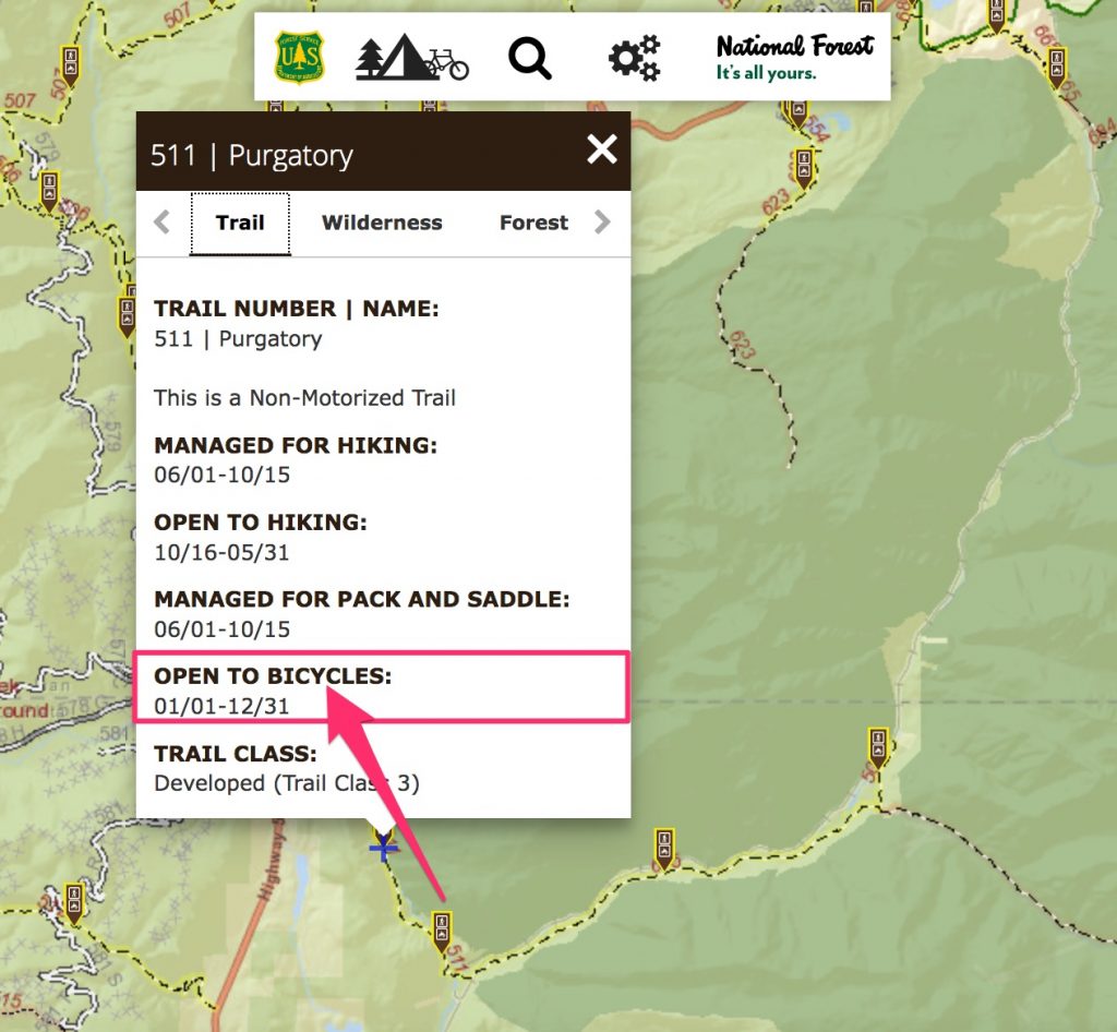
According to the National Forest Service’s interactive map, this trail is open to bikes without restrictions. If a trail does not allow access by bike, it will simply not list bicycles in the trail information. Be careful with trails that may start outside of a Wilderness area, then continue on inside of one: The trail would then be open to bicycles, until the Wilderness boundary.
Confusing Access
San Luis Peak
San Luis is entirely within the La Garita Wilderness, so is also completely off-limits for riding. The confusion comes from the poorly-marked southern Designated Wilderness boundary you’ll cross between the end of Willow Creek Road and right before reaching the Colorado Trail – people seem to not realize that they’ve cross into Wilderness.
The Colorado Trail is also very rideable from where the trail crosses CO 149 to the west. You’ll hit a Wilderness Boundary approximately 7.63 miles from Spring Creek Pass. From there, it would be a further 6.8 miles to where one usually picks up the Colorado Trail to take to San Luis, and a further 5.11 miles to the summit.
Redcloud/Sunshine/Handies
This trio of mountains are either in the Red Cloud Wilderness Study Area or the Handies Peak Wilderness Study Area and are off limits to bike access. These mountains are erroneously labeled as BLM land on many maps. These maps are outdated.
Updates:
- 5/5/21 – Corrected information about access to San Luis, from the Colorado Trail, starting from Spring Creek Pass. I had erroneously written that the Wilderness Boundary was only a few hundred feet, but it is actually several miles in
- 5/5/21 – added a note about the RMNP timed entry permit reservation system. a reservation is not needed when entering the Park via bicycle.
Work in Progress
Bikepacking to the Colorado 14ers is currently being written and published publicly. Get news and updates by joining the Facebook group, Follow us on Instagram, join our subreddit, and mailing list.
You can support its development by purchasing items through the affiliate links on this site: check out the gear reviews, as well as the items below: