Work in Progress
Bikepacking to the Colorado 14ers is currently being written and published publicly. Get news and updates by joining the Facebook group, Instagram, Twitter, subreddit, and mailing list.
Introduction
MTB QUEEN STAGE!
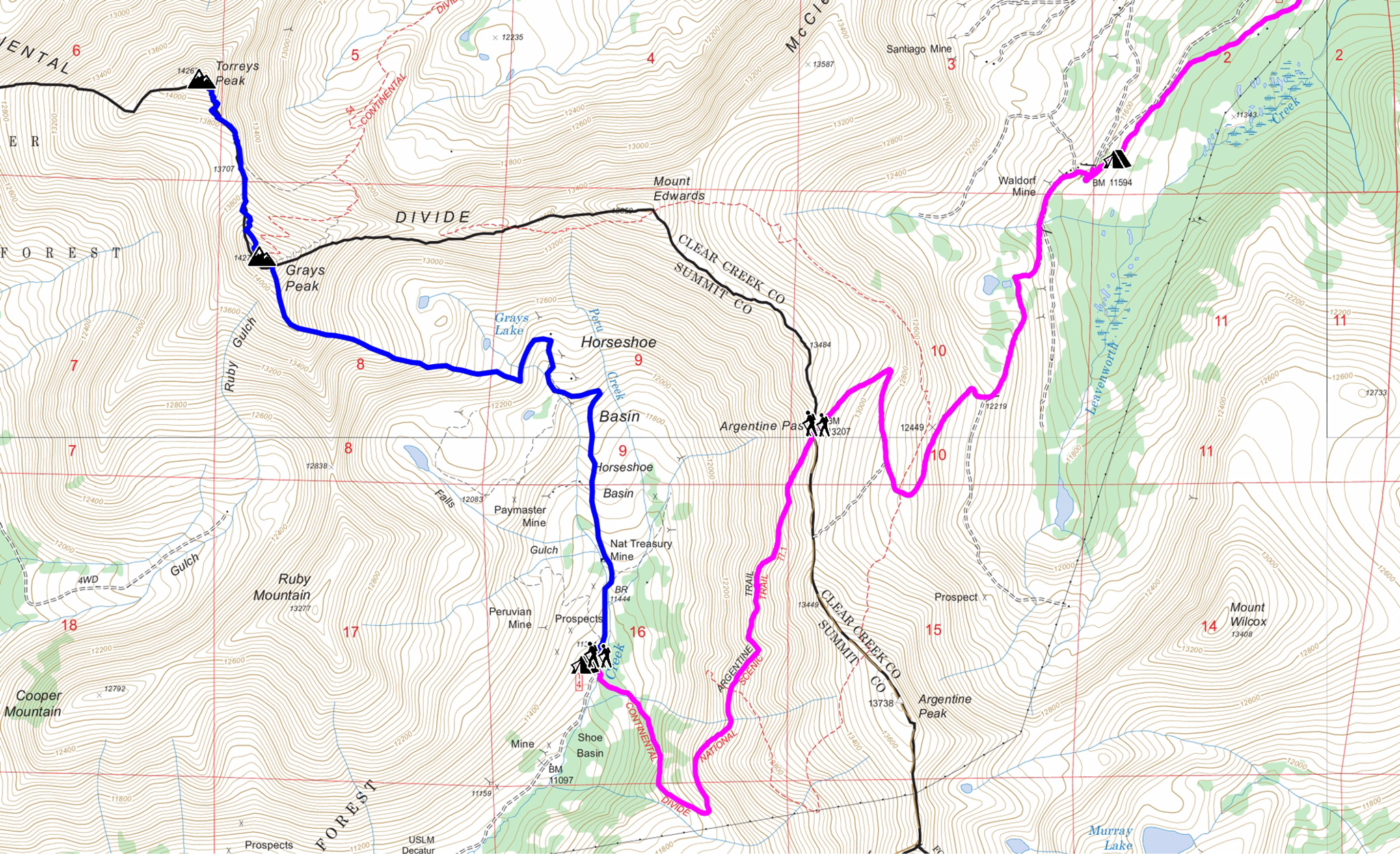
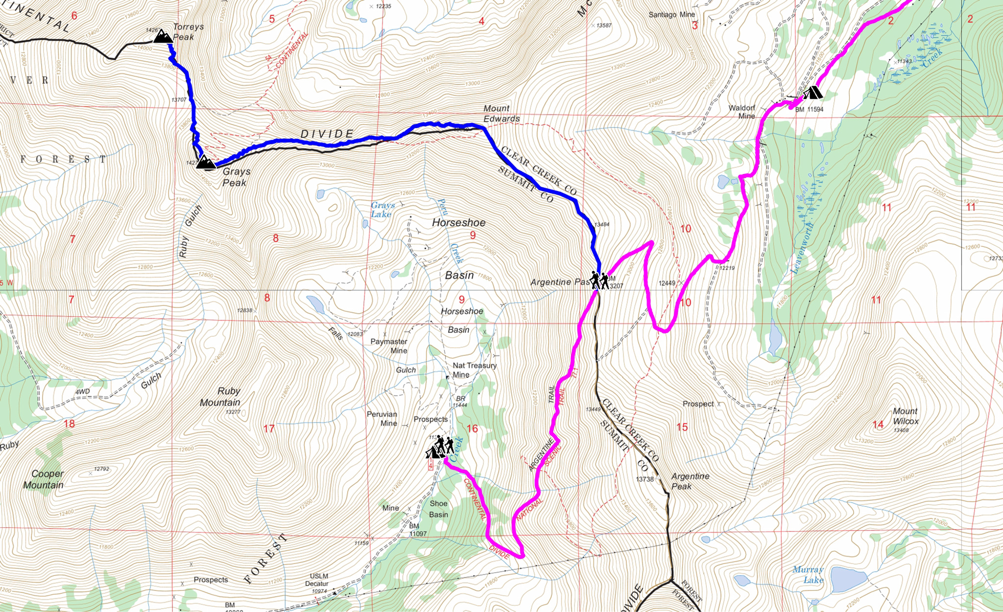
Although shorter than other segments, Segment #3 packs a big punch and is not to be underestimated. Highlights include summiting over the 13,207′ Argentine Pass – one of the highest rideable passes in Colorado, to an incredible ribbon singletrack descent into Horseshoe Basin. Horseshoe, outside the old mining camp of Montezuma, features relative tranquility compared to the crowds up at Guanella Pass. Make camp in the basin before taking on Grays and Torreys from the south.
Summiting Grays and Torreys from Horseshoe Basin is not as popular as other options, and you may find some solace from the Front Range crowds. Think of this basin as a back door to Grays and Torreys. There are some water source issues that we’ll describe in detail in the narrative.
The MTB version is around 27 miles/5000′ gain, and there are several options to make it shorter by starting your hike at different points on the route itself. Plan on 1-2 days for either the MTB or Road narratives to get to camp and to be in a good position for the hike the next day.
The Road version is slightly shorter and has a little more downhill than uphill. Both will ride through the town of Georgetown which will work as a resupply point, before the Road version splits off and moves onto Stevens Gulch Road. As a stark contrast to Horseshoe Basin, you’ll find Stevens Gulch an extremely popular way to access Grays and Torreys – this is the front door.
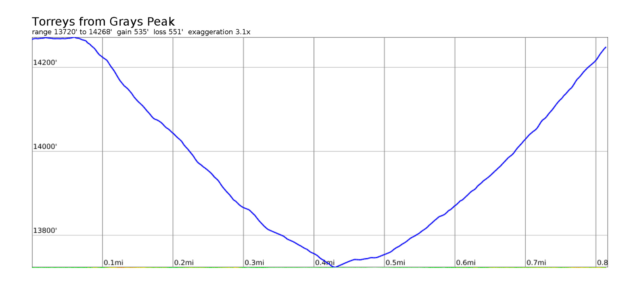
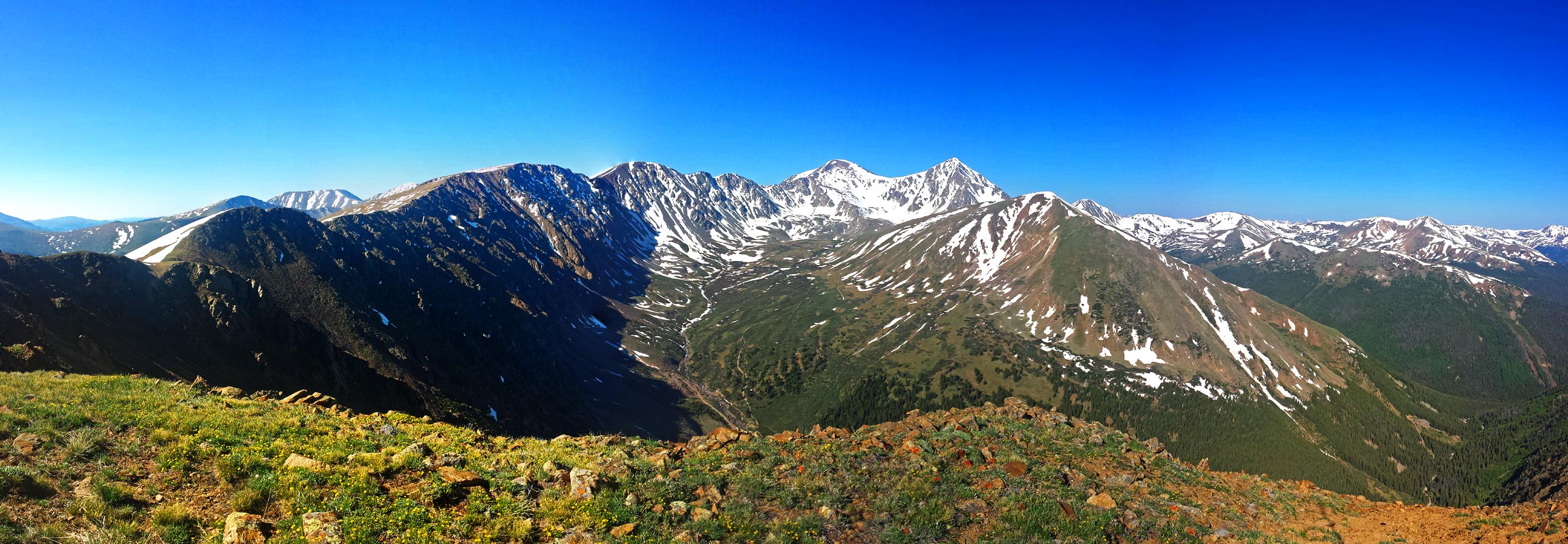
The summits of Grays and Torreys are less than a mile apart from each other, and the terrain itself is mild. Combining these two peaks is frequently done.
MTB Narrative

- Mileage: 27 miles
- Elevation Gain/Loss: +4930′ -5286′
From the crest of Guanella Pass, head down north towards Georgetown. Before reaching town, you’ll pass an easy to miss forest road, Leavenworth Creek RD/FR 248.1 at a tight switchback – locate it on the west side of the road. If you have enough supplies for the night and the next day, start up FR 248.1 for a shortcut up to Argentine Pass. There’s some dispersed camping spots on this road to take advantage of.
Continue down Guanella Pass to Georgetown.
Georgetown Services
- Groceries: Georgetown Market (small)
1204 Argentine St - Pizza/Coffee: Mountainbuzz Cafe and Pizza
1200 Argentine St.
Georgetown’s city center is well-curated with many tourist trappings complete with chocolate shops and other delicacies. The above services are out near the interstate exit.
There’s no great camping near the town of Georgetown that I would recommend and the ambience will be somewhat tarnished by the nearby interstate anyways. You will want to resupply with both food and water here, before continuing. Make sure to really camel up if you decide on camping in Horseshoe Basin on the other side of Argentine Pass, as the water quality may be suspect due to mining pollution.
Bailing
Ride east on signed bike route frontage roads to Idaho Springs. The Bustang stops here towards Denver. Both the MTB and Road narratives continue on from Idaho Springs if you would like to skip Grays/Torreys, but continue on to Longs Peak.
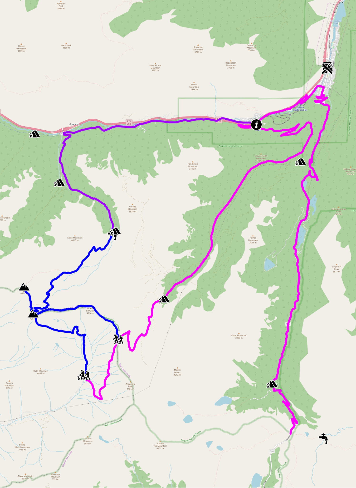
Take Loop Dr. southwest out of town, and follow the signed bike route west. This segment switchbacks up and around the Georgetown Loop Railroad, then parallels I-70, dumping you near the underpass near Silverplume. This is where the MTB and Road narratives split for the remainder of the segments.
Jog a little left and locate Mountain Street/CR 330, which will begin as gravel. Head up west on CR 330. CR 330/Argentine Central Grade Railroad will soon switchback and climb eastward and you’re on your way to escaping the hustle of the I-70 corridor. This portion is closed to motor vehicles, being gated by the switchback, until Pavilion Point.
Follow the switchbacks up, as the road gets rougher after Pavilion Point and outside the gate. Soon, you’ll be close to the Guanella Pass Scenic Byway you were just on.
Follow Leavenworth Creek RD/FR 248.1 west, then southwest towards the Waldorf mine site. Waldorf is a good place to make a dispersed campsite. Ahead is the steep climb up Argentine Pass. Continue south, and find the track that switchbacks west up the saddle between Argentine Peak and Mountain Edwards. Start climbing!
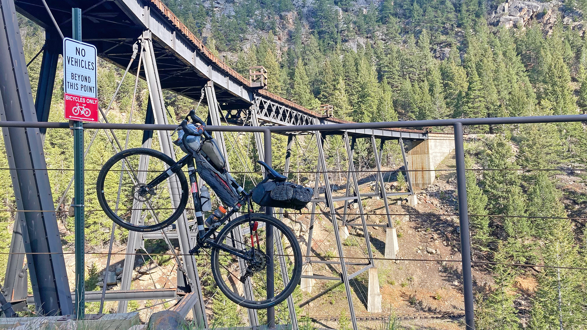
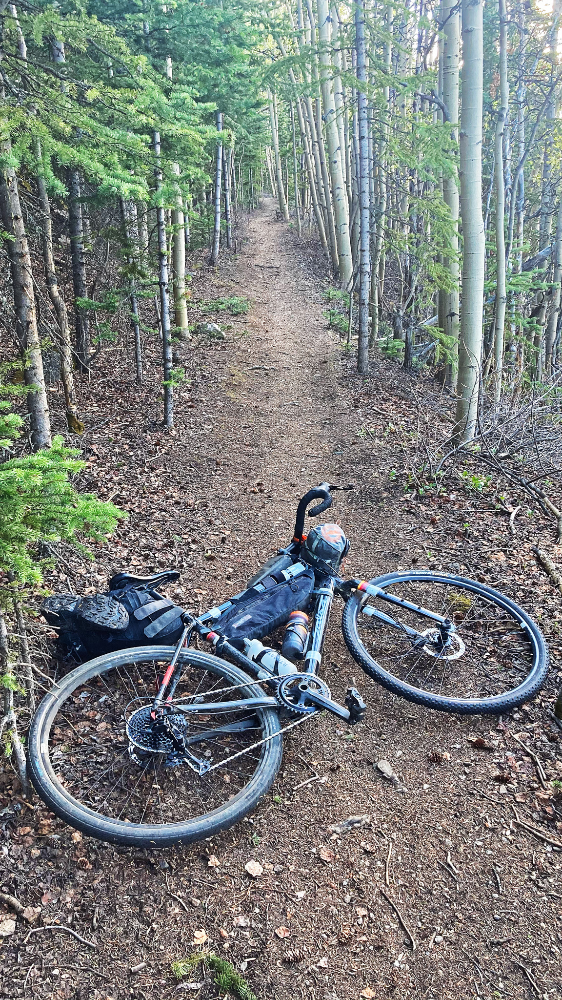
Crest Argentine Pass at 13,207′ and take in the views. Once you’re ready, prepare to ride down the other side into Horseshoe Basin on some rough singletrack. There will be some parts that are unrideable because of trail damage/rock slides, so temper your speed to be able to stop before going off the brief Class 3 sections of the trail! The trail here also doubles as the Continental Divide Trail, so there’s a chance you’ll meet up with some through hikers on their way to Mexico/Canada.
At the bottom, the trail will run into the gated Peru Creek Road #260. Set camp up wherever you’d like.
Water Source Considerations
Be careful of surface water sources, as local mining activity may have added pollution to the creeks that run through the mines themselves. Peru Creek will not be running a natural color because of the oxidation of minerals from the acidity of the water. If drinking water is needed, it’s suggested to source it from snowfields, or from springs found high up in the basin. The safest bet is to carry water in. Most conventional water treatment techniques won’t remove heavy metals from the water, but there are some solutions, including the Sawyer S3 Foam Filter.
More Information:
Bailing
If the chances of re-ascending Argentine Pass looks grim, your best bet is to ride west on Peru Creek Road #260 to right outside of Montezuma. Turn right on CO 5/Montezuma Road and take this road west to civilization. This is a fantastic 4WD route. Montezuma will end at HW 6, right at Keystone Resort. Several options are open to you:
You can ride back east and get back on route by riding the 8 miles up US 6 to Loveland Pass (paved), then drop back down into Georgetown and points east.
Alternatively, catch the free Summit Stage bus to Frisco at HW 6/Rasor Dr. From Frisco, you can then catch the Bustang West Line east to Idaho Springs and Denver. Pick up the route in Idaho Springs.
Frisco, and Summit County as a whole is a mountain playground, with incredible access to mountain hiking and biking. Both the GDMBR and Colorado Trail roll through Summit County. 14er Quandary Peak is located 9 miles south outside of Breckenridge.
Hiking: Horseshoe Basin to Grays/Torreys via South Ridge

- Rating: Class 2
- Mileage: Grays only: 2.61 miles (one way); Grays/Torreys: 3.43 mi (one way)
- Elevation Gain/Loss: Grays only: +2992’/-48′ (one way); Grays/Torreys +3,527’/-601′ (one way)
- 14ers.com Narrative
Hiking Alternative: Argentine Pass to Grays/Torreys
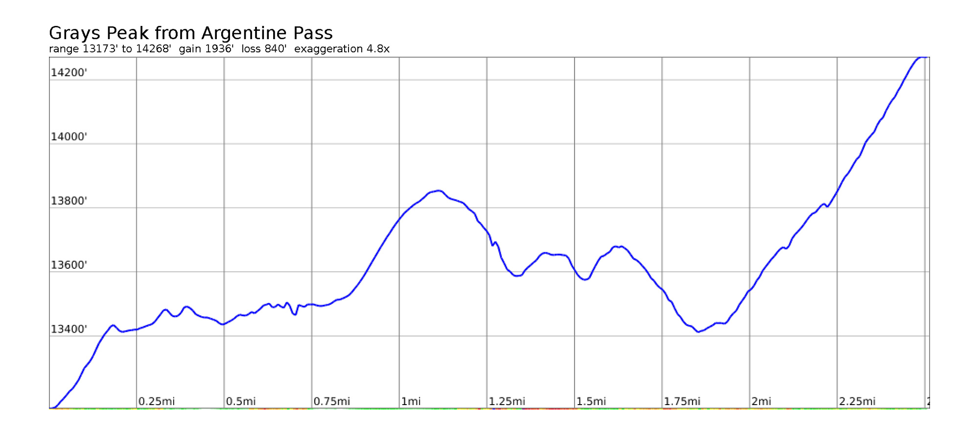
- Rating: Hard Class 2
- Mileage: Grays only: 2.51 miles (one way); Grays/Torreys: 3.33 mi (one way)
- Elevation Gain/Loss: Grays only: +1937′ -841′ (one way); Grays/Torreys +2,472’/-1,394′ (one way)
This route works well if you decide to camp near Waldorf, and don’t want to drop down the other side. It’ll demand an early start of the next day. From Waldorf, ride/hike up to the summit of Argentine Pass, and instead of dropping down the other side, continue by foot north, then northwest up Mt. Edwards (Centennial) following the ridgeline. Continue following the ridgeline west to Grays Peak, then to Torreys. You’ll be following the Continental Divide from Argentine, all the way to Torreys, which makes this quite a special feeling route.
It does come with a few important details to remember: you’ll be exposed on this ridgeline most of the day, and will also need to resummit Mt. Edwards on your return. This route will mostly be cutting out the descent/reascent of Argentine Pass, but the hiking mileage/elevation gain is surprisingly similar.
Road Narrative

- Mileage: 21 miles
- Elevation Gain/Loss: +2888′ -3285′
Follow the MTB narrative until near the underpass near Silverplume. The MTB narrative continues straight west.
Instead, turn right and head under the underpass into Silverplume (very limited services), then take a left to head west on Water Street. Water Street/Silver Valley Road will dip below the Interstate. Continue following it as it parallels the Interstate until the Bakerville exit. On the south side of the road will be the road up to Stevens Gulch. This is the Winter trailhead for Grays/Torreys.
To the west, a paved bike path can be found, which doubles as part of the Continental Divide Trail. A meager dispersed camping spot can be made a mile or so down this path, but be warned that the noise of I-70, including the brakes of tractor trailers cruising through Eisenhower Tunnel, won’t make the best of night-time situations. It’s suggested to continue up Stevens Gulch.
Stevens Gulch Road can be fairly rough in spots, but 2WD vehicles of surprising makes and models make it up all the time in summer to the upper trailhead, and with a little chutzpah, so can you on a gravel bike. Your real challenge will be coming back down, so be on the lookout of problem areas on your way up, to finesse on your descent.
Ride/Push your bike south on Stevens Gulch road. Camping opportunities are a little slim until the end of the road, where good dispersed sites are available. The road also crosses into private property (please be respectful). The road will split – Grizzly Gulch road will be on your right, and dispersed camping opportunities may be available where this road levels out.
Stevens Gulch continues on your left. Continue up. At the end of the road is the Grays Peak summer trailhead, parking lot, pit toilets, dispersed camping, and a creek to source water from (definitely filter). You’re also bound to find a large gathering of people also enjoying the area, also most likely enjoying the curious scene of cyclists that have just come up the road.
Hiking: Grays/Torreys From Stevens Gulch
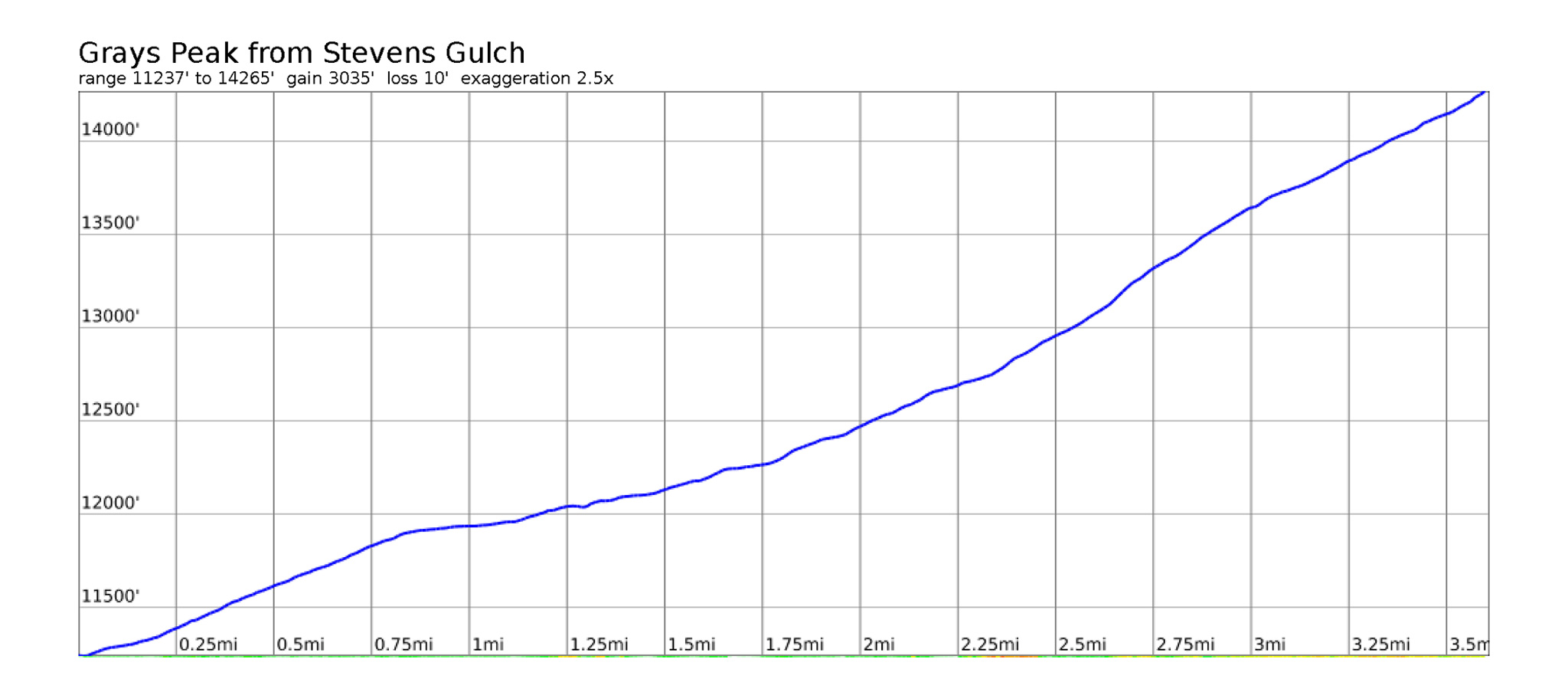
This is classic, and extremely popular hike. From the summer trailhead, follow the easy trail west to Grays, then traverse to Torreys. The trail is well-trodden and marked.
Work in Progress
Bikepacking to the Colorado 14ers is currently being written and published publicly. Get news and updates by joining the Facebook group, Follow us on Instagram, join our subreddit, and mailing list.
You can support its development by purchasing items through the affiliate links on this site: check out the gear reviews, as well as the items below: