Like this? Follow me:
I’ve put myself into some pretty stupid situations of my own making. It’s sometimes amazing even to me that I’ve gotten out of a few of them relatively unscathed. Like that one time I thought it would be absolutely brilliant to ride from Denver pedaling a completely overloaded trailer-laden bike with all my gear, then make my camp on top of a ridgeline at 13,000′ where an old mining road ended, 60 miles later:
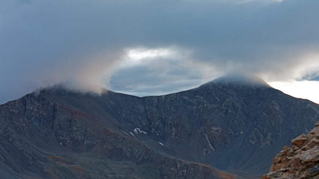
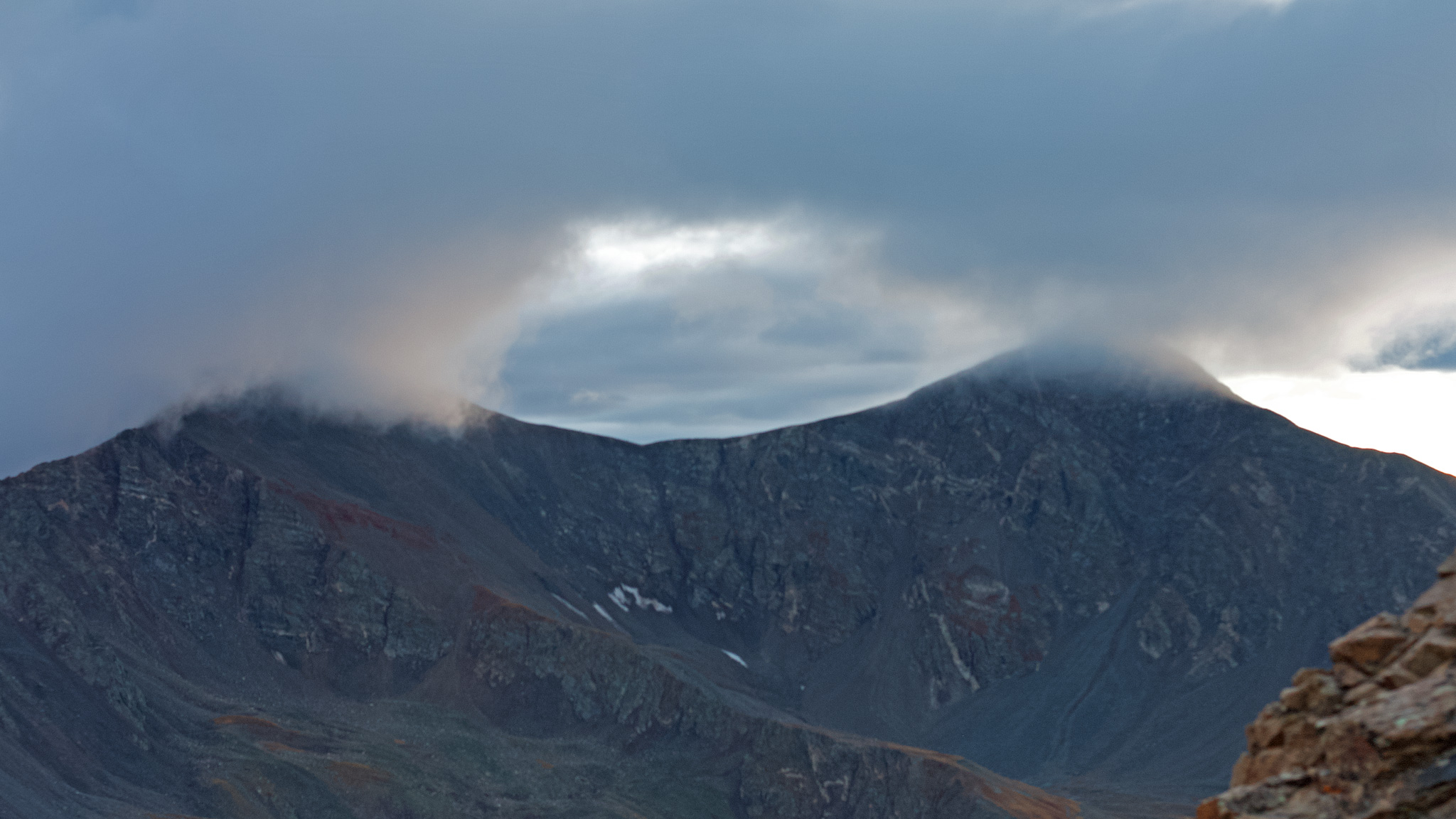
By the time I topped-out onto the ridge, a storm was fiercely building up cross valley on the resident 14er. I uselessly pounded in the stakes to my little tent into the chunky talus as I looked on in wonder at the lightning-laden cloud accumulated more and more energy. All that anger was blowing my way. My response was to stop what I was doing and take pictures.
An hour later, I was pinned down laying in my tent, as the tent walls themselves were pushed all the way into my face by the absolute savageness of the wind. I had never experienced anything like this before. Tent poles started snapping in half one by one. Every stuff sack and bag I brought was now filled with rocks so that my tent – and me along with it, wouldn’t simply be blown off the ridge to be found later downwind somewhere in Kansas. I had no water for the noodles I brought, and my stove wouldn’t light anyways.
Check the Weather
Most all my trips are multi-day. It takes a little longer to get to an objective in Colorado when one goes car free (like me), so before I pack my bags, I look at the weather report. weather.gov is as good as it probably gets. I also just went through how I plan my Longs Peak trips – worth a read. Weather in Colorado summers when the monsoon is in control usually comes in fast, dumps moisture, then leaves. Anticipating an afternoon shower is usually a good bet, no matter what the weather report says. Being inevitable, I make sure to have a contingency plan to be low down when it does. Precipitation is one thing, but lightning is quite another.
Sometimes we get an honest cold front move in. For what I like to do, long periods of weather don’t work. In those cases, I just stay home.
Leave a Simple Itinerary
As the rain turned to hail and I was in danger of my rain fly not only wetting out, but in fact ripping to shreds, I realized that no one knew I was up here. I wasn’t due at my meeting point with my girlfriend for another few days! Even if I could somehow de-camp, the nearest town was many miles away, back down the mining road. But everything in town would have been closed.
I was one step from my current situation: highly uncomfortable but able to laugh at my foolishness as all hell was breaking loose around me; and where I could be in real trouble: being on a 13,000′ ridgeline, with a broken shelter and dealing with hypothermia, while all my gear blows away.
What I should have done is leave an itinerary of what I was going to do, and where to find me. It doesn’t always matter if the people I leave it with know exactly what I was doing, but if they could relay the information, someone should be able to look at a map and have a good idea where to start to look. Plans change, so for long trips, consider a few contingency plans. Write these down! Are there things for people to look for? For me, if I’m hiking a trail, there’s usually a bicycle at the trailhead. No bike, I’m not there. Good thing to let people know. Look below for an example.
Decide Who’s Getting Notified
Also consider who to tell. Usually, I’ll tell my significant other, as well as someone I live with. On large trips, I’ll even tell an expert of the area. When I did my Milner to Berthoud Pass trip, I notified Andrew Skurka. Even though he’s never done the route I was about to embark on (no one had!) he at least knew the area around it – probably better than anyone else.
The storm subsided. I didn’t get blown off the mountain. My plans to hike the ridgeline to the 14er I watched the storm form on was going to have to be canceled. I needed food, I needed water, and I needed to get out of there.
But instead of making an about face, I kept going forward! I descended down the ridge to an old mining camp, then back up a ridge to one of the highest mountain passes you can take a bicycle up and over. My gear wasn’t dialed, and it took three separate trips portaging gear from the bottom to the top. First the bike itself, then down to get my backpack, then down again for the bike trailer. It would take me years to get my gear strategy and fitness to a level where I could just ride a road like this. Once on the other side, the mining road turned to singletrack with a few Class 3 sections. Nothing my cyclocross bike w/trailer could handle, so it was another walk of shame down, taking valuable time.

Leave a Caltopo Map of Your Intended Trip
Caltopo is a online mapping and trip planner. With my written itinerary, I also leave a link to a Caltopo Map showing the exact route I’m using to plan my intended route, as well as any contingency plans/alternatives, plus any places where I’m worried I may find a cruxy part.
Caltopo even allows you to record a track while you’re on your trip, and if you can grab a signal (a good chance in Colorado), you can save the track on your phone, and it’ll sync up to the Caltopo file and update it there as well. Then, anyone who can view the map can also see your progress – no GPS locator needed.
Finally – Caltopo has a way to print out your map. Lots of my advice in this post relies on electronic gadgets but phones and GPS devices do fail. To be thourough, print out your own map and save it in a ziplock bag for a little water resistance.
Get a Garmin inReach Mini and Use It
Thankfully (for me), the singletrack peterd out into another 4WD track and it pointed down towards town. Even in my weakened, wrecked state, I could soon get a burrito – or five. I checked into a motel – the cheapest I could find, jumped into the hot tub and enjoyed getting feeling back into my fingers and toes. Afterwards, Jon Muir’s Alone Across Australia played on the T.V.. Inspired, I did my best to repair my tent, sort my gear, and get some sleep for another day, and another mountain range to ride (somehow?) over.
Change in plans isn’t always easy to communicate through maps and notes. Using something like a Garmin inReach Mini can give people real time information on exactly where you are. They’re not cheap, and the unit requires a subscription (also not cheap), but it’s utility is second to none, as not only can someone see where you are, you can send two-way messages!
The next day, I set out to go up and over the Ten Mile Range. Considering my performance over the last few days, this seemed like it would shape up to be yet another misadventure. Not 100 meters into this section of the Colorado Trail from the highway, I clipped a pedal on a large rock and broke the damn thing clean off. My attempt at dumpstering a replacement pedal back in town got me nowhere.
Ride over! A wave of relief flowed across me. Who knows what would have happened trying to ascend then descend the Ten Mile Range on a cyclocross bike with too-large tires and a massive trailer on the back? I don’t think my rim brakes were up to the task even without the trailer!
I wandered into town and into a bookstore. By chance, I picked up Laurence Gonzales’s, Deep Survival: Who Lives, Who Dies and Why. Turned out to be one of those books that you just can’t put down. The big takeaway for me was the theory that bad accidents in the backcountry can happen due to a series of small, bad decisions which culminate into getting yourself trapped essentially into a preventable accident.
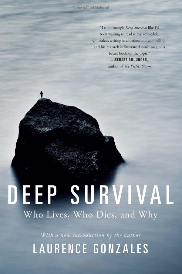
It didn’t take long for me to see myself the last few days of misadventure as one of the examples that Gonzales himself could have written about in this very book: the inadequate and heavy gear, the weird “bicycle” route I told no one about, the lack of foresight checking the weather, the decision to be stubborn and not react to the storm by retreating far below treeline for a better campsite, the broken stove, the tent being torn apart – and on and on.
I devoured the book in the book shop, then called my girlfriend (FINALLY!) to tell her to meet me at a different location. While she drove to where I now was, I finished the book. We did our hike up Mt. of the Holy Cross without incident and once back home, I reread the book. It’s quite possible this book saved my life. Perhaps without understanding the disastrous setup of my trips my next trip I took could have been my last.
Template/Resources
Email Itinerary
Here’s an example o f the type of itinerary that I email out:
Hey everyone! I’m off to ride to Longs Peak! I’ll be leaving the house at 3:00am, and riding to Lyons, then up St. Vrain. Here’s that route:
I’ll be climbing the Cables route, which I will also be descending (I’ve brought a rope):
https://www.mountainproject.com/route/105754720/cable-route
Here’s a Caltopo map of my intended route once on Longs Peak:
If things don’t look in condition, I’ll probably just hike up Mt. Lady Washington and call it a day.
I should be back down to the TH before it gets dark. I’ll be riding home the same way and shouldn’t be out past 9:00pm. If I am, please text me, and if I don’t reply check my inReach and try to contact me that way. If i seem to be on the mountain still, call 911 and give them my location and a link to the map. I won’t have service until I’m back in Lyons.
Here’s my inReach:
https://share.garmin.com/longranger
Wish me luck!
Caltopo
Caltopo is free to use, but I do spring for the yearly subscription, in order to download maps to use offline. In my example, I downloaded a GPX track from one of my previous trips, then uploaded it to Caltopo:

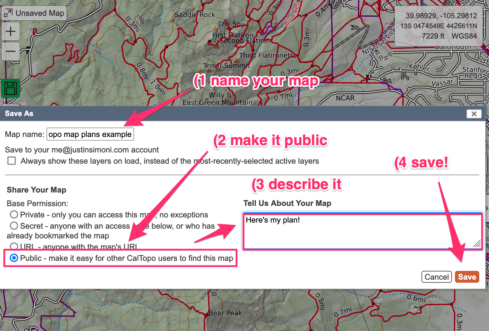
Once the import is complete, Caltopo will ask you to save your map. Make sure it’s public:
Copy the URL that’s in the browser’s address bar, and use that to share the map with your contacts.
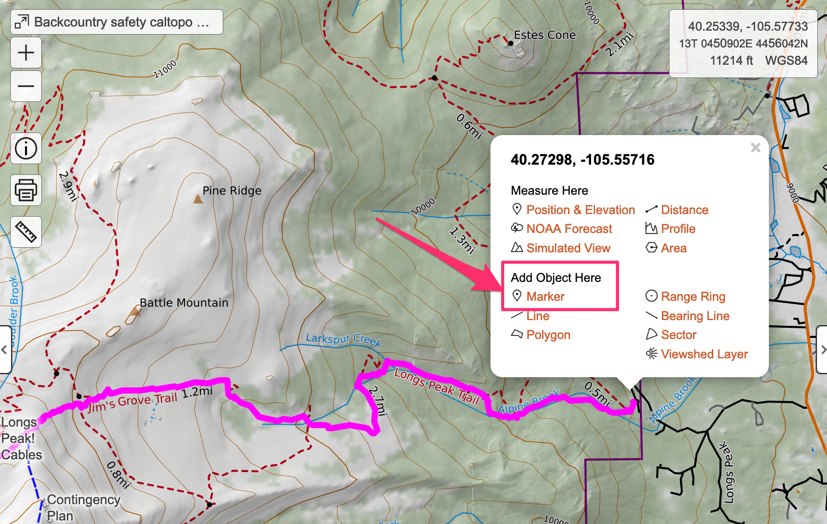
There’s a million things you can do to enhance your map. One idea is to add markers. Control Click/Right Click anywhere on the map you would like a marker, and select, Add Object Here, Marker,
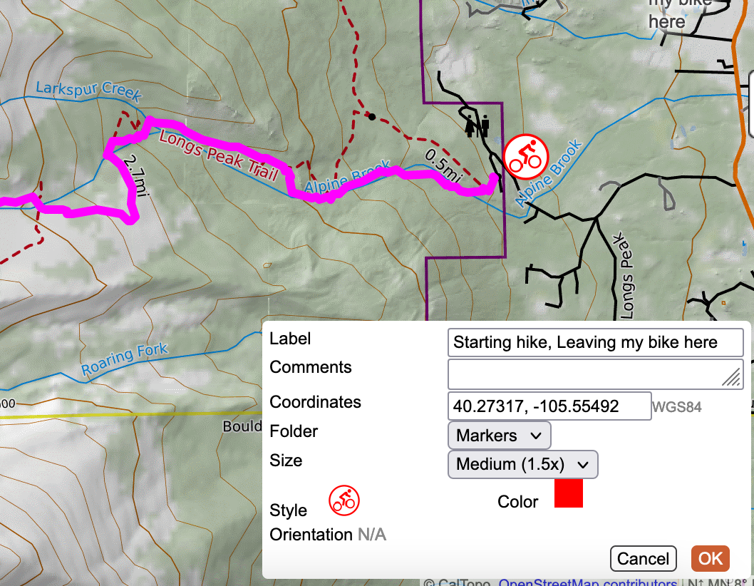
I’ll place a marker where I’ll be leaving my bike to start up on foot:
I’ll also put a marker where the crux of the route is,
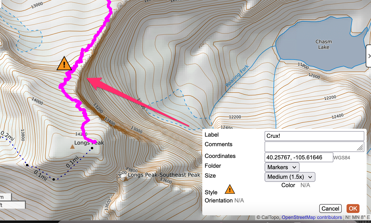
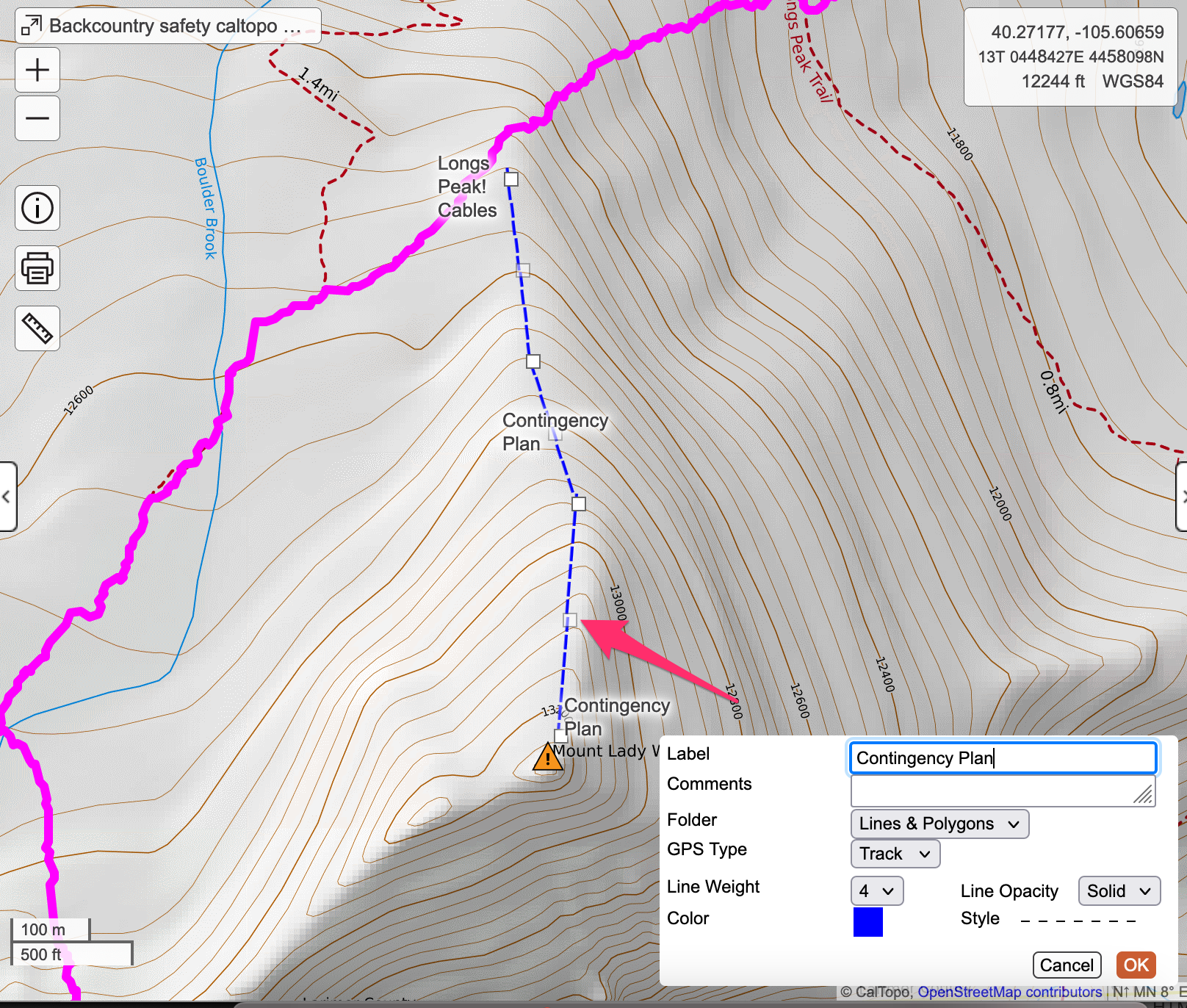
Another handy tool is the ability to draw a line on the map. I’ll use this to illustrate my contingency plan:
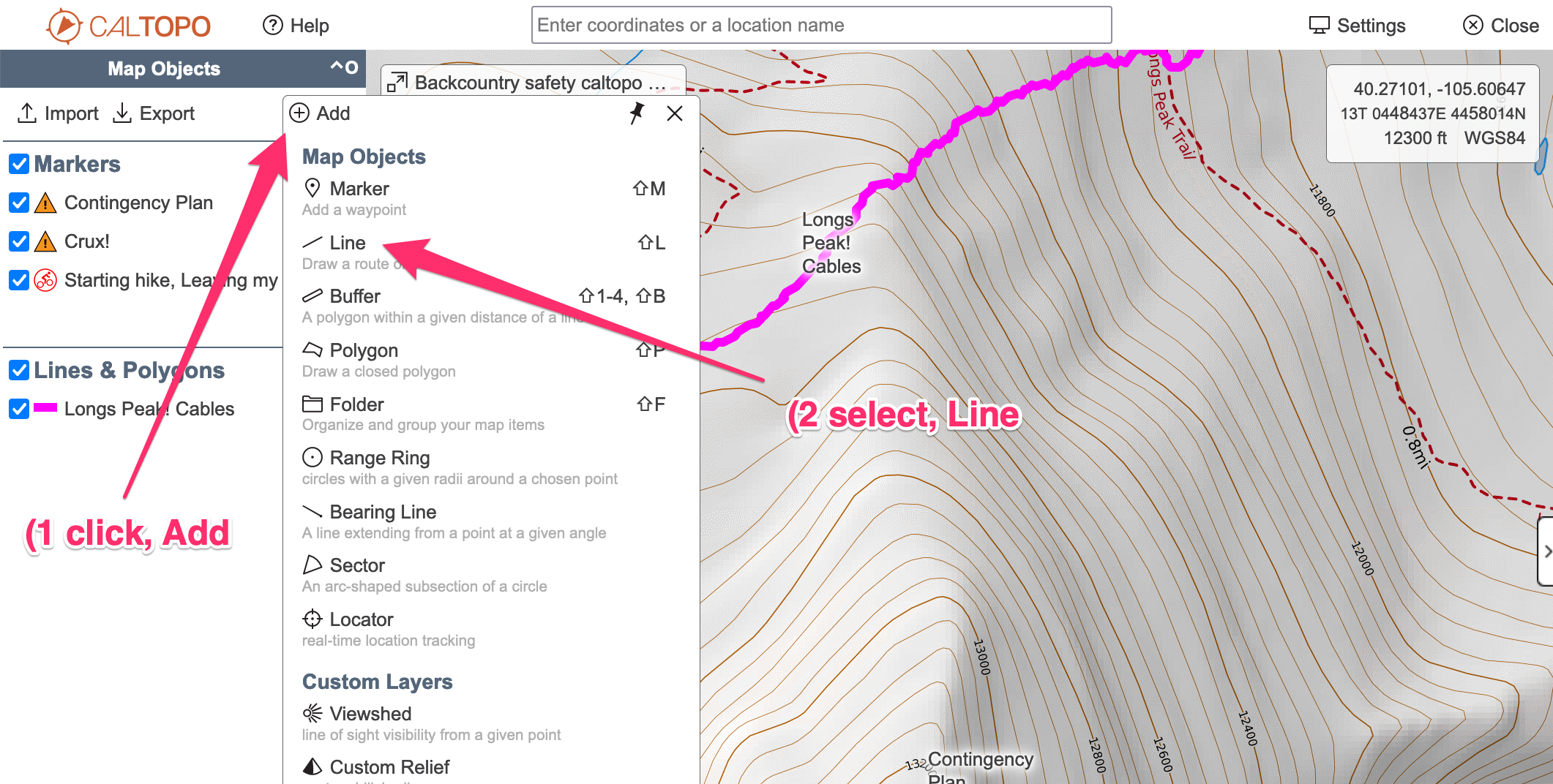
Click on the map where you’d like the line to go, then double-click to end the line. Click the line again to bring up its modal window to edit.
Download Offline Maps
Once on my trip, I’ll use the Caltopo app on my phone. One of the features it has (for paid subscribers) is the ability to download maps for offline use. In the backcountry, good chance that I won’t have cell signal. With the map downloaded, I can use Caltopo to navigate. Download the map before you leave!
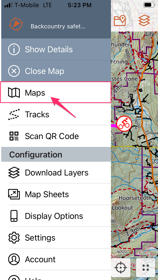
In the Caltopo App, click the hamburger menu on the upper left, and choose, Maps:
Click on the actual map you want to use – this will make sure that your map is loaded/sync’d on your phone:
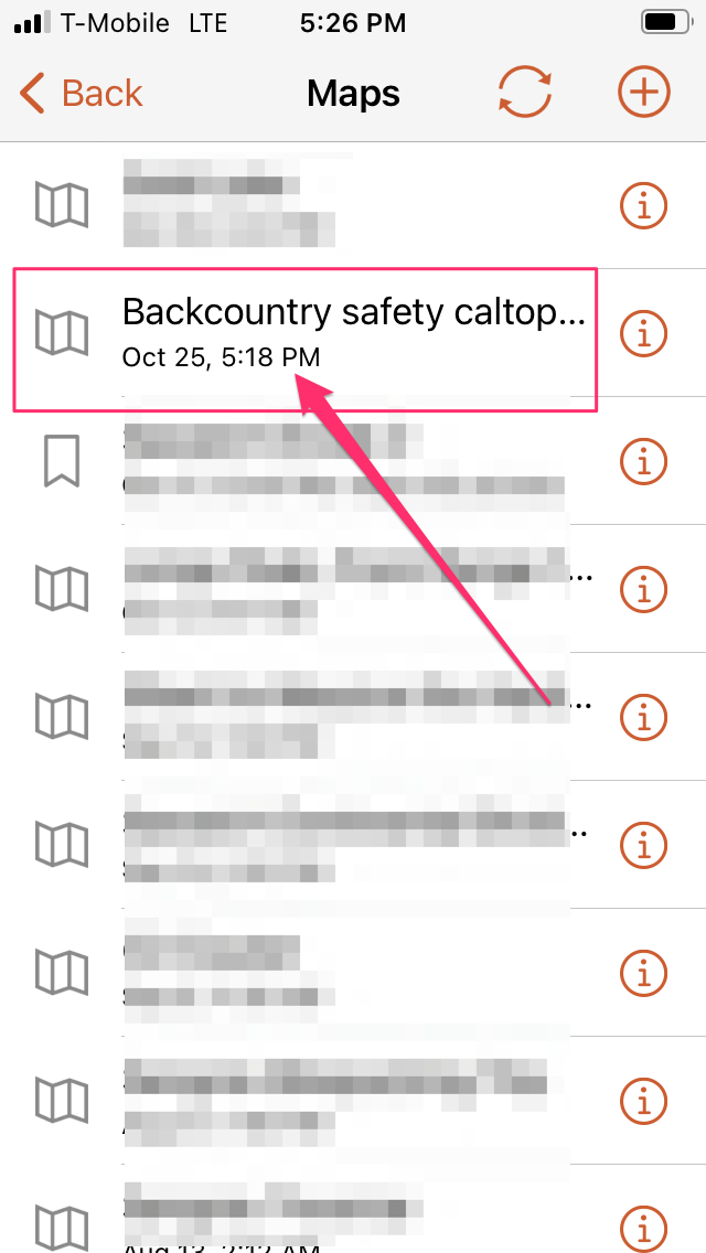
Click on the hamburger menu on the upper left again, and tap, Download Layers:
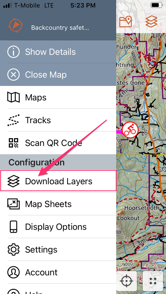
This is where we can download a map for offline use. The map will be cut up into quadrants. Tab on the quadrant on the map you want to download, then click the icon of the cloud with the downward-pointing arrow:

You’ll get a few options on what to download – below is what I usually use:
- high resolution
- Mapbuilder Topo
- Mapbuilder Overlay
- Forest Service 2016
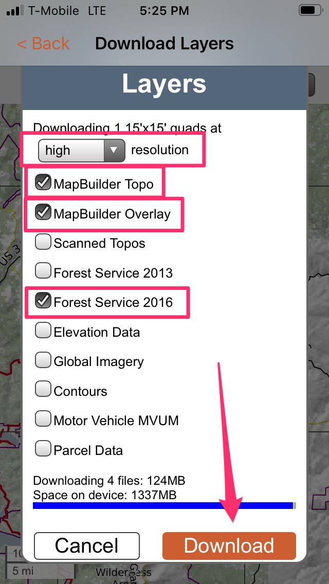
Click, Download and you’re all set.
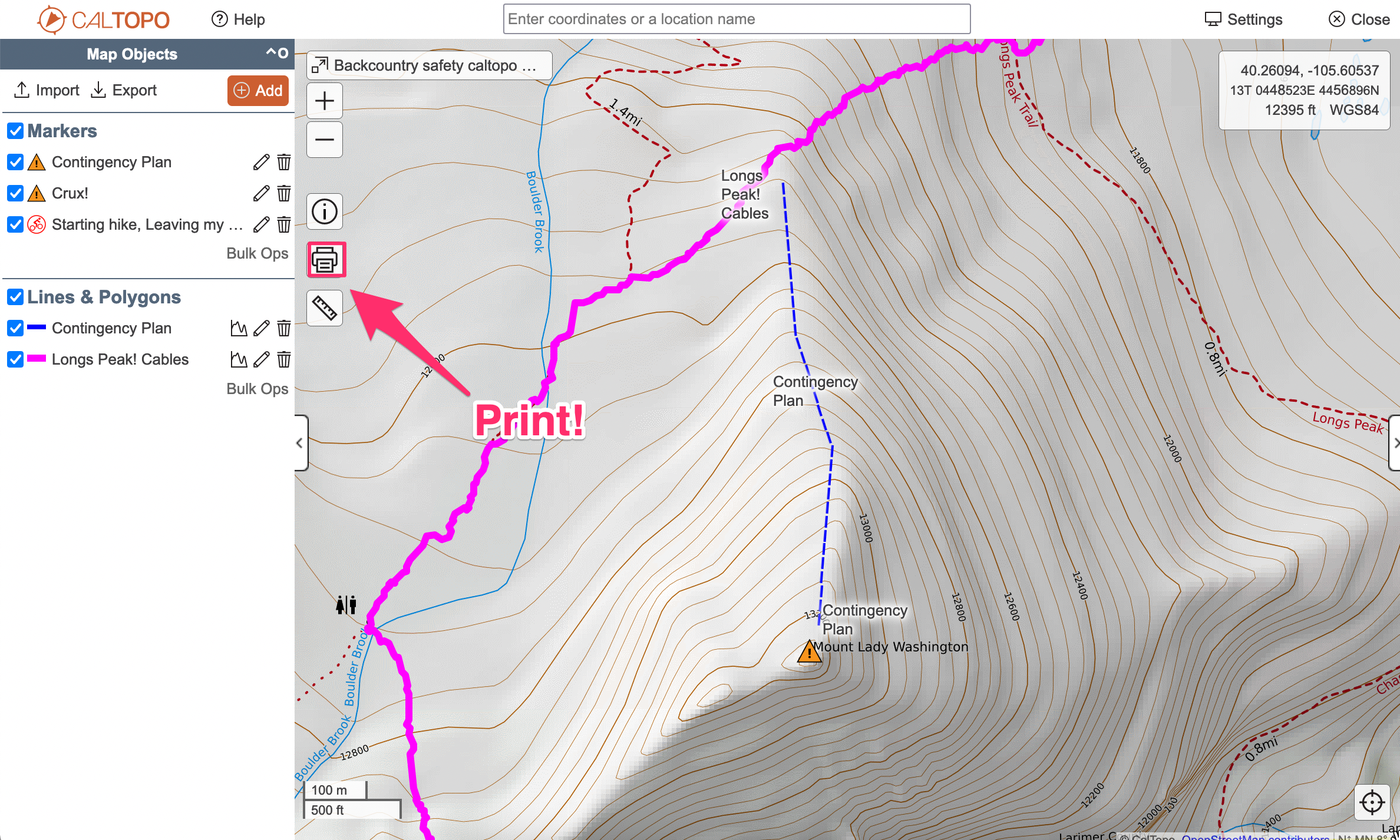
Print Paper Maps
To remove the electronic-only weakness in your own navigation, you can print a map directly from Caltopo. Find the Print button, generate the PDF and print the map out. Once printed, put the map on a Ziplock bag to keep water off of the paper (no special expensive paper needed).
The PDF generated can also be saved for the web to produce maps that are better than screenshotting Caltopo:

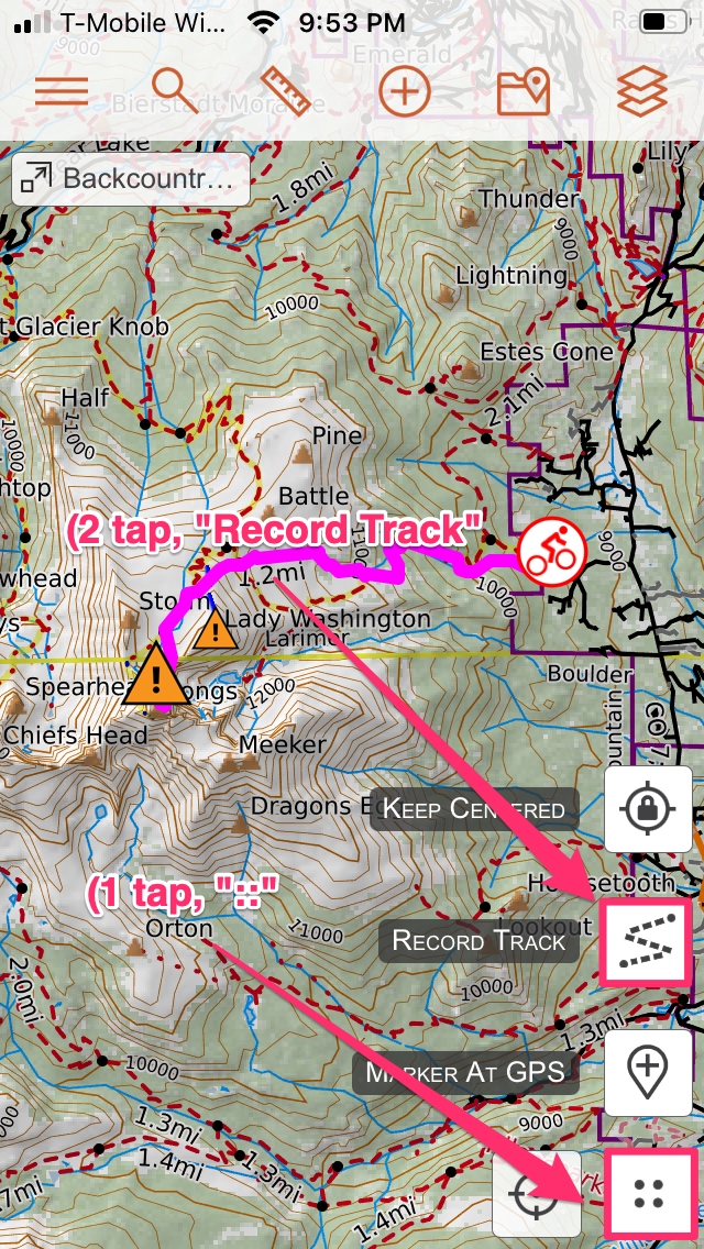
Record a Track
In the Caltopo phone app, tap the icon of the four dots in the lower right hand corner:
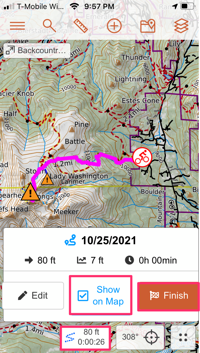
Then tap the icon labeled, Record Track. This can help you with navigation during your trip, and the track can be added to this same public map when you save the track itself.
To save, tap on the icon with the squiggly track line, then tap, Finish. Make sure, Show Track on Map is selected. If/when you get service, your trip’s track will be shown on the public map.
Inreach
Map Setup
Once you’ve purchased an inReach, and set up your account, log in to explore.inreach.com and click on the Social link/tab. On that screen, Click on the button labeled, MapShare: Off, so the button changes to say, MapShare: On. Below that button, there’s an option to customize your sharing URL.
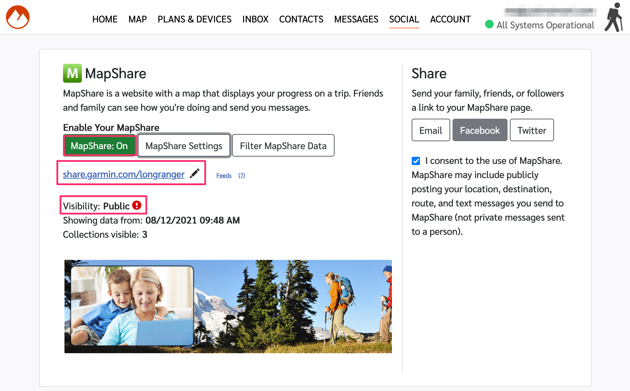
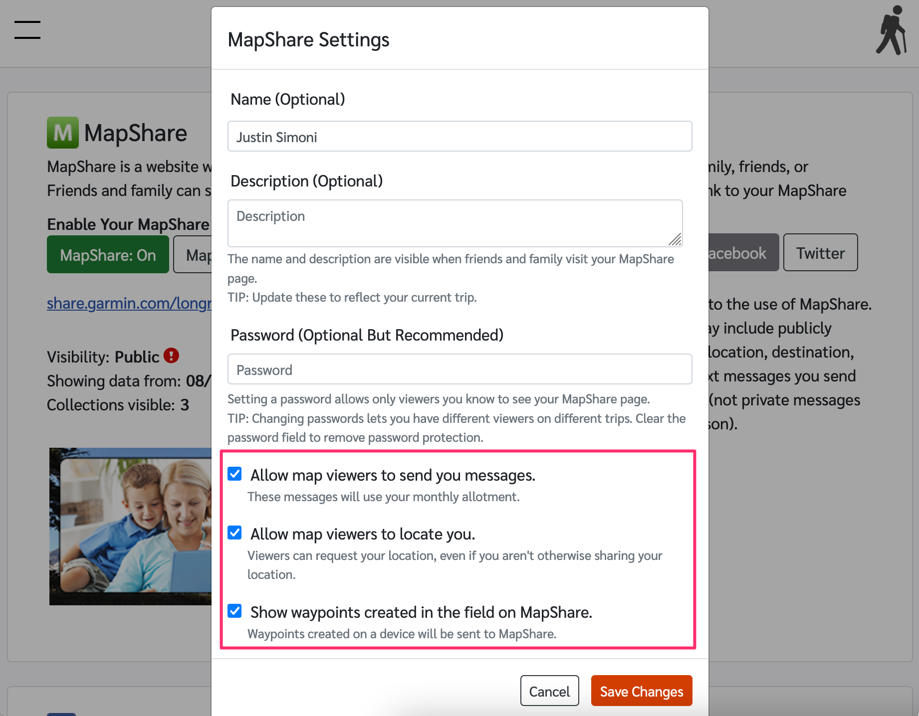
Click on the button labeled, MapShare Settings, to pull up a new modal window. These settings will allow you to ,
- Allow map viewers to send you messages.
- Allow map viewers to locate you.
- Show waypoints created in the field on MapShare.
All of which can be used as tools to help locate and communicate with you in the field.
So long as your contacts have your public map URL, they can see where you are, and what you’re doing.
Setting up Contacts
Click on the, Contacts link/tab to set up who you can send messages to. Sending texts and emails are supported.
Setting up Preset Messages/Quick Text Messages
The inReach is a tiny device. Sending custom messages from it is almost impossible – don’t try. Rather, set up preset/quick text messages. I use ones like, “At the TH”, or, “Summit”. Preset Messages go to certain phone numbers/email addresses/web services (like Twitter) without you having to select them. Quick Text allow you to pick who gets the message. I use Preset Messages the most, as it’s the fastest to get a message out.
Put Your Caltopo Map on the inReach Public Map
Indeed, you can download your Caltopo Map as a GPX track, and upload it to your inReach Public Map.
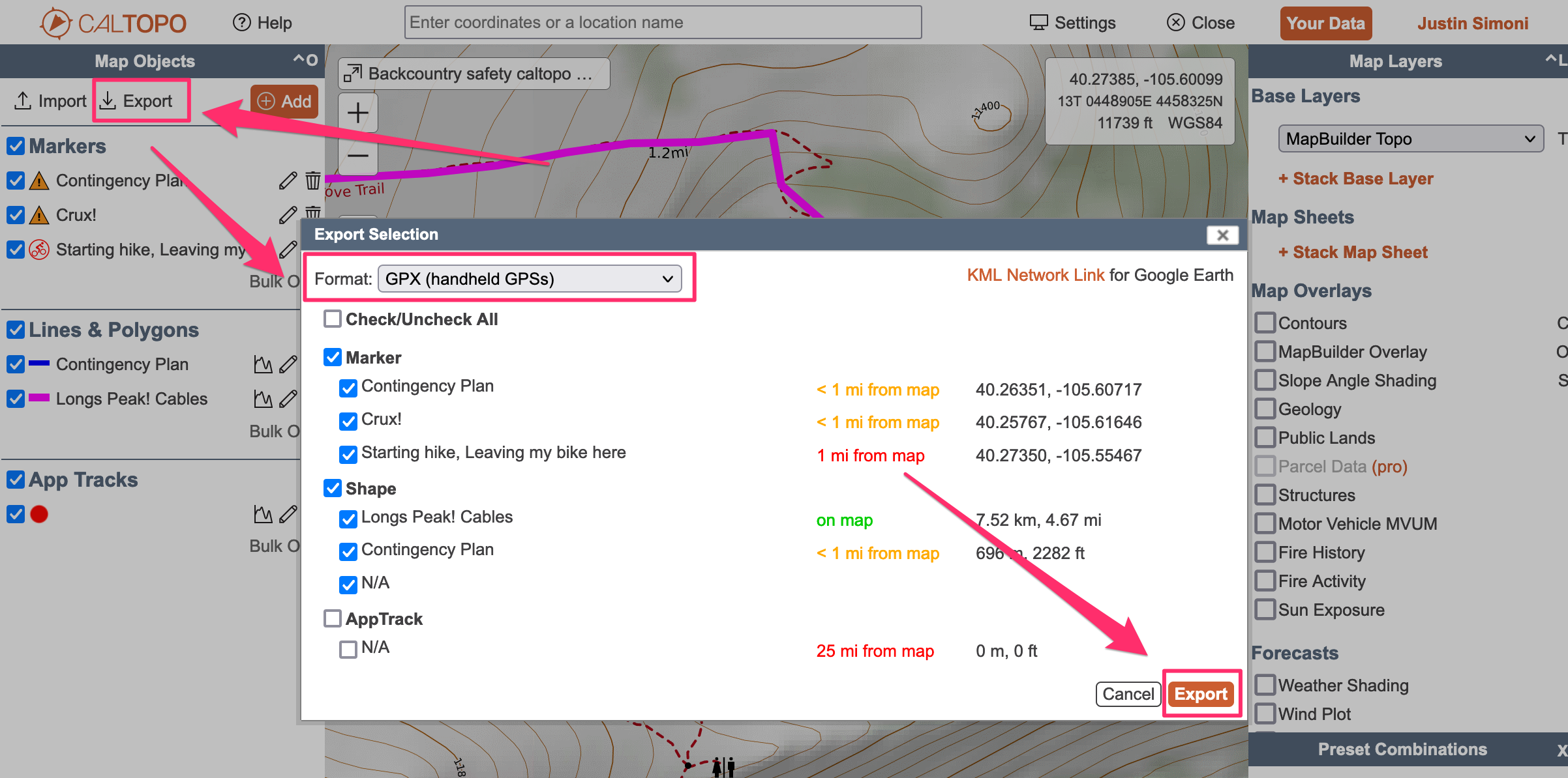
In Caltopo, click the, Export button. In the modal window, make sure you’ve set the Format to, GPX. Click the Export button in the modal menu to start the download of the GPX.
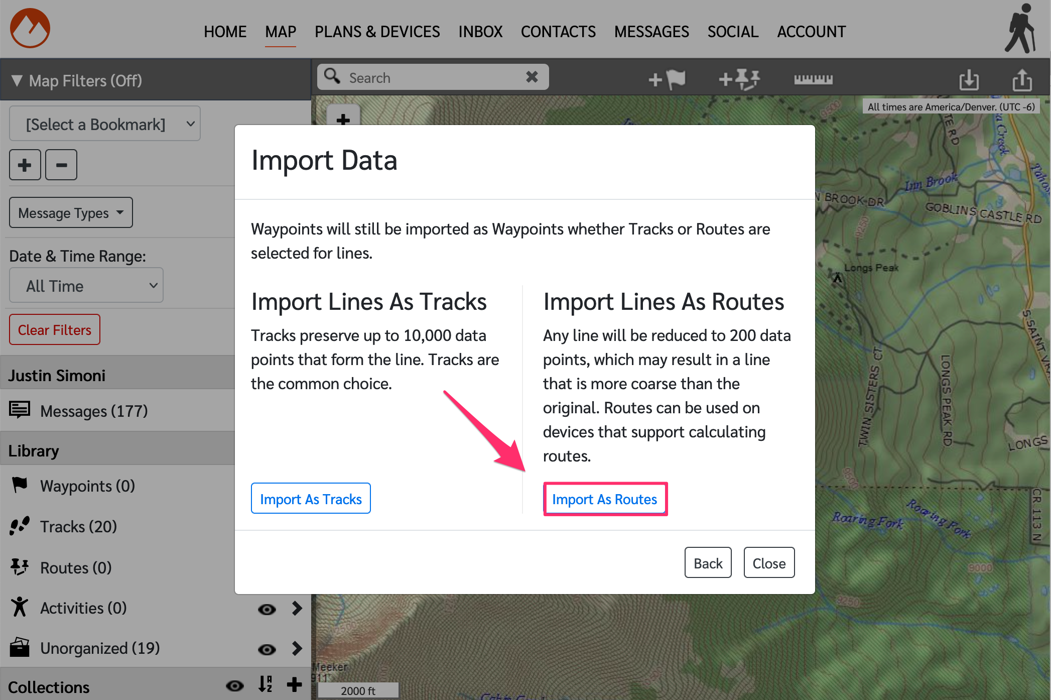
Once downloaded, go back to the explore.garmin.com and click the link/tab labeled, Map. Once on the map, click the, Import button on the upper right hand side. In the modal window, select Import GPX, KML, KMZ.

Select Import Lines As Routes,
Select, Just add imported Items to my library and click Next,

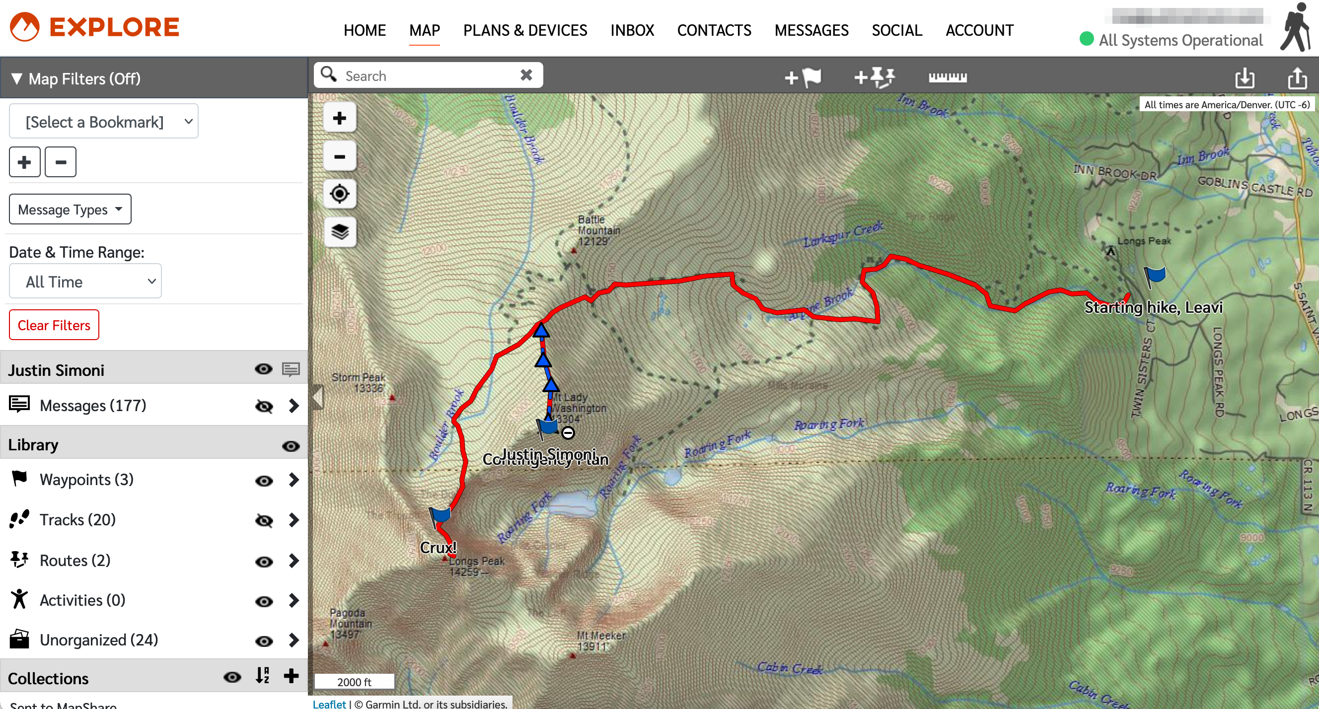
And finally (finally!) select your GPX file to import. Now everything from your Caltopo map will be on the inReach map:
This data is static, so any changes you make in Caltopo will not be reflected in the inReach map, unless you manually make an update.
