Like this? Follow me:
The number of ideas for projects that swirl in my head is exhausting. There is always an incredible route that I want test myself on. Here are my top ideas:
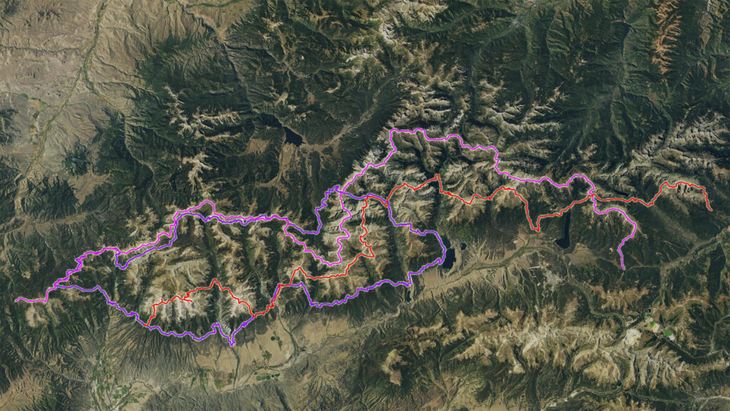
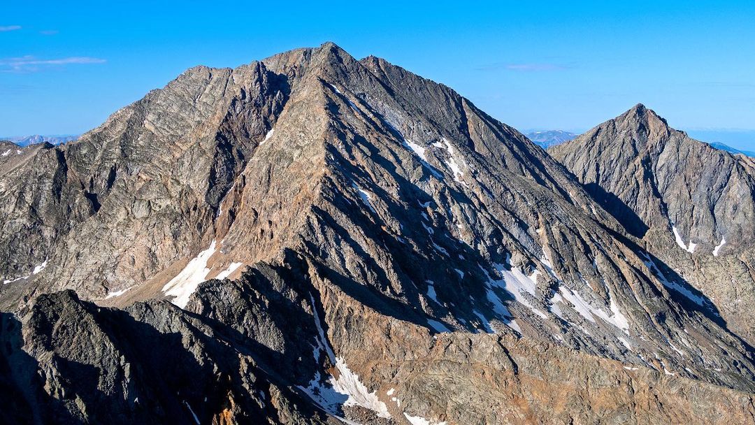
The Sawatch Trifecta
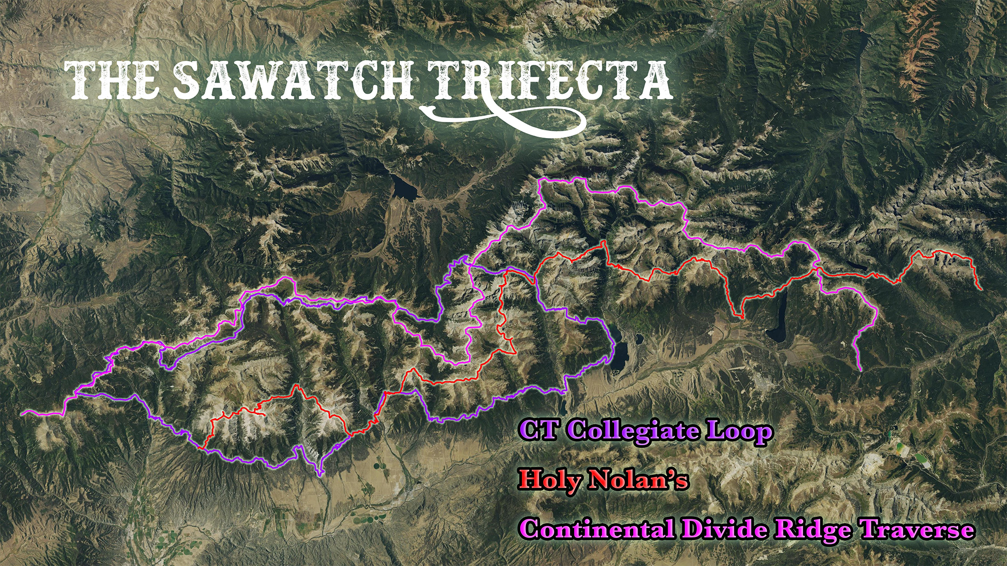
As the name suggests, this is actually three separate projects that just so happen to be in the Sawatch Range, which are all very different, are all very hard and are all very, very awesome.
Unsupported Collegiate Loop FKT
- Distance: 170 miles
- Elevation Gain/Loss: +36,756′, -36,762′
- Terrain: Singletrack
- Goal: < 2 days, 14 hours
- FKT Page
The first stop on our Trifecta is the Unsupported Collegiate Loop FKT. I was actually going to do this last year, but somebody forget to properly put their campfire out, which burnt down 700 acres of forest near the start/finish by Twin Lakes, closing the area. I waited it out for the Forest Service to open the area, but no dice. This was going to be a final trip to test my fitness before my Unsupported Colorado Trail FKT attempt later that year.
Current time is 2d 14hr 20min* for the 166.9 miles with 33,400′ of gain/loss. A light load out, some sleepless nights trudging through the trees, and a ton of walking! I could do the Collegiate East in my sleep, having covered most of this terrain many times just approaching the Sawatch 14ers, it’s the Collegiate West I’ll be giving most of my focus on to get in and out fast. Because of that, I’ll probably start out there as fresh as possible. As far as starting points go, I would love to start at Twin Lakes, but finding a quiet, dispersed campsite (that’s accessible by someone without a car!) is a little tricky in the area, so I may be starting somewhere near Salida, perhaps even at the Shavano Trailhead, and take the route clockwise.
This will be the fastest, longest, and quickest leg of the project by far, as it has the easiest terrain, with the least elevation gain and loss. I would also have said it’s what I’m least equipped to do well in, but over the past years, I’ve worked on moving faster on easy terrain, so I give myself a fighting chance of beating this time. Regardless, it would be a hoot to try.
* (FKT for this route was actually set last year strangely enough using a reroute because of the fire. If this reroute is still in place, I won’t be attempting as it comes out to several percent of the entire route! — I want my time to compare to historical attempts on the full route.)
Unsupported Holy Nolan’s
- Distance: 122 miles
- Elevation Gain/Loss: +55,094′, -54,523′
- Terrain: Singletrack, Off-Trail up to Class 2+
- Goal: Nolan’s 14 < 60 hours; Holy Nolan’s < 72 hours
- FKT Page
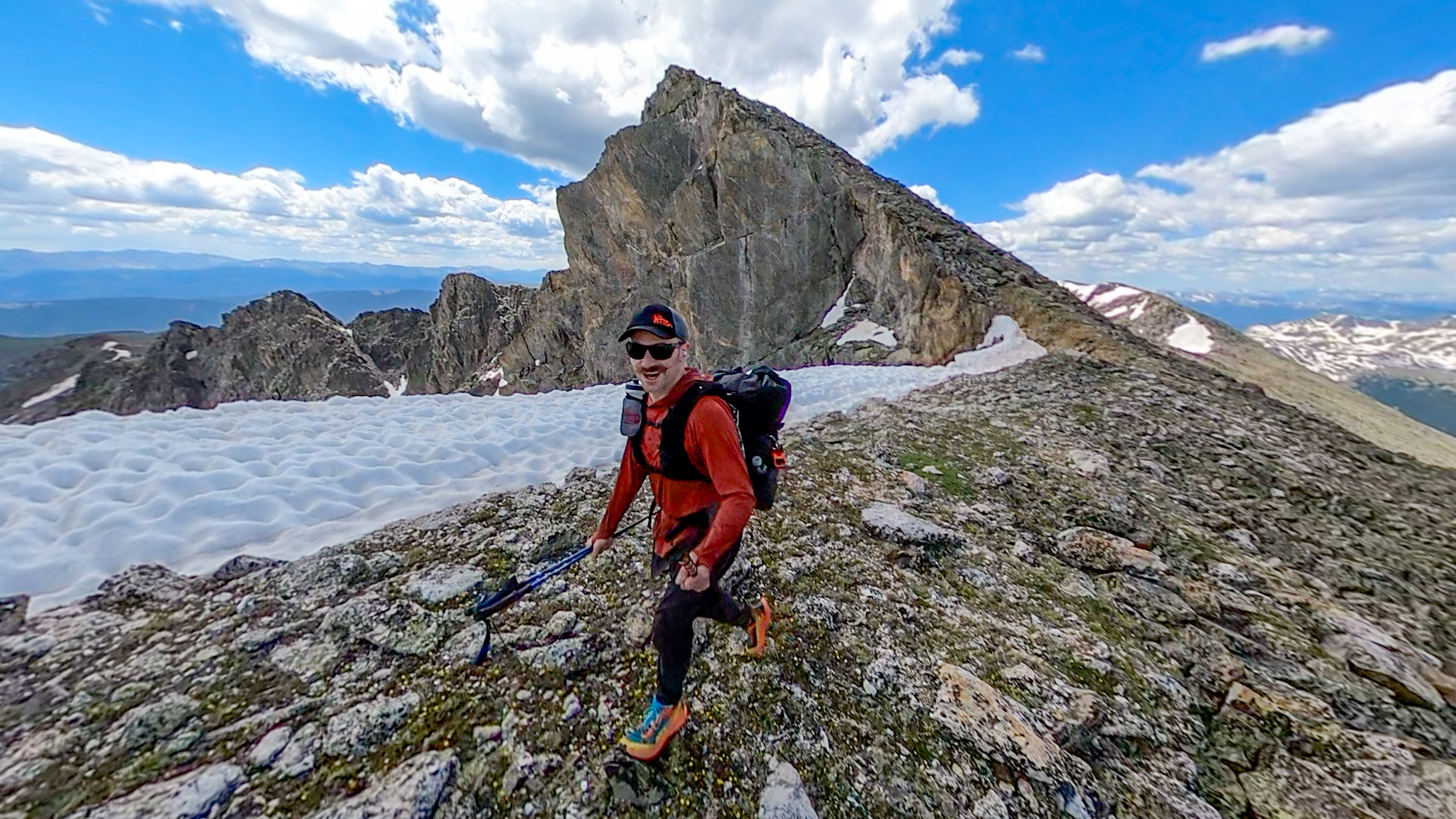
I’ve tried Nolan’s 14 so many times – My first attempt at Nolan’s 14 was in 2015! – I’ve stopped counting. I get thwarted mostly from succumbing to an asthma attack, which I’m having a hard time shaking, so stars will need to align. The Unsupported Nolan’s 14 FKT is so far and away out of my league, set by the Man/Myth/Legend: Joey Campanelli, I’ll never get close. His performance is literally one of the most impressive feats of mountain running ever done.
My goal is far more modest: do Nolan’s 14 South to North in the allotted 60 hour time limit (hopefully a little less!), then keep going the additional 30 miles to tag Mount of the Holy Cross. There’s no Unsupported Holy Nolan’s at all, so I’m happy to try to be the first.
I reconned the route from the Fish Hatchery to Holy Cross and it’s reasonable if not a little tricky to get up and over the Continental Divide. Much of the distance is downhill road walking. Save for Longs Peak, there is no other high mountain route in Colorado that I have tread more upon — I even route a guidebook on how to backpack it!. Some of these peaks I’ve summited over a dozen times. It’s just a matter of coming in with fitness and not succumbing to my lungs tapping out.
Unfortunately, my ego is wrapped up a little too tightly in this route and Nolan’s 14 has become a white whale for me. I hope that does not get in my way from a safe and successful go. This will be the middle-distance route of the Trifecta by a tiny amount and will take the second longest to finish.
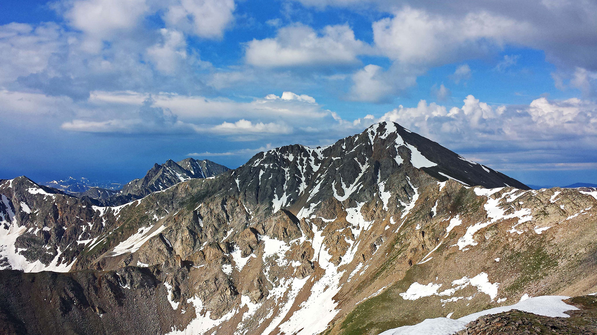
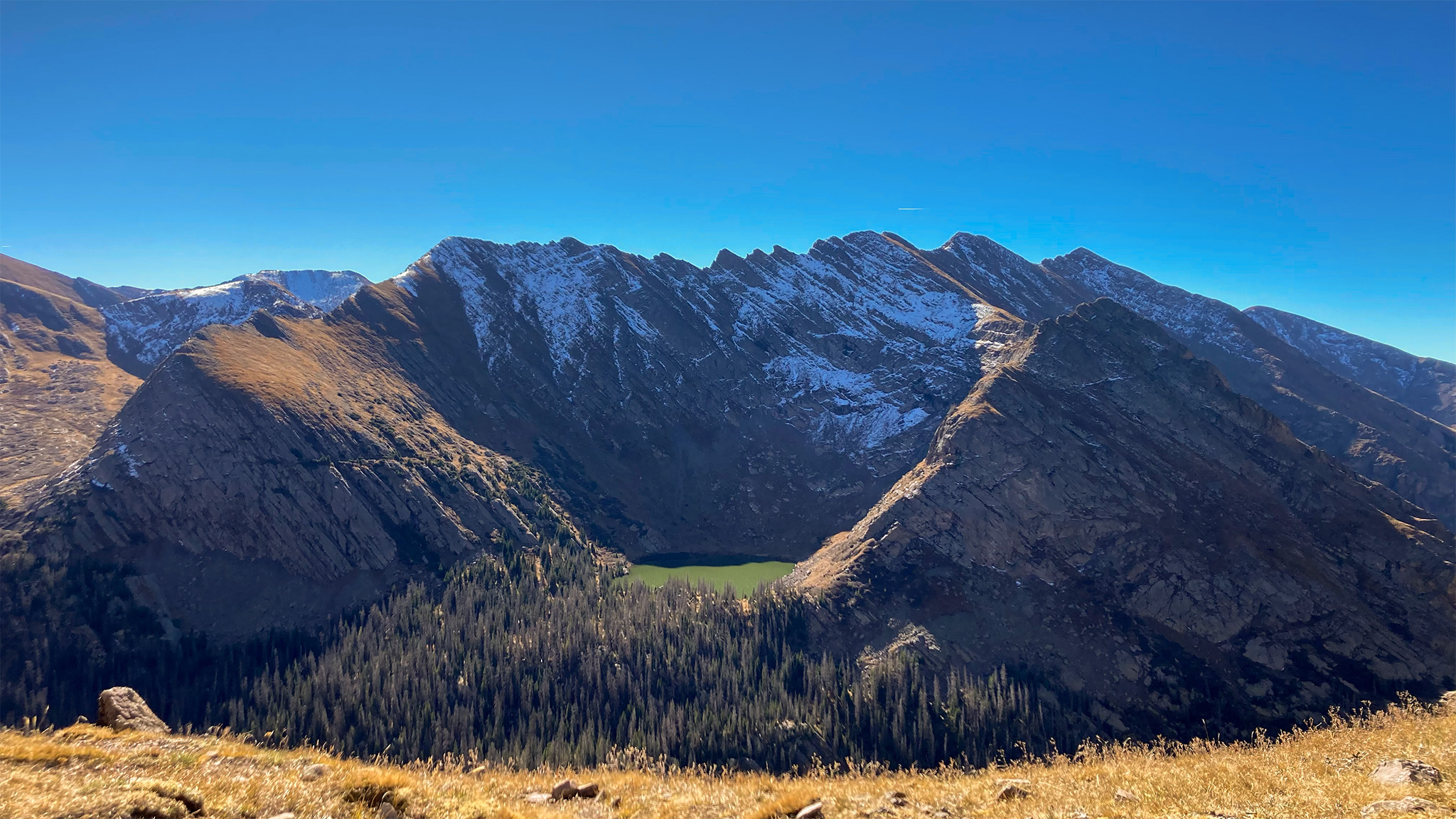
The Sawatch Continental Divide Ridge Traverse
- Distance: 119 miles
- Elevation Gain/Loss: +58,424′, -58,839′
- Terrain: Mostly Class 2 talus hopping, with harder cruxes of loose Class 3 to loose 5th
- Goal: Just Complete Safely
The Big Boy.
This is a huge project in of itself: travel on the very ridge of the Continental Divide from Tennessee Pass to Marshall Pass. This is the Sawatch version of the Sangre de Cristo Range Traverse, except the rock quality is absolutely terrible. So much so, there is segment of ridgeline from Mt. Harvard to Birthday Peak that I’ve tried and failed to traverse over! The entire project rests upon being able to cross this one, one mile segment of ridgeline.
This Saewatchg section of the Continental Divide ridgeline hasn’t been done in full by anyone — it’s dubious that anyone has crossed the above ridge in question without gear — I did find an old anchor at a tower the last time I was scouting things out. This project could take upwards of 7 days to complete. It’s not the longest being a little shorter than Holy Nolan’s, but may have the most elevation gain and loss. Of the three, it is the most extreme route by far and is probably in the running for one of the hardest long-distance route in the State, due to its poor rock quality.
I’ve already tried this route starting from the North, but got stormed off after a few days. From what I sampled, it’s pretty incredible:
I may start in the South — it really depends on what the best and safest way is for the “The Birthday Party” – the ridge between Birthday Peak and Harvard.
These projects are inherently related to one another, but are all unique in their own way. The Colorado Trail is an incredible loop of almost all single track, while the Continental Divide Ridge has almost no trail what-so-ever. The two flirt with each other on the Collegiate West portion by never commit to joining up for too long. Holy Nolan’s uses the Colorado Trail judiciously to get you from peak to peak, but what the Colorado Trail tries to avoid (high peaks!) is Holy Nolan’s whole reason for being. And that defining trait Holy Nolan’s: all the 14ers of the range in a row is curiously missing from the Continental Divide Ridge Route, as there are actually no 14ers on the main ridge itself! This makes the ridge a lonely place to be.
Other Projects
The Sangre de Cristo High Route
- Distance: 121.3 miles
- Elevation Gain/Loss: 49,473′ gain, 50,043′ loss
- Terrain: Some trail, some heinous bushwhacking, tons of Class 2 talus hopping, a few points of Class 3
- Goal: Enjoy Yourself!
Although I’m almost always game to give the Sangre de Cristo Range Traverse proper another go – it is that good – I’ve recently mapped out a different traverse that eschews a lot of the difficulties of the ridge for more pleasant high livin’. I’d like to actually walk it from tip to tail, and double-check that the beta I’ve put out is correct. This would be a late in the season trip and wouldn’t necessarily be about speed.
Sangre de Cristos: Cleveland/Tijeras/Music/Milwaukee Traverse
The Sangres hold a special place in my heart, and I’d go back in a second. There are so many wonderful challenges, it’s hard to pick, but here’s one: the Cleveland/Tijeras/Music/Milwaukee Traverse.
This subsidiary ridgeline starts from the bottom slopes Great Sand Dunes National Park, ending on Milwaukee Peak – an amazing and awesome subsidiary ridge to the main ridgeline and traverse. Other than getting to it (kind of the middle of nowhere — walk from the town of Crestone?), this ridge isn’t all that difficult to do. Ending at Milwaukee gives you the option to join the main ridgeline to Broken Hand, Crestone Needle and Peak and points north, until you dive down back to town. What an adventure to be had!
Unsupported Colorado Trail FKT Attempt
Maybe a third time would be a charm, but it’s always hard to come back to things you’ve had poor luck on. Last year’s build up was immense to get into better shape only to have it succumb to an asthma attack on just the third day.
So there are some ideas! I’m not sure what’s going to happen, as it seems summer always goes too fast! And plans always change: maybe one attempt goes south, and another goes much better than expected, but leaves me wrecked. I’ve learned from my time in the mountains, it’s always best to have amenable plans.
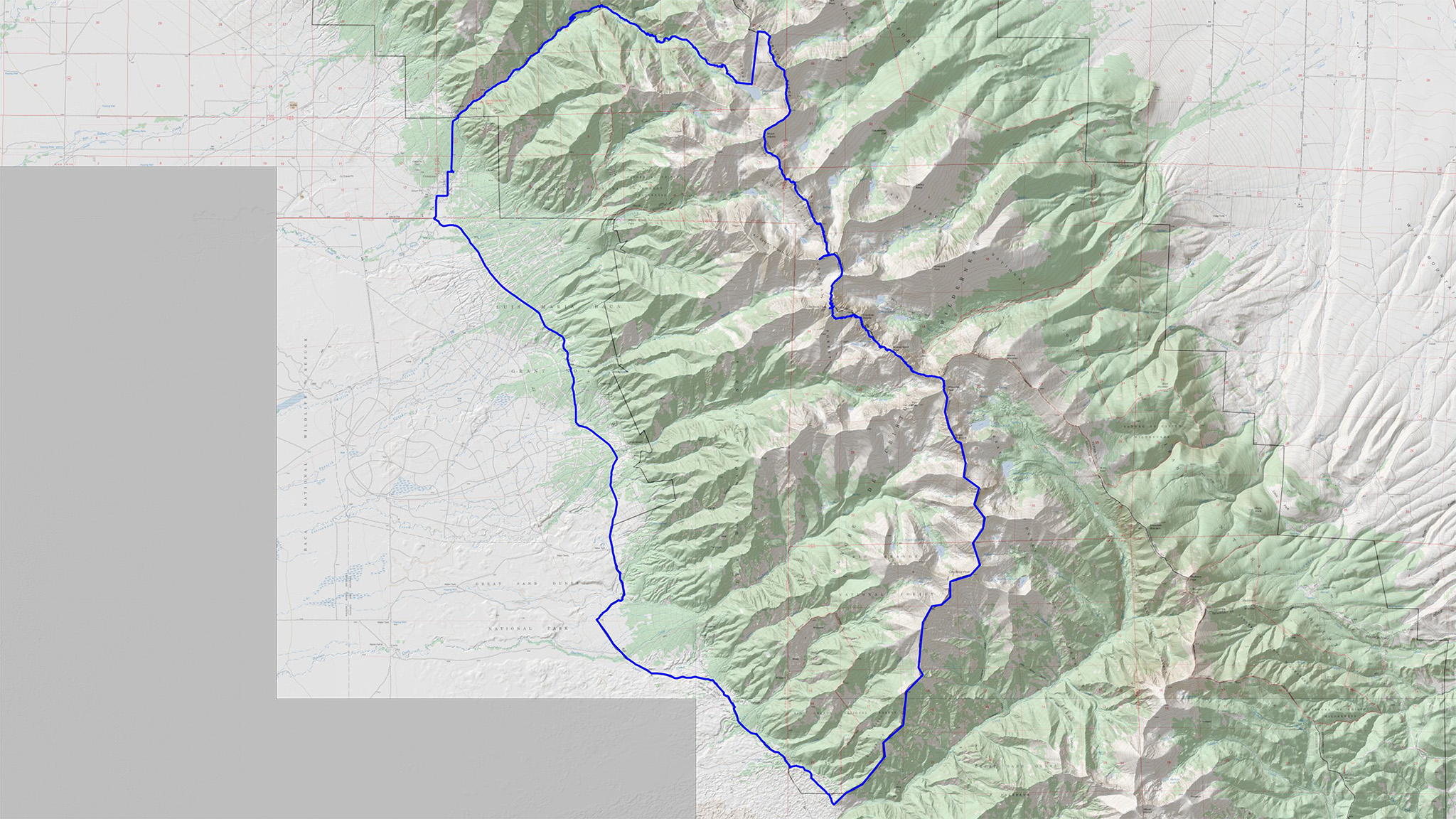
Here’s a Caltopo Map to let you explore these routes, yourself.
