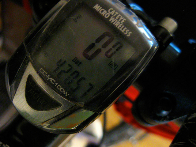
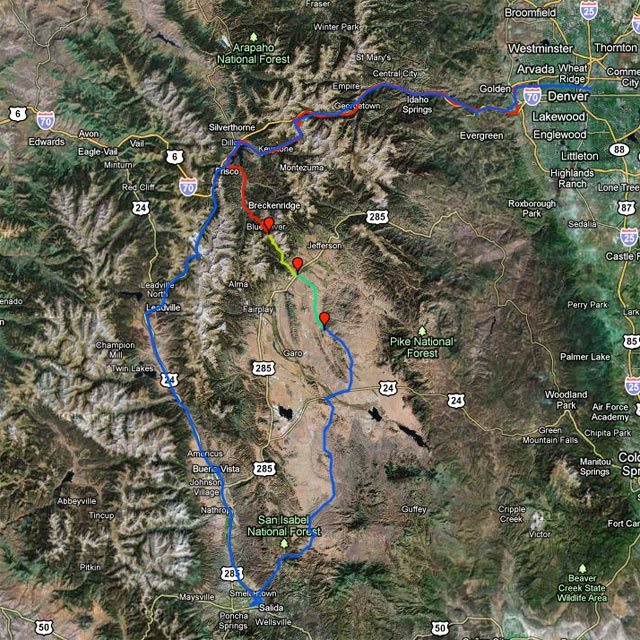
Four days, 420 miles, 4 continental divide crossings, 9 hours of snowshoeing, two days of minstrel headwinds,
snow showers and over-caffeine-ation.

“Well,” said the shaggy man, “let’s start on, or we won’t get anywhere before night comes.”
“Where do you expect to get to?” asked Dorothy.
“I’m like Button-Bright. I don’t know,” answered the shaggy man, with a laugh. “But I’ve learned from long experience that every road leads somewhere, or there wouldn’t be any road; so it’s likely that if we travel long enough, my dear, we will come to some place or another in the end. What place it will be we can’t even guess at this moment, but we’re sure to find out when we get there.”
“Why, yes,” said Dorothy; “that seems reas’n’ble, Shaggy Man.”
Dorothy Meets Button-Bright, The Road to Oz by L. Frank Baum
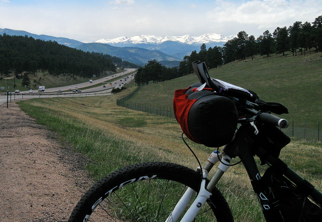
Over the first foothills
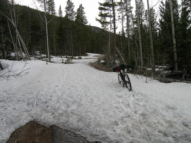
Bakerville to Loveland Pass Bikepath
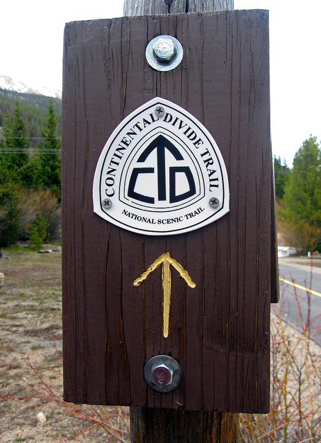
Crossing over the Continental Divide Trail
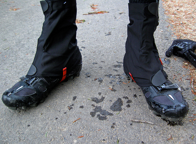
Donning gators. Will this work?
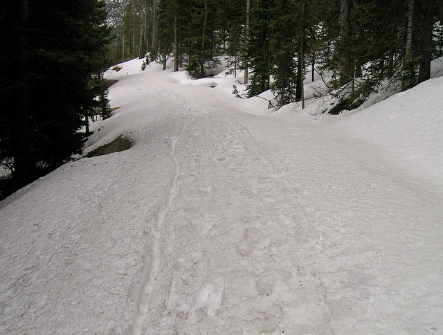
Ha. No.
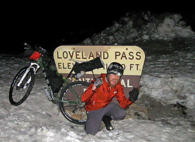
Traversing Loveland Pass at night. Dangerous. ?
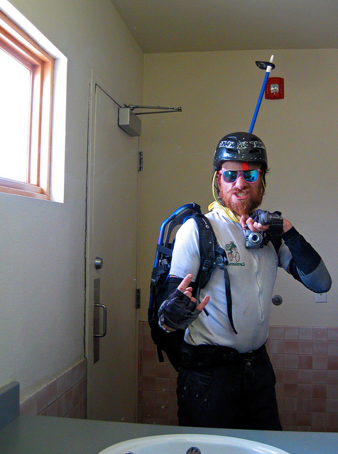
With snowshoes and a ski pole, I go out to attempt to traverse Boreas Pass. I feel like I’m wearing a screwed up looking Boba Fett Halloween costume.
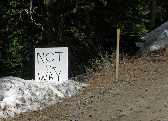
NOT the WAY
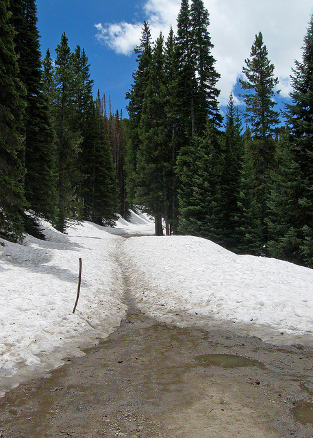
That’s the way. The way is snowy.

Panoramic of the Ten Mile Range from Boreas Pass
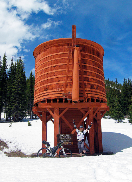
Bakers Tank and one special nerd.
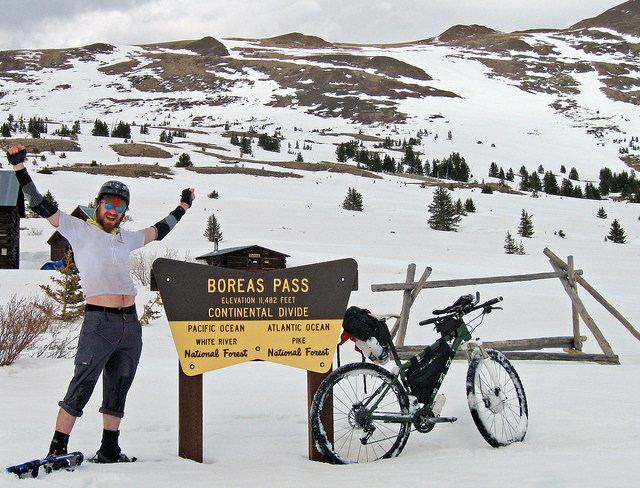
Crossing the Continental Divide at Boreas Pass
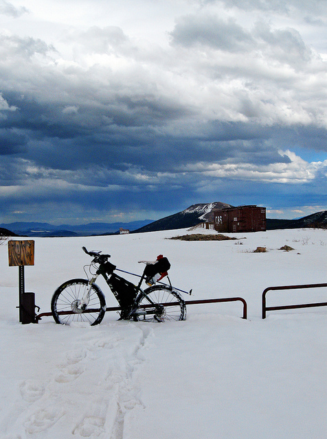
Snowdrifts on Boreas Pass
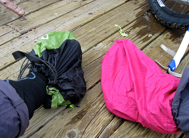
Keeping my feet dry.
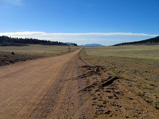
South Park, looking South between Como and Hartsel
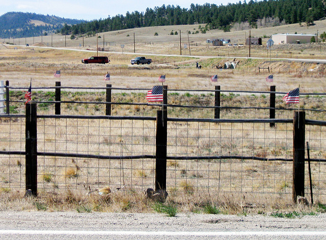
Winds in Hartsel
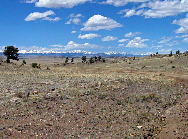
South Park, looking North, south of Hartsel.
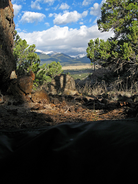
Good morning, above Buena Vista.
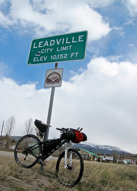
City Limits
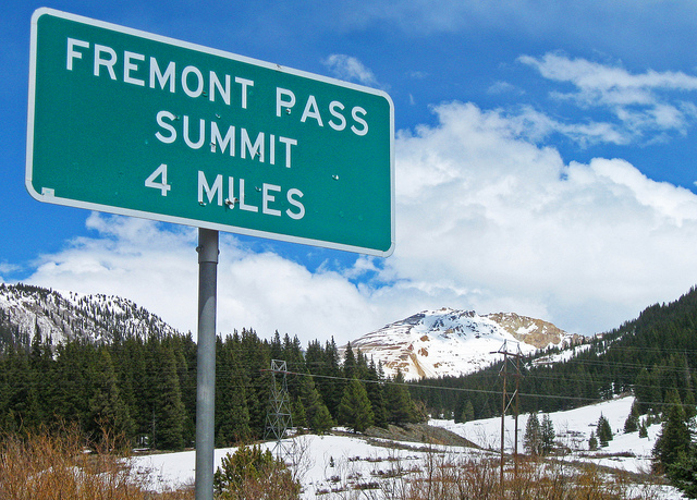
Freemont Pass, Climax Mine in the background
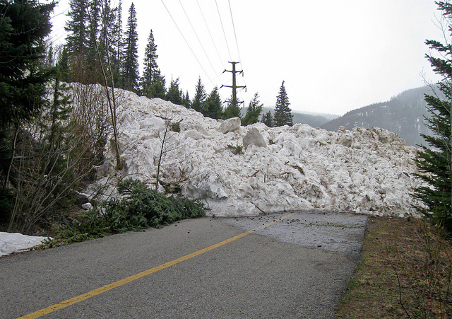
Avalanche!
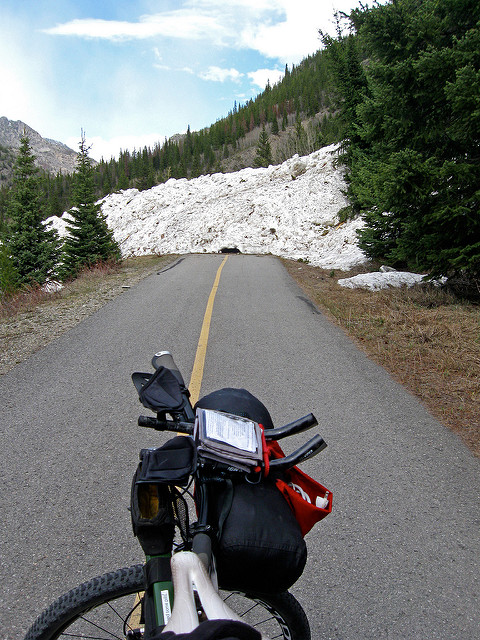
Avalanche!
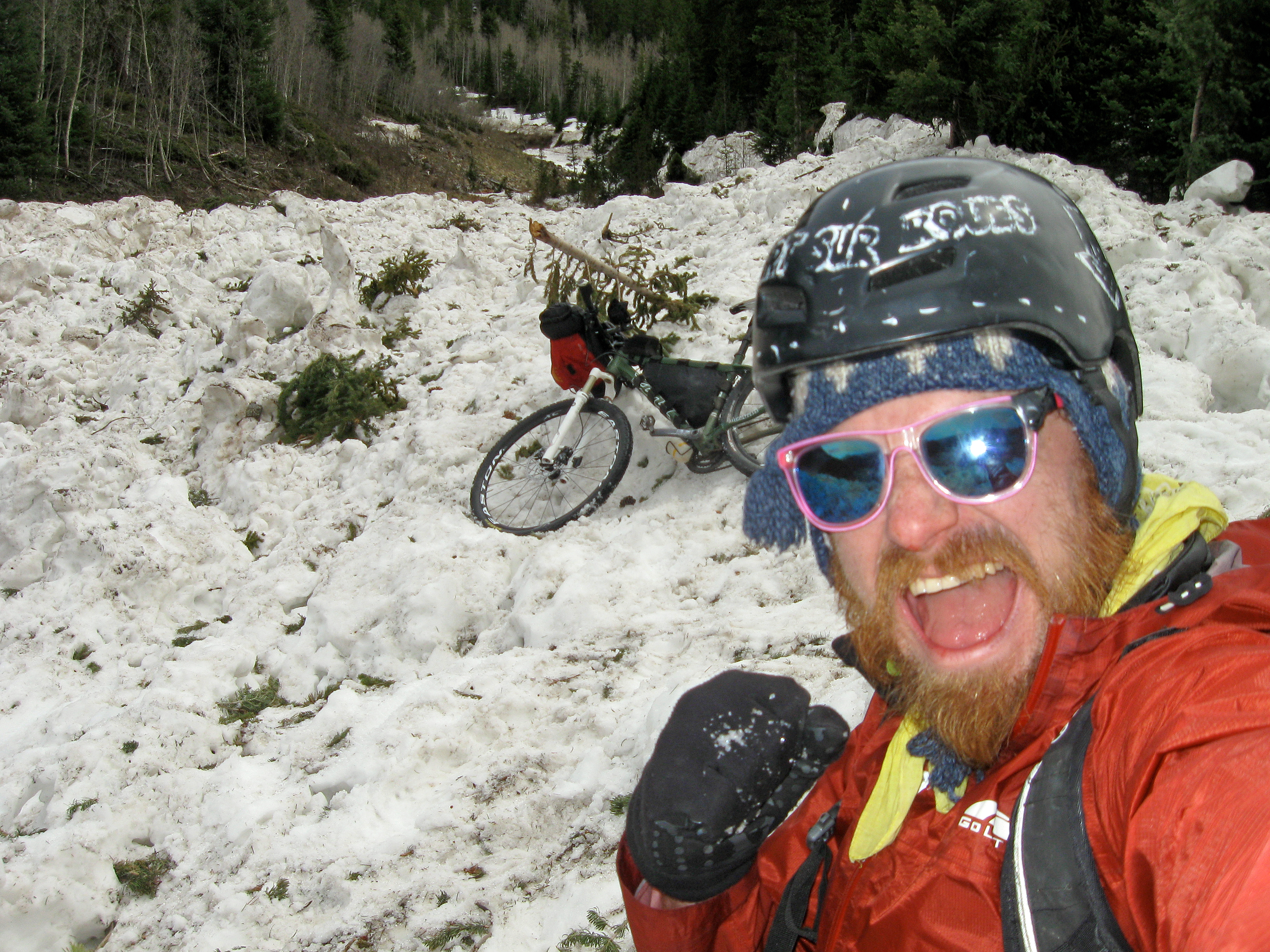
Avalanche!
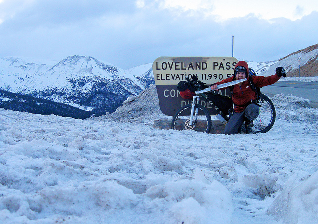
Traversing Loveland Pass #2
Cycling is a coping mechanism for me. It smooths out my crankiness. Cycling renews me, allows me to be out by myself and alone with my thoughts, or lack of thoughts. I almost never ride with a group or a partner. I sometimes get asked why I chose to ride something like the Tour Divide and the answer at first seems intangible, or at best Mallory-an (“Because, it’s there!”), but a major part is the long lonely stretches of little-improved upon basins, deserts, passes and less than picturesque places I can hide myself, away from my usual urban environment to do absolutely nothing, but ride bikes and live inside my head. For all my eccentricities, I’m still a very charismatic person when I want to be. Positive or not, being out alone and self reliant is a major attraction to me.
Art is also a major coping mechanism. It’s a simple trap to fall into, if you’ve reject how you’re told how world works around you, your mind starts attempting to create answers to the questions you have found yourself constantly asking. The drive to examine and frame what’s before your eyes or in your mind. If my job was to do nothing but work in a brain-shaped room and come out with wacky ideas that more focused, intelligent and grounded people could then created into exceptional and world-sustaining inventions, I would sign my life away. Experimenting without a clear thesis isn’t the worst definition to what Art is for me.
Cycling, to train for this race, has so severely cut into my time to create, that I’m finding that cycling has stopped being a coping mechanism and is starting to be something that requires a coping mechanism. Racing is not my forté, but adventure and self discovery is. I’m realizing a lot of this race is going to be coping with having to, well, race the race. Coping with being tired, or wet or cold or sick or annoyed or sunburned or hungry or thirsty or through with the idea – and still needing to continue. I’m used to being able to quit anything I want, any time I want. This won’t be something I can do. Too much of an investment.
So maybe it’ll be enough to take along a good-enough camera with me, so I can switch gears and take a few photos while I’m “racing”. It seems like a small thing, but a poorly-defined art project is enough of a coping mechanism to get me through. My family ties are tenuous and I have no romantic involvement to speak of. Art and photography will be my little pink cuddly teddy bear.
The Last Big Ride before the Tour Divide started as every single one of my practice rides have, by leaving my front door, forgetting ten separate things, unlocking the front door and finding them again. The itinerary was to ride up to Frisco and follow the Great Divide Mountain Bike Route as far as two days allowed me and then ride home, perhaps backtracking.
There were a lot of unknowns, as I’ve never had ridden any length of the GDMBR, save for the part on the bike path that crosses the Dillon Reservoir. Record snowfall in the area meant that the lofty, 11,492 ftfoot Boreas Pass route, south of Breckenridge, my be snowed in and impassible. Really, only one way to find out for sure. This would also be my longest ride since September, where I attempted, quite unsuccessfully to ride an extremely hard route west into the mountains, up Guanella Pass, through the ghost town of Waldorf, and up and over the highest continental divide pass in Colorado: the 13,205 foot Argentine Pass. All on a Surly Crosscheck cyclocross bike, fitted with extremely large tires and pulling a BOB trailer with enough gear to climb any Class 3 route of any 14er that I may want to visit, along the way.
Traversing Argentine pass was mildly successful, although it required walking up and down the east side twice to get all the gear over. The west side was only rideable if you’re suicidal, so I had to walk the few miles down the treacherous and seemingly crumbling west face. The night’s hail storm left me with a broken tent, a broken stove, no extra food or water and a severely shaken spirit. I had decided that camp would be on top of nearby 13,587 foot Mount McClellan. While I watched the storm accumulate on the very peaks of Grays and Torreys, two 14ers just on the other side of the valley, I questioned my camping spot, but by that time, the wind gusts were strong enough to blow my tent down without an incredible amount of support from makeshift sandbags to weigh the tent down, made by packing every single stuff sack I had with dirt and rocks. After a day off of riding and staying in a hotel in Frisco repairing my tent and equipment, the next day’s ride was cut short by a broken pedal from a rock strike, only a few hundred yards into the Ten Mile Range traverse section of the Colorado Trail, the same trail I intended to follow all the way to the old 10th Mountain Division’s Camp Hale, and from there, 20+ miles to the start of the trail to the Mountain of Holy Cross. Instead, I was picked up after simply hiking the trail over Ten Mile, was driven to Holy Cross, hiked with my partner and driven home.
My trip was to cover at least a week and a half more, around 4 more 14er summits, including a traverse between Bierdstat and Evans via The Sawtooth but I was drained. It was one of those trips I took that, I told myself, if I finish, I’d write my letter of intent to race the Tour Divide the next year. A few other small trips with slightly less lofty goals and slightly more success happened in October and November, all with the same nebulous promise to myself: do this somewhat related stunt, throw your hat into the Tour Divide.
I finally did write that letter and on the day I was to leave for my last big ride before the Tour Divide, I had a little over a week to prepare.
Finally leaving my house around 11:00am – or was it 12:00pm? 1:00pm? Whatever it was, it was late, but my goal was only to ride to Frisco, maybe 80 miles away if you go the shortest route, but still over an almost 12,000 foot Loveland Pass and a total of well over 7,000 feet of elevation gain. The ride went well enough until past Bakerville, as the high country slowly revealed itself, while I rolled over larger and larger ranges in succession.
Trying the newly paved Bakerville to Loveland ski area bike path turned out to be fruitless. Even at this seemingly low altitude, there was too much snow to make travel easy enough. Trying to walk through the drifts with gators, I quickly found major spots where I post holed up to my knees. Guess I’ll have to take the Interstate.
The summit of Loveland Pass was reached well after nightfall – my first night traverse over Loveland Pass. Just large lorreys carrying explosive chemicals and myself.
I rode to Frisco, checking the camping situation. Eighteen Dollars was required to camp, which I was unwilling to pay, so I backtracked a half a mile to my contingency plan: bivvying on the Dillon Resovoir Trail. Picked a lovely spot and sleep came easily.
The next day, I woke up and had a leisurely breakfast, waiting for a sport recyclery place to open up to see if they had any snowshoes to sell. Ate breakfast, minor work on the bike, bought a sandwich for lunch, annoyed the locals about conditions on Boreas Pass and found a pair of very small snowshoes that looked like they’d work. Road to Breckenridge search for Boreas Pass road, where I happened upon a gear swap. Picked up one ski pole in the, “free” pile and went up Boreas Pass road to try my luck.
The pass was snowed in from the beginning, only walkable for a little less than a half mile, before the snow became too high to walk in, without shoes, let alone ride a bike in.
Luckily, I brought the snowshoes, so I put them on, starting to make slow progress up the pass by pushing the bike with one hand and pushing myself with the ski pole in the other. Very slow work, but it did work. Within a few hours I was at Bakers Tank, my personal No Turning Back point. The summit of the pass was still a very long ways off, but I didn’t know what there was to lose, Trudging forward, I felt more energized than
mortified, still knowing I had hours of pushing left and an unknown amount of snow on the other side of the pass. Hoping that the North side would have less than the South, I continued on.
I reached the summit of the pass around 7:00pm, nearly 8 hours after getting to Breckenridge, finding a collection of cabins maintained by the 10th Mountain Division. Breaking in proved unsuccessful, so I ate my, “lunch” and recouped between two cabins, hoping to get out of the winds that were picking up and do some damage report on my feet, which were getting soaked from my inadequate bike shoes. a layer of plastic bags, new socks, another layer of waterproof stuff sacks, shoes, gators and waterproof pants were what I could try out. After snapping a few photos I descended.
The snow didn’t let up for another 2 hours, although the walking was slightly easier because of the descent. The snow petered out after a few flirtations around Selkirk Campground and I was able to coast unimpeded down to Como, where I again regrouped, stashed the shoes and poles away and went about my business.
There was no services open in Como, so my dinner consisted of nothing but a few bars. Making a few miles South of Como in South Park – around 50 recorded miles, I bivvyed again in a young aspen grove, right off the side of the road.
I awoke after a good 8 hours of sleep to a desolate flat and arid basin and a very strong headwind. With little water and no food, the ride to Hartsel was a little less than fun, but manageable. Breakfast at Hartsel and supplies bought at the Mercantile and I was off for the rest of South Park and towards Salida.
The afternoon proved windier than the morning and dirt devils sometimes threw me off my bike. Hours slowly ran by, as I road at a pace of literally, 5 mph. Ran out of water, just before the one creek crossing and treating the severely questionable water with iodine tablets. The water was fast flowing enough, but muddy and filled with small floating green plants. The area around was covered in cow patties, with cows grazing nearby. Bad signs, bad signs. Guess we’ll know in a few weeks if there’s a problem.
The wind only relented at the shadow of watersheds or, finally, the pass between South Park and Salida. The last pass was a relief, as I had consumed all my food and water. All I wanted was a burrito that I knew I could find in Salida.
Sure enough, a burrito was found and I discovered the friendliness of the locals of Salida. It took only a few minutes of wandering around to become the small center of attention to a few curious folks, multiple times. They wanted to know about my trip, the bike, etc and I was happy to answer questions. A local proprietor promised me free coffee when I stopped by on the race, which I thought was super kind of him. More showings of support and some advice to get to my next destination. It seems that a mountain-bike friendly town’s residents can get extremely excited to see a crazy guy with an ultralight mountain bike rig set up to eat up miles by the thousand with snowshoes strapped to his back. It already tells a story. I now put Salida up as far as saying it could very well possibly be the Wanaka, New Zealand of Colorado. On the surface, they’re twin cities.
I had blown through way too much time getting over the pass and beating the headwinds to Salida, it was already time to get home. I only had the night and the next day to get back to Denver. Over 190 miles away.
Deciding to go via Leadville, instead of backtracking, or taking the shorter and more boring route via HW 24 east, I set out to Buena Vista in the dark. Having no idea if the shoulder of the highway would be safe enough to take on a bike at night, I really had no contingency plan this time, except to camp anywhere off the side, if needed.
But, it wasn’t. The shoulder afforded me an almost complete lane to do my crazy night riding. I thought, perhaps a little full of myself, that I have this biking at night thing wired. If I could ride a fixed geared bicycle in Paris traffic, I wagered, anything else was cake. And really, it was, especially with this rig. I could hear cars coming and even with the large shoulder, I could still move even farther to the right – off the road, if need be, to allow a huge berth. The vast majority of the cars seem to be cool with me on the highway – most of the traffic were Memorial Day Weekend campers anyways. The least aggro highway riding I have ever had, anywhere.
Making it to Buena Vista in good time, helped with the now, a tailwind I was riding, I was hoping to find a brewery mentioned by a local in Salida. Yes, I wanted a beer, but there was also a dirt road I could take a little North of Buena Vista to Leadville, allowing me to get off the highway for a while and also afford me a place to bivvy.
The brewery was found, but it had closed up an hour ago, with locals and workers still inside drinking up. I decided not to ask to be part of the company. What I did find, instead, was a bridge to the east side of the Arkansas river and… a system of trails! One which seemed to lead to the road I was looking for. So, I investigated.
Finding myself on singletrack in the middle of the night, with a full load and tired legs was somewhat of a hilarious situation, but I rolled with it. Eventually, I found a road I thought was My Road, but it stopped short of a few hundred foot cliff, which once had a railroad bridge spanning it. I decided that bedding down now and figuring out what to do tomorrow was a good idea.
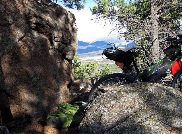
Finding a good spot next to a large boulder that worked as a wind shield, I bedded down on a blanket of pine needles and pine cones – I removed the pine cones. My view the next day was somewhat incredible, as many 14ers were in direct view and I was perched a few hundred feet above town.
I made my way back to town and sniffed out a coffee shop, where I immediately fell in love with the barista roasting coffee in the back, who didn’t pay me any attention and I got coffee and breakfast. A little bit more chatting with locals. I had never really looked around Buena Vista all that often, venturing only off the main highway. It’s an interesting little town, much more interesting than I have given it credit in the past.
Rode north to Leadville and made good time – around 2hr 30 minutes to the town limits. Passing Mt. Elbert, the weather changed from nice to flurries and I changed into all of my packed clothes in a few steps.
I reached a restaurant to get some food, but the staff was slow and the wait seemed long. Lots of tourists and their families. I opted out of it and just went straight to the coffee shop, thinking they’d have something to eat as well. At this point, I had run mostly out of energy. Wondering a little how I was going to make it over now, two Continental Divide passes with a crazy 3 1/2 days of riding behind me. It would have to be done. Seven more hours of daylight left, anyways.
The waitstaff at this coffee shop is usually comprised of severely headstrong mountain women, whom I both exalt and fear. They usually haven’t the time for my bullshit and keep me in line. I tried to be fairly low-key, grab some coffee, something to eat and go. The fact that I was now, very stinking, wearing camping clothes and sunburnt seemed to only enhance my camouflage – it was Memorial Day Weekend, by the way and I was in the mountains: Everyone looked just like I did.
“I’ll have a Cap – even though it’s after 11:00am – I apologize and that… sausage egg and cheese biscuit, please”
Even with my tired state, I can’t help but put in the barista in-joke about Italians and their cappuccino protocols.
The barista asked me, “Where are you coming from?”
“Like, where did I start?!”
“Well, yeah.”
“I started in Denver, went over Loveland Pass, through Summit country and over Boreas Pass, using snowshoes. I managed to get through a killer headwind to Salida and last night I rode and camped outside of Buena Vista. I road here this mor
ning. I’ll have to make it back to Denver tonight”.
Christ, I thought, that was kind of a lot to pack into four days.
“Wow, well good luck”
“Thanks, by the grace of God and your coffee, I’ll make it through”.
Another coffee joke – God and coffee being on the same level. My flirtation is transparent.
“So, hey, this coffee is on me.”
“Really?! Thanks!”
“Hey, any thru hike mountain biker packing showshoes gets free coffee”
A bonafide Trail Angel. Guess I wasn’t so invisible. This trip was turning into the most fun and epic bike trip I’ve ever had, anywhere. What has changed? I must just be taking things in stride more than I’ve in the past. In other words, I’m having fun doing crazy things are destroying my body. My mental game was on and I was happy for that.
Leaving Leadville, the ride up Freemont Pass and past the Climax Mine was slow, but doable. Climax Mine intrigues me, as they’re literally crumbling a 13,000 foot mountain to gain access to the low grade sources of molybdenum. The destruction of an entire mountain, as well as the thousands of acres of tailing ponds seems like a horrible disaster, exacerbated by the fact that molybdenum is what makes a lot of steel bike frames strong, resilient and light. It’s a good bet that the chromoly from a steel bike frame came from this mine.
The close of this mine in 1995 almost destroyed the town of Leadville financially, but it may soon reopen. Being a complicated matter, I have mixed feelings about it. The laws on the books for cleaning up environmental damage of such a super mine are incredibly outdated. Corporations that own these mines operate them under grandfathered in rules from the 1870’s in some cases. The mountain is cut down, the surrounding environment is ruined, the mine shuts down, the worked lose their jobs and gain an incredible ugly scarred mountaintop and a wasteland of shallow ponds of sometimes disturbing colors. Is it all worth it?
Dropping down from Freemont Pass, I was stopped in my tracks by two things I had never seen before. Not expecting them, the both took a half second for my brain to identify. The first was a beaver! Hanging out right by the side of the bike path in a flooded area, she seemed content in doing beaver things, until I tried to take its picture and then she shot off the scene.
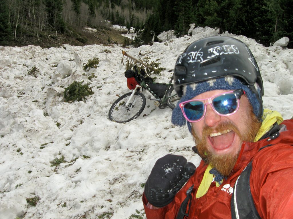
The second was… an avalanche! In the middle of the bike path was tons and tons of snow that had fallen from Peak 1 a few days or so before. Even if its gigantic size, it took me a split second to understand completely what it could possibly be. And then another split second to climb and play all over it. I couldn’t stop laughing at how much snow was in my way. Literally ten feet to climb over.
Getting off the bike path I again was crossing the Dillon Dam road into Frisco. Deciding to take a short trip to the outlet stores, I turned off. The one I wanted to hit up was Pearl Izumi. In Hartsel, I had lost my arm warmers, so those needed to be replaced. My gloves were now ghosts of past gloves, so maybe they had something for me as well. And boy, would it be nice to get an actual pair of bibs instead of a spent pair of shorts. Well, let’s see what the deal is.
The deal was that everything in the store was marked down 20% on top of the 20% it was originally marked down. I grabbed so much wool and spandex crap, I now look like Team Pearl Izumi. At least my ass will thank me. And a black sharpie will handle all the corporate logo-ization.
Stopped for a sub and then I was off. Making a slow start of things – it was well after 5:00pm before I started off for Loveland Pass. Again, night threatened, but I made it up and over before both night and the snowstorm that was heading right for me. Icicles hung from the overhangs of the plowed snow on the side of the road. I plunked the largest one I could find and used it as a sword while riding, threatening all cars and trucks passing my way.
Descending, I froze my fingers off trying to make as much time as possible, not stopping for anything, even the waning daylight to put on lights, until I got to Georgetown.
Being Monday and bring Georgetown, there was nothing open, except one glimmer of hope: a coffee shop/pizza place. There was the owner, a few people on laptops and a single mother with a passed out kid, sprawled on two chairs.
I ordered a pizza and coffee and stared at things, trying to get feeling back in my hands, happy to have found a place with a pizza oven on, “high”. The back wall had a bulletin board with some of the owner’s outdoor exploits. What caught my eye were his mountaineering photos. La Grave, Petite Fourche. A few others. Impressed me, anyways.
The scene got a little weird, as mountain towns tend to get, so I removed myself after finishing up. Realizing I had lost my headtorch, I improvised a $4 light I had found at a gas station and taped it to my helmet.
In my way to my hammock at home was a sequence of long drawn out downhills and ever decreasing ascents. 1,000 feet ascent, descent, 500 foot ascent, descent, 100 foot ascent, decent, 50 foot ascent, home. Saw a black fox in the middle of downtown Golden. Again, it escaped my camera.
Five more hours past of riding in the dark with crap lights, tired from a monumental ride but at 3:00 am, I found myself home. Took a shower and past out.
Woke up around 6 hours later than I would have liked and missed out on the soundcheck I was supposed to be in, to play Red Rocks later that evening. The total reason I booked it back home was to make this show. A total letdown, I couldn’t believe I couldn’t get my shit together and embarrassed to tell the band I couldn’t make the biggest gig of our collective career.
These are the kinds of very difficult sacrifices I’m needing to make to race this race. I said I was going to be at the gig and I thought there was some chance, that after 4 days of extremely difficult riding I could then play a extremely energetic show. I want to be there for my band who supports me and has given me so many incredible experiences, but I couldn’t pull it off. It makes me feel ashamed. Part of growing up for me and one of a myriad of lessons I’m having a slow time learning is to not over extend myself and promise things I just can’t do, no matter how much I want to. These lessons come from difficult defeats. My hope is it’s all worth it.
At least, with my final practice ride, it feels doable. I can ride four days at race pace and thrive, no matter the wind, the cold and my personal forming crust on fancy expensive ultralight equipment.
As long as it stays an adventure and not a routine, I think I’ll be happy.
