Caltopo Map
The Slowlans Caltopo map can be found here, and is also embedded at the top of all the pages of this guide. You will want to use that map in conjunction with the narratives provided. The Caltopo app can be run on your phone and be used as your primary navigation tool.
Nolan’s 14 Line
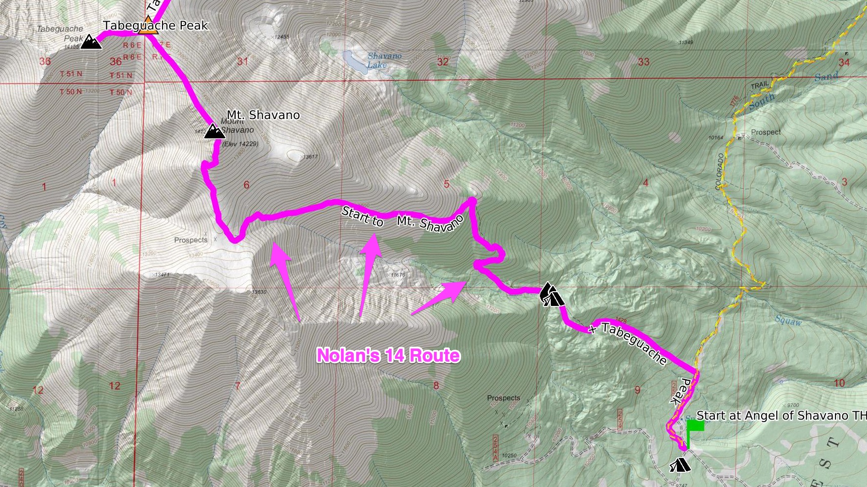
The Nolan’s 14 line is in magenta and is generally optimized to take the quickest, most direct way up and down the peaks, and doesn’t primarily consider things like camping options, water sources, etc.
Slowlans Alternatives
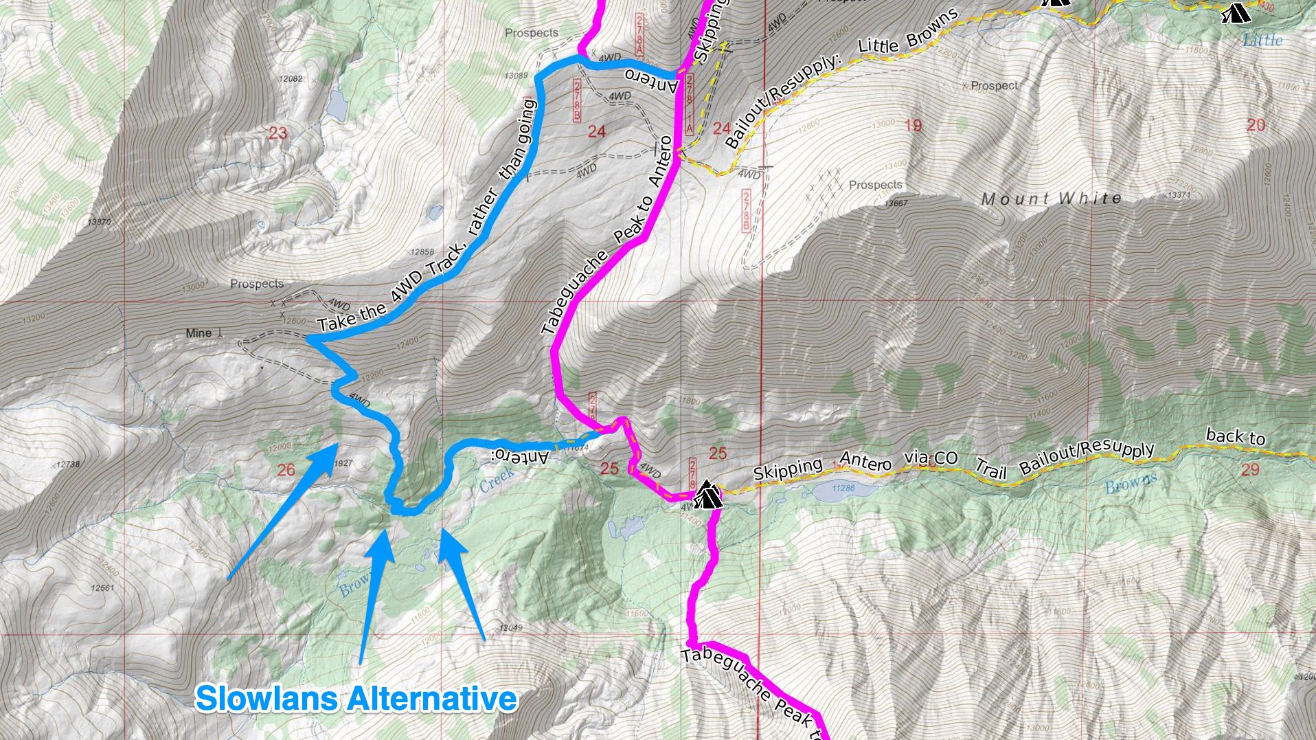
Alternative route segments, off the Nolan’s 14 route are shown in blue. These route segments are provided to give a more backpacking-friendly version of the route, if one is available. They may allow a more sustainable path through the terrain, an easier route, a route that provides better camping/water sources, etc.
Bailing/Resupply
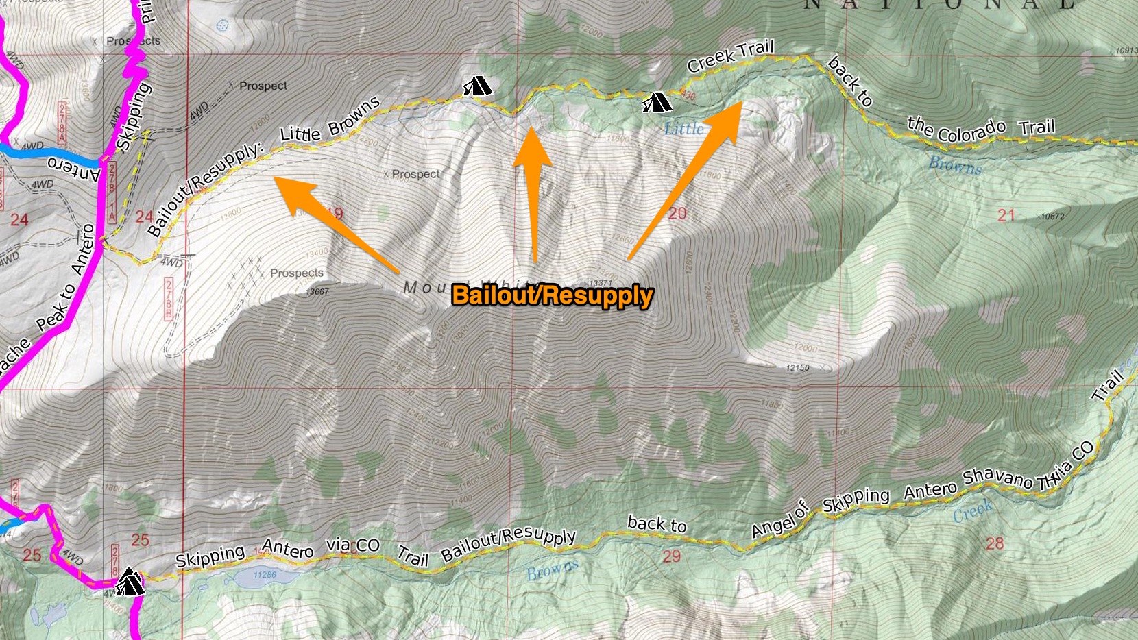
Routes to get out off the main route to either bail or to pick up supplies are in orange and are dashed. Bailout routes primarily go back to the Colorado Trail/Continental Divide Trail that often parallels the Nolan’s 14 line. Consult guides on the Colorado Trail for in-depth information on water supplies, camping, and how to get to town. Bailout routes can also be used to shorten the full point to point line for a smaller round trip – or at least severly shorten elevation gain and loss.
Skipping Peaks
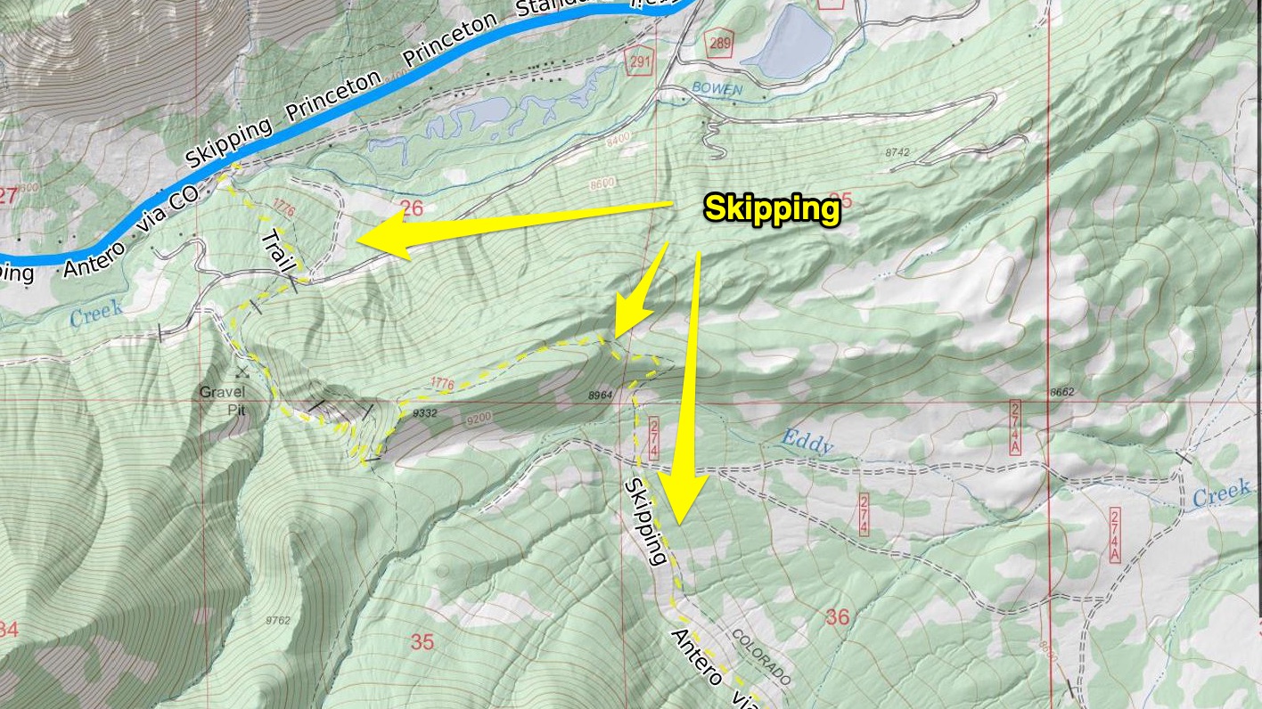
Routes that can be used to skip peaks are in yellow and are dashed. Depending on your timeline, weather, and stoke of your group, skipping a peak for an easier route may be wise. They’ll almost always meet up with the Nolan’s 14 route later on.
Summit/Water Sources/Camping Labels
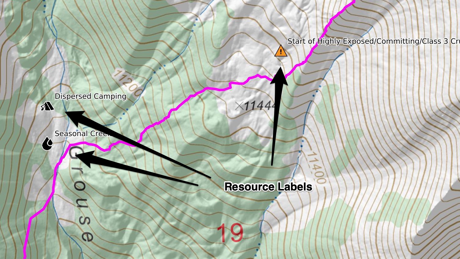
Peak summits, water sources, and camping spots are labeled on the map.
Route Narrative
The route narrative is written to give you a general idea of what to expect on the route, so that you can properly prepare for the challenges ahead. Other than the first and last segments, each segment begins and ends on a mountain summit, as that’s where many decisions on where to go next are generally made. Going into a different direction into a different drainage can vastly change the course of your trip.
Each segment does NOT represent a suggested day! A few itineraries of different time lengths are provided, but they do assume perfect conditions.
Embedded GPS Coordinates
The narrative will often time have GPS coordinates added to various resources. Clicking on these GPS coordinates will bring you to the Slowlans Caltopo map at that location.
Overview Maps
Each segment starts with an overview map, which will include a distance ruler, to help you estimate mileage of the different route lines. Some maps on this site do have PDF versions in 8.5″x11″ size for easy at-home printing. Hi-res versions of each overview map is available simply by right clicking/control clicking the image itself. All these maps are created using the main Caltopo map provided and it’s suggested that you print your own custom maps using the Caltopo website if you need additional maps for your own trip.