
Like this? Follow me:
This was most likely the largest week in the entire tour, in terms of number of peaks summited. Access in the Sawatch is generally easy, resupply is plenty, and most of the peaks don’t pose too much technical problems.
Centennials Summited (19):
- Cronin Peak
- Mt. Antero
- Mt. Shavano
- Tabeguache Peak
- Mt. Princeton
- Mt. Harvard
- Mt. Columbia
- Mt. Yale
- Mt. Hope
- Missouri Mountain
- Mt. Oxford
- Mt. Belford
- La Plata Peak
- Ice Mountain
- North Apostle
- Mt. Huron
- Horseshoe Mountain
- Mt. Sherman
- Dyer Mountain
Plus bonus peaks: Iowa, Gemini, Peerless, etc
Total Mileage:
- On foot: 103.8 miles, 48,889′ elevation gain
- On bike: 136.5 miles, 10,029′ elevation gain
Day #35 (August 21, 2017): Cronin, Antero, Shavano, Tabeguache
Big day crushing some Sawatch giants. This type of linkup was the norm in the Sawatch, and almost gives a false impression on someone thinking about how easy this project is. Compare this to the San Juans where – although there was some linkups, there was also mountains like Rio Grande Pyramid, which was 20 miles roundtrip for one peak!
I had recon’d the idea of linking all these mountains up earlier in the year, by taking the ridgeline from Cronin all the way to Shavano, but opted against it, as it was just too many extra peaks to ascend/descend, and it made sense to just drop down across the basin from Cronin/Antero to Shavano/Tabeguache.
I also did quite a bit of caching gear, since Cronin was an out and back from the saddle between Cronin and Antero (and the same could be said for Antero), as well as not needing much after getting to the base of the climb up Tabeguache.
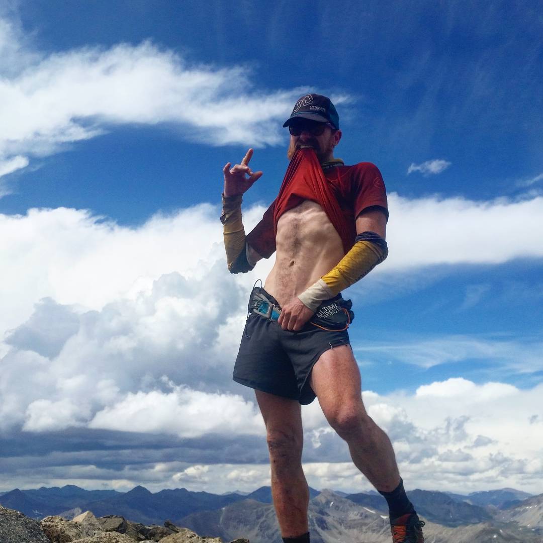
August 20th was also a full solar eclipse, and I happened to be on the summit of Antero at the time. Kind of special. Kind of.
I don’t have the greatest eclipse story, but I was on the summit of Mt. Antero at its most… eclipse-y. One other person – he was a bit too involved in his own viewing to let me borrow his special glasses -just for a sec., for a look-see.
Man, I’d be like, what a great way to make a new friend for life, but the glasses were his. But this pic is from the summit. That patch of black is a group of heavily modified jeeps that brought up some ancients for eclipse viewing. Weird to share a trail with jeepers – our mode of transportation is so different. It must be strange to just sit shotgun while watching someone else laboring up the trail @ 13,800′. They most likely have no idea what’s going on in my strange little world… (and no diss on jeepers, I find them on the whole exceptionally polite, and friendly).
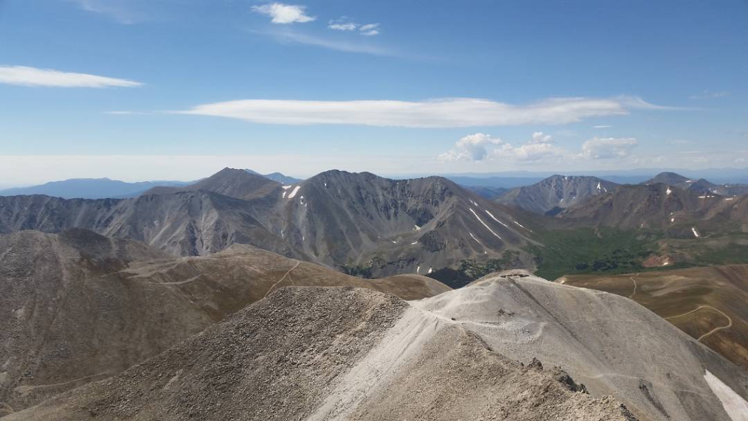
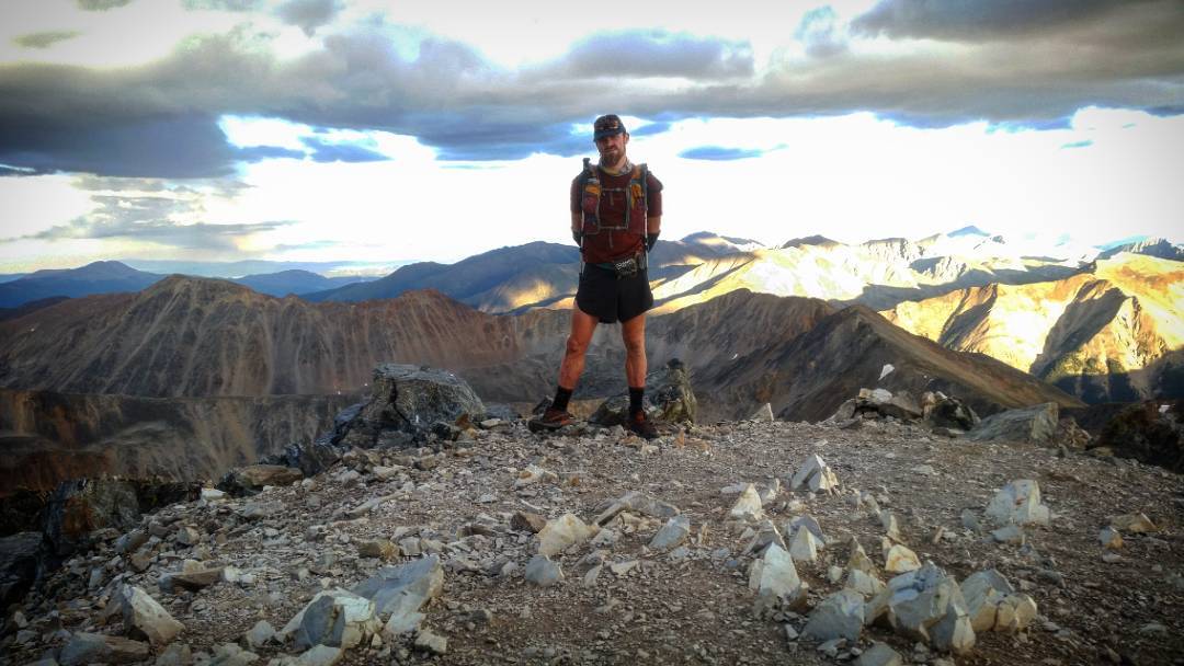
Tabeguache. The Antero/Cronin/Shavano/Tabeguache link up was a day I knew could either be pure Hell, or just simply, Hard. Lots of peaks, lots of terrain to cover. It was Hell on my 14er tour, and that was without Cronin. So I strategized quite a bit to be as efficient as possible. Gear caches, strange and unusual route selections, lots of risks with riding the bike partly up that terrible road. In the end, I felt I nailed it perfectly. But as this pic hopefully communicates, it still was Hard.
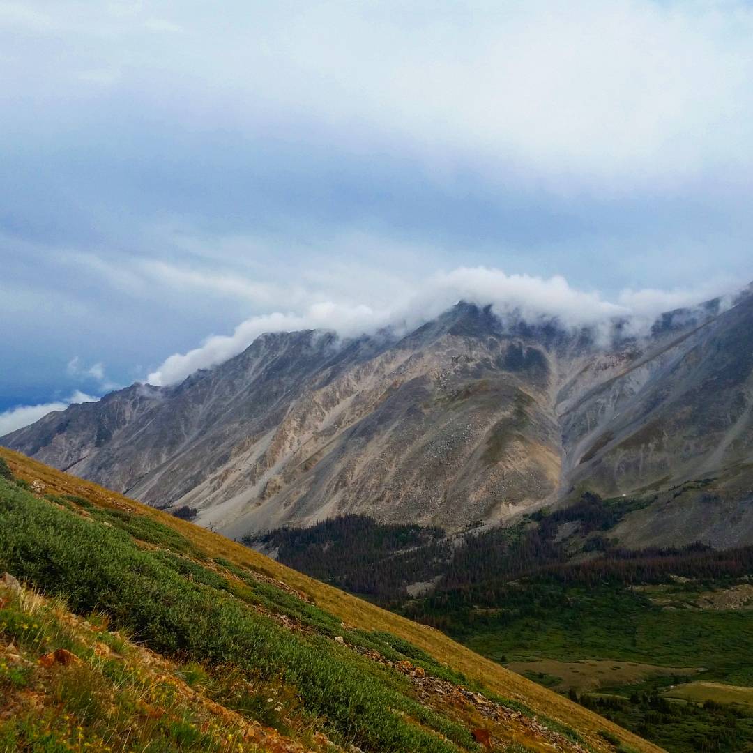
Poorly captured, but one of my favorite mountain phenomena: a bank of low clouds creeping up and over the Shavano ridgeline. It needs motion for the full effect, but it’s a truly unsettling scene, seeing a full mountain just be engulfed and disappear. I’m alone most afternoons on my large linkups, as anyone sensible is already back in town with BBQ and aprés hike libations. But scenes like this – they all usually miss out on. And this is one of the reasons I do what I do. .
Later: Down Antero 4WD to Bivy
Rode down late in the day to bivy at the base of the 4WD track that goes up to almost the summit of Antero. Squeaked out a tiny patch to pass out after the four summits.
Day #36 (August 22, 2017): Antero to Princeton TH
Kind of an interesting example of what the approach rides were between mountains in the Sawatch. I decided on taking Princeton on via the route that starts in Alpine. To do the standard route, would require a time-consuming road climb up, which I really wasn’t stoked on doing (again).
Later: Mt. Princeton
Such a good route. Trail begins as perfect singletrack which ends…? Breaking away from the trail, you need to cross a thick patch of aspens, then go up one of the main ridgelines of Princeton. Just delicious. This is a route often used for Nolans 14, and I felt quite a bit as if I was reconing for that challenge, and fantasies of actually doing Nolans 14 after my Tour danced in my head. This, of course, was insanity.
Later: Alpine to North Cottonwood Creek TH
The main road up to Antero is actually quite steep in places, but it’s SO much fun to rocket down. I stopped in Buena Vista to resupply before getting to Harvard/Columbia/Yale. There is an option to take the Colorado Trail from the Princeton Hot Springs to CR 306 – plus (as I now look at the map…), there’s another backway called, “Rodeo Road”. Although not suss’d out, I bet the latter would work well to avoid this highway riding. Save a few miles, too.
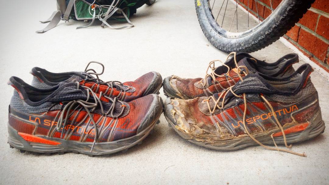
People quite often ask me, “how hard is the route?”, since they see in my eyes my exhaustion. I just point to my shoes and give them the number of days I’ve worn them, which is low enough to cause gasps. These made it most of the San Juans, and into the Sawatch. A sigh of relief to find a new pair waiting for me at the Buena Vista USPS. The trail – there are actual *trails* now, should be a lot nicer to my new pair of La Sportiva
Mutant. I dare think what a lesser pair of shoes would look like! My sincere gratitude to La Sportiva for being a clutch part of this project!
Day #37 (August 23rd, 2017): Harvard/Columbia/Yale
Another huge day of tagging three peaks.
There is a Harvard/Columbia ridge traverse (goes at ~5.7?), but I’ve never done it, and I somewhat didn’t feel up to it this day – until about halfway through the regular traverse of dropping way off the ridge. In my infinite wisdom, I decided to climb up the ridge far earlier than you usually do. Very loose, and kind of a dumb decision. I should just go for the actual traverse one of these days, I’m sure I could do it without much bother (more Nolans recon!)
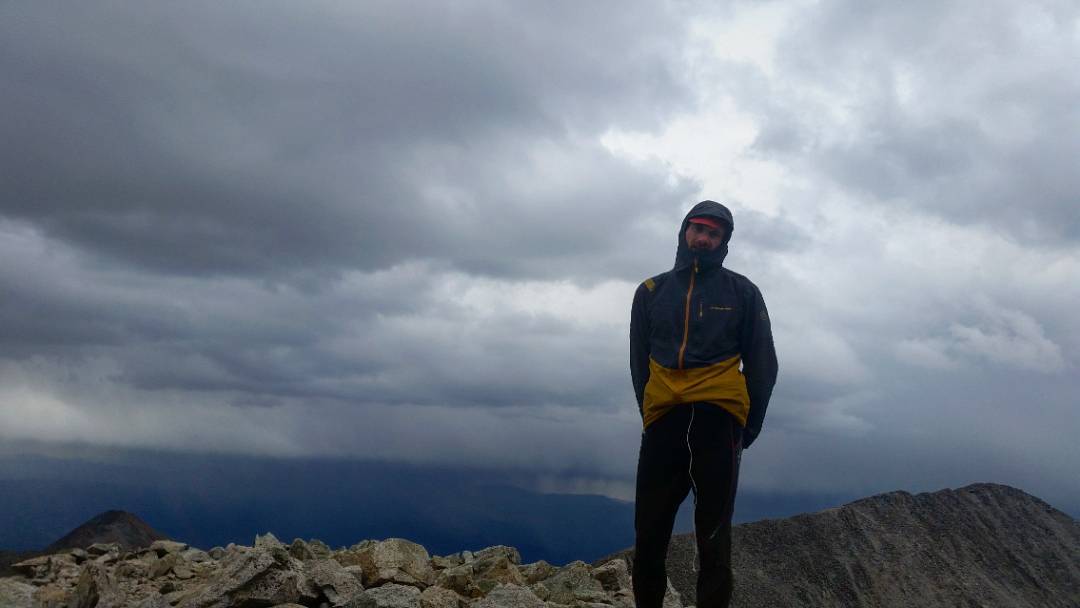
Afterwards, I summited Yale. Pretty nasty electrical storm brewing at the summit, and I took risks to tag the thing, and get down. Again, the route used for Yale from Cottonwood is used in Nolans, and I’ve scouted it, at least to the top of the avalanche gulley, so no huge surprises there. The rest is just gaining a ridge, and following it to the summit (some side hilling is done). Honestly, a really great route – the avy gulley isn’t terribly, although getting from it to the trail is a bit of a bushwhack, but TONS of raspberries were there to completely destroy any PR’s of mine.
Harvard/Columbia/Yale linkup! A little less than 26 miles, 10,000′ of elevation, and 12 hours. Speaking of numbers: Gawd-Dayum who knew 36 would look so goooood! Time to put on the Black Flag and outrun this here thunderstorm!
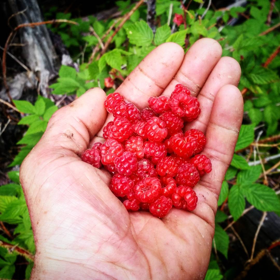
One of the benefits of weirdo, off trail, rarely used routes. I bet you think I just took all these amazing wild rasberries, and mashed them in my mouth. All at once. Well you’d be right.
Later: North Cottonwood TH to Chaffee County 390
Another rocket back down to BV to stock up on an amazing amount of food. Since I knew I could be in Chaffee County 390 for a while, I actually bought some Hammer Products Perpetum, Hot Cocoa powder, Starbucks Via instant coffee, and ziplock bags, to make ready-to-be-consumed, “sports nutrition” packets I could just add to water. It must had been a weird sight to see this terribly disgusting man dole out all these ingredients into baggies in front of the store.
Also ran into Brendan of Semi-Rad and Meghan Hicks of iRunFar as I was exiting the coffee shop/roaster. I was in a semi-manic state – the amount of stoke coupled with such a huge day will do that to you, so I probably made a terribly first impression to Meghan.
Although riding a major high, I also needed to majorly crash, and made my way down CR371 which closely follows the Arkansas river, to bivy for the night at a small climbing crag. Bootied ANOTHER Black Diamond Cam, but yet again, put it in a place that could be easily found for someone else. What did I need with cams (kicking myself)
In the morning, I woke up, but something was obviously pretty off. Although I made it to just across the ways from Sheep Gulch by bike, I didn’t feel like doing any summits, and I figured the best thing to do was crash out. And of course Meghan spots me, and asks very kindly if I was OK. All I could really do is show a thumbs up outside of my tarp. Gawd, what an asshole I was. Sorry Meghan!
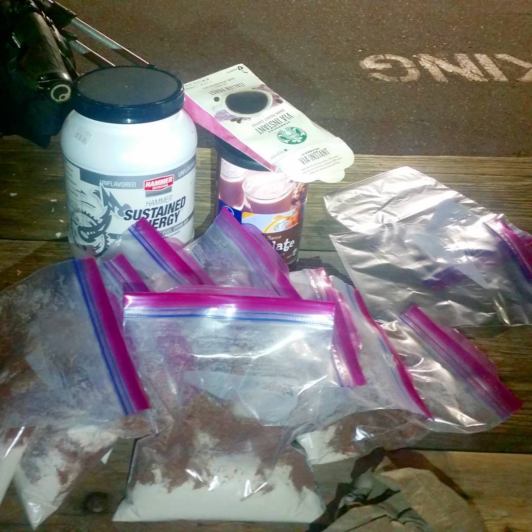
Hey, Leadville Trail 100 enthusiasts, know where Winfield is? Of course you do. Packing a few days of food to stay awhile and grab the 9 (?) Centennials in the area. Sometimes I even use sports nutrition products. Mixed with chocolate milk powder. And instant coffee.
Day #38 (August 24th, 2017): Mt. Hope
After many hours of sleeping, I got up, and realized the best thing to do to keep going, was to keep going. I didn’t want a soft 0 for the day, so up to Mt. Hope I went, even though I felt I had just went through basically losing my mind.
Hope is relatively easy hike up Sheep Gulch, until Hope Pass, where you have to get off the main trail, and follow the Class 2/3 ridge to the summit. Being fairly late, I had most of the trail to myself. I even managed to jog some of the easy miles down, and I started to feel much better. Good, because the next day was going to be a big one.
This is a mountain called Hope. “Hope” I guess can be defined as anticipating a favorable outcome, but understanding fully you lack any influence over the future. Funnily, earlier this day, I had what could be described as a mental breakdown. I obviously knew what brought it on (fatigue+related things), so it really wasn’t frightening, but instead of bagging peaks, I just decided to pass out for a few hours. I woke up to mash potato skies, but thought it best to try and go for an easy one in the area. It started to drizzle as I walked slowly up, but no matter – no thunder. Shit hike, really but I turned a terrible day into a non-zero summit day, so I was happy about that. And I felt much better and had a wonderful rest of the night snoozing. .
Later: Sheep Gulch to Missouri Gulch
I don’t remember doing this, but it looks as if I moved camp closer to Missouri Gulch, to make the next day’s marathon a little easier to start.
Day #39 (August 25th, 2017): Missouri/Iowa/Emerald/Oxford/Belford
Another huge day ticking off peaks! I had previously hiked Missouri/Iowa/Emerald on a recon ride/hike in particularly disastrous weather conditions, so knew the route from Missouri to Emerald was really no sweat. Added Belford and Oxford to my previous foray, which were easy to do. Some slow trotting, making me feel like yesterdays complete loss of myself was a passing thing, and not what I
Later: Ride to La Plata TH
Wandered over to La Plate for another peak today
Later: La Plata
I really enjoy this route on La Plata, although the standard route is probably a little faster/easier. This route is just a lot more convenient, since I’m in this area, anyways. Took it fairly slow, but wanted to get down before it got too dark. Passed out at the end of the 4WD trailhead/start of the trail. Remember someone drove up late in a SUV and decided that just across from me was exactly where they needed to be for the night. How rude!
My first mountain bike race was the 2011 Tour Divide. On April 1st of that year, I bought my first mountain bike, and in June, I was up in Canada pointing it south anticipating a 2700 mile ride to the finish at the Mexican border. I made it 2600 of those miles, and then crashed hard enough to taco my wheel and tear my shoulder. A visit to the ER and a scratch. It was a miserable and uncomfortable bus ride home. I lined up again in Canada in 2012 to complete those last 100 miles – after repeating those first 2600 – this time, without incident. Anyways, perseverance (and a good night’s sleep) After my mental meltdown, the next day saw me summit Missouri, Iowa (bonus!), Emerald, Oxford, Belford, and finally: La Plata Peak. I was ready for more, but knew the long game of this Centennial challenge is not necessarily pure speed, but intelligent pacing. Tomorrow is another day.

Storm’s a-comin’, but you can’t catch me.
Day #40 (August 26th, 2017): La Plata TH to Huron TH
Rode to the La Plata TH early in the morning, and left the bike at the info sign
(August 26th, 2017): Ice Mountain/North Apostle/Huron
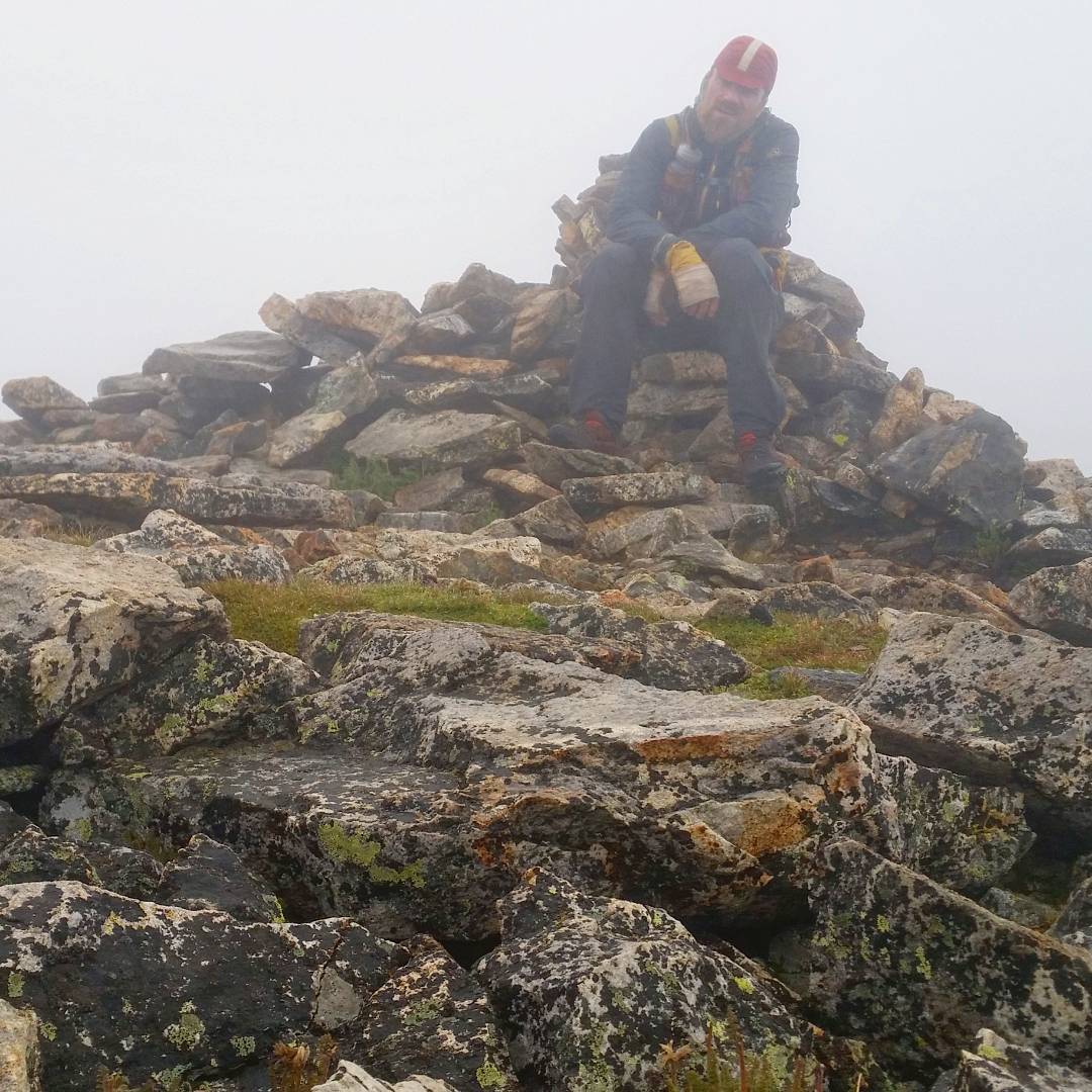
Ice and North Apostle were mountains I planned to recon, but I got spooked by the snow conditions where I tried it earlier that year. By now, there wasn’t much lingering snow, and actually, the route up Ice Mountain was fairly straightforward and certainly didn’t live up to its reputation of being too difficult or dangerous. I was at this point pretty tempered to all manner of loose alpine rock, so take this point of view with a grain of salt. Altogether, a wonderful experience.
After getting down, I took the old standard route up Huron in an attempt to shave some time and not backtrack quite so far. Looking at the map… probably 6 in 1, but I had a great deal fun exploring a new route. The current standard route up Huron is one of the easiest of all the 14ers, and made an easy and exhilarating run down.
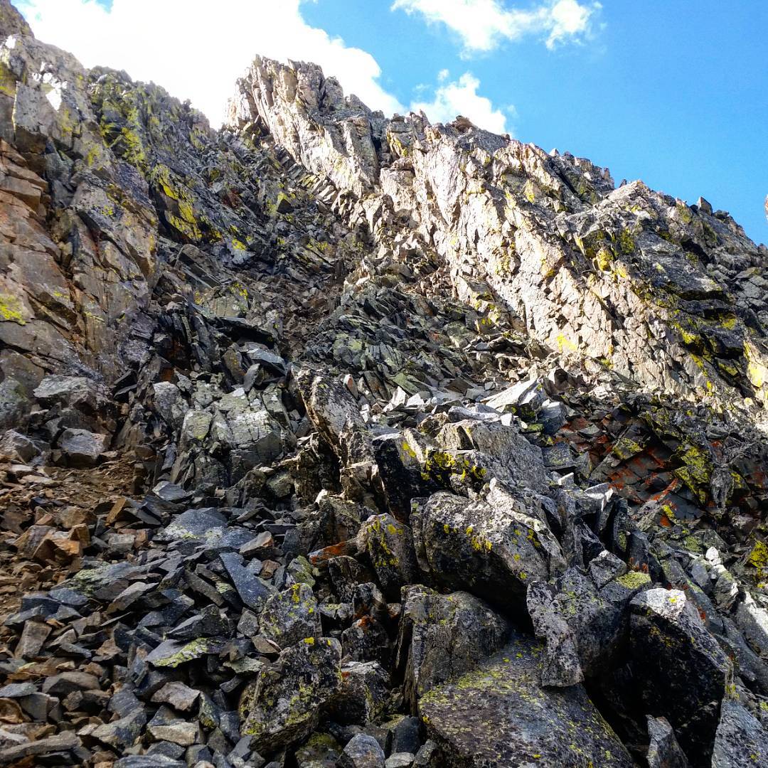
Ice Mountain’s crux. Ohhh scary! From some online route descriptions, you would think that Ice is somehow this hellish death trap of a hill. But it’s not, it’s fine if you’re prepared. These route descriptions must be written by people who dislike the very activity they’re trying to encapsulate, I swear to you. Word to the wise: find a fanatic to give you intel on the chosen subject, and not some out of the loop curmudgeon. Today saw summits of Ice, N. Apostle, and Huron, for 9 peaks, on 3 days.
Later: Chaffee County 390 – Mayflower Gulch
Three peaks in one day isn’t too bad. 42 miles to Leadville, then up to Mayflower Gulch to get myself ready for Sherman et al in the morning. Mayflower Gulch is not a picturesque place and I don’t really trust the water there. I practically bivyed in an old prospect hole. Not a highlight place to bivy, but whatever.
Day #41 (August 27th, 2017):Peerless (bonus!), Horseshoe, Sherman, Gemini (bonus!), Dyer
A nice, “easy” romp to tag three Centennials I was counting, plus another (Gemini) which isn’t on the official list, but seemed silly to pass by. I had first done Gemini quite a few years before, and it was nice to come back in very different conditions. The next year, I’d yet again visit Gemini, as well as all these other mountains in my Mosquito/Tenmile traverse, where this day sort of acted as a, “didn’t know it at the time”, recon for.
No real surprises – all these peaks are pretty easy. Being a Sunday, they were also very busy. I usually shy away from crowds, but it was a nice change of pace, and I was able to pet a ton of dogs.
Later: Mayflower Gulch to Mount of the Holy Cross TH
Yet another visit back to Leadville. Spent the night at the hostel to eat a ton of food and repair gear. I don’t think I even slept in the bed I rented.
The next day (Monday, Day #42), I rode out to the trailhead for Mount of the Holy Cross. There is an option to take the Colorado Trail, starting at Tennessee Pass, but I just don’t know if it’s worth it, unless you want to make some miles, and it’s the middle of the night.
Remember the gravel ride up to from the highway to the trailhead being particularly hot and unbearable – they’ve clear cut a lot of the beetle-kill lodgepoles which has dramatically changes the feel of this ride. Happy that the road finally ended! Bivyed a little above the TH itself, on some sloping ground.
- Week #1: Boulder – Sierra Blanca Group
- Week #2: Crestone Group – Lake City
- Week #3: Cinnamon Pass – Molas Pass
- Week #4: Weminuche + Wilsons
- Week #5: Telluride – Antero
- Week #6: Antero – Mount of the Holy Cross TH
- Week #7: Holy Cross – Capitol Group
- Week #8: Castle Group – Grizzly Peak (A)
- Week #9: Democrat Group – Finish!
