Like this? Follow me:
Centennials Summited (6):
- Dallas Peak
- Teakettle Peak
- Mt. Sneffels
- Wetterhorn Peak
- Uncompahgre Peak
- Mt. Ouray
Total Mileage:
- By foot: 41.1 miles, 17,815′ elevation gain
- By bike: 249.1 miles, 27,561′ elevation gain
Day #28 (August 14th, 2017): Rock of Ages TH -> Mill Creek
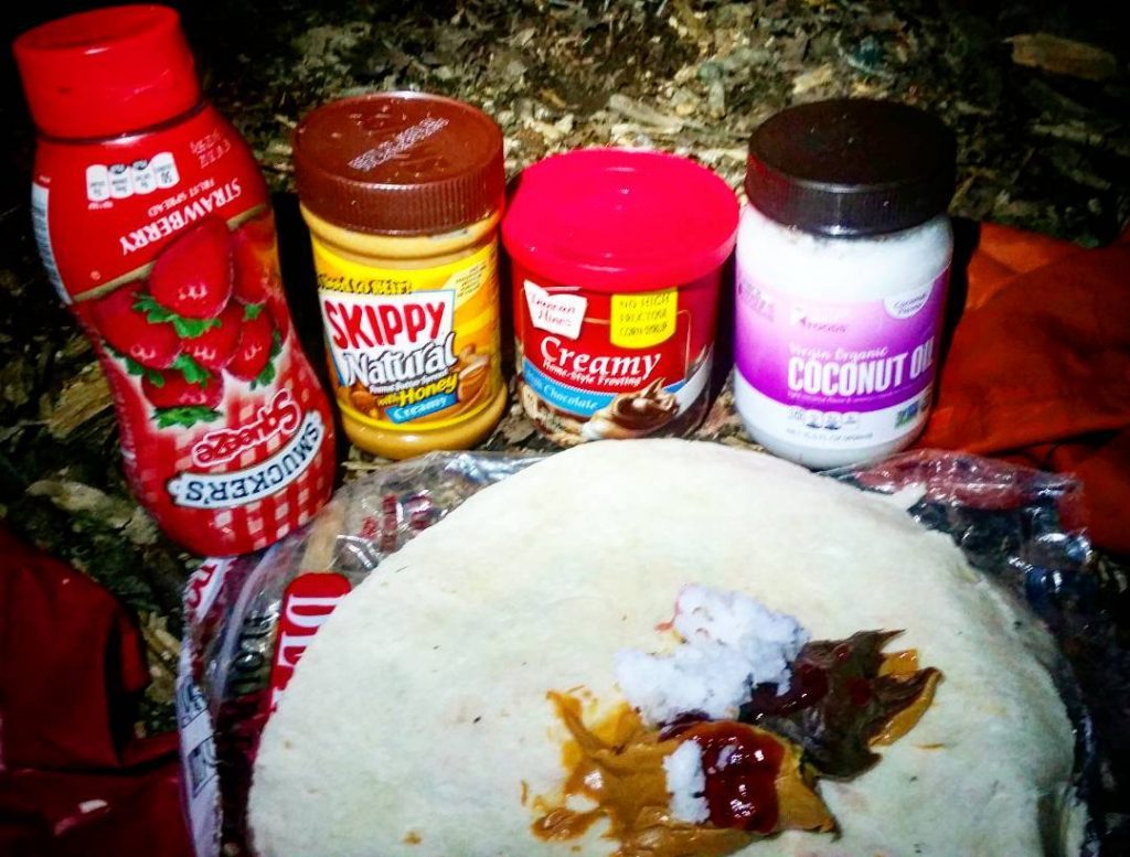
The four peaks of the Wilsons was a pretty big day, and I finished a bit after dark started settling in. Rather than ride the narrow-shouldered highway road to Telluride at night, I called it at the trailhead and made camp – having one of my signature burritos made of peanut butter, coconut oil and any manner of sugary sweetness I could source from the small grocery stores.
Delicious.
The next morning, I rode to Telluride – that main highway always seems to be in some sort of less than ideal state, and the same construction I hit in 2014, I again hit in 2017. Stressful. No real alternative route, though.
There are two small grocery-like stores before you hit Telluride; one near the ski-area that’s a bit more like a well-stocked gas station, and another that’s a little more like a country store. Not the worst idea to fill yourself up with cheap food, before hitting Telluride, where your selection of economically priced anything will be bit thinner. The actual grocery store in Telluride is awesome, and you’ll find anything and everything there. Reminded me very much of a Dutch-style grocery store: small, well thought out, good selection, but a little on the pricey side. People in Telluride are mostly friendly, but a very different feel than SIlveron/Lake City.
Telluride also has an honest to goodness bike shop. I failed to stop in, since my sleep deprived thinking was: if my front wheel is doing OK now, it’ll do OK over 13,000’+ Imogene Pass too, so don’t worry about it. But, it’s there, and it’s one of the only bike shops in the San Juans.
Good coffee to be found at the fancy hotel too – lots of places to plug in electronic accessories.
Camped a little up Mill Creek trail in a large meadow (or actually just off of a large meadow, in some trees. Trail is mostly rideable up to that point, although you can’t ride too much farther without hitting Wilderness.
There’s a bit of local drama regarding camping in Mill Creek; Telluride has a colorful home-lacking population, so you may run into some long-term campers before hitting the trail itself, on the road leading to the reservoir. Wave hello!
Day #29 (August 15th, 2017): Dallas Peak
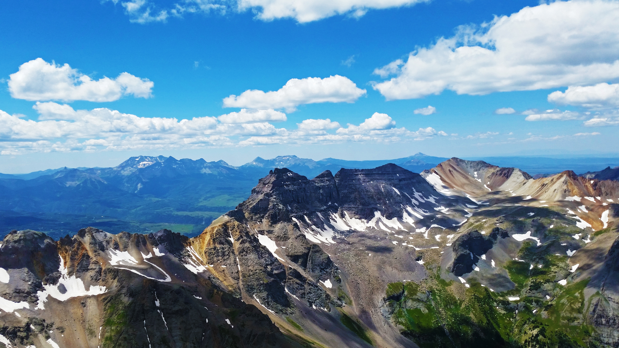
Highlight day. The trail up to Dallas is in amazing shape. Once off-trail, it’s a bit of a grovel, but the scrambling is pretty fun on fairly solid rock. The last pitch is the technical crux and you’ll find yourself in a fairly amazing position of big exposure.
I employed my strategy of just climbing up until I felt 110% chill on the terrain, then climbing down to do it all over again + a few extra moves, until I made the summit. Down climbing is usually harder than climbing up, and one of my fears was always getting stuck or forgetting my beta. Climbing is relatively easy (but still technical), but given the amount of exposure and having not seen anyone all day, a fall would be less than ideal.
The Class 4 gully pitch, I thought, was actually much harder than the summit pitch if you’re going solo. Certainly took more time for me to suss out. Would definitely repeat this climb. I haven’t found any beta on accessing Dallas from the north, although if you could, there would be potential link it up with Sneffels.
“Potential” is the keyword, though.
See the blog post, What Are the Most Difficult/Technical Parts of The Tour of the Highest Hundred?, (written before the trip)
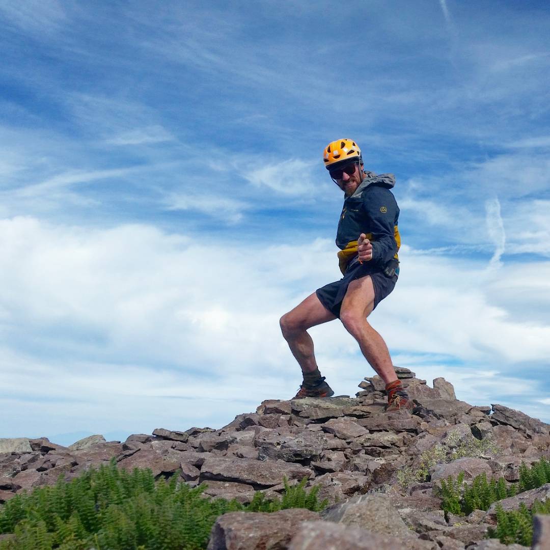
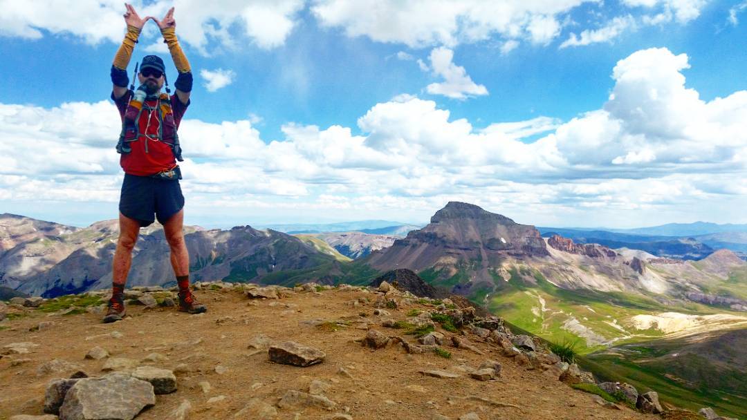
Shoot from the hip! In (erm, “on”) Dallas Peak! The lowest mountain on the Centennial list, but having the highest technical climbing grade by its standard route, Dallas proved a wonderful objective this morning. Approach wasn’t too bad, and the climbing proved easy enough if you employ some old school climbing moves: chimneying, a hand jam or two and a nice reachy stem will get you up and over the Business. Crux for me honestly was the Class 4 approach gulley – downclimbing that sucker meant hugging a round boulder, while stepping down and to the right blind, while moving your left hand down to a hold you hope was there. Who’s got two thumbs and is happy to have long legs? This guuuuuy. Speaking of legs, manage to jog down the buffed trail for the first time in forever. Happy! Onwards to Sneffles and Teakettle over 13,000+’ Imogene Pass!
First, coffee! .
Later: Mill Creek -> Camp Bird via Imogene Pass
Dallas Peak was a nice start for the morning, but the real meat of the day was to get over Imogene Pass. I remember spending a bit too much time back in town doing my recharging routine and eating most everything in front of me. I think the ride up Imogene is one of the highlights of the entire trip, being one of the highest passes one can ride up – not just on this trip, but in Colorado, and maybe even the contiguous lower 48.
The last few miles were, for me, a hike-a-bike, being pretty gassed. The north side of the pass is much more rockier than the south side.
Made it to a bivvy for Teakettle and Sneffels, happily. Tomorrow would be a pretty huge day, but I was thoroughly enjoying myself at this point, and happy to be getting the San Juans done.

Day #30 (August 16th, 2017): Teakettle/Sneffels
Teakettle was a fun peak, with the worst approach you can imagine. The scree slope up to the black gully really has to be experienced to understand the suck.
The crux summit pitch seemed very short. Bootied a purple BD cam that was almost reachable from the start of the pitch (ie: useless). I put it back, ’cause I had no use for it, and wasn’t about to mail it back to myself when back in town.
Summit itself is just about big enough to stand on. Reversed the last chimney pitch to get off. Fun start of the day.
Next was Sneffels. Side hilled across in an attempt to save time, but looking at the track, I doubt I did – just saved a little elevation gain/loss, except via worse terrain. Doing it again, I would just drop down to the road again.
Sneffels’ scree slope up also isn’t all that fun, but it was an improvement over Teakettle. Not big issues summiting.
Obligatory, “I’m in the handle of Teakettle Mountain and I’m totally shirtless!” movie moment. .

Day #30 + 31 (August 16th + 17th, 2017): Camp Bird -> Matterhorn Creek TH via Engineer Pass
A “quick” stop in Ouray to grab food at the grocery, sample some enormous burger at a restaurant, and hang at the coffee/chocolate shop before night engulfed the town.
The road out of Ouray has huge dropoffs and practically no shoulder, so be very careful. Once you turn on the Alpine Loop, I ran into yet another gruff ATVer that thought I was a complete idiot for doing what I was doing, especially since I explained my destination was Lake City. I didn’t tell him about the mountains between Ouray and Lake City I intended to summit beforehand, but that kind of stuff is on a Need to Know basis. The grumpiness of some ATVers is almost cartoonish.
Engineer Pass is another highlight of the bikepacking part of this trip, and is a much, much larger portion of the day, than the actual hiking/scrambling was if you look at elevation gained or hours on the road. Make sure to calculate the riding – rarely is it ever a gimme and usually it’s going to Kick. Your. Ass. It’s a tough route, but the all-road ride alt. is almost 70 miles!
Camped a few clicks before Engineer Pass proper in the great wide open. A little cold… but great star-gazing conditions. Found a hand knit hat a still own – “The Trail Provides”. Woke up fairly early to summit Engineer Pass and rocket down the back side. I still needed to get to my intended trailhead for the day and summit Wetterhorn and Uncompaghre. Big day!
After a quick stop in Ouray for a Maggie’s 420 burger, it was back on the Alpine Loop en route to visit the last two mountains on my list – Wetterhorn and Uncompahgre. I almost couldn’t believe that I – and all my gear had survived the San Juan Caldera of ~2 dozen mountain summits! I started on the track at dusk, and within a few hours, the cloudless sky and new moon revealed an almost perfect black velvet tapestry of inumerable stars stroked with the Milky Way. A late night pedaling slow and pushing slower, happy to be alone in this mountain landscape. Made camp at treeline and enjoyed stargazing and shooting star counting until sleep befell me.
Woke up and stumbled the last few switchbacks up Engineer Pass, rocketed down the other side and slowly gained altitude to the Matterhorn TH for the long day of hiking those two last peaks .
Day #31 (August 17th, 2017): Wetterhorn/Uncompahgre
Wett/Unc is a fun linkup, although still feels inefficient/long @ ~17 miles. I would love to recon a direct way back to the trailhead after finishing up Unc., but the direct link is blocked by a foreboding-named, “Broken Hill” that has kept me away from just onsighting it on trips like these. I also always get suckered into attempting to cut the approach to Unc. a little ways, and just end up in some terrible talus field going molasses slow. The trail at that point is very fast, mostly runnable.
I’d suggest to start these two mountains fresh, bring little extra, and trot what you can.
Uncompahgre’s summit sports a serious drop off, tall enough to easily use as an exit point for base jumping. I’ll miss these sorts of precipices once on the gentle giants of the Sawatch. .
Day #32 (August 18th, 2017): Matterhorn Creek TH -> Lake City
Spent the night near the TH – a little ways into the main track, there’s some damn good camping, and I took up a 10+ person campsite all from myself.
In the morning, I rode to Lake City, and booked myself back into the Raven’s Rest for the rest of the day to clean/repair the bike, eat enormous amounts of food (ate a dozen eggs worth of bacon breakfast burritos) and generally confuse the backpackers staying there with how long I sat around mending all my gear, rather than enjoying the amenities of the town (Movie theater! Soda fountain! Booze!). I had some much stuff to fix, I didn’t even enjoy a shower – I’m not sure I even slept in the bunk I rented!
Day #33 (August 19th, 2017): Lake City -> Marshall Pass
Finishing the San Juans was, to me, a conceptual half-way point of the trip. Time-wise, at least. The number of mountains I had summited wasn’t even close to half, which can make one nervous, but I knew I could crush through the next big target: The entire Sawatch range.
But before I could start cruising up those gentle giants, I had to get there. My route back east was an amalgamation of the Colorado Trail Wilderness bike detour and the GDMBR/Tour Divide route – and funnily: from Raven’s Rest to the summit of Marshall Pass, it was almost exactly 100 miles. Inter-range rides seemed to always be a doozy. I describe more about this route in my post, GDMBR Detours: Lake City Linkup.
Getting out of Lake City is a huge climb on pavement, followed by a huge descent on gravel road. There is another climb before Marshall Pass proper, but it’s very much dwarfed by the hill just getting out of town – you may fail to even register it as anything but a bump!
Remember being pretty thirsty once I hit the GDMBR portion of the trip, so make sure to stock up on water before the water gets too… cattle grazing-y.
I was pretty mentally out of it as I got to the base of Marshall Pass. There’s a very strange restaurant/store/campsite at Sagents, which essentially makes up the town. Stopped in for a fairly forgettable burger.
I guess my mental destruction wasn’t apparent, since a few people wanted to strike up a conversation with me while I was in full zombie mode. The two people had some part in running the Iditarod Trail Invitational, which was really cool and all, but I just wasn’t in the greatest mood to be stoked by it and they didn’t seem to take my cues of wanting to eat alone.
They wanted to know why I never had raced the Iditarod, or wasn’t planning to. It’s hard, you know?: when the reason is, “it’s really fucking expensive!“, when you talk to people like race directors. I thought what I was doing was so incredibly cool that doing the Iditarod wouldn’t really stack up. I guess I make no apologies for that!
Marshall Pass is a long one, and I finished the ride pretty late in the night. A large group were camped at the trailhead and had literally taken it over (there’s bathrooms). They were none to happy with my presence, but I wasn’t taking any of their shit that night.
I had to literally walk through their camp to get to the trailhead proper. As I started hiking up past the trailhead to find a quiet place to pass out, some dude followed me up to ask what was going on. I told him none of his g.d. business. I honestly didn’t care what he was up to (looks like drinking and camping – cool), and he had no right what so ever to ask me what I was up to.
Passed out under some trees.
Day #34 (August 20th, 2017): Mt. Ouray
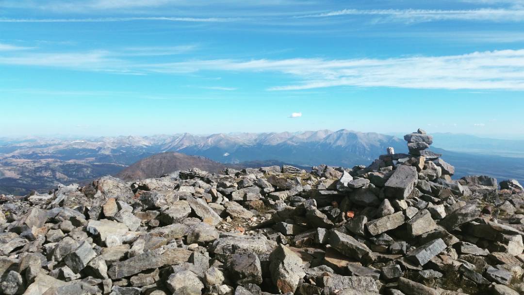
Rando paranoid out-of-towners aside, the quick hike up Ouray was a nice intro to the Sawatch, as you can see many of the peaks you’ll be visiting in the days ahead, in one fell swoop, from the summit. Marshall Pass is the standard approach to Ouray, but if you’re looking for something a little quieter, consider the alternative route I described in my recon trip: Ouray and Chipeta.
I quickly forgot the dramz from the night before, and anxiously looked forward to the ride down Marshall Pass, down the highway, and to SALIDA!
Later: Marshall Pass -> Antero
From the top of Marshall Pass it’s almost a no-pedal affair down a very popular/busy Marshall Pass Road, then to the highway, and then to Salida. I finally, finally stopped at Absolute Bikes to talk wheels. Intelligently, they didn’t want to touch the damn thing, as nothing they could do would make it better, and most likely could make things much worse. I could get the wheel rebuilt, but I felt I just wanted to keep moving forward. The next bike shop was just in Buena Vista. I was out of the woods when it came to bike shops, so might as well risk it.
After far too many burritos and coffee from far too many different locations, and a quick stop at the grocery store, I pedaled up the road to Mt. Antero! The main road works well enough, but there is also a side road that’ll afford you a little more dirt if one desires – ride as if going to the CO Trail, but don’t turn onto the trail itself – rather: take the Narrow Gauge Trail.
56 miles is quite a jaunt from mountain to mountain – especially in this range, but the plan was to tag four peaks the next day, which seems to justify the distance. There are closer trailheads to get to Shavano/Tabeguache, but with prior scouting, I decided to link those two peaks with Antero and Cronin. See: Shavano/Tabeguache, Antero/Cronin Recon.
- Week #1: Boulder – Sierra Blanca Group
- Week #2: Crestone Group – Lake City
- Week #3: Cinnamon Pass – Molas Pass
- Week #4: Weminuche + Wilsons
- Week #5: Telluride – Antero
- Week #6: Antero – Mount of the Holy Cross TH
- Week #7: Holy Cross – Capitol Group
- Week #8: Castle Group – Grizzly Peak (A)
- Week #9: Democrat Group – Finish!
