Like this? Follow me:
Centennials Summited (13):
- Pigeon Peak
- Turret Peak
- Jupiter Mountain
- Windom Peak
- Sunlight Peak
- North Eolus
- Eolus Peak
- Jagged Mountain
- Vestal Peak
- Wilson Peak
- Gladstone Peak
- Mt. Wilson
- El Diente
Total Mileage:
- On foot: 98.1 miles, 42,073′ elevation gain
- On bike: 42.7 miles, 5,342′ elevation gain
Day #20-24 (August 6-11th, 2017): Weminuche Throwdown
Much of this week was done in a long fastpack I dubbed the, Weminuche Throwdown, which I’ve documented in my blog post, Fastpacks From Hell: The Weminuche Throwdown.
This could rightfully described as the crux of the trip and took five days to complete. Atypical of the majority of the peaks in this project, the peaks in the Weminche don’t enjoy the same ease of accessibility. Approaches are long, and mostly off-trail. It’s an incredible place.
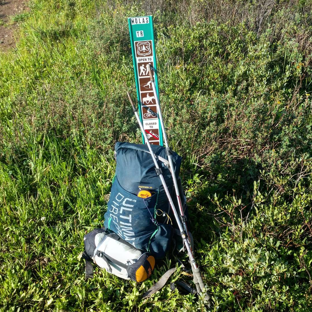
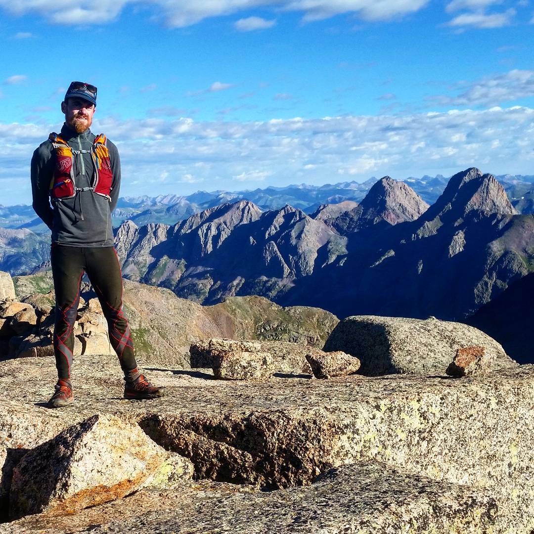
Using a phrase that Gerry Roach, eminent guidebook author, so often uses for his route descriptions: “The introduction is over“. The Weminuche Throwdown starts here almost at the top of Molas Pass. A 5-7 day out and back unsupported thru-hike in Colorado’s largest Wilderness area – mostly off trail over extremely rough terrain to summit 9 Centennials: Vestal, Jagged, Pigeon, Turret, Jupiter, Windom, Sunlight, North Eoulus, and Eoulus.
Of all the audacious linkups on my trip, this is the big one. Going in solo, and only bringing along what I can fit in my Fast Pack 35, I’ll try to summit all 9 peaks, before I run out of food, evade injury, and/or exhaustion. The majority of the peaks I haven’t ever been to, and two of those summits require technical, Class 5 climbing. I’ll be doing it all solo.

Vestal Peak!
The first Centennial I pass. It’s soaking wet, and the premiere route on it, Wham Ridge, is out of condition,as a hail storm just blew in – large enough that I took refuge under my tarp and napped for two hours as it blew through.
I pass the mountain, as I’ve designed my route as an out and back, trading efficiency for flexibility, in case of just such a scenario. I’ve decided NOT to hike the train tracks back in my route design because of legal reasons (trespassing on the railroad’s right of way), but this decision adds thousands of extra feet of elevation gain on rugged, trail-less terrain over many mountain passes. Will my gamble pay off, or will I find Vestal Peak just as wet and dangerous to climb in a few days time? Moving on, I crest the first unknown-to-me pass south towards the Chicago Basin.

Night slowly sets in – the days are already getting noticeably shorter! The relatively undocumented pass between Vestal and West Trinity goes and I drop down into one of the many, many narrow basins that define the Weminuche.
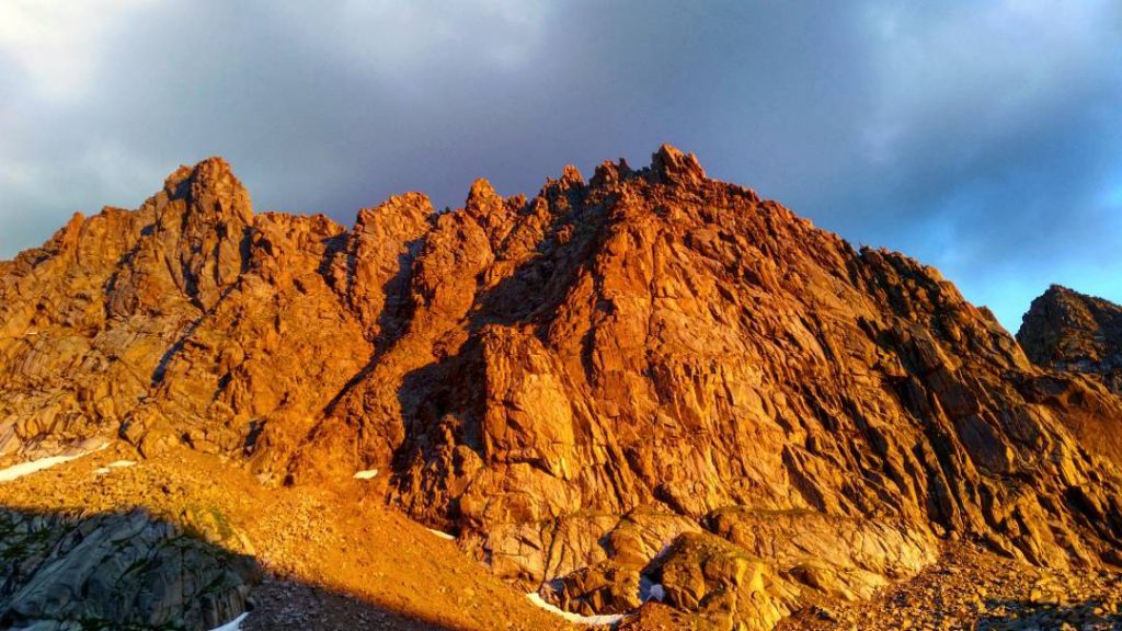
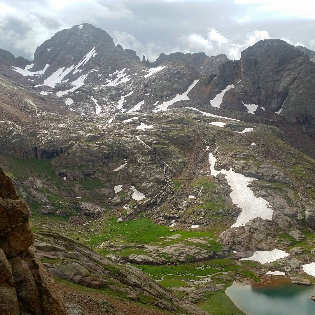
Although soaking wet and somewhat miserable, the storm clears the sky, and I’m beginning to be treated to some of those payoff views I’ve been so hungry for in the past weeks of deplorable, morale-destroying, socked-in peak bagging while in the rain and clouds. This is truly one of the most beautiful areas in Colorado, rivaling anything I’ve ever witnessed: hidden by the long approaches that thins the crowds to a slow drip of seekers of this overwhelming allure. Here, the backside of Vestal Peak, and the Grenadier Range.
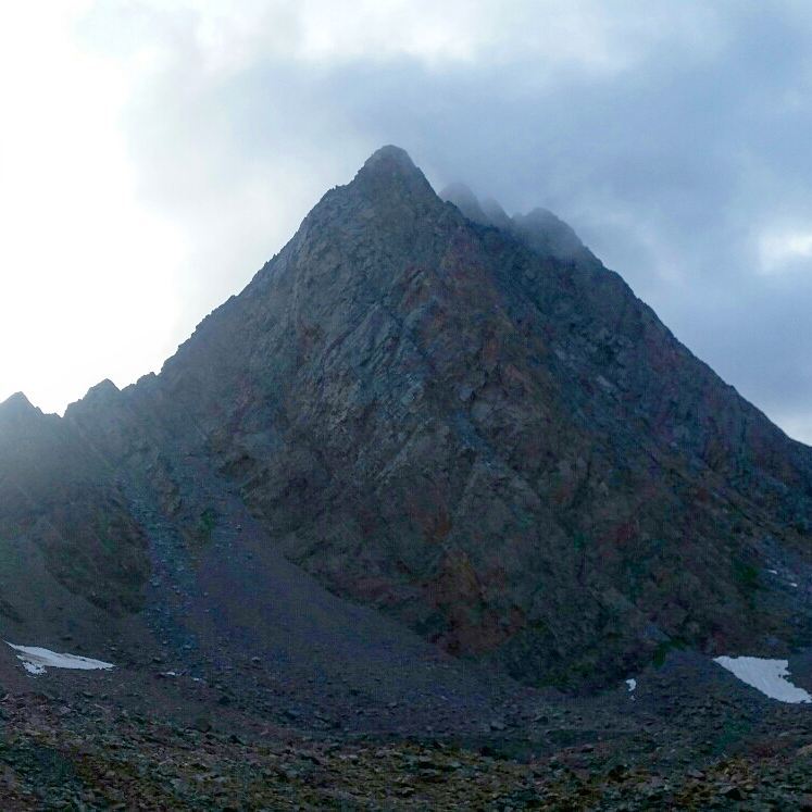
I climb up to lower Ruby Basin, drop down, hike a few miles and find the steep hike up the col between Pigeon/Turret. Pigeon looks like a slightly longer route, so I choose it first. The route turns out to be severely convoluted: once you crest the 13,000′ col., you have to drop down the backside of Pigeon to 12,200′ on terribly loose terrain, just to then hike back up and around to 13,800+’ to summit. All this because of an impenetrable wall of vertical cliffs, with no known sneak through. As a formation, it’s absolutely impressive, but it adds few thousand feet vertical more hiking than I expected.
Thankfully, I beat the night back to the col. Turret is far more direct, and even at night with an overpriced and underpowered head torch, it’s a simple boulder hop – even fun! Getting down the col, through the basin, hiking back up to Upper Ruby Basin is a test of will, and I constantly consider crashing underneath one of the many overhanging boulders I need to negotiate towards my actual camp. But, I’m anxious to find out the damage done to my campsite by opportunistic animals. I beat Midnight to camp by minutes, and find everything in a perfect state. I won the wildlife lottery.
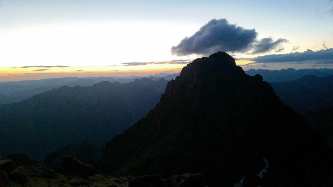
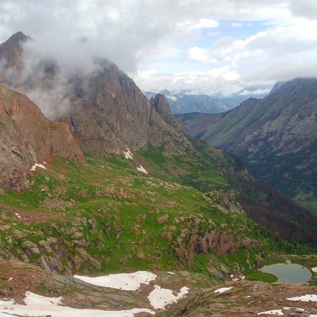
Here: Pigeon from Turret. Even in late evening, I’m overwhelmed by the scenery as the weather very delicately holds.

Day #3: a late start, because of a late night. I find Twin Thumbs Pass exists, and it goes! Elated. On the other side: The Chicago Basin. I successfully took what must be one of the hardest/ridiculous routes to the area. Since I’m only self-powered, the D&S train and mild hike in were off the table from the beginning. My joy is somewhat tempered by the fact I’ve got 5 Centennials to summit *today* and these three days of hiking have to then be reversed in *two*, plus the two technical peaks. Weather looks questionable, but time to drop in and see other people for the first time in two days

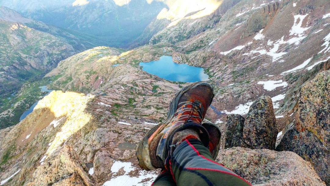
Summit of Windom Peak. It sounds apocryphal, but the Chicago Basin just doesn’t compare to the beauty of the other parts of the Weminuche – the mountains here seems too bulky and out of proportion when compared to the delicate if not jagged Needles or the jaw dropping sweeps up the Heavens of the Grenadiers; the lakes too shallow and diminutive. Yet, it’s much more popular – by far. Why? Access is just easier. If you don’t seek out something off the more sensible path, you’ll just never know. Given that, my favorite summit view is from Windom, looking over the Needles, the Grenadiers. Beyond my reach is traced my route back
Summit of Sunlight. Weather holds, and I make this summit before evening. Everything is wet, but I’ve got two Mutant best friends that have been through Hell with me and my footing is solid on the Class 4 terrain. Two more peaks before I get to rest.

Summit of Eolus! Just about midnight. My memory is fuzzy, and I decided to summit the two Eolus’s last, thinking they’re walk ups- they’re anything but. I skitter out and back on the fabled knife edge of the Catwalk under a full Moon and shooting stars. It’s a sensational position to be in! But everything otherworldly is also temporary. I need to get down before I lose all hold on reality – I’m past my capabilities in endurance (as hard as that is to believe).
I turn on some jams and march down with authority. Finding the first flat-ish spot below the, “no camping” sign, a thousand or so crippling feet lower than I would have wished not to lose, I use my tarp as a ground cloth, and throw my sleeping bag on top of that.
I manage to prepare my staple meal for my entire trip: a peanut butter, jelly, and coconut butter burrito, and pass out fairly quickly. It’s past 1am. I hope to sleep in until 7:00 am, but of course it rains, and with the tarp under me instead of over, I’m unprotected. But I wake up stoked: 7 down, the two hardest peaks to go – only a few thousand calories left packed to do it. I can will my way through most anything, but my destiny is up to Zeus.
Day #4: From the campsites in Chicago Basin, I pack up, and head towards Twin Thumbs Pass once more. Hard to leave an area I just reached, having taken so long to get to, but I’ve still got two technical peaks left, and they’re not exactly close, or over easy ground. Food isn’t running low, but the indulgent items – cheese, etc, are gone.
My pace up is painfully slow, as other hikers start passing *me*. I can now fit my sleep kit inside my pack, rather than outside, which makes the Fast Pack 35 looked equipped as a day pack. People comment as such. If you want to go far, go without.
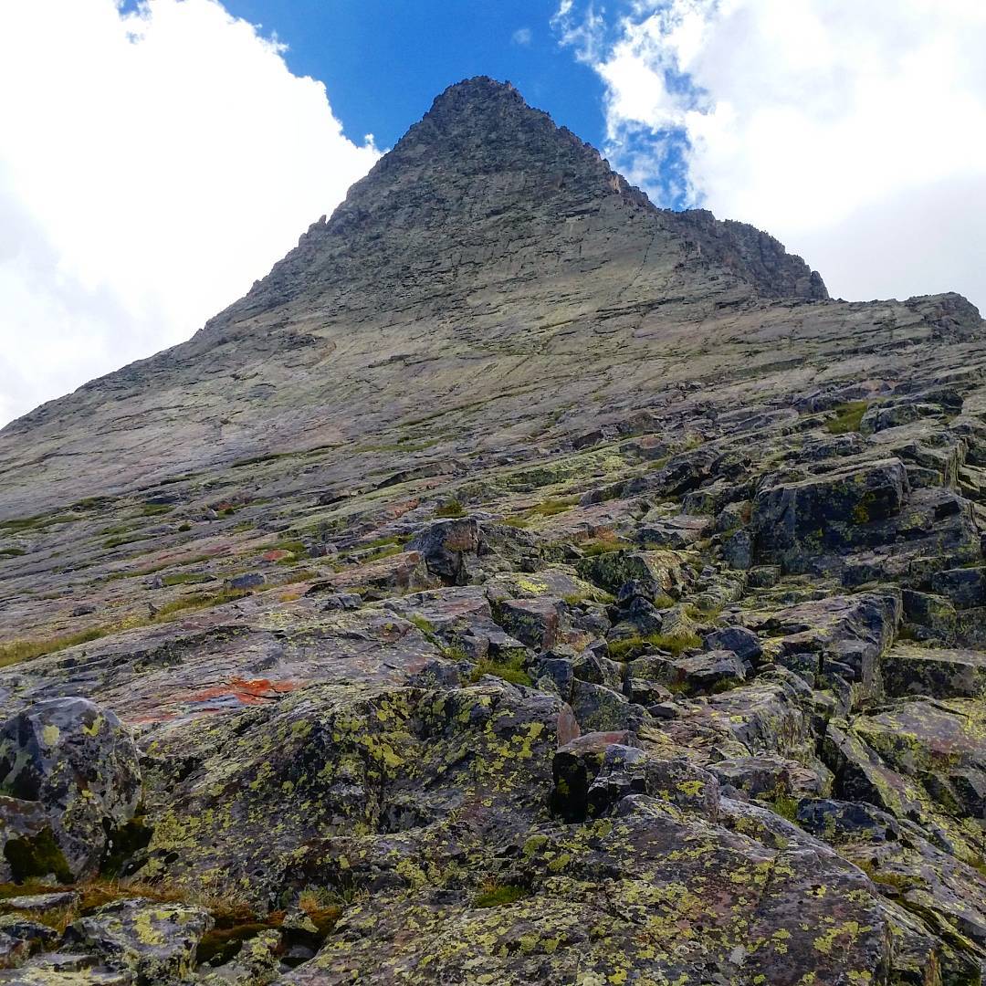
I make it up and over the pass, down into the basin below, and finally into Upper Noname Basin where my route splits again. One pass leads to the trailhead, the other is Jagged Pass. Jagged Mountain looms above – an awesome sight. I feel it’s too late for a summit bid, and my legs protest just looking at either pass as I crumple onto the wildflower-laden tundra.
The weather is perfect, but I’m out of everything I’ve got. I make camp at 2pm and nap, which turns into a full night’s sleep until my 4am wakeup call. I hope my legs recover, the weather holds, and Jagged allows me to summit. It’s a tall order and I feel nervous I’m letting an atypically perfect afternoon go with my downtime. I’ll only know the outcome of my decision tomorrow. My sleep kit has been working perfectly, even at these > 12,000′ camps – I couldn’t be more happier with such solid gear.
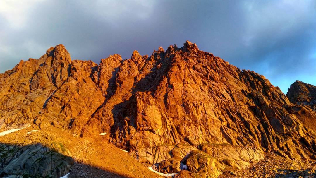
I woke up from my prolonged slumber to catch the evening alpine glow on the South face of Jagged Mountain. Jagged is so close, it took up my entire view. As if the world was on fire.
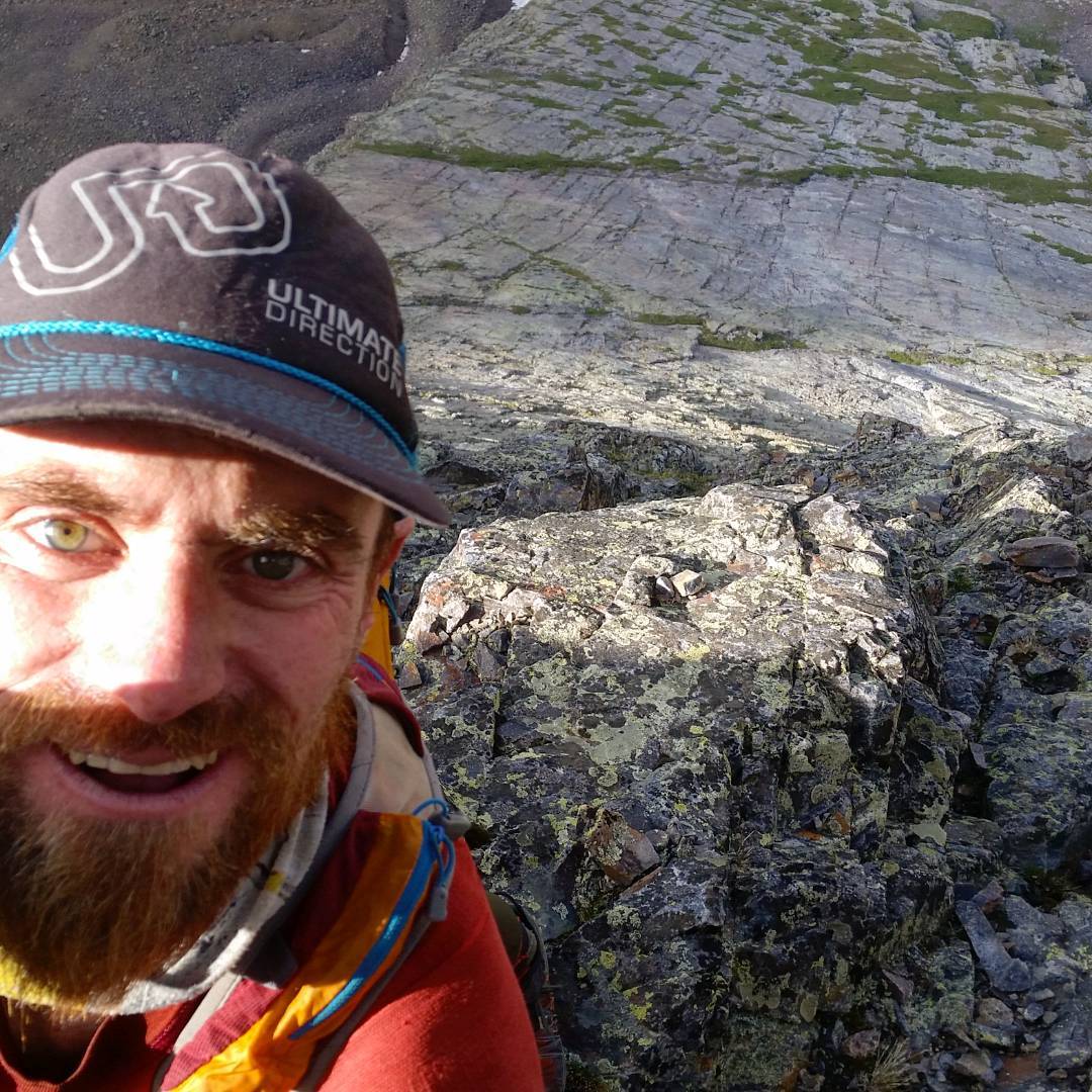
Summit of Jagged Mountain in absolutely perfect conditions the next morning. My luck hadn’t run out. Behind me, the Grenadiers and my next peak: Vestal. As casual as the technical sections are, I’m literally miles from nowhere, and screwing things up would not be good. Getting into the climbing groove took a bit of a warmup, but once in it, I felt confident.
Still, for each technical section, I would climb up, then downclimb the section, then climb up again – wiring the moves. Being primarily a boulderer in training – and a fairly mediocre one at that, it was natural to think of each section as a separate problem, and remember the route’s moves using the bouldering shorthand jargon. Once wired, it was a breeze. The most dangerous parts of the route though were the gravel, the wet sloping grass, and the wet rock. That, I had no perfect defense against. Careful, Ranger

As much as I quest for summits, the valley floor can be pretty OK too. Bradley Lake made me wish I had an actual camera to capture all that was before my eyes. The water was that deep otherworldy turquoise I just couldn’t catch, perfectly mirroring the high peaks that totally engulfed the lake. No one else around to speak of.A John Muir moment. I was happy to stop for just a bit for lunch, after burning so much lean muscle to get here.
Wham Ridge, Vestal Peak. If I was anxious about Jagged Mountain, I couldn’t wait to hop on Wham Ridge, no matter the time of day or impending doom from above – THAT is an f’ing alpine route par-excellence.
Surprisingly, after Jagged, there was enough energy in my legs to make the arduous cross country trek to Vestal. A quick bite, a quick nap, a quick warmup dancing on the ledges below, and it was time to crush this thing. A steady diet of slab scunblingthe flatirons High Over Boulder is the perfect preparation for Wham Ridge, which itself looks like a megafauna, out-of-its-own-time version of the Third. A mammoth. The climbing was joyous and the position was beyond any words. As the face ramps up, the climbing just gets oh so much better, your brain almost gets too full of its quartzite bounty. Highlight scramble, I think: of my life. Doubly so to have onsighted Jagged that morning!
My risks paid off with this insane route, and I felt all the stars align- I had done the improbable: 9 Weminuche Centennials in 5 days! And I rode a bike from Boulder to get here! Sometimes you overwhelmingly surprise even yourself. With the stoke high and the jamz kickin’, I made the rest of the hike all the way to the Animas River, where I found my stashed Redbull, a tiny patch of space to throw down the sleeping bag, and a few hours to sleep, before finishing up the very last few miles to be reunited with my bike. That night, it wouldn’t rain. .

One more from up high on Wham Ridge. That view defines awesome. A literal high. All that shit weather to endure: worth it.
After 5 days, and one half hour in total, I finished my hike out of the Weminuche completing my goal of summiting the 9 Centennials found in the area.
Having consumed most all my food, my pack appeared far more diminutive in volume than one would expect for such a thruhike – just my sleep kit, trash, some batteries, and a toothbrush really, left inside.
I walked briskly to the local campsite, where my bike was being held for me – I really want to thank the camp hosts for keeping an eye on it! (Doug!) The biggest link up of Centennials for my project was complete! And the San Juans were slowly getting chipped away.
Onwards to the Wilsons!
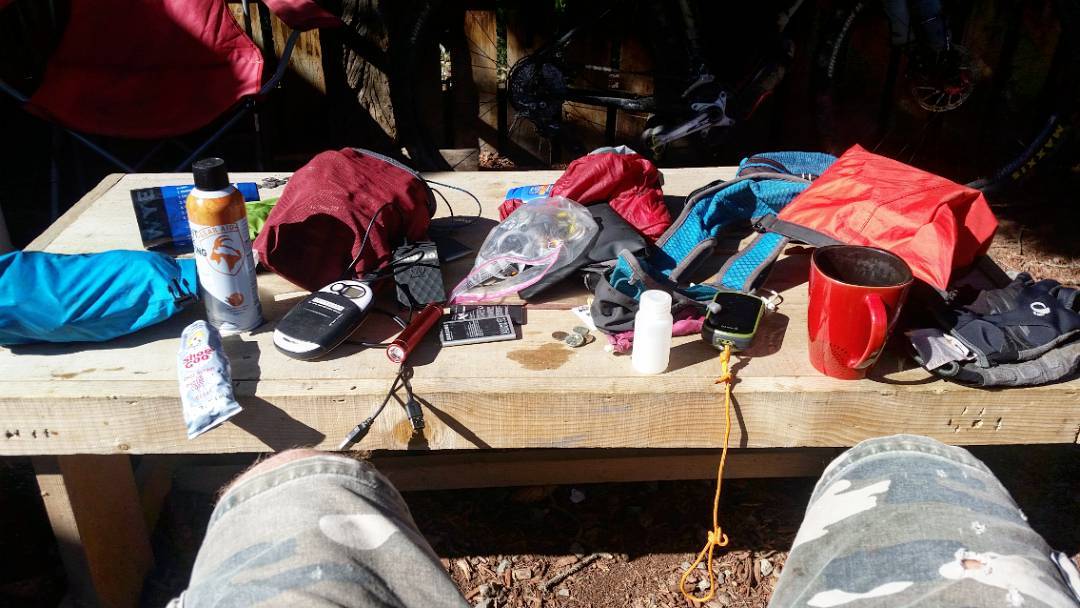
The slightly less glamorous side of a two month adventure: sorting gear, charging batteries, repairs, organization – and a little downtime goes a long way in allowing the legs to recover and maybe get stronger for the second half. Gotta run a tight ship, you’ll save time in the future.
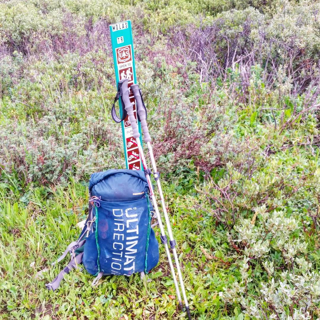
Day #25 (August 11th) Molas Lake to Silverton
Back to Silverton for some rest after this quick, mostly downhill cycle down. The only other thing I did today was hike the CT from the Animas River.
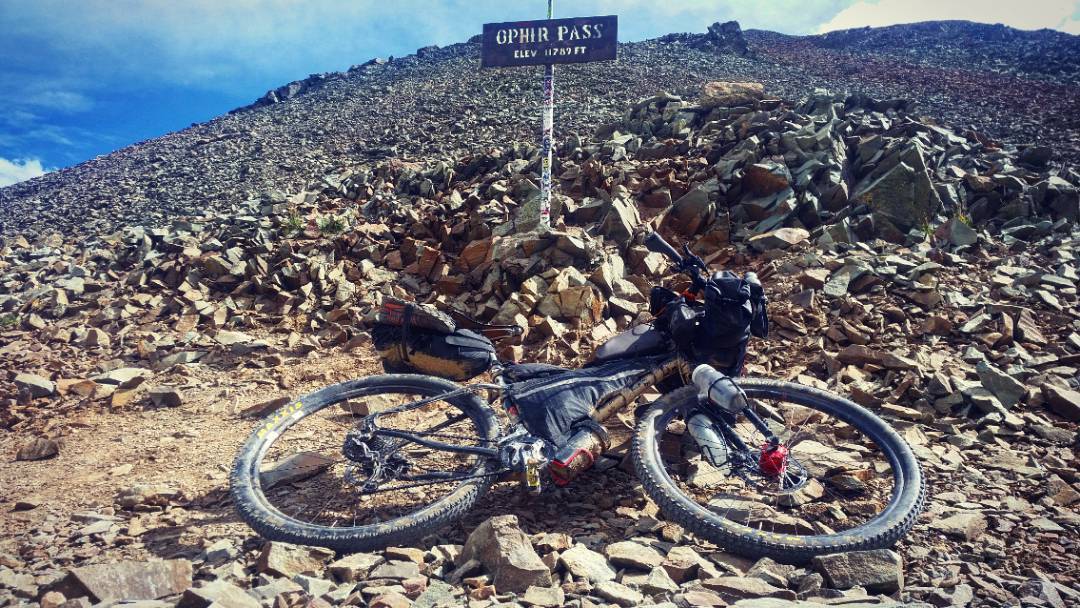
Day #26 (August 12th): Silverton to Rock of Ages Trailhead
A fun ride to Ophir (At least) to the WIlson Group. First real test of the front wheel to see if it would hold up against the rough ATV trails. Seemed alright.
Good camping at Rock of Ages. Lots of peaks for the next day, but my depression had completely lifted and I couldn’t wait to tackle more peaks.
Day #27: (August 13th) Wilson Group
BIG one-day linkup of Wilson Peak, Gladstone Peak, Mt. Wilson and El Diente. Ridge between Wilson in Gladstone was really fun, although I got stuck in a lightning storm right before summiting Gladstone.
The gully I used to descend towards Mt. Wilson was seriously dangerous, and not something I would suggest for a casual hiker. The Wilson – El Diente traverse was much harder/longer than I remember; I might have been slightly off route going down El Diente. I’d consider perhaps doing this in the reverse order than I had done for a better experience.
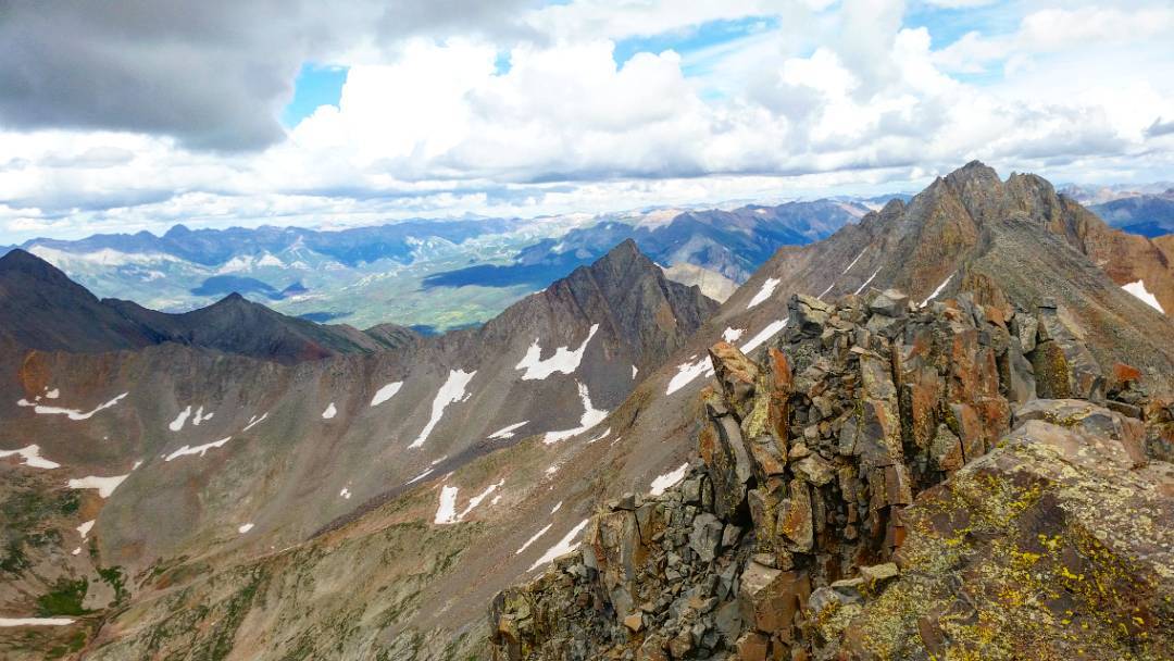
Greatly underestimated the 4 peak circuit that makes up the Wilson Centennials.
After a mile, route turns into a wide variety of choss, just doesn’t relent. Approach up to the Rock of Ages saddle straightforward enough, but footing is never pleasant on the road made of talus.
Wilson Peak is filled with rocks just waiting to crumble underneath you.
Wilson Peak.-> Gladstone traverse was all new territory for me; rarely done. Certainly the highlight of the day- a mostly 2+ ridge scramble on rel. bomber rock. About 100′ from the summit, my progress stymied by a lingering thunderstorm I tried to nap through in a nook on the face. Made a mad rush for the summit, touched the rusty crowbar (crowbar!) that marks the summit, swiftly ran for cover as the hail storm started in earnest.
Descent path: the large gully closest to the summit passed on the ridge run. First: I dunno, footing was great, the rest: a bomb bay of widow-makers I found myself in the gunsight of. Worst choss-filled questionable descent route yet?
With slurry of quickly melting hail making everything just that more slippery… it’s in the running.
But as direct a path to the permanent snowfield as I could have wished, so thanks Mr. Suicidal Gully!
Weather couldn’t make up its mind, just seemed low energy, so onwards to Mt. Wilson! Good route up, fun scramble to the top. Scramble down for the Wilson -> El D. traverse. My (shoddy) memory informed me this will be a breeze, w/much of the traverse being below the actual ridge and could be time to put down the defenses.
Stupid Memory. Turns out there’s much scrambling on the crest of the ridge, making for some excitement! If only I wasn’t so sore, fatigued, tired.
Longed for some coffee. Part of me had a whole lot of fun up there and El D. summited. No toaster (toaster!) found, unfortunately. Memory and me were fighting, so figuring out the N. Buttress route down felt like an onsight and some of that Class 4 choss climbing near the top may have been off route. Rest was enjoyable. Long hike out. 9pm back at TH Another bivvy at the Trailhead. 38-> 41 ticked!
Easy day tomorrow?
- Week #1: Boulder – Sierra Blanca Group
- Week #2: Crestone Group – Lake City
- Week #3: Cinnamon Pass – Molas Pass
- Week #4: Weminuche + Wilsons
- Week #5: Telluride – Antero
- Week #6: Antero – Mount of the Holy Cross TH
- Week #7: Holy Cross – Capitol Group
- Week #8: Castle Group – Grizzly Peak (A)
- Week #9: Democrat Group – Finish!
