6/12/13 – 6/17/13

The trip’s itinerary was to hit up most all the 14ers in the path between Denver, CO and Alma, CO, taking the I-70 corridor to Breckenridge, and then HW 9 to Alma. Ambitious, as the routes picked weren’t the easiest, or shortest: Bierdtstat from the East Ridge, then over the Sawtooth to Evans, Torreys via Kelso Ridge – and then to Grays, Quandary via the West Ridge – and then a final push to do Democrat, Lincoln, and Bross. All in five days – all ridden to on a bicycle.
Leaving the Denver area at around 1:00pm for a alpine adventure is always weird, but my general theme in this trip wasn’t running out of time, it was what to do with the time I had. My goal for the first day is to ride up Evans, and camp around Summit Lake, to have a early-as possible start for the next day. Leave too early, and I’ll be at the Echo Lake Lodge, twiddling my thumbs, eating their food and reading my book for far too many hours.
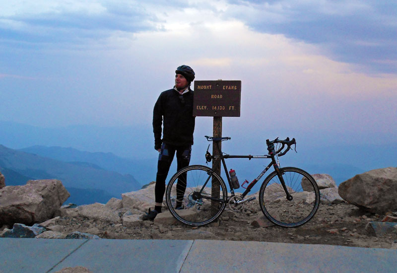
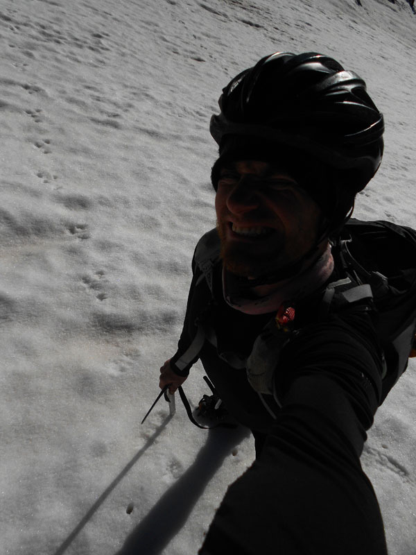
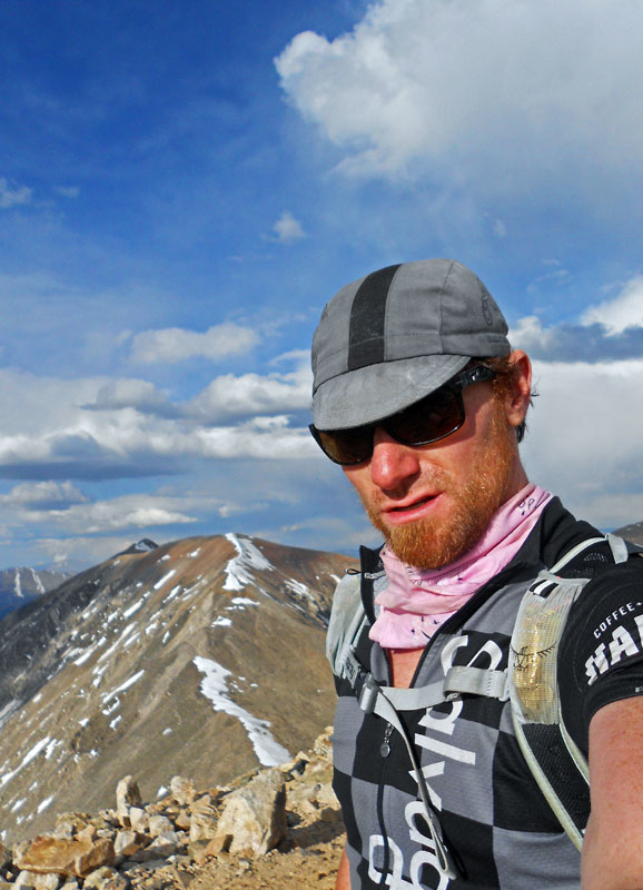
Summited my ~12th time on Evans on the first evening, via a bicycle ride up to the top, documenting it with a cheesy summit shot by this simple sign –
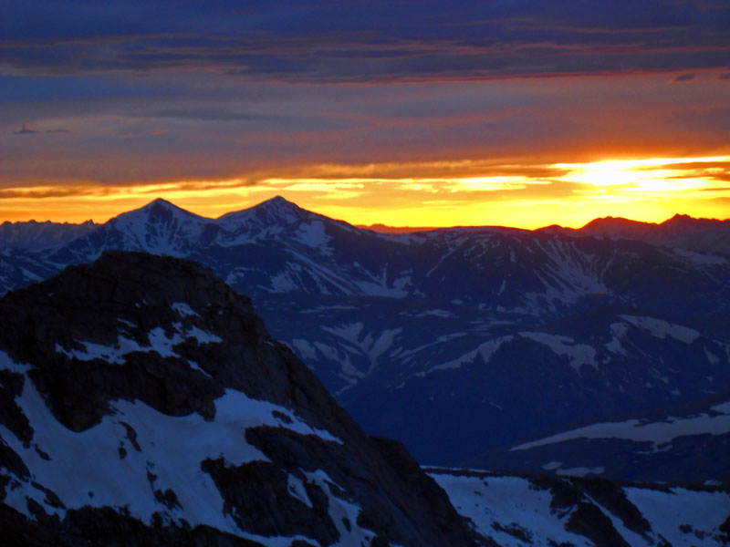
The atmosphere around the Front Range was filled with smoke from the many wildfires dotting Colorado. It’s sad to see so many things out of control, but it does make for good sunsets,
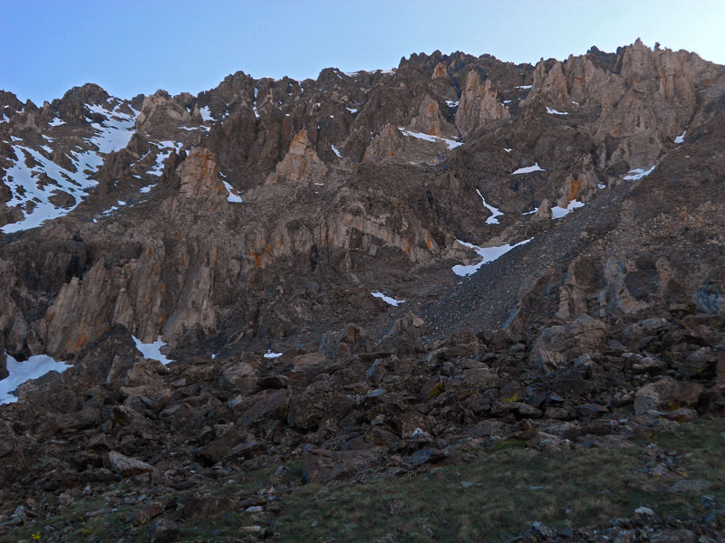
The next day, I got up before daylight, and packed it up for a little romp around the area, starting with a walk South on the Mt. Evans Road, up Epaulet, and down into the basin south of Bierdtstat, to take on its East Ridge. The route proved fun enough, with plenty of places to warm up my climbing hands. Long approach to do the peak from, that’s for sure. Once on Bierdtstat, I dropped down to traverse back to Evans via the Sawtooth,
and then, quite knackered, took the shortcut down Evans back to the bike that was resting on the shelter at Summit Lake. Without any shame, I took a quick nap, right then and there, amidst all the tourists and mountain goats grazing around. It was only around 10:00am.
After the nap, took off down towards Idaho Springs, losing around 7,000 feet of elevation from Summit Lake, to have lunch in Idaho Springs. Had a hell of a headache – somewhat rare these days – maybe elevation-related, maybe caffeine withdrawals To play it safe, took 2 Aleves (which I never do) and a cup of coffee (which I do, religiously) and within 15 minutes, that damn thing was gone. Onwards!
Rode a bit up the road towards Summit County to Georgetown and had another meal at the pizza shop in town, and then resupplied some more at the gas station. No need again to rush too fast – there’s not much else for me to do. The rest of the day was getting to the Grays summer trailhead, which was just up the road. Happily for me, the road linking the winter, and summer Grays TH crossed the path of what seems to be the yearly avalanche off of Kelso Mountain. This debris was enough to defeat most motor vehicles from wanting to try to traverse over, but was simple enough to walk over, pushing a bicycle. The end result was that I had the entire summer trailhead of Grays, to myself. An unthinkable situation in the summertime! I did some very rudimentary cleaning and prepping and nestled into my bivy bag to nod off for a while.
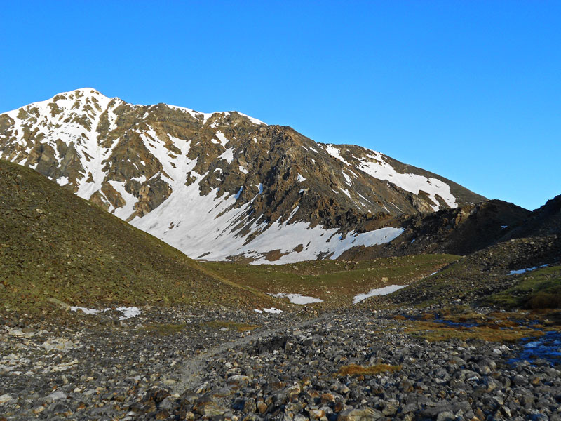
5:00am came and a wonderful day started. The conditions of Kelso were a little unknown to me. My biggest fear was that it would be crap snow on everything, with ice underneath for poor purchase, but from the first look of it that morning, it looked dry for the first 2/3rds of the way up, and then simple snow walks the rest of the way.
And that held to be mostly true – except most of the snow was avoidable on the ridge, itself,
The, “knife edge” portion of the ridge was filled in on both sides with snow, blunting at least the psychological dangers of it. A fall from here would still not be so nice.
Knackered after the climb, and the days’ previous, I took ‘er easy after summiting Torreys, to wander off and summit Grays. But something compelled me then run down to the trailhead, which I did.
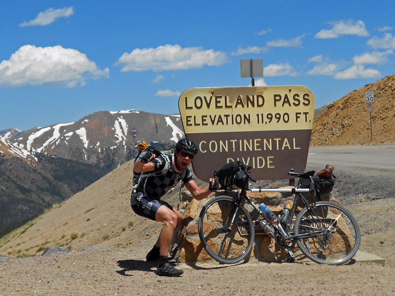
Packing up everything, I made the bumpy ride back to the I-70 corridor and summitted Loveland Pass on the bike – not without showing the tourists how to take a photo with the sign,
It was lunchtime when I reached Frisco, so I stopped and took lunch. My next objective was Quandary, but it was far too early to get to the trailhead already. I played with the idea of even taking in a movie, but opted to find the bookstore in Breckenridge instead, to find another book to read, as I was just about done with the book I brought.
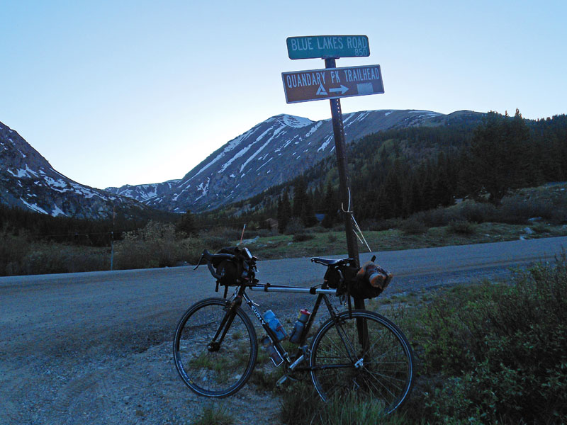
Burned through some time, and road up Blue Lakes road towards the reservoir to make camp, in the late afternoon’s failing light,
Beautiful area, but I made the mistake of camping right next to 5 younger gentlemen, that had spent most of the night in town, and had gotten back to their campsite fairly toasted and exceptionally loud. Not the best sleep I’ve ever had. I’m always amazed at the very different experiences two different groups of people can have, doing basically the same activity, at basically the same place. They probably had no idea what this weird bicyclist was doing, sleeping without a tent.
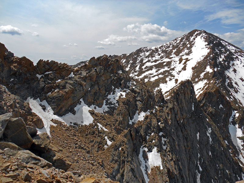
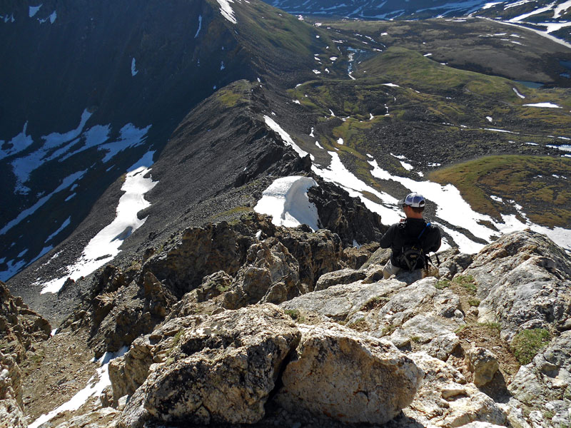
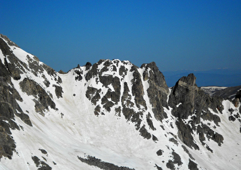
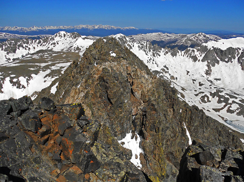
Didn’t really waste much time leaving this area – locked the bike at the open gate that takes you to the res., and started the hike up to the West Ridge of Quandary. This route is well known for the parties that get in trouble when they attempt to descend off the ridge prematurely for whatever reason – usually weather-related. There really is no safe bailout point, until you’re on the summit proper – it really is a bad place to be when a thunderstorm rolls in. Inspecting the ridge itself, it’s easy to see why,
“Terrain Trap” would be a light-hearted term for this beautiful mess. Access to the ridge started with a surprise snow climb!
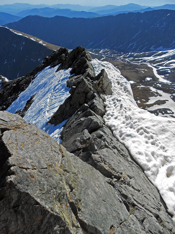
Which is always a pleasure, especially so early in the day, when the snow is stable and cold. Once on the ridge itself, the real fun begins and you realize the cubist nightmare you’ve landed upon. The ridge is just littered with crumbling towers you either have to traverse around and climb up and descend. Snow filled the areas between them and the condition of the snow varied, depending if it was North or South facing.
The views while looking West on the route were remarkable. The original Holy Cross mountain was just off of Wheeler’s own West ridge,
But it certainly wasn’t much to take your mind off of the problems you had to deal with, to complete Quandary’s West Ridge. The towers become larger and larger, and the options to get past them grow ever more confusing. One tower seemed to need to be traversed to the North, by descending down over and back up to the next lowpoint, but the only option to traverse was a small, snow-packed slope, well over 45 degrees, with nothing below it but the valley floor. Intense.
Footsteps showed that it had been traversed recently, but the snow’s condition was that of a slush mess. If nothing could bite into it, it was a long way down. I carefully, yet nervously climbed down to take a closer look at the traverse, and see what the shortest way forward was. Even this climb felt uneasy. Everything was loose wanted just to fall away. Any flat surface was sullied with ball bearing-like gravel. Perhaps trail running shoes weren’t the best pick for this route.
I reach the area of the snow traverse and look for a place to gear up: crampons, ice axe, etc. I take a closer look at the path left behind. Turns out to be goat tracks. Stunned, I put everything away and climb up and out of there. The slab I was resting on gives way, as I take my next step up, and starts tumbling down, making a horrible racket, echoing through the entire valley. Enough to make your heart sink and your adrenaline to flow. A quarter ton piece of the mountain, easily.
I find the way to climb up and over this tower, just to be assaulted with another unsavory blockade, with more rotten choices to make.
The “crux” of this particular climb was the final downclimb off of a tower and ascent of large wall in your way, with the now commonplace snow in the areas between the towers, gravel on any flat surface, and the rotten rock everywhere –
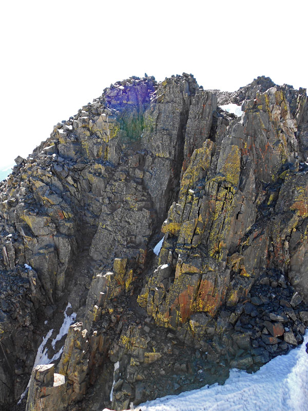
That’s over 40 feet. I took a good amount of time just contemplating the moves. A fall just wouldn’t mean a fall of 5 or 10 feet – a fall would mean a fall of 5 or 10 feet, into a gully, where your body would ricochet off many loose boulders and rocks, and then the additional flight of 1,000+ feet to the base of the mountain. However easy the climbing could turn out to be, it had to be done without fault. I’m thinking of all this, weighing what my life is worth, how hard it would be to reverse the delicate moves on just about as rotten rock I’ve already gotten to, while also being able to see the summit, and the people on the summit having completed the far easier East Ridge route: a man with arms crossed, relaxing, lying down; groups with American flags, taking their summit shot – it all seemed so comical, as I stared at uncertainty just a few hundred feet away. It’s been a full three days prior and I’m not in the freshest of shape.
After ascending the final crux, looking back didn’t make one feel the greatest. The brain just asked the body why this route was so necessary.
Limping to the final highpoint of the mountain, I could do nothing but walk, and attempt myself to not lose complete emotional control. I sat down by the register and just cried into my open hands for a few minutes silently, as more light-hearted people literally danced around me in delight, relishing the view and the trek upwards.
Once I got myself together, I took the East ridge route down by force. If the West Ridge wasn’t going to take me, the East Ridge certainly wouldn’t either. Gathering up my remaining strength, I literally blitzed down the mountain again, to the confusion of the more casual hikers tramping slowly up. Still crazed from my West Ridge ascent, if felt as if I was metabolizing the very adrenaline that was overflowing my circulation system.
But that wasn’t enough, I thought. Why not cut the East Rige route, by descending down the very ridges I had deemed full of terrain traps earlier this morning? Sure it was risky, but it could save me miles of boring walking on the Blue Lakes Road, back to the bike.
So – whoooosh! down the first reasonable looking part of the south side of Quandary and into the forests to be bushwhacked through below, knowing full well that there were cliff bands I couldn’t see in my way to be navigated.
Surprisingly, I did so, without too much bother. Everything seemed unreal enough after the West Ridge – I felt invincible. Reunited myself with my bike and gave my camping neighbors – who seemed to have just woken up a stern look or two, from a good ways away, out of sheer ludicrousness and away I went! Down Blue Lakes, back to the highway, and up! Hoosier Pass and into Alma for food. Burned through some hours of the day, and decided, “the hell with it!” and rolled up slowly towards Kite Lake, and the Trailhead of Decalibron – three 14ers in a large circular tour of the area, all from the same trailhead.
The trailhead was made by four o’clock in the afternoon. I spied the weather above: cloudy, getting cloudier – 3/4 of my view is hidden by the mountains themselves, so there’s no way to see what’s coming. But up above, dark clouds. Gonna rain tonight – a good bet as any. Taking just a bivvy bag and a sleeping bag with you has many advantages when you’re under your own power (lightness! Speed! Simplicity!), but it sure as hell puts you in a bad place at a campsite that’s 12,000+ feet up.
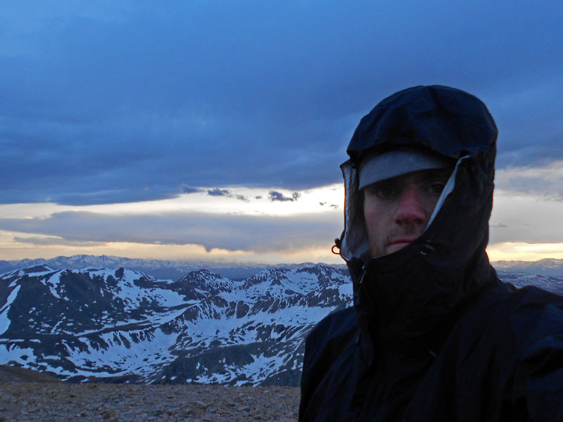
Contingency plans. Cower underneath one of the picnic tables. Sleep in the pit toilet. Well, if it’s gonna rain on me, I justified, I might as well be moving. And at 4:30 pm, I set out for Democrat. Passed one person going down, but other than that, the mountains were mine. As the day creeped into night, the temperature sunk, and my weariness grew.
Democrat:
Lincoln:
Bross:
As I half-fell descended the horrible trail from Bross, I was guided by a fire from the campsite someone had started. I sang to myself, as I romped down the last of the crap talus, then onto the spongy tundra, over creeks and through snowfields, racing the sun setting down upon me and the basin that quickly engulfed me.

I quickly made camp: roll out the sleeping bag and bivvy sack; and nestled in. Watching the weather change overhead: the low, heavy clouds gave way to high, cirrus clouds and then: nothing but clear dark skies and bands of stars. Well now: it’s not going to rain tonight after all.
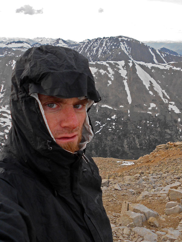
After days of waking up at 4:00 – 5:00 am, I slept in a little this next morning, and packed up slowly, watching the circus of visitors coming in and starting their own hike. I swiftly tore down the road back to Alma, over the pass and into Breck, to stop for a spell, as the weather finally did rain upon me. Glad I wasn’t on the trails, today.
Two hours later, I was back pushing the bike, first over Loveland Pass, and then rocketing down the I-70 corridor, and then: home.
